
Maps / Directions
.
.
MAPS
There are a few different versions of maps of the Rubicon. The ‘legal’ version are the Forest Service (FS) Motor Vehicle Use Maps or MVUMs. They depict what is legally open to OHV users. Keep in mind, the FS can close trails at any time but should post the Forest Order (FO) on their website. It is the users responsibility to know what trails are open and which are closed.
The two links below are of the flier I try and keep at the Rubicon trailhead, the Middle Fork trailhead, Barker Pass and the Tahoe City visitor’s center.
It is the result of hundreds of hours working Photoshop. It is a combination of the OHV maps from the three forests through which the Rubicon Trail runs. This map was developed to educate the users to the side trails near the Rubicon Trail on the Tahoe side of the trail.
Link to the cover of the flier:
tor-trifold-cover-10_2016-color
The map in the flier:

The map below is my ‘poster’ of the flier map with the trail information on the same side as the map:

You can’t really blow up that version even though it is an 11×17 version. Here is a link to a higher quality version. Feel free to print it out and hang it in your garage:
.
The Rubicon Trail Foundation has map of the Rubicon Trail that focuses on, of course, the Rubicon Trail itself. Some side trails are shown. I’d like to thank Randii for all his work to get this information in one place, the RTF Board for getting these published and El Dorado County for getting the grant money to pay for it all.
.
Forest Motor Vehicle Use Maps (MVUMs).
Link to the LTBMU MVUM for:
.
Link to the TNF MVUM – the TNF has just released the latest MVUM. There are ten maps for the Tahoe National Forest:
Page with links to all ten maps
The Rubicon map:
.
Link to the ENF MVUM for the Rubicon Trail:
Close-ups of certain section of the forest, including Loon Lake to Rubicon Springs.
Larger overview of entire forest
.
DIRECTIONS
Directions from Tahoe City to the Tahoma staging area for the Rubicon Trail:
From Tahoe City, drive south on highway 89 towards South Lake Tahoe, Emerald bay, Homewood. You’re looking to turn right on McKinney-Rubicon Springs Road. It’s about 8.5 miles out of Tahoe City. You’ll pass Chambers Landing, then the road drops down, crosses McKinney Creek and starts to climb again. Turn right on McKinney Rubicon Springs Road.
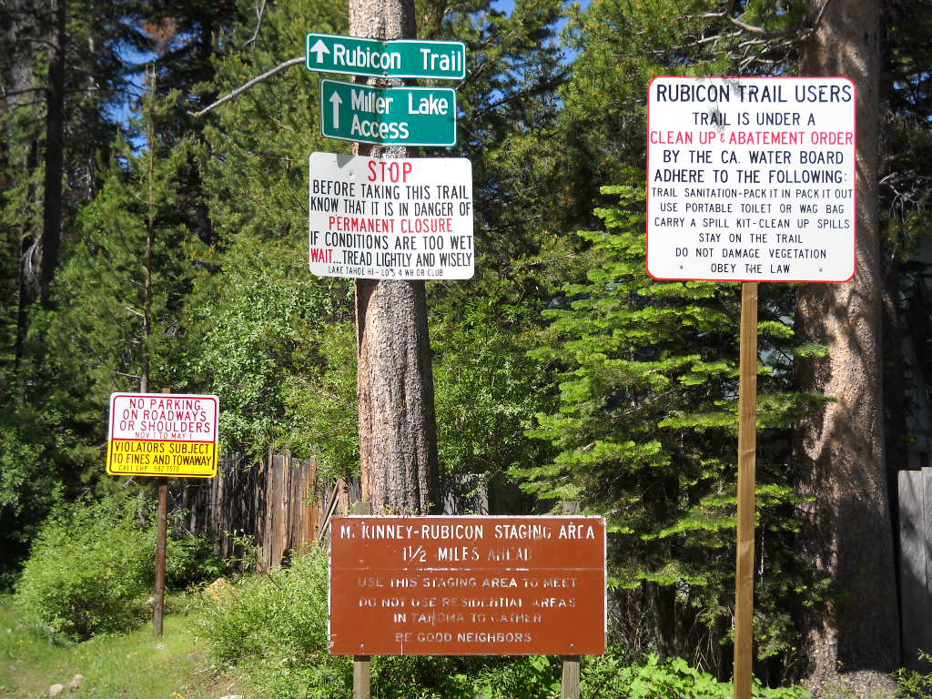
You can see the crosswalk that goes across McKinney Rubicon Springs Road:
Turn left, it’s more like veer left, on to Bellevue Ave. When it ends, turn right on to McKinney Road and follow it around as it turns in to Springs Court.
Turn Left on to McKinney Rubicon Springs Road. Yes, it’s the same road name but it doesn’t connect through.
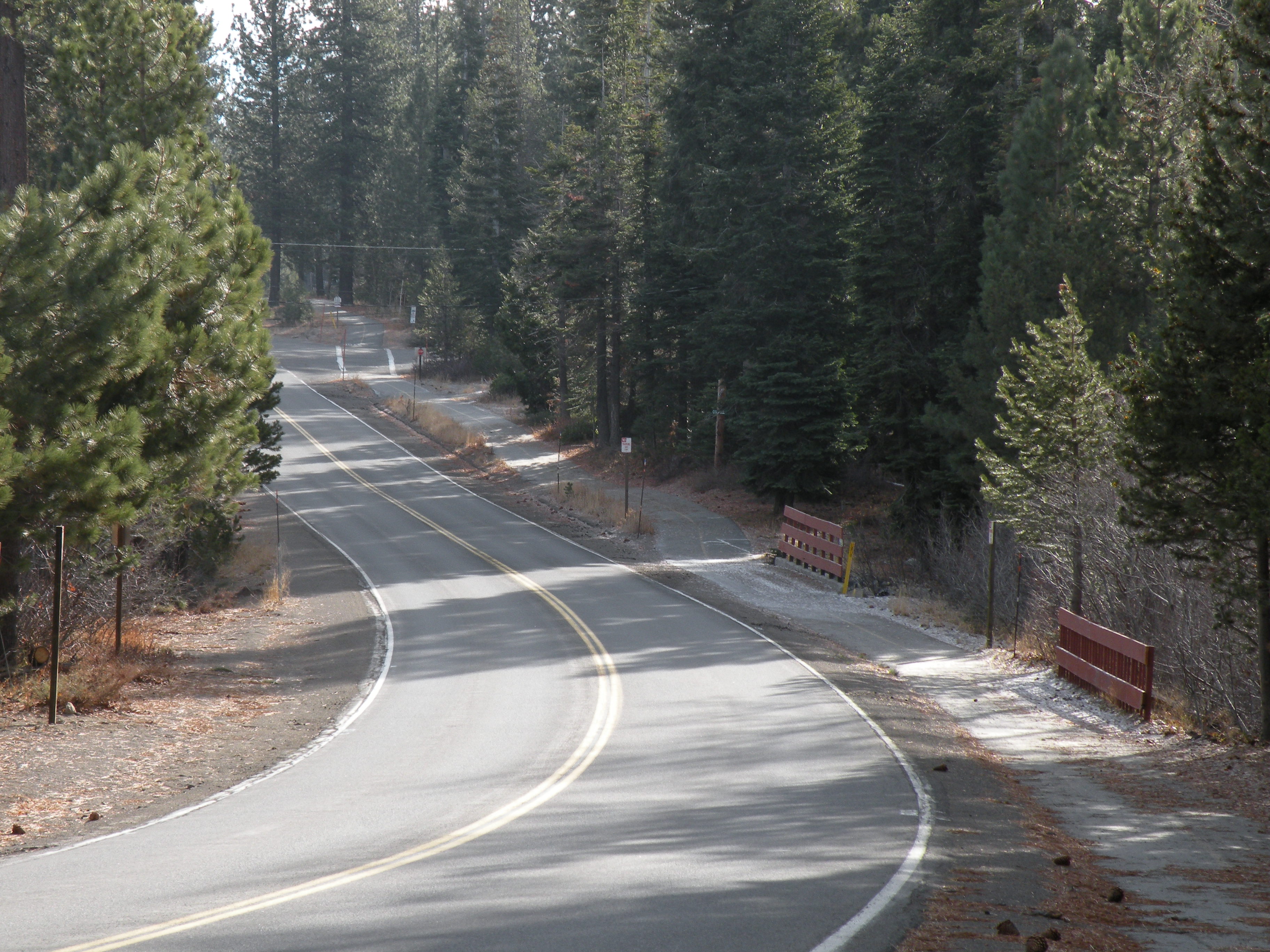
As you cross Evergreen Way, the road becomes a single lane paved road. This is a windy, narrow road often used by locals for running and walking dogs. Watch for others using the road. Although the trees and bushes have been trimmed back, the turns do not have the best line of sight to see who might be coming towards you. Drive slow.
The staging area is about a mile and a half up the road.
From the South Lake Tahoe “Y” (the intersection of 89 & 50), drive north on Highway 89 about 19 miles. Look for the PDQ Market on the right.
The PDQ market. Note: they serve the BEST sandwiches in the entire Lake Tahoe basin!

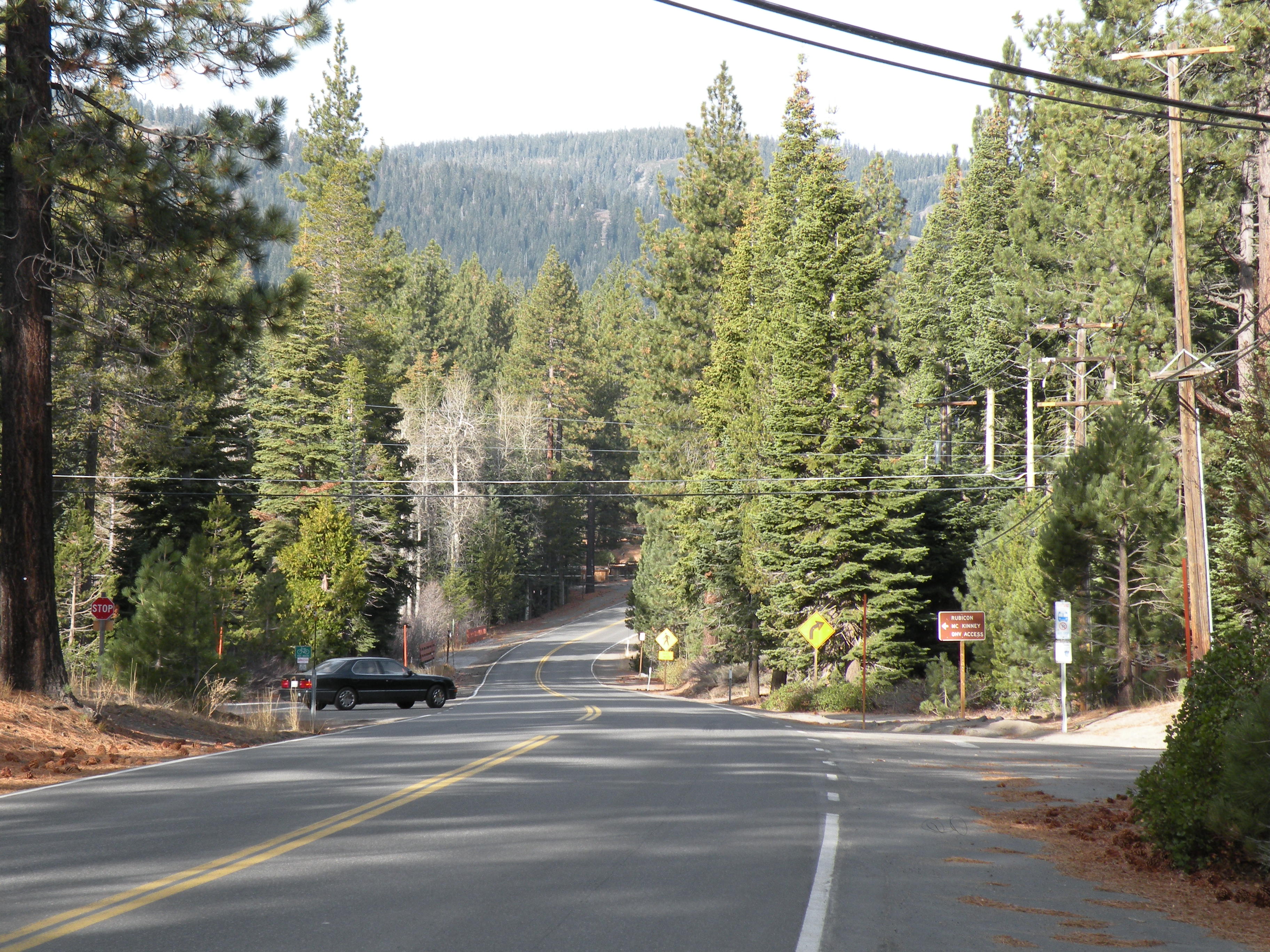
The turn for the Rubicon is about a half mile further north. (Where the car is coming out.) Turn left and follow the directions above. Note the brown and white FS sign on the right side of the road.

