
Who Decides?
Posted: July 26, 2014 Filed under: Maintenance Leave a commentWho Decides?
It has recently come to my attention that an alteration has been made to Cadillac Hill. Although I’m good with individuals and groups doing trail maintenance “as needed”, it should only be done “when needed”.
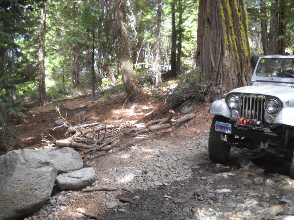
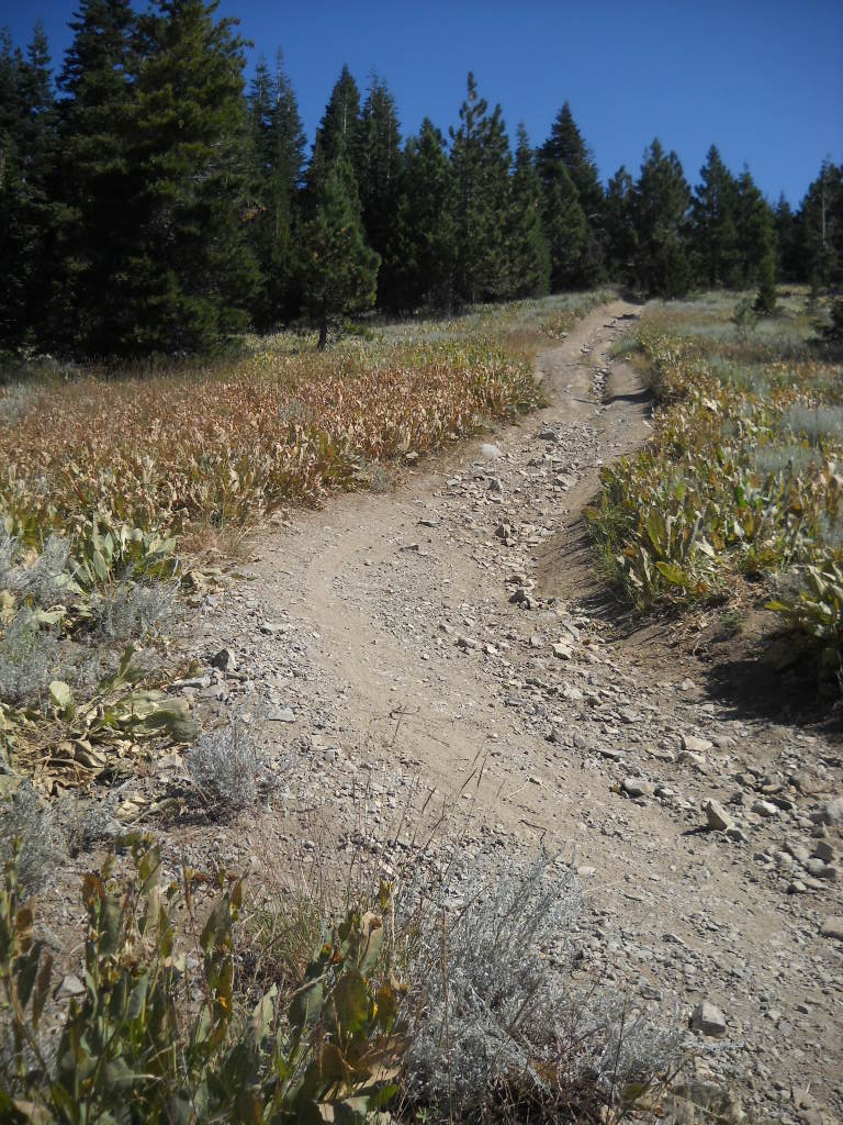
Although I have not seen it for myself, it is reported that the ‘alteration’ to Cadillac Hill was the removal of the rock in the middle of the trail just below V-Rock. This rock had caused the Sheriff’s, in their Razor, to negotiate the obstacle on the low side. Very dangerous as the soil is loose just off the trail and it’s a long way down if you go over. The rock in question is hidden in the shadow in the picture below.
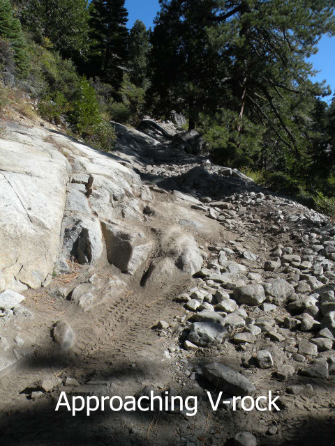
The rock was tall enough that you would scrape your axle or get hung up if you straddled it. It was surrounded by smaller rock and thus had not grown over the years due to erosion. It had been there forever. Going up Cadillac Hill, the common line was to put your low (right) side tires on the rock and allow the left side to climb the granite slab. Those with narrow axles didn’t experience much lean. Those will full width axles had to climb further up the slab and would experience much more lean. This rock was part of Cadillac Hill and although not a ‘named’ obstacle it added to the experience that was Cadillac Hill and added to the ‘stories’ of Cadillac Hill being one of the tougher obstacles on the way out.
I’m disappointed that a group or individual made the decision to remove this rock. My concerns are how do we prevent this type of thing from happening in the future?
2nd Update (9/16)
Here is a good “before” photo:

UPDATE:
I was out there yesterday and took these photos.

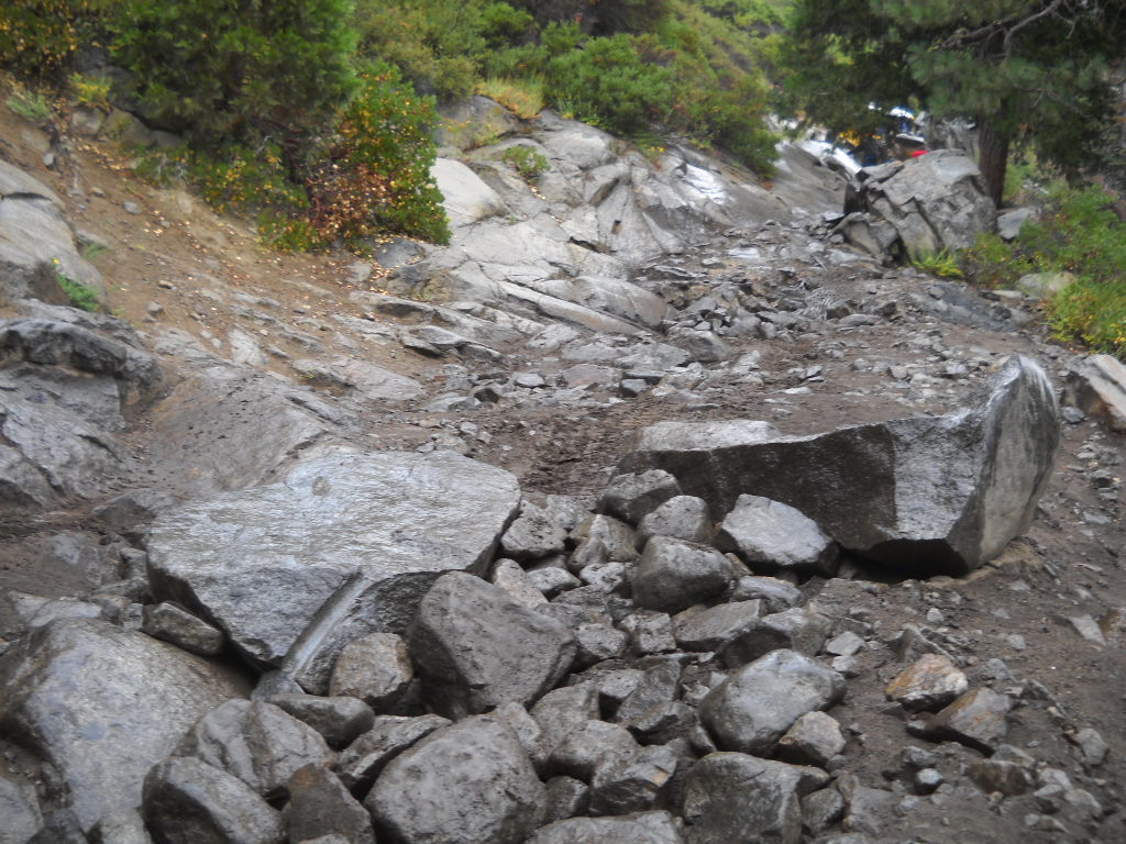

It looks like they topped the rock and flipped the top over in to the middle of the trail. I guess this is better than pushing the entire rock of the edge of the trail but still not cool.
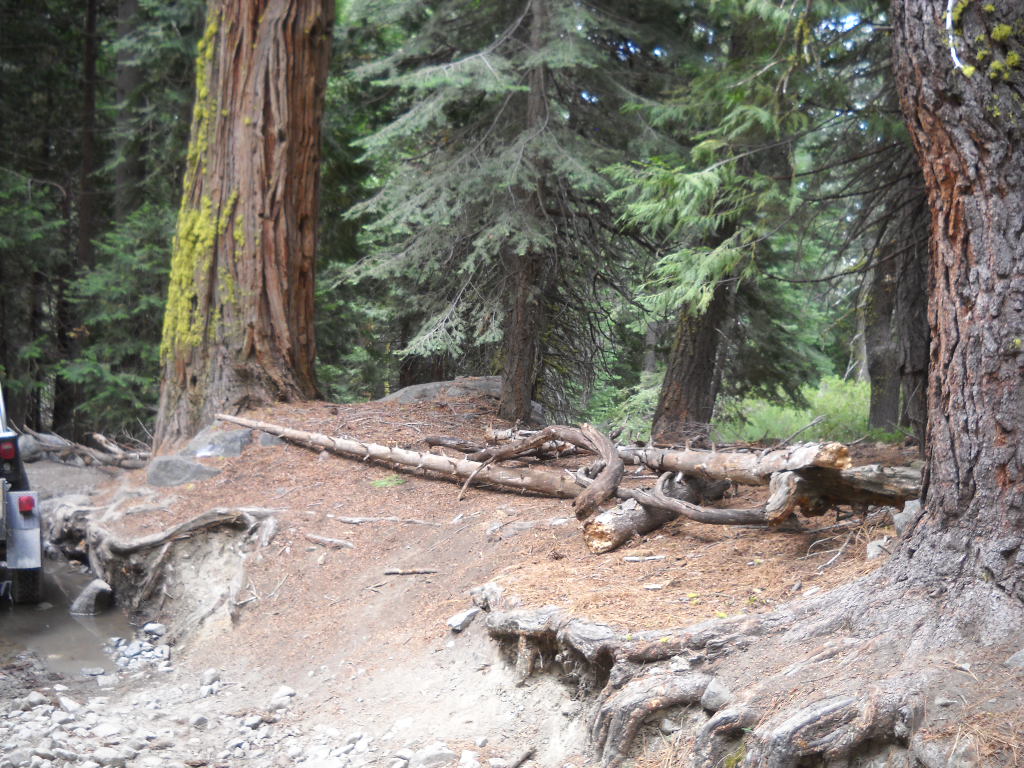
Last month, I came across a new bypass further up Cadillac Hill. It went around the tree at the rock out cropping / creek crossing with the log anchored to the ground as a water bar:

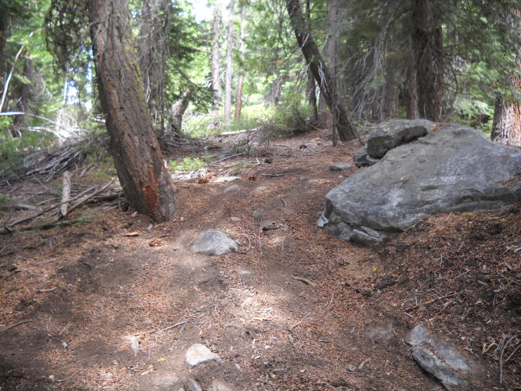
From a few conversations I’ve had, it was concluded that the side-by-sides didn’t like the clearance issues going over the step right about where my trailer hitch is in the pictures. So, they drove off trail, going around the tree and dropped back on to the trail above the tree.
I took the time to block the new illegal bypass:

I’m not holding my breath that this block will last. Volunteers will have to go back and drag some larger trees and either tie them together with bailing wire or anchor them to the ground with rebar.
It’s disappointing that there is still an educational gap. How do we educate those wanting to ‘help’ out on the trail before they make alterations? How do we prevent people from going rogue and pioneering new trails? With two counties, three forests and numerous 4wd organizations overseeing the Rubicon, who should be leading this effort? Can we get one organization to step up and lead?
I don’t know.
Trailers on the Rubicon
Posted: July 20, 2014 Filed under: Maintenance, Travel | Tags: recovery, Rubicon, trailer Leave a commentA few years ago, the Lake Tahoe Hi-Lo’s, working with FOTR, moved more than 70+ cubic yards of rock to fill “The Mud hole”.

Last weekend, a group of volunteers moved 16 cubic yards of gravel (with road base and a binder), up the Richardson Lake Trail. Many projects in between have used trailers.
Just about everything you can imagine have been hauled along the Rubicon with a trailer, okay, almost everything. Even people down the river…
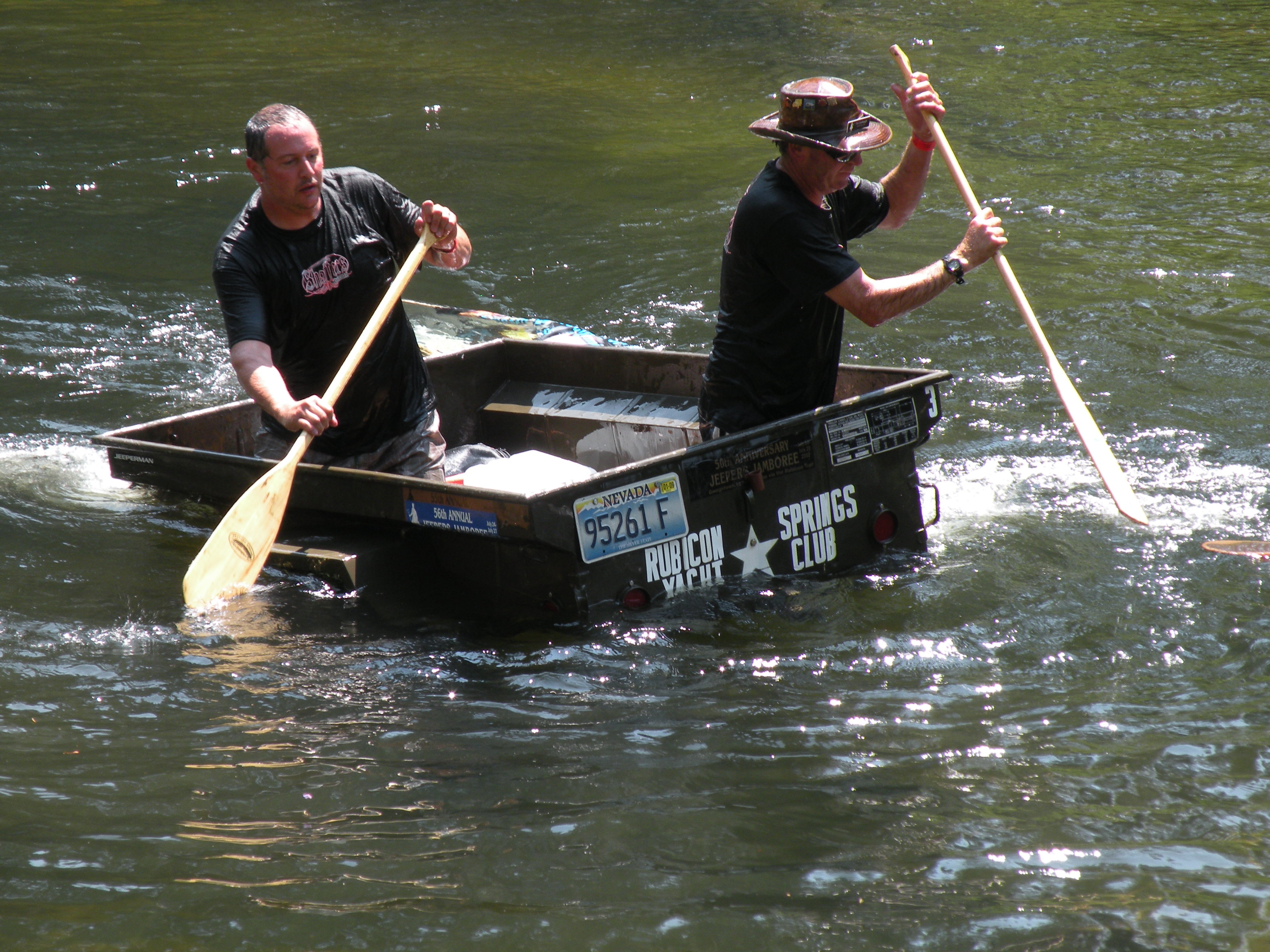
Hi-Lo’s in the trailer races at Jeepers Jamboree!
Trailers are so important to the Rubicon and its maintenance that RTF used an OHV grant to buy six of them. They were featured in a previous post. (RTF Trailers)
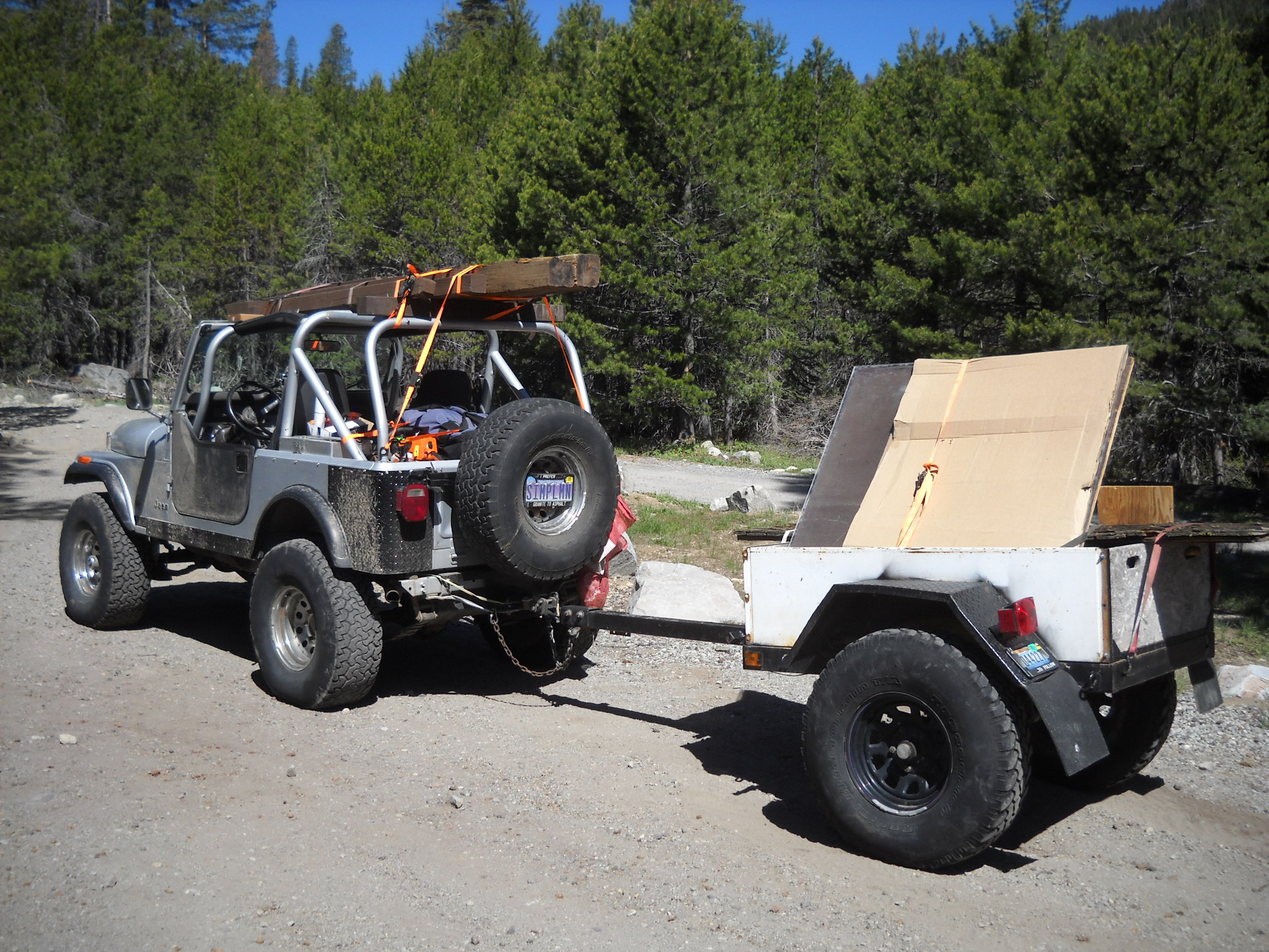
Over the last few days, FOTR moved 90 bags of concrete to Cadillac Hill for a project they did this morning. I helped out a week earlier by taking a trailer load of concrete to just above Morris Rock.
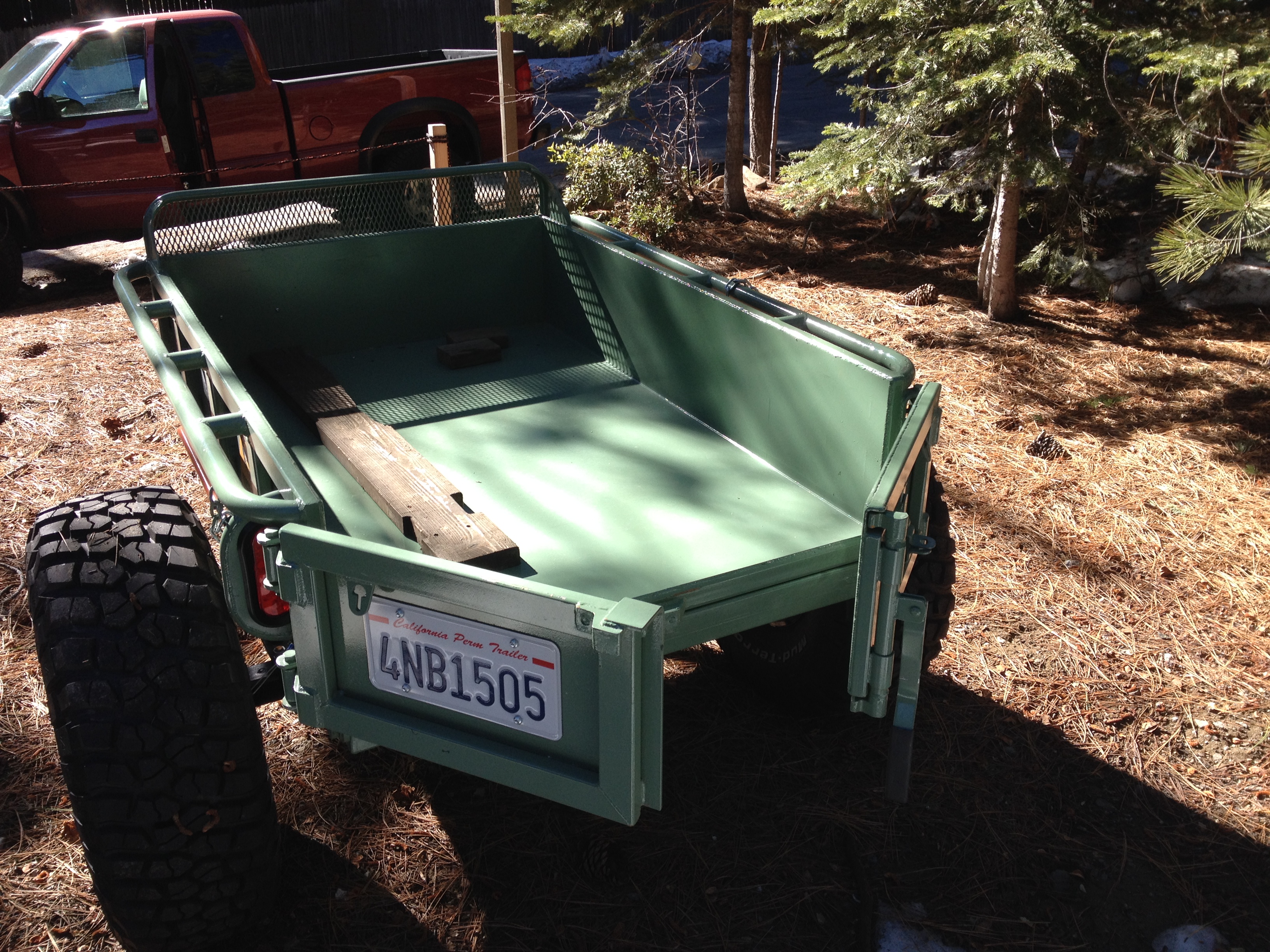
The trip started okay. I stopped by Steve Morris’ cabin, where the concrete was being staged and loaded up 12 bags in to my trailer. I have an old highway lighting trailer that was gutted and sold at auction. I bought it from a guy who had a bunch of them from that auction. I cut down the front panel to match the sides and welded up and installed some channel tubing for a slide in tailgate. As pictured before, I used it to haul in the new sign for the Long Lake Trail (16E12).
Bringing the new trailhead sign in for TKS-11
After loading the trailer with 12 bags of concrete, I headed for the staging area. I thought it was going to be a quiet Thursday morning drive in to Morris Rock but it was Friday morning and the Auburn Jeep Club and the Dirty Dozen Jeep Club were both getting ready to hit the trial. I aired down as quick as I could to get in front of them. But some got out in front of me. It was a slow drive even for a guy hauling a trailer of concrete.
The drop went okay and I left the trailer and checked out the Long Lake Trail at the bottom of Cadillac Hill. Still a fun side trip. Coming back up Cadillac, I got hung up at the hairpin turn. Even with 35″ tires, there is an undercut just past the halfway point through the turn while you’re trying to climb on to the slab on the left while avoiding the stub of a rock sticking up on the right. I had to stack a few rocks but got through it.
I picked up my trailer and headed home. After getting to Observation I breathed a sigh of relief, grabbed another gear and speed up down the trail. That was a mistake. I wasn’t 50 yards past Observation and felt a good, quiet, tug on the Jeep. As I looked over my right shoulder, I saw the left tire of my trailer sticking straight up in the air. The trailer was on it’s way over and I couldn’t do anything about it. While the trailer was loaded, it towed fine. Unloaded, it was bouncing off every rock in sight. By speeding up, I was now applying enough force to flip the trailer. The left tire hit a rock and up and over it went.

Story to follow…
The point of the large rock in the picture put a small hole in the bed of the trailer and then broke out the tailgate as I couldn’t stop in time. I figured I didn’t have much time before someone was going to drive by so I had to get it righted and quick. Being alone, I had to double time it. I pulled my recovery gear bag, and the winch line.
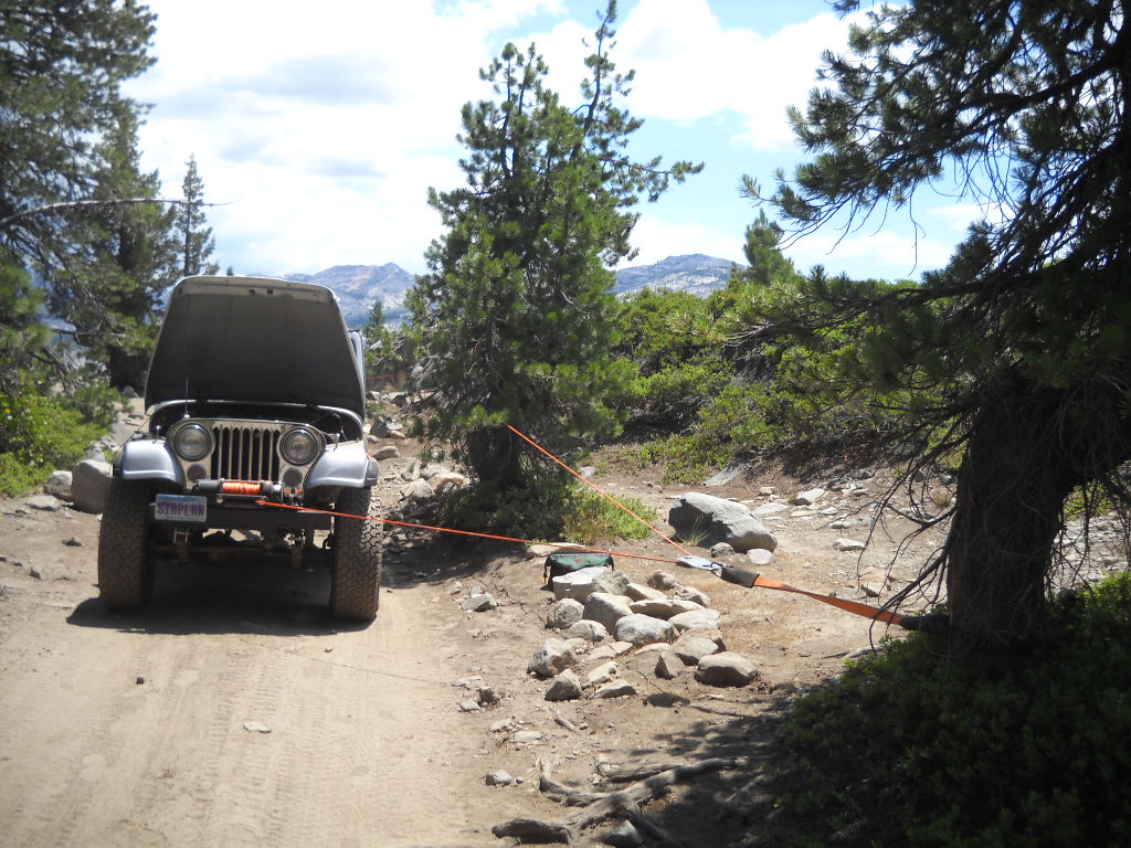
A snatch block off the tree in front for a change in direction. And a second snatch block off the tree at the trailer to actually pull it back over.

A quick run of the winch and it was back to the rubber side down. I was able to get it righted before anyone came along.
Now I had to replace the tailgate before I was to haul gravel the next day. John Briggs helped me out by pulling out and old piece of plywood and 2×6 to get me back in the game for the Richardson Lake Trail project the next day.
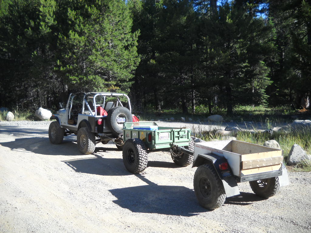
Here I am pulling “doubles”. We had left the trailers at Miller Lake Saturday night. I had run up to Miller early Sunday morning and hauled both back to the staging area for Sunday’s effort. What a noisy run down that trail.
Lesson learned, don’t be in a hurry while towing a trailer on the Rubicon and always carry enough gear for a self recovery.
.
Awesome 14N39 news!
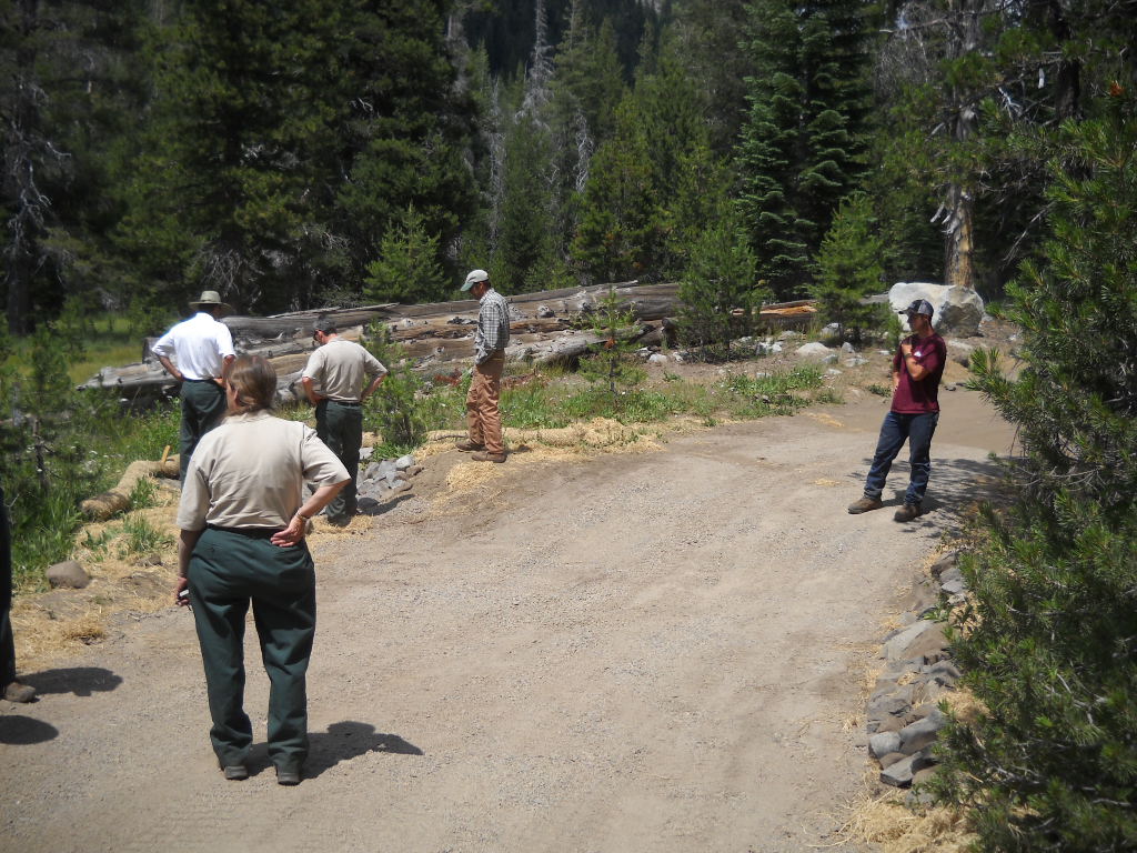
Posted: July 17, 2014 Filed under: Access, Maintenance Leave a commentOn July 16th, 12 people took part in a tour of 14N39-9. This is the last ‘meadow’ on the Richardson Lake Trail. This one is actually a meadow and the trail goes right through it. We were going to hear the FS ideas to get the trail to meet S&G100 and to offer our ideas. I must say the ENF has been open to input throughout this process.
Early opinions had this one pegged as a reroute as the trail did go through a meadow, actually the documents claim two meadows. This would require a NEPA, EIS, EA and of course CYA. Read as lots of money and many YEARS to finally get the route open to the top.
Well, the tour started with a briefing at the Rubicon staging area. I nearly fell over when the lead FS guy, Richard Thorburgh, said they were favoring a “fix in place” over a reroute. The day just kept getting better.
The trail does cross a meadow. But it does so at the shortest point and perpendicular to the meadow. The hydrologist said, ‘when you have to cross a meadow with a road, that’s how is should be done’.
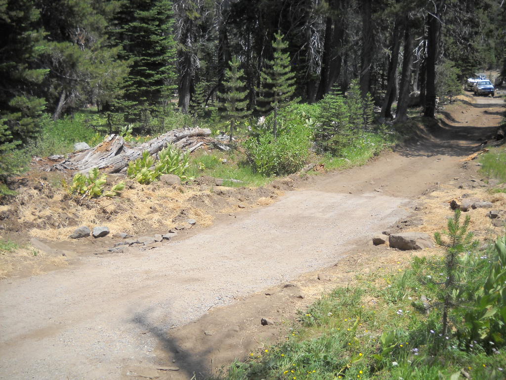
Here’s a shot of the tour returning down the mountain, driving through meadow 14N39-9, after having lunch at the summit:
The proposed solution is to rebuild the road in a manor that allows water to flow from the upper meadow to the lower meadow. The classic part of all this is that the lower meadow looked completely unaffected by the trail. It was pointed out by a few people but the FS wants to harden the trail before it gets reopened.
Karen S (I will not put her name on my website) was part of the tour and was still pushing for a reroute, to save the undamaged meadow. The FS explained what would be involved with a reroute, falling of trees (62 were dropped to reroute Barrett), cutting of a road with a bulldozer, the future possible problem of water on the new road, etc. She still wanted to walk around the back side of the hill to see for herself. Most went with her, I stayed at the rigs and had lunch.
The original survey stated that the last 500 feet went through a meadow. The FS took a second look at the trail earlier this year and concluded that the ‘meadow’ was really a cleared hillside and too steep to hold enough water, even seasonally, to be called a meadow. Thus it was not a meadow and did not have to meet S&G100. No fix needed, We moved on.
Although not a meadow, the trail does need some work. A few rolling dips would go a long way. The non-meadow:

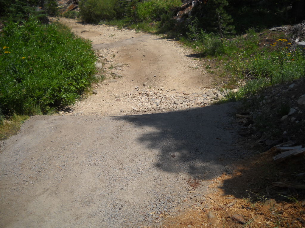
Further along in the non-meadow, it’s steeper than it looks:
The best news, yes it gets better, is how soon this could open. The reroute would have taken all year to plan, fund and study. It would have been done in 2015 but a new road requires “winterizing” by waiting over one winter before it can be used. That would put the opening in 2016.
By fixing in place it could be open next spring. The FS is looking in to using a Placer County contractor who will be working the Rubicon in Sept to transport material this Sept! The FS would be there with heavy equipment to get the bulk of the work done. I don’t see it being finished this fall but I do see it opening next summer after it gets hardened the same way the first three meadows were done.
The basic plan is to rip up the current road to restore the ability of water to flow below the road surface (even thought it still flows under the currently compacted road), fill with large rip-rap crushed rock, use a geo-fabric to prevent the movement of dirt but allow water to drain and then cover it all with an appropriate surface rock.
At each end of the road through the meadow (see the two Jeeps in the above photo), there will be a large rolling dip. The upper and lower rolling dips will prevent water from running down the trail.
What an awesome day!
14N39 to re-open!!!
Posted: July 14, 2014 Filed under: Access, Maintenance | Tags: 14N39, ENF Leave a commentWe should still wait for the official word from the ENF but this past weekend, the FS and two dozen volunteers ‘fixed’ the S&G100 issues along 14N39. At least we fixed the first three issues. The trail should now be open to a point past 14N39-7 but before 14N39-9.

Thanks to everyone involved!
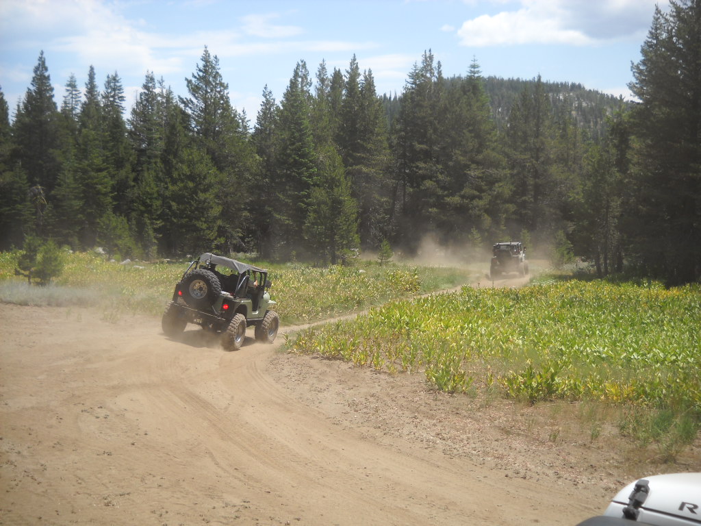
We had a good turnout. Five trailers and one full size pick-up moving gravel (gravel/dirt/binder mix – like road base) the first day and three trailers running the second day. I didn’t count but probably 20 people the first day and 7 or 8 the next day.
The group built to rolling dips with the ‘gravel’, we covered about seven features with gravel, about 150′ of trail. We hand moved rock so the FS could rock line the sediment trap at the first ‘meadow’. Bad photo, but the trap is to the left where everyone is looking.
Once the gravel was dumped (Thank you RTF for the trailers, we had two working both days) the volunteers spread it to the depth required by the FS. The FS then sprayed it with water to activate the binding agent and then ran a ‘vibra-plate’ compactor over every square foot of gravel to pack it down. They were there very late on Sunday finishing that off, we left.
This is meadow 14N39-5. Heavy equipment rebuilt the rolling dip, the volunteers hauled and placed the gravel and the FS compacted it down.
This is meadow 14N39-7 (actually a creek issue). We built two rolling dips and spread forest debris to slow water and promote growth.
Special thanks to Mike for feeding us BOTH days.
The FS did install a fence further up the trail, past the last ‘meadow’ we fixed but before the last ‘meadow’ issue. They were to drive to the last meadow, turn around, drive down and place the gate at the first wide spot (to allow people to turn around) that was not a arch site.

I was the last one through the gate on a tour of 14N39-9 on July 16th.
The last meadow needs a re-route. We will be on the trail Wed to find the new route. There will be NEPA and the rest of the studies that go with it. Best case is we find a route on Wed, study it and plan it over the winter, and build it in 2015. Because it is a brand new road cut in the forest, it will need to ‘winter’ once before it can be driven, so look for it to open in 2016.
I will be pushing HARD for a temporary fix of that meadow so we can access the summit while the re-route is being planned and built. Stay tuned.
Picture just added but I’ll leave this one. I did have some fun moving trailers around:
Sent out Monday the 14th:
Forest Road 14N39 re-opened today as far as the Pacific Crest Trail. Our hydrologist verified that the Forest is in compliance with S&G 100 at Meadows 14N39-1, -5 and -7 based on the maintenance repairs completed to date. A big thanks to all the volunteers who worked so hard over the weekend!
Richard Thornburgh
Pacific District Ranger
Eldorado National Forest7887 Highway 50
Pollock Pines, CA 95726
😉
FOTR work party on Cadillac Hill
Posted: July 14, 2014 Filed under: Access, Travel | Tags: FOTR, Placer Leave a commentFriends of the Rubicon will be conducting a work party on Cadillac Hill on Saturday the 19th. They will be pouring concrete in order to secure the trail to the hill side. Don’t get bent out of shape. There has been concrete on Cadillac Hill for decades in about half dozen different spots.
Friday the 18th, they will be moving bags of concrete to the site and prepping the area.
Saturday morning, from dawn to when the concrete finally cures, the trail will be CLOSED!
Details of the project and how to jump in and help are available at the following link:
http://www.pirate4x4.com/forum/rubicon-trail/1779170-july-fotr-work-party.html
Please let Eric Agee of FOTR know if you can help out. Without these types of projects, the trail would have closed years ago. Please be supportive and plan your trip around the work being done.
A summary of the work project has been posted on Pirate:
http://www.pirate4x4.com/forum/rubicon-trail/1838481-july-fotr-work-party-summary.html
.

