
Adopt-A-Campsite is official!
Posted: May 9, 2015 Filed under: Uncategorized Leave a commentLast week I stopped by the Truckee District office of the Tahoe National Forest (TNF) to meet with Susanne Jensen, the OHV Recreation Specialist. I was going to discuss the status of the campsites I was trying to get adopted and a few of the side trails off the Rubicon. She presented me with the finalized paperwork making the Adopt-A-Campsite program official.
Susanne asked me to be the liaison for any club/group/business/individual wanting to Adopt-A-Campsite. So far we have four camps adopted. Observation is still available. There are many camps off the side trails off the Rubicon. I’m currently working to get them added to my ‘Rubicon Area OHV Trails’ map. These are off the beaten path and very quite places to spend a night.
Please contact me if you are interested in an adoption. It a very small commitment. Currently the TNF is asking for a minimum of two visits a season to clean and maintain the area.
Another maintenance day on the trail…
Posted: May 1, 2015 Filed under: Uncategorized Leave a commentYesterday, I spent six hours on the Rubicon and surrounding trails. It was awesome.
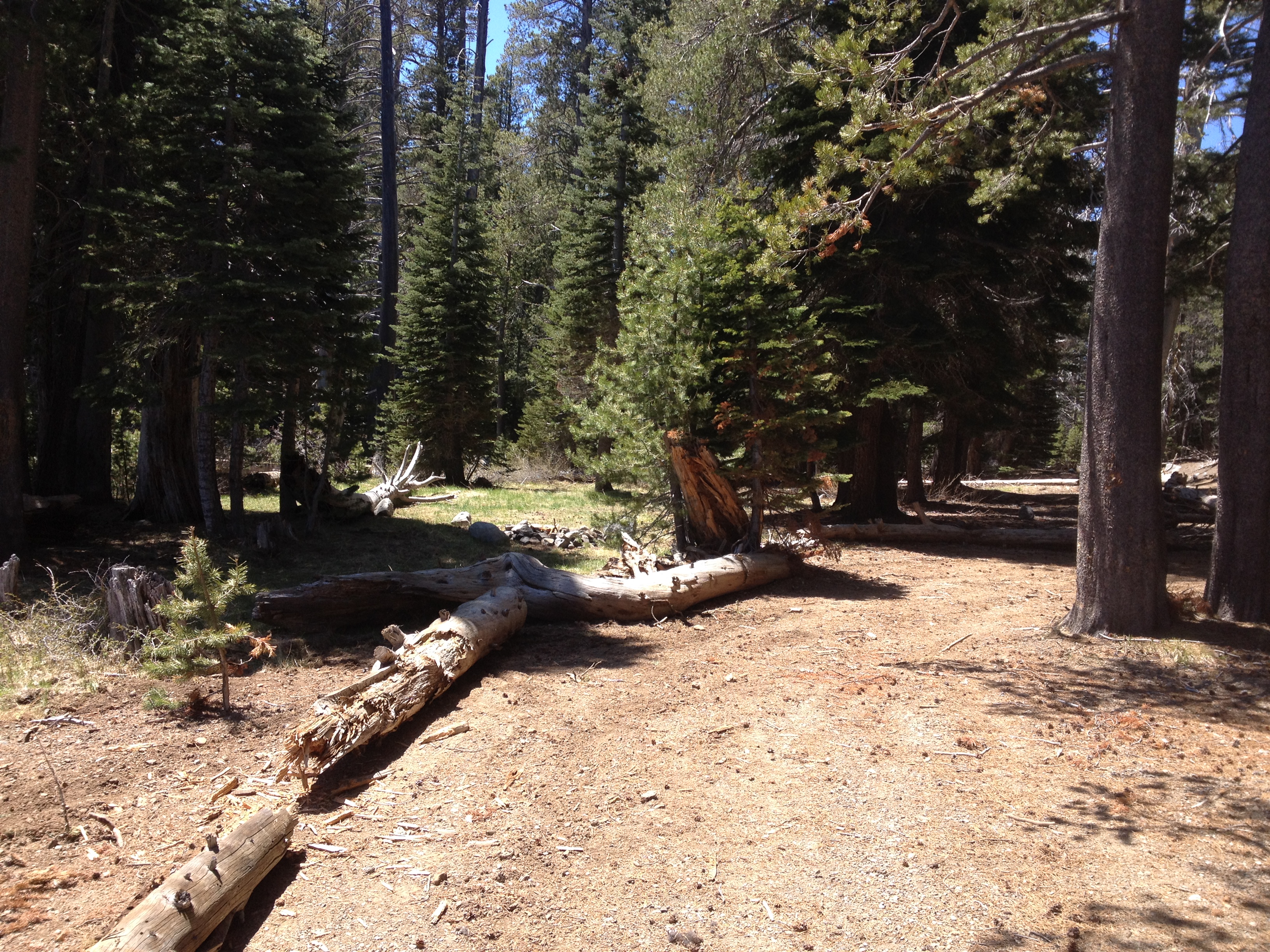
It started with cleaning up my newly adopted campsite on the west end of Miller Lake. Just some general cleaning: moving logs to protect little trees, spreading out the downed tree someone dropped last week so no reason (it was green) and cleaning out the fire pit.
Campsite before, the trees were unprotected and the drive through parking was too wide:

Campsite after, the logs were moved to protect the trees:
There are many more campsite and “short trails” to adopt within the TNF. Please let me know if you are interested in stepping up and adopting one or more.
Also along the trail, I removed the one piece of graffiti that has been visible for years:

It still needs work. I’ll hit it again the next time I’m out.

This is just one of many trees I cut that were across of hindering travel on our OHV trails. This particular one was up 003-004-12, the west Ellis Peak Trail.

I cleared this one and drove up quite a bit more but stopped at a very long snow drift. Being a single vehicle and single occupant, I didn’t want to press my luck.
I headed up Barker Pass Road (FS 003-004) but again had to turn back when I encountered a long snow drift. So, there are still places to challenge yourself with snow wheeling out there. Remember, if you head up 003-004, the gates at the bottom do not open until May 31st. That’s the Sunday after Memorial Weekend.
Go prepared and Tread Lightly!
The season begins
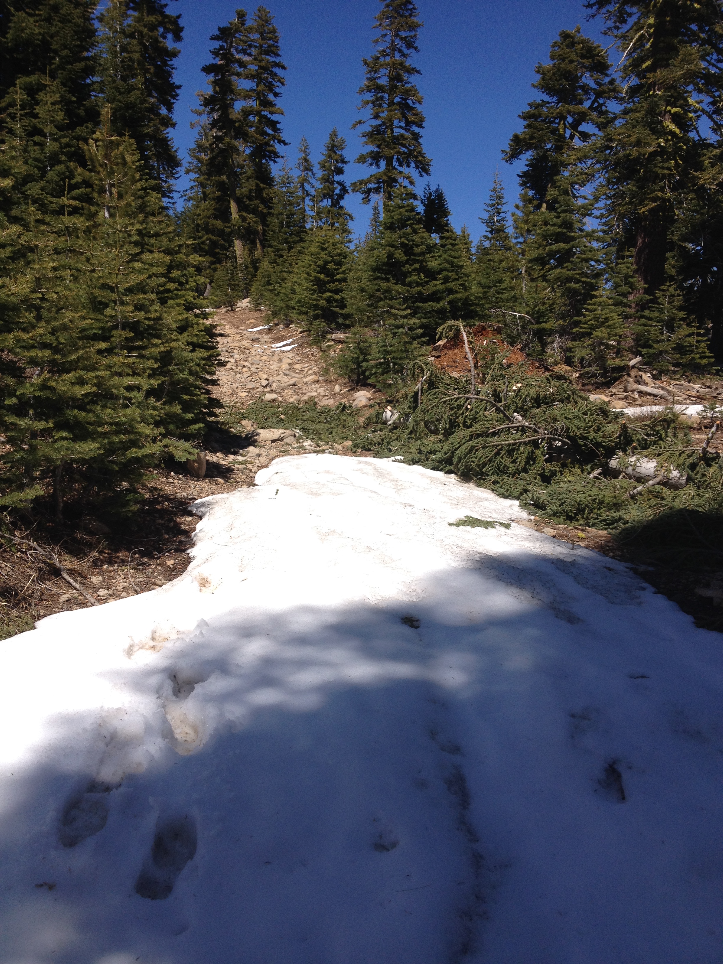
Posted: April 20, 2015 Filed under: Uncategorized | Tags: access, Hi-Lo's, Long Lake Trail Leave a commentLast week I checked out the Rubicon for the first time this season. There was evidence of trees that had fallen across the trail but had been cleared, but no snow to speak of.
That was a little different on the Richardson Lake Trail, 14N39. This trail opened on April 1st. That is earlier than most side trails along the Rubicon. My plan was to drive the trail up to the gate at the Pacific Crest Trail (PCT) and clear any trees across the trail.
Along the way, I came across a few snow drifts on the trail, mostly on the northern aspect of the hill. Some had tracks of previous travelers but the last few did not. It’s a cool feeling knowing you are the first person of the season to run the trail. As long as I was breaking trail going uphill, I felt I was okay. Although alone, I had a winch, gravity and all my other recovery tools if I didn’t make the climb.
When I crested the climb and came across another snow drift in front of me going downhill. It was time to turn around.

This drift was no larger than any of the others I had already driven through that day but it was downhill. If I got stuck, I’d have to winch against gravity or further down the hill. If I had another vehicle with me, I would have driven it for sure. Maybe next time.
The snow is melting fast. I suspect most of the snow in that picture is now gone.
The Hi-Lo’s drove down to the Long Lake Trail on Saturday to open the trail for next weekend. There was one HUGE tree across the trail but it’s been moved. That trail opens to the public on April 24th. I’ll post a detailed report when I get some pictures from my fellow Hi-Lo’s. Enjoy!
Swap Meet!
Posted: March 22, 2015 Filed under: Uncategorized Leave a commentThe Nevada 4 Wheel Drive Association (N4WDA) is going to hold a 4×4 swap meet at the 4 Wheel Parts in Sparks, NV on Saturday April 25th. The address is 40 Victorian Ave, you can see it from Highway 80.
Bring your stuff and leave with cash. For only $10, you get a single car parking space to display all your treasures.
N4WDA will have helpers on hand as early as 7am to help you set-up. They will also have a booth and will be serving food.
The 4 Wheel Parts RTI ramp and the ‘rock crawl’ area will be open during the swap.
For more information or to sign up, please contact Larry @ (775) 246-3212.
Winter on the Rubicon
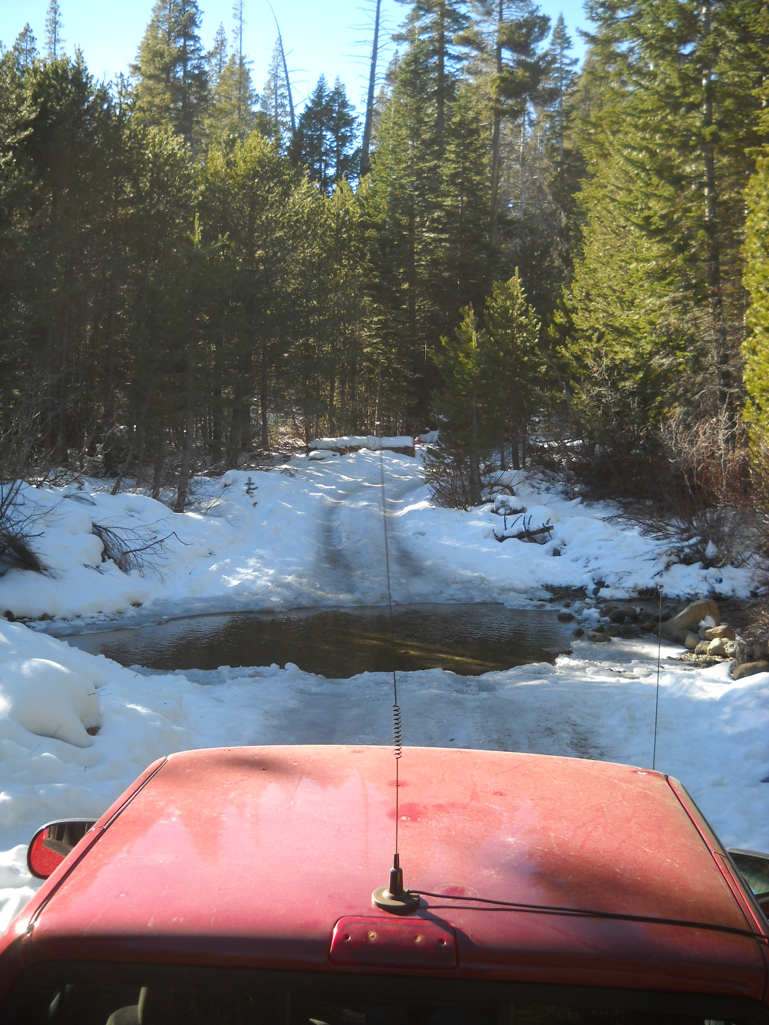
Posted: January 8, 2015 Filed under: Uncategorized Leave a commentI drove out to the Rubicon yesterday. Being alone and in my street truck, 2002 ZR-2, I didn’t venture too far.
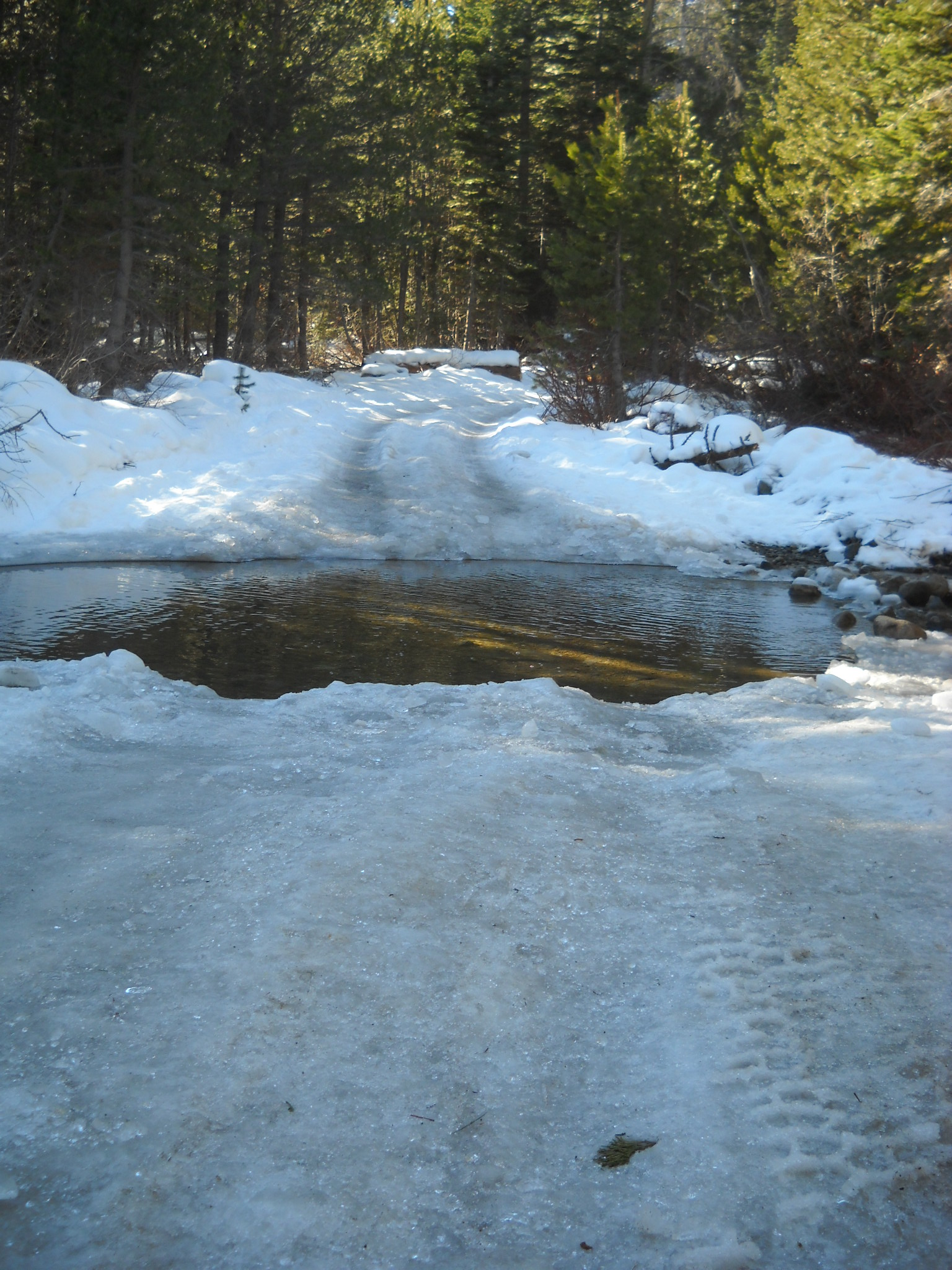
Here is my truck at water bar number eight, actually an Arizona crossing. It’s about a 1/8 mile past the intersection with the Buck Lake Trail. The trail was very icy due to the warm day temperatures and below freezing nights.
Plenty of evidence of people out playing on the trail.

Just before WB#8, someone took the time to clear a downed tree from the trail. Thank you to all of you who take care of business while you’re out on the trail. If you document your time and the people involved, we can get credit towards grant fund matching. Forward any documentation to FOTR.

Please remember to go prepared.
“Turn around, don’t go around.”
If you come across a downed tree or other obstacle and don’t have the means to clear the trail, turn around and head home. Do not drive around the blockage. If you have a chain saw or what ever it takes to clear the trail, feel free to do so but be very careful. This time of year there is less traffic on the trail. If you hurt yourself, you might not see someone drive by for days.

