
Tahoma Parking Issues
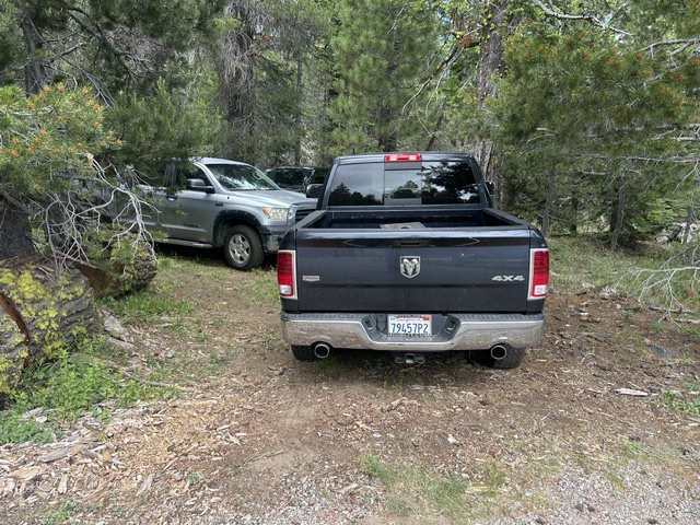
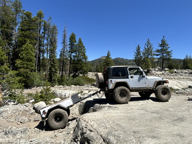
Posted: June 30, 2026 Filed under: Uncategorized | Tags: access, illegal, parking, ticket Leave a commentRubithon was held last weekend. I happened to visit the staging area that Friday for another OHV project I’m working on, and I witnessed some very improper parking. Let’s call it what it was, ILLEGAL!
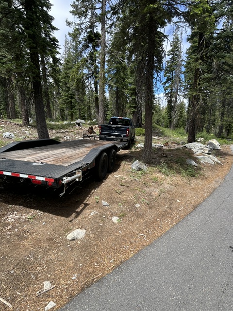
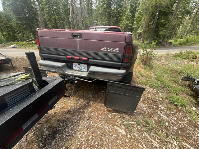
Parking off pavement may or may not be legal, depending on how it is done. I believe you can pull over enough to get off the pavement as long as you are not on any vegetation. We’re talking pulling off the trail one vehicle width; only enough to get off the trail. Don’t quote me on this as I’m not a law enforcement officer.
The parking in these pictures (and I could have taken more pictures) are all illegal. It is either a straightforward illegal parking ticket or a much more expensive resource damage ticket. Again, not a LEO.
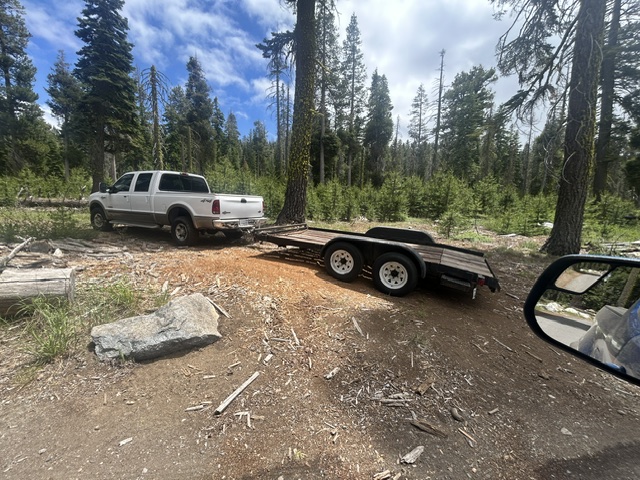
We as OHV users need to do better. Images like this will be used by the anti-OHV crowd to put us in a bad light and get our trails and staging areas shut down. Yes, they might pull these images off and use them against us. For the record, I am not giving anyone permission to use these images, for any reason.
There was/is an effort underway to enlarge the parking at the Tahoma Rubicon staging area. That project is on hold as the Lake Taheo Basin Management Unit (LTBMU) has had people retire and others move to other forests. There is a lack of personnel and thus some projects have slowed to a stop.
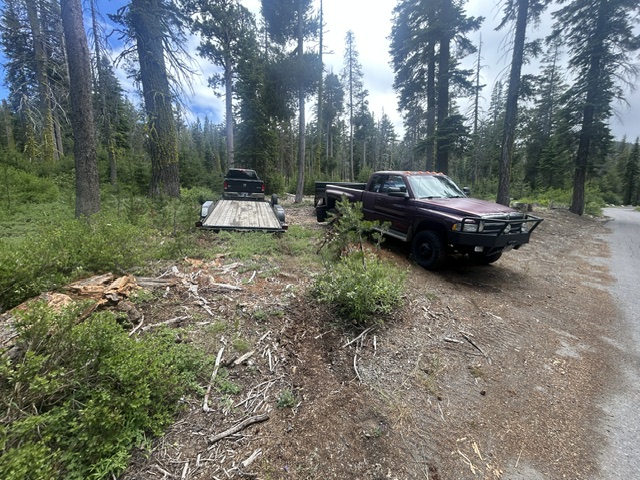
A small parking lot is no reason to park illegally. If you can’t find room at the staging area, drive back out to the residential area and park along the street.
There has been a trend over the last 20+ years to trailer rigs to the trail. Back in the day, everyone drove to the trail. And then drove home! I get not wanting to drive a trail rig a couple of hundred miles, but those living closer should drive. There has been a trend of bringing non-street legal rigs to the trail. And I’m not talking just side-by-sides, but they are growing in number as well.
Everyone comes to the Rubicon Trail for a challenge. Why not take on the challenge of building a rig that can be driven 100+ miles, do the trail without breaking, and then be driven home? Where’s the challenge of building a buggy with an LS, one-ton axles and 42″ tires?

The parking area was paved a number of years ago. At the time, the FS agreed not to stripe the parking area and to allow the users to park as they wished. For the most part, it has worked. Occasionally, someone parks weird and messes up the flow for everyone else.
I believe that the outer ring of the staging area should be a no parking zone. It should be left open as a guaranteed through route for those looking to park and for emergency vehicles. The area directly in front of the kiosk could be a staging area for rigs coming off or entering the trail. Drivers must remain with their vehicles, if parked there.
We can do better. We must do better. Don’t be that guy. Don’t let your buddy be that guy.
.
Rubicon Ronin
Fire Restrictions on ENF and TNF
Posted: June 29, 2026 Filed under: Uncategorized | Tags: fire, permit Leave a commentAs of June 29th, 2026, fire restrictions are in place on the Eldorado National Forest (ENF) and the Tahoe National Forest (TNF).
For the record, fire restrictions in place year-round on the Lake Tahoe Basin Management Unit.
Here is a link to the page on the ENF website:
Eldorado National Forest | Fire Restrictions are in Effect Forest Wide | Forest Servicehttps://www.fs.usda.gov/r05/eldorado/alerts/fire-restrictions-are-effect-forest-wide
Here is the ENF Forest Order:
Here is the link to the page on the TNF website:
Here is the TNF Forest Order:
Please be careful out there.
.
Rubicon Ronin
Ham Repeater Update
Posted: June 20, 2026 Filed under: Uncategorized | Tags: communications, ham Leave a commentAs most of you know, there is quite the repeater system along the Rubicon Trail. For years the repeater on the Rubicon was seasonal. Dennis Mayer, of the Rubicon Trail Foundation, headed the drive to make that repeater year-round.
The Rubicon repeater is privately owned, but the owner works very closely with RTF to upgrade and maintain the building and system. The RTF website has the best explanation of the systems now serving the Rubicon Trail.
www.RubiconTrailFoundation.com
In 2022, a GMRS repeater was added to the Rubicon repeater site.
Keeping this to the Tahoe side conversation, we have the 805 repeater, which I believe is above the Heavenly Valley ski area. That repeater is tied to the Eldorado 805 and if you’re using the ‘linked’ frequency and PL tone, you get the Rubicon repeater at Spider.
Please remember, this is not a dedicated Rubicon Trail only repeater. You’re hear people talking about everything. This particular repeater covers more than just the Lake Tahoe basin but can be used from the Nevada side of Heavenly as well. Think Minden and Gardnerville.
Three years ago, the equipment above Heavenly was rebuilt to Forest Service specifications. Unfortunately, not all of the upgrades were installed at that time. Life happens. Right now, those involved are headed up there to install a new receiver for the Tahoe 805 system.
I hear there had been a few dead spots where you could not consistently hit the Heavenly repeater.
Be assured that those involved are continuing to keep communications working for the Rubicon Trail.
Whether you prefer ham or GMRS, get out there and get a license, get a radio and stay in touch.
.
Rubicon Ronin
Paving the Rubicon!
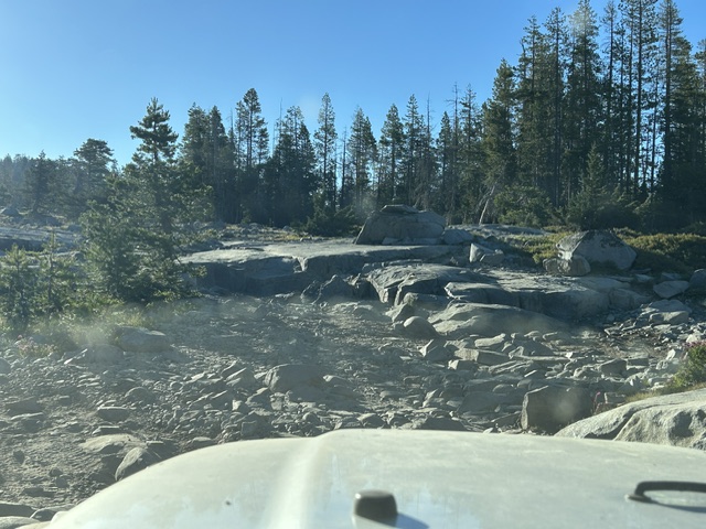
Posted: June 16, 2026 Filed under: Uncategorized | Tags: maintenance, rock, step Leave a commentOkay, that was a cheap tactic to get you to read this article. The Rubicon Trail was not paved but a bypass was rock lined to prevent erosion and ensure safe travel.
Again, let me be clear, this is a bypass, not the original route of the Rubicon Trail. The original route remains untouched, somewhat difficult but very doable.
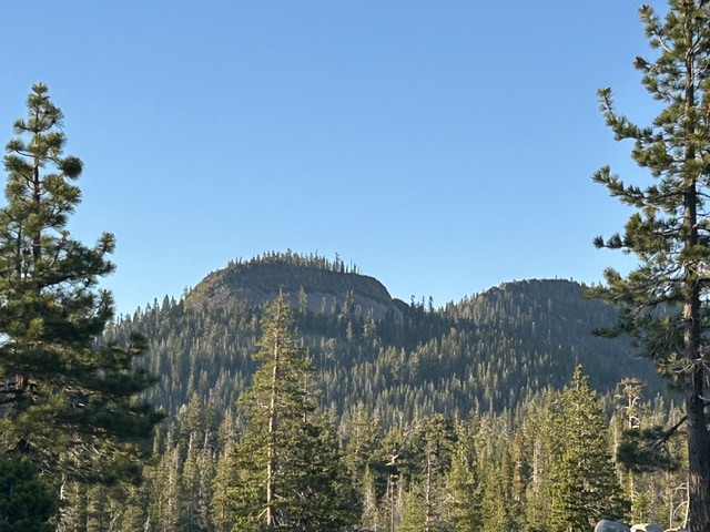
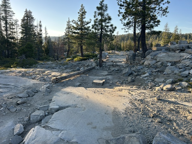
The area in question I know as “The Step”, because it is one HUGE step. Others refer to it as “Birthday Cake” because you can see a mountain top that looks like a flat top cake with candles (trees). Yesterday, for the first time, I heard it referred to as “The S-Turn”.
“The Step” is one of a few named obstacles on the Tahoe side. And named many different things.
The original route runs right down the middle. It’s one large step, obviously. That’s the ‘most difficult’ route. It’s not really that hard. To the south (right) is the newest route and it’s the ‘intermediate’ route. There are a few lines through it. It’s never been my favorite. To the north (left) is the ‘easy’ route. It’s been around for some time and for decades provided a route for those coming out broken or towing a trailer.
Birthday Cake…as seen from The Step.
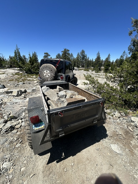
I moved ten loads of rock from the local area to the hole at the bottom of the northern most route at The Step. Okay, they were half loads. It gave me more time to rest between loads.
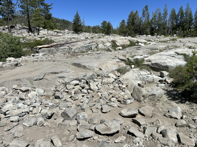
Over time, the easy route has been flooded and washed out, creating another step, but smaller than the namesake of this area.
Some years ago, I witnessed a rig get flopped on its side while being towed up the easy route. Ever since then, I’ve wanted to get out there and fix it. The flop was more the result of a towing error, but the difficulty of the route needed to be dealt with.
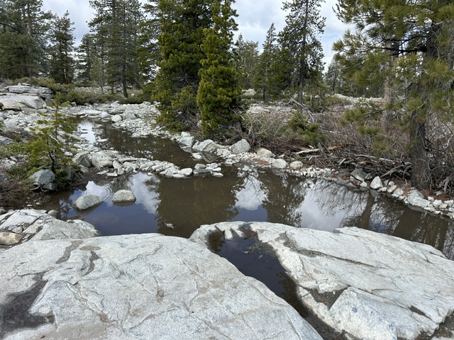
I forgot to take a good picture of the before. Here is was a few weeks ago, filled with water.
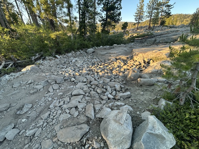
Here’s the one picture I took right before I unloaded the first trailer of rock.

Here’s what ten (half) loads of rock looks like.
Once I got to the site and started moving rock, I noticed some tracks cutting the corner. It wasn’t until a guy in a Jeep cut the corner right in front of me, that I figured I needed to do something. I called him out about not staying on the trail and he said it was a rental and it was his first time on the trail. Who rents a guy a Jeep and says go drive to Rubicon Springs?
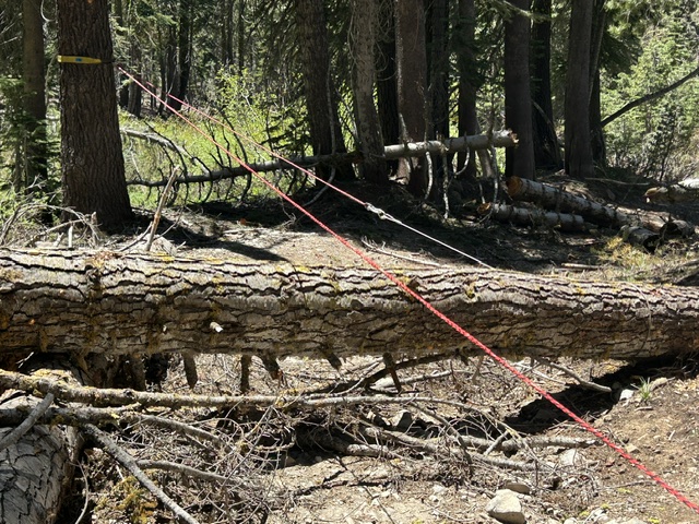
So…I moved some trees.
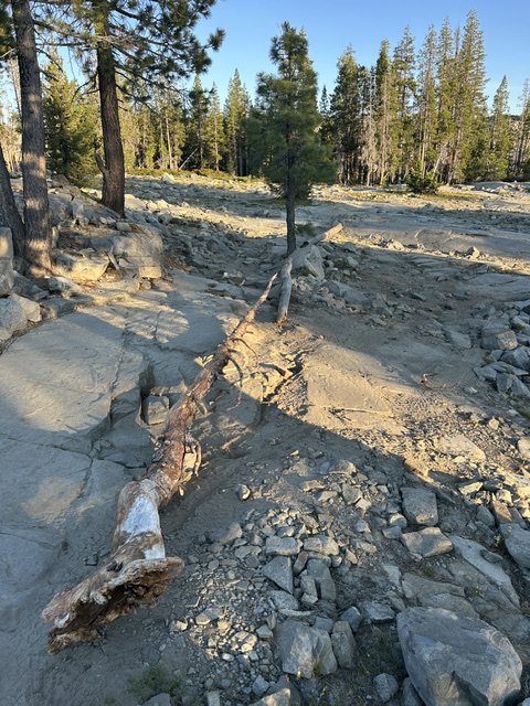
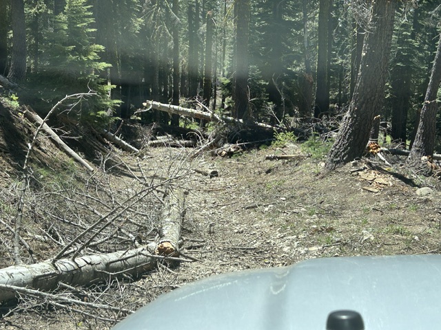
This is the approach to the area from the east. Trail is to the left of the small tree. Tracks were cutting the corner to the right.
Dragged a third just to make sure they stayed on the trail.
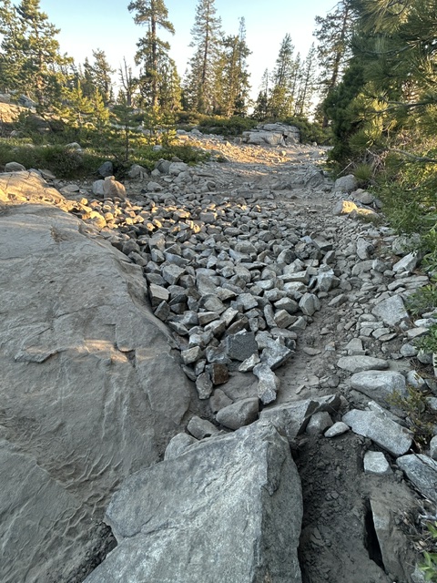
Coming from the west, people were driving straight through the easy route, up the ledge. Hopefully, that tree lets them know that is not the correct route. (It’s off to the right) Note all the newly placed rock in hole before the granite. I moved two more loads after that photo.
It was a long but very satisfying day.
.
Rubicon Ronin
Part III, finally!
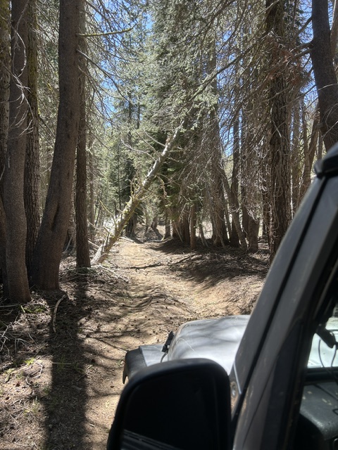
Posted: June 5, 2026 Filed under: Uncategorized | Tags: gates, snag, trees Leave a commentIt was a short day, but we finally cleared the last of the LARGE trees from the Blackwood Canyon trails.
03-04 is clear from the Rubicon to Barker Pass. 16E76, the Hobbit Trail is clear from the Rubicon to 03-04. 16E79, the Red Cabin Trail (upper Hobbit) is clear from 03-04 to Barker Pass.
The Basin cleared and opened Middle Fork Trail on the 2nd. We drove it today and it was fine.
The paved road, Forest Road 03, is clear of trees but not debris from the summit to Lake Tahoe. Since it is a huge cycling route, the Basin should get a sweeper truck in there to clear the loose debris.
Now, when I say cleared, I mean a standard rig can pass. The trails are narrow in places, and many spots have a lot of debris on the trail. Drive slowly, be cautious. If you have time, stop and throw the debris off to the side.
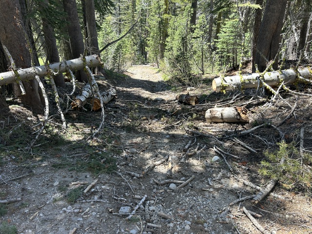
This is how the day started…
Dragging is the quickest and safest method of clearing the trail. Once this was done, we cleared the pile in the upper right corner of the picture.
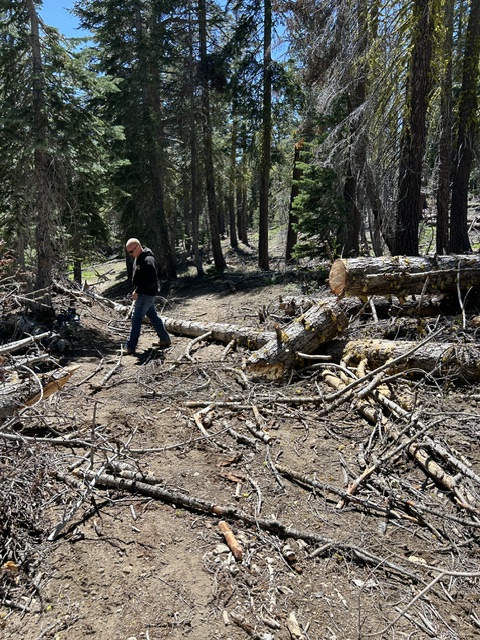
Again, passable but not polished.
We were out on the trail for probably two hours clearing the last of 16E79. This was in the middle of clearing this section.
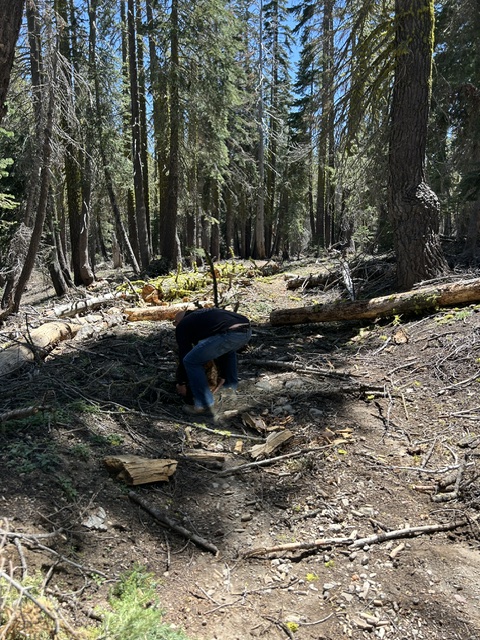
This was the last of the piles.
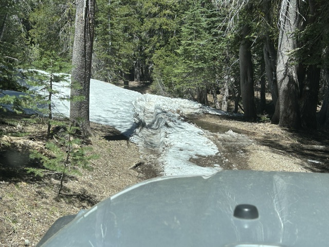
This is where we turned around on Sunday. There is quite a bit of snow left but very passable.
We didn’t touch this one. There is a large snag hanging over 16E79. I have notified the Tahoe National Forest. Hopefully, they will get on this one soon. It’s about a half mile down from 03-04.
Always be prepared to deal with trail issues. I always carry a large handsaw, just in case.
Turn Around, Don’t Go Around
If there is a tree across the trail or a boulder you can’t navigate, do not go off trail to get around it. Turn around and come back another day.
.
Rubicon Ronin

