
Eldorado Forest Fire Restrictions in Effect
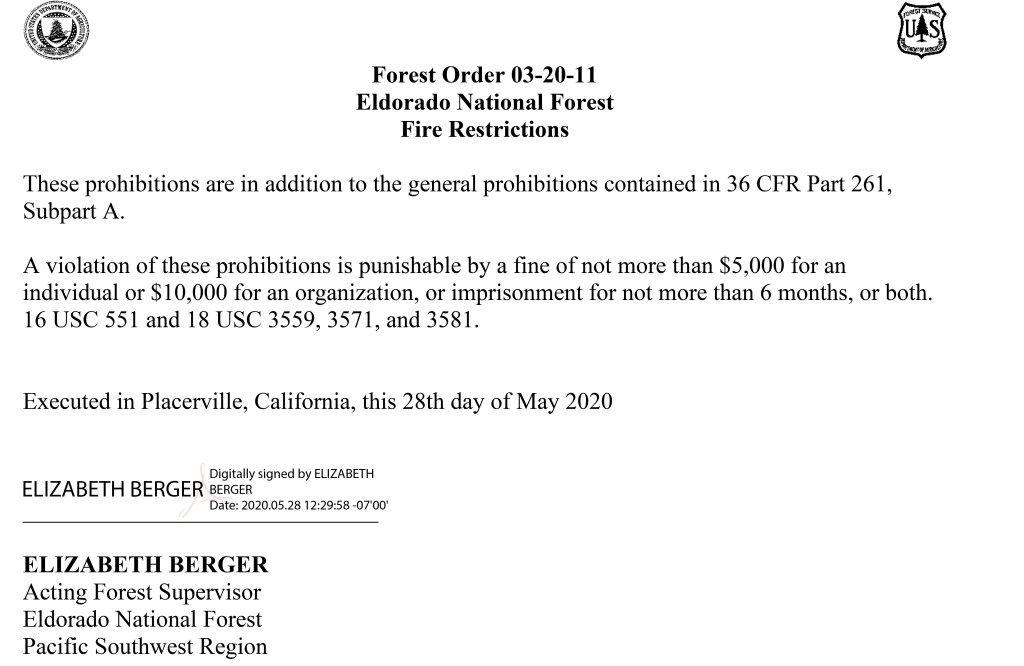
Posted: May 29, 2020 Filed under: Travel | Tags: camp fire, fire, fire permit Leave a commentAs of today 5/29/2020, fire restrictions are in effect in the Eldorado National Forest. No campfires outside of fire rings or stoves in designated campsites. This includes welding!
This is a little early but one email I read cites that 95% of all fires in California are man caused.
Propane stoves are still allowed with a fire permit.
ENF prescribed burns coming
Posted: October 26, 2018 Filed under: Maintenance, Travel | Tags: fire Leave a commentThe Eldorado National Forest has released plans for their fall prescribed burning projects.
Although there’s nothing close to the Rubicon, there are fires along the route to the Rubicon.
The link to the Forest Service’s page on the projects is below. The easiest way to figure out where things are happening is to click on the map and zoom in.
https://www.fs.usda.gov/detailfull/eldorado/home/?cid=fseprd560831&width=full
More on prescribed burns…
Posted: October 17, 2018 Filed under: Maintenance, Travel | Tags: education, fire Leave a comment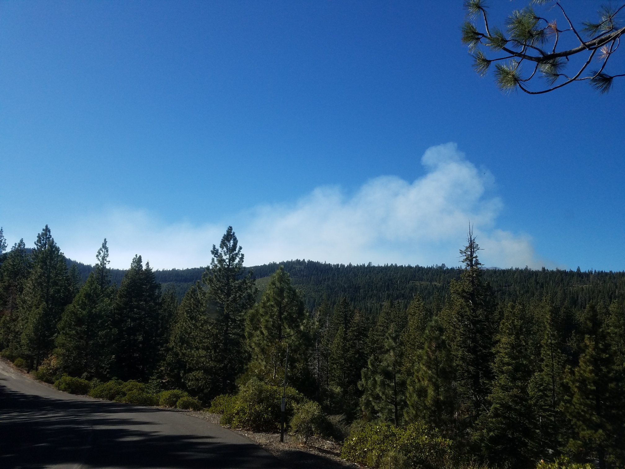
This is a photo looking northwest from Meeks Bay. The Smoke is coming from the west end of Sugar Pine State Park. I didn’t stop to take the more dramatic picture as I was travelling south on 89.
Here is the email I received because I subscribe to the Lake Tahoe Basin Management Unit’s prescribed burn email notifications…
PRESS RELEASE
Tahoe Fire and Fuels Team
October 17, 2018 For Immediate Release
Prescribed fire operations today on Tahoe’s West and South Shores
Contact: U.S. Forest Service, Lisa Herron (530) 543-2815
SOUTH LAKE TAHOE, Calif. – Weather and conditions permitting, California State Parks and the U.S. Forest Service may conduct prescribed fire operations in Sugar Pine Point State Park on the West Shore and near Twin Peaks on the South Shore beginning today, October 17, 2018. Smoke will likely be present. A map with project locations and details is available for viewing at http://www.tahoefft.org. To receive prescribed fire notifications, send an email to pa_ltbmu@fs.fed.us.
Prescribed fire operations are conducted whenever conditions allow to reduce excess vegetation that can feed unwanted wildfires. Planned fires now reduce the threat of unplanned fires later, which helps provide increased community protection. Fire is a natural process in the Sierra Nevada and helps keep our forests healthy by minimizing the spread of insects and disease, recycling nutrients back into the soil and promoting improved habitat for diverse vegetation and wildlife.
Fall and winter bring cooler temperatures and precipitation, which are ideal for conducting prescribed fire operations. Each operation follows a specialized burn plan, which considers temperature, humidity, wind, moisture of the vegetation, and conditions for the dispersal of smoke. This information is used to decide when and where to burn.
Smoke from prescribed fire operations is normal and may continue for several days after an ignition depending on the project size and environmental conditions. Prescribed fire smoke is generally less intense and of much shorter duration than smoke produced by unwanted wildland fires.
Agencies coordinate closely with local county and state air pollution control districts and monitor weather conditions carefully prior to prescribed fire ignitions. They wait for favorable conditions that will carry smoke up and disperse it away from smoke sensitive areas. Crews also conduct test burns before igniting a larger area, to verify how effectively materials are consumed and how smoke will travel.
Before prescribed fire operations are conducted, agencies post road signs around areas affected by prescribed fire, send email notifications and update the local fire information line maintained by the Lake Tahoe Basin Management Unit at 530-543-2816. The Tahoe Fire and Fuels Team gives as much advance notice as possible before burning, but some operations may be conducted on short notice due to the small window of opportunity for conducting these operations
Prescribed Fires have Started
Posted: October 14, 2018 Filed under: Maintenance, Travel | Tags: fire Leave a commentFall brings cooler temperatures, changing colors and prescribed burns by the forest service.
Some of those fires are happening right now on 125 acres of federal and state land near the Rubicon Trail. Mostly, well south of the trail.
Here is a link to the Lake Tahoe Basin Management Unit about the projects:
https://www.fs.usda.gov/detail/ltbmu/news-events/?cid=FSEPRD599074
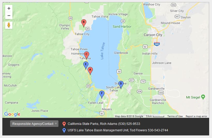
“C” is Sugar Pine State Park – 54 acres
“E” is El Dorado County piles – 6 acres
“A” is DL Bliss State Park – 65
Just an FYI if you’re headed near the trail in the next few weeks.
Rubicon Ronin
Fire Restrictions are in place on the ENF
Posted: July 17, 2018 Filed under: Access | Tags: education, fire Leave a commentThe Eldorado national Forest has started fire restrictions as of July 14th.
The Tahoe National Forest has not yet posted restrictions but last year it was the 25th, the year before the 11th. Check the TNF website before you go. It is the users responsibility to know what restrictions are in effect.
Fire Permits are free from any forest office or even online.
FYI, the Lake Tahoe Basin Management Unit does not have fire restrictions by date. No fires are allowed outside official Forest Service fire pits and then only in official Forest Service campsites.
Don’t be that person!
Rubicon Ronin


