
Awesome 14N39 news!
Posted: July 17, 2014 Filed under: Access, Maintenance Leave a commentOn July 16th, 12 people took part in a tour of 14N39-9. This is the last ‘meadow’ on the Richardson Lake Trail. This one is actually a meadow and the trail goes right through it. We were going to hear the FS ideas to get the trail to meet S&G100 and to offer our ideas. I must say the ENF has been open to input throughout this process.
Early opinions had this one pegged as a reroute as the trail did go through a meadow, actually the documents claim two meadows. This would require a NEPA, EIS, EA and of course CYA. Read as lots of money and many YEARS to finally get the route open to the top.
Well, the tour started with a briefing at the Rubicon staging area. I nearly fell over when the lead FS guy, Richard Thorburgh, said they were favoring a “fix in place” over a reroute. The day just kept getting better.
The trail does cross a meadow. But it does so at the shortest point and perpendicular to the meadow. The hydrologist said, ‘when you have to cross a meadow with a road, that’s how is should be done’.
Here’s a shot of the tour returning down the mountain, driving through meadow 14N39-9, after having lunch at the summit:
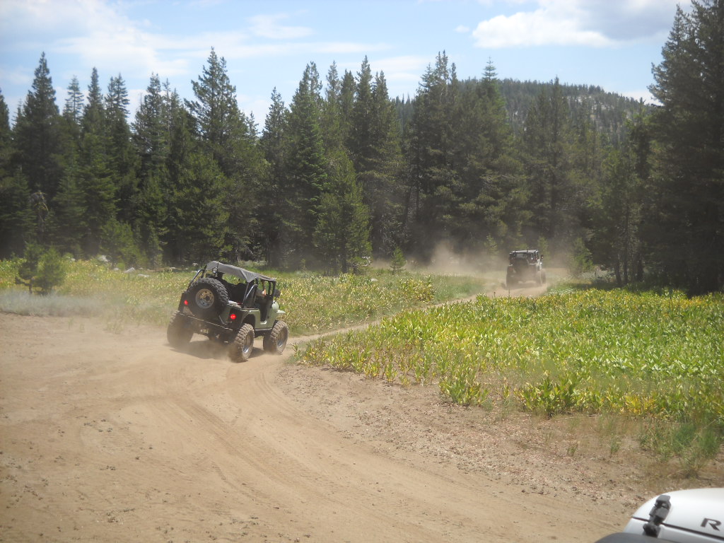
The proposed solution is to rebuild the road in a manor that allows water to flow from the upper meadow to the lower meadow. The classic part of all this is that the lower meadow looked completely unaffected by the trail. It was pointed out by a few people but the FS wants to harden the trail before it gets reopened.
Karen S (I will not put her name on my website) was part of the tour and was still pushing for a reroute, to save the undamaged meadow. The FS explained what would be involved with a reroute, falling of trees (62 were dropped to reroute Barrett), cutting of a road with a bulldozer, the future possible problem of water on the new road, etc. She still wanted to walk around the back side of the hill to see for herself. Most went with her, I stayed at the rigs and had lunch.
The original survey stated that the last 500 feet went through a meadow. The FS took a second look at the trail earlier this year and concluded that the ‘meadow’ was really a cleared hillside and too steep to hold enough water, even seasonally, to be called a meadow. Thus it was not a meadow and did not have to meet S&G100. No fix needed, We moved on.
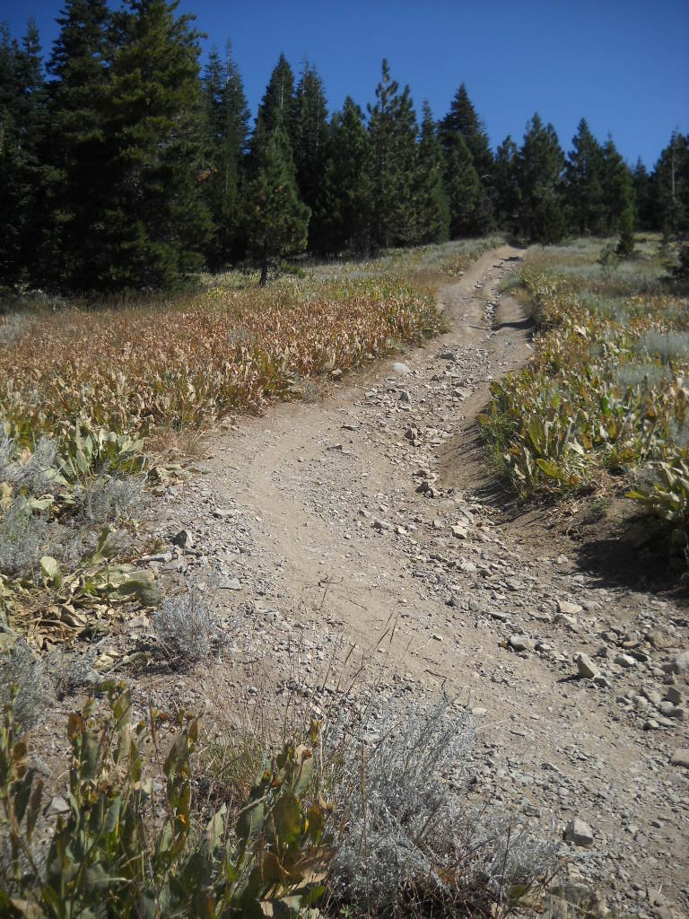
Although not a meadow, the trail does need some work. A few rolling dips would go a long way. The non-meadow:

Further along in the non-meadow, it’s steeper than it looks:
The best news, yes it gets better, is how soon this could open. The reroute would have taken all year to plan, fund and study. It would have been done in 2015 but a new road requires “winterizing” by waiting over one winter before it can be used. That would put the opening in 2016.
By fixing in place it could be open next spring. The FS is looking in to using a Placer County contractor who will be working the Rubicon in Sept to transport material this Sept! The FS would be there with heavy equipment to get the bulk of the work done. I don’t see it being finished this fall but I do see it opening next summer after it gets hardened the same way the first three meadows were done.
The basic plan is to rip up the current road to restore the ability of water to flow below the road surface (even thought it still flows under the currently compacted road), fill with large rip-rap crushed rock, use a geo-fabric to prevent the movement of dirt but allow water to drain and then cover it all with an appropriate surface rock.
At each end of the road through the meadow (see the two Jeeps in the above photo), there will be a large rolling dip. The upper and lower rolling dips will prevent water from running down the trail.
What an awesome day!

