
Hazard Trees at Tahoma Staging
Posted: June 18, 2025 Filed under: Uncategorized | Tags: LTBMU, trees Leave a commentI just got a cryptic voice mail from the Lake Tahoe Basin Management Unit at 5:55pm on Wednesday the 18th.
They said there are several hazard trees around the Tahoma staging area parking lot that need to be taken down.
Notices are being put on cars currently parked there but if you see flagging blocking part of the parking lot, please respect it.
Tomorrow is a federal holiday so no one will be around dropping trees, but maybe Friday? Hopefully before the weekend.
I’ll post more as I learn more.
.
Rubicon Ronin
LTBMU: the left hand doesn’t know what the right hand is doing, or they are not telling the public
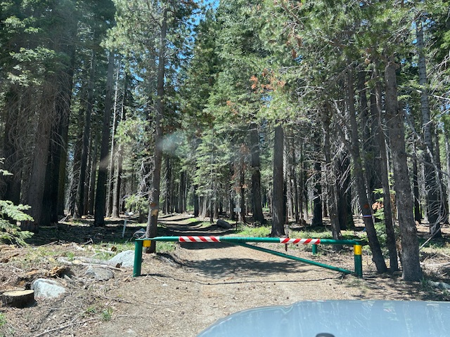
Posted: June 17, 2025 Filed under: Uncategorized | Tags: 15N38, gate, gates, LTBMU Leave a comment15N38 is open, but it’s a long story…

If you read my previous post, on Saturday I discovered that the FS had failed to open the 15N38 gate by the weekend. Sunday, I was on the Rubicon and made it all the way down to the bridge. See the photo of the month. Monday, I golfed because I do have a life. I did play well, thanks for asking.
This morning, I left early and was at the Lake Tahoe Basin management Unit building at 8:15am.
The lady at the FS front desk, who has been with the FS since the FS was established, told me a story about the FS opening the gate last week, then someone got stuck in a mud hole, did some resource damage trying to get out, through or around that mud hole, that was being fed by a large snow drift on the trail, and the FS had to go in a drag him out. So, the FS closed the gate again and were waiting for the snow to melt and the mud hole to dry up.
(Again, I was told the gate had been closed and was currently closed, waiting for the trail to dry!)
The lady in charge of the gates was not available. I got the Forest Supervisor’s assistant and worked on getting a meeting with him as soon as possible. I left with what I thought was an accurate update about the trail and why it was closed, opened and then reclosed.
I had my new to me used electric mountain bike with me, because I planned on riding up the trail to see where the snow was that I was told about back on the 9th. Now I really wanted to see the snow and the mud hole and the resource damage.
As previously stated, I got to the gate and found it open. Who didn’t tell the lady at the desk? Did the lady at the desk not know, or did she purposely give me bad information? Does anyone at the FS talk to each other?
Going back to her story, the FS does not go out on OHV trails and get people unstuck. Was that whole story bad information or did she lie to me about that?
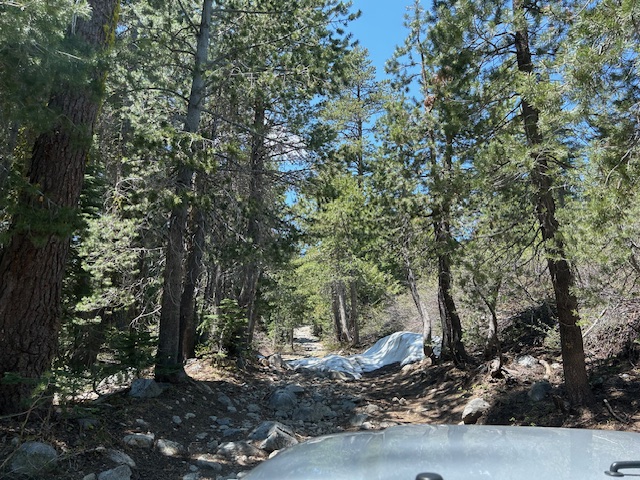
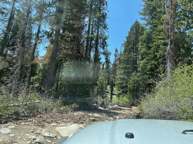
Let me say that the FS has done quite a bit of tree clearing along the Middle Fork Trail (15N38). It would have taken me forever to get all that work done. It could be cleared back a little more but the trail is easily travelable. I was in my 2012 Colorado. There were many examples along the trail of tree clearing.

I was not able to check the Upper and Lower Hobbit trails, but I was told on Sunday, someone had come through those on a quad. Second hand information, at best
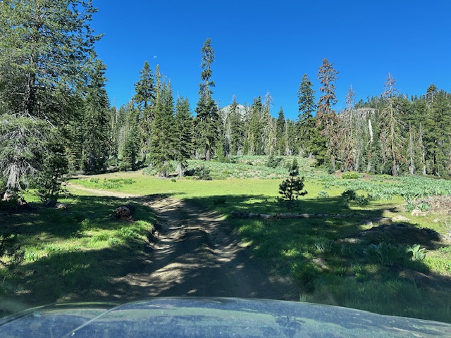
The ONLY snow I found on, or even near the trail, is pictured below. No mud puddle nearby.

There were a few puddles on the trail. And I must point out that those water puddles were at rolling dips that needed their drainages cleared out and then there would be no puddles! Tracks in wet dirt is not a mud hole and not resource damage.

On a lighter note, it is a beautiful trail, if you take the time to look around.
This might have been the first time I put my Colorado in low range. I was a little worried about my sidewalls in one section of the trail but the truck did well.

I will meet with the Forest Supervisor and work out a plan to prevent this from happening in the future.
.
Rubicon Ronin
And the gates are still closed!
Posted: June 14, 2025 Filed under: Uncategorized | Tags: 15N38, gate, gates, LTBMU Leave a commentFlag Day was spent with the girlfriend in her Corvette. Yes, she has the Corvette and drives fast; I have the Jeeps and drive slow. We had an early, expensive, lunch at Garwoods, with 40 other Corvettes from the Reno Corvette Club, and then drove her Corvette around the lake. Yes, we put on quite a sight when 40 Corvettes run around Lake Tahoe.
Of course, I had to drive up Forest Road 03 to see if the gate on 15N38 had been opened. No, I didn’t drive her Corvette to the gate, that road is a little pitted. It was a nice day for a short hike.
And the gate was closed. I’m not surprised. The FS said they would notify me when the gates were open and I never got a notice.
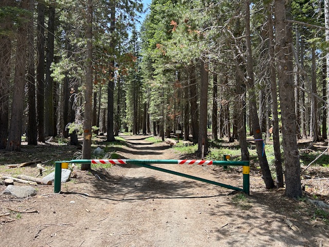
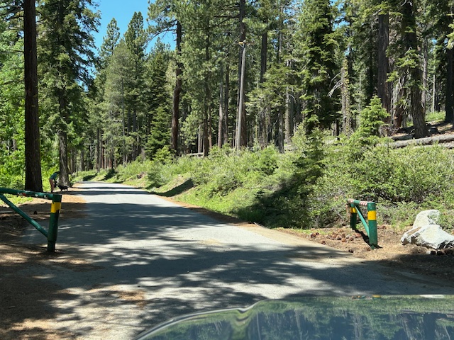
Surprisingly, the lower gate on Forest Road 03 was open. That road opens tomorrow, and the FS got all over opening that gate so the hikers and cyclists and back country skiers would have timely access. But the OHV gate remained closed. At least with 03 open, wheelers now have a way out to Highway 89.
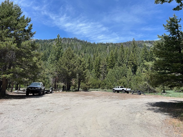
People are out with their off-highway rigs. I’m not sure if these guys went around the gate or up Forest Road 03.
There was evidence of motorcycles going around the 15N38 gate. I did not see evidence of 4-wheeled rigs going off trail to get around the gate.

As soon as this gets posted, I will be emailing the FS, again.
Phone calls on Monday.
Tuesday morning might find me at the Forest Service office, again.
.
Rubicon Ronin
Traffic, Gates, Camping, Parking, Fires…
Posted: June 9, 2025 Filed under: Uncategorized | Tags: access, gate, gates Leave a commentI left my house at 6:45 this morning. My laptop told me I had a one hour and eleven-minute drive to the Lake Tahoe Basin Management Unit (LTBMU) offices in South Lake Tahoe. The plan was to walk in as they opened their doors at 8am.
I walked into the headquarters at 9:45. At one point, the entire road was red with traffic on my phone. Yes, I had to drive through that entire traffic jam.

There was more than a one and a half hour delay due to construction, once into the Tahoe basin.
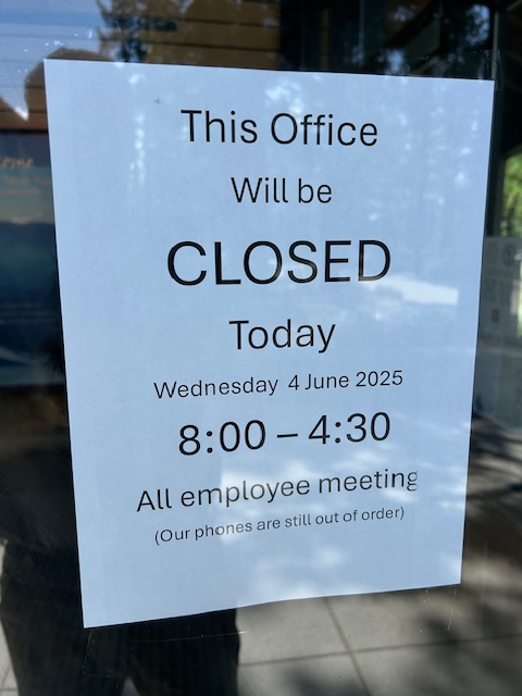
The LTBMU is in disarray. People have left; retired or moved to other forests. Some positions have been filled but they do not have the experience, at the position or on the LTBMU. Misinformation is being communicated within the LTBMU. The phones have been out for five weeks. But, I finally found someone who could help.
Progress was made as the latest employee responsible for opening seasonal gates guaranteed me the gate on 15N38 would be open by the end of the week. She even said she would drive up the west side of the lake today and open the gate. Cautiously waiting on her email.
My plan is to be out tomorrow morning to make sure the Middle Fork Trail is safe and clear. It sounds like some clearing has been done already by one of the Fire Prevention people.
The camping at Kaspian at the lake on Forest Road 03 and the Blackwood campground are now being managed by Vista Recreation. Part of the agreement includes charging for parking for “day use” at the SnoPark lot during the summer. I’m hoping we can stop and use the restrooms without being charged.

There have been numerous lightning strikes over the last few days but the only fires in the basin was a single tree above the Kings Beach area.
We’re close. We’re very, very close to getting our OHV trails open. Please be patient, stay on the trails. “Turn Around, Don’t Turn Around”.
.
Rubicon Ronin
Good News, Bad News
Posted: June 4, 2025 Filed under: Uncategorized | Tags: gates, opening day, snow Leave a commentThe good news is that the gate on Forest Road 03 has been opened. That’s the first gate off Highway 89 going up Blackwood Canyon. The gate was supposed to be opened on the 1st but was not. I’m not sure when it opened.
The bad news is that the gate on our OHV trail 15N38, the Middle Fork Trail, is still closed. This gate should have been opened for use of the trail on June 1st.
So, change of plans, I headed out to the Rubicon in search of another side trail. I headed up the Buck Lake Trail, 14N40. It’s not an overly difficult trail except for one short, but steep, section.

I wasn’t the first, but I was the first since a significant snow melt.
There was one tree across the Trail. Now you see it…

Now you don’t…
I did drop into the Buck Lake campground area. There are a few trees down blocking the campground. Sorry, but I didn’t take the time to clear them.

Here’s the difficult section. There is a winch post installed above this section because it is that difficult.

Have I mentioned the great views from this trail?

Here’s where my travels ended today. I tried it slow. I tried it fast. But I kept getting pushed off to the right. I could have winched through it but I figured someone was trying to tell me to turn around. I imagine there are more snow drifts along the Ellis trails.

With that snow drift shortening my day, I decided to drive home through South Lake Tahoe and stop at the Forest Service office and ask why the Middle Fork Trail is closed.
Maybe another day.
I did send an email on Monday asking about the gates still closed after their opening dates. I will send out another tonight.
.
Rubicon Ronin

