
OHV Gates, working on it
Posted: August 8, 2026 Filed under: Uncategorized | Tags: access, closed, gates Leave a commentFor the last three straight years, many of the OHV gates within the Lake Tahoe Basin Management Unit (LTBMU) did not open on time. This is not a new phenomenon. Sadly, it is a regular occurrence. This has always been the gate in question: The Middle Fork Trail 15N38.
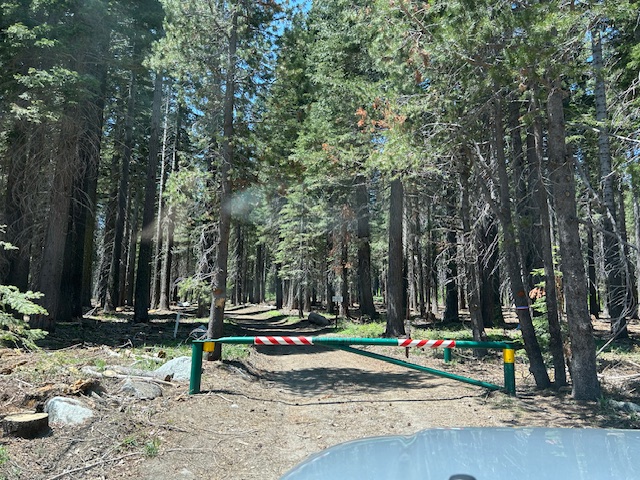
It was so bad in 2025, that I decided to push hard to see that it did not happen again. (I had worked with the Basin previous years without success.) I contacted the LTBMU and had a meeting scheduled to talk about OHV gates in October of 2025. That’s seven months before the OHV gates were to be opened! Well, that was the time the federal government shut down due to lack of funding for about 40 days. No meeting.
Come January, the government is back open. The previous ‘acting’ Forest Supervisor retired. So, I started over with the new ‘acting’ Supervisor. We did meet. I thought we were on the right track. A few meetings, many emails.
But 15N38 was not open on June 1st. I emailed the Basin and I got this in response…
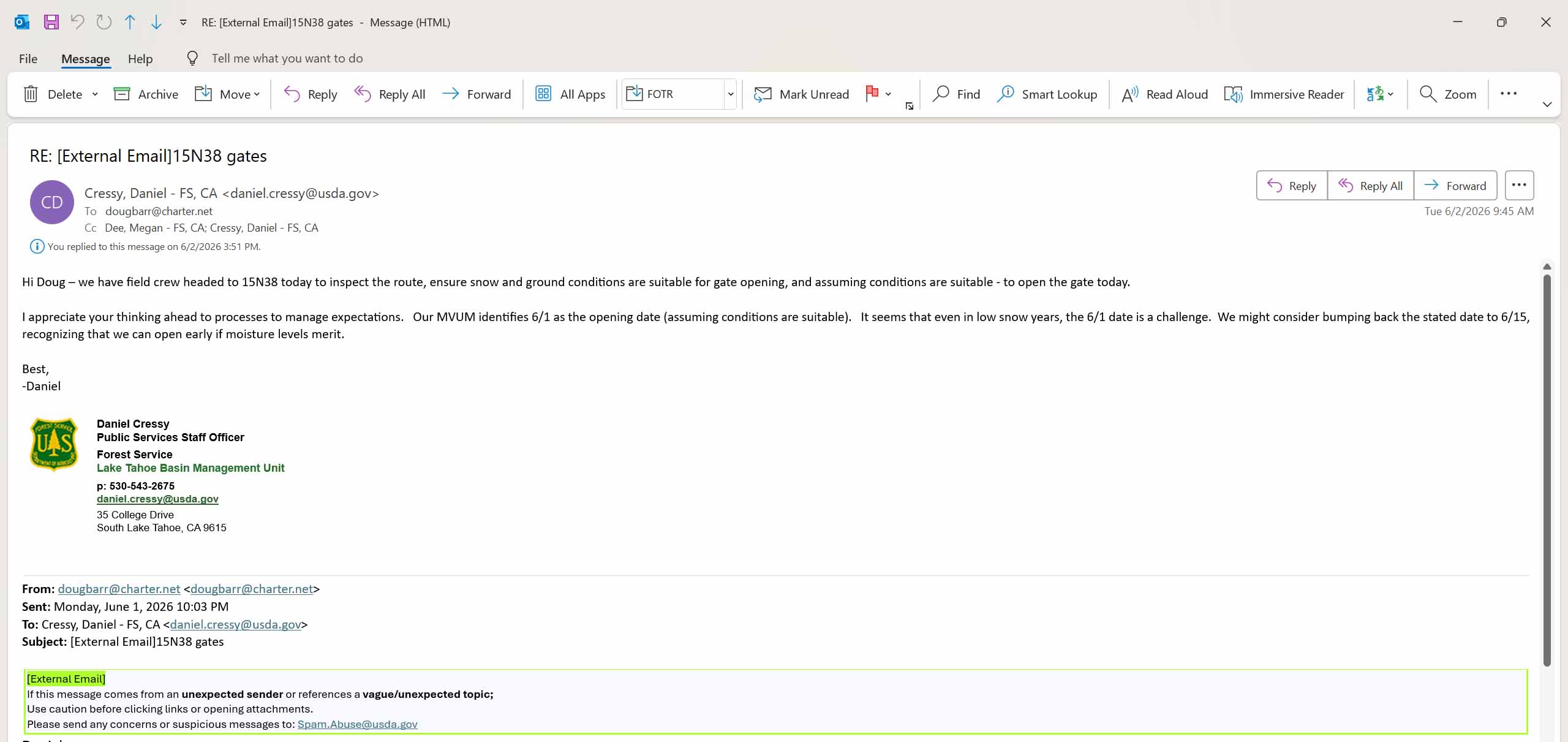
Tough to read but it says they had a crew scheduled to inspect the trail “today”. (6-2-2026). The day AFTER the trail was to open. My response was professional but very heated. A trail should not be scheduled for an inspection, the day after it’s to open.
Another new ‘acting’ Supervisor. More emails. More meetings.
My argument is that people out playing on the Rubicon read the Motor Vehicle Use Map (MVUM), read that the Middle Fork Trail opens June 1st. So, they plan to exit the Rubicon Trail using Barker Meadow OHV Trail (16E76), then Red Cabin Trail (16E79) and head down the Middle Fork Trail (15N38) to Tahoe. But they find 15N38 closed because the Basin has failed to do their job.
The FS is down employees, due to transfers out of the Basin and retirements. They claim to be down on funding and cannot replace people fast enough. So, I’m stepping up and removing some of their excuses regarding why OHV gates do not open on time.
The first step is developing a list of OHV gates. The MVUM lists all the trails, but some don’t have gates and some have two gates. I decided to hit the road/trail and figure it out.
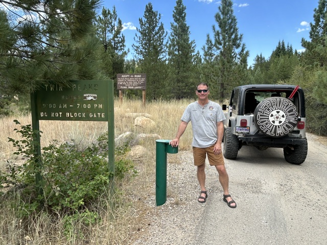
It has been more than one trip to the lake to find and document all the OHV gates and their access and condition. I hadn’t been to Twin Peaks for years but I documented it. For the record, according to the signs, this is still a “day use” area and not one I need to worry about opening seasonally.
Some trails were campgrounds, not OHV areas. Some were FS cabin track roads, not OHV trails. Some were WAY overgrown and had not opened in years, but still on the MVUM. Those will take more research. But there is now a user created OHV list for the Basin.
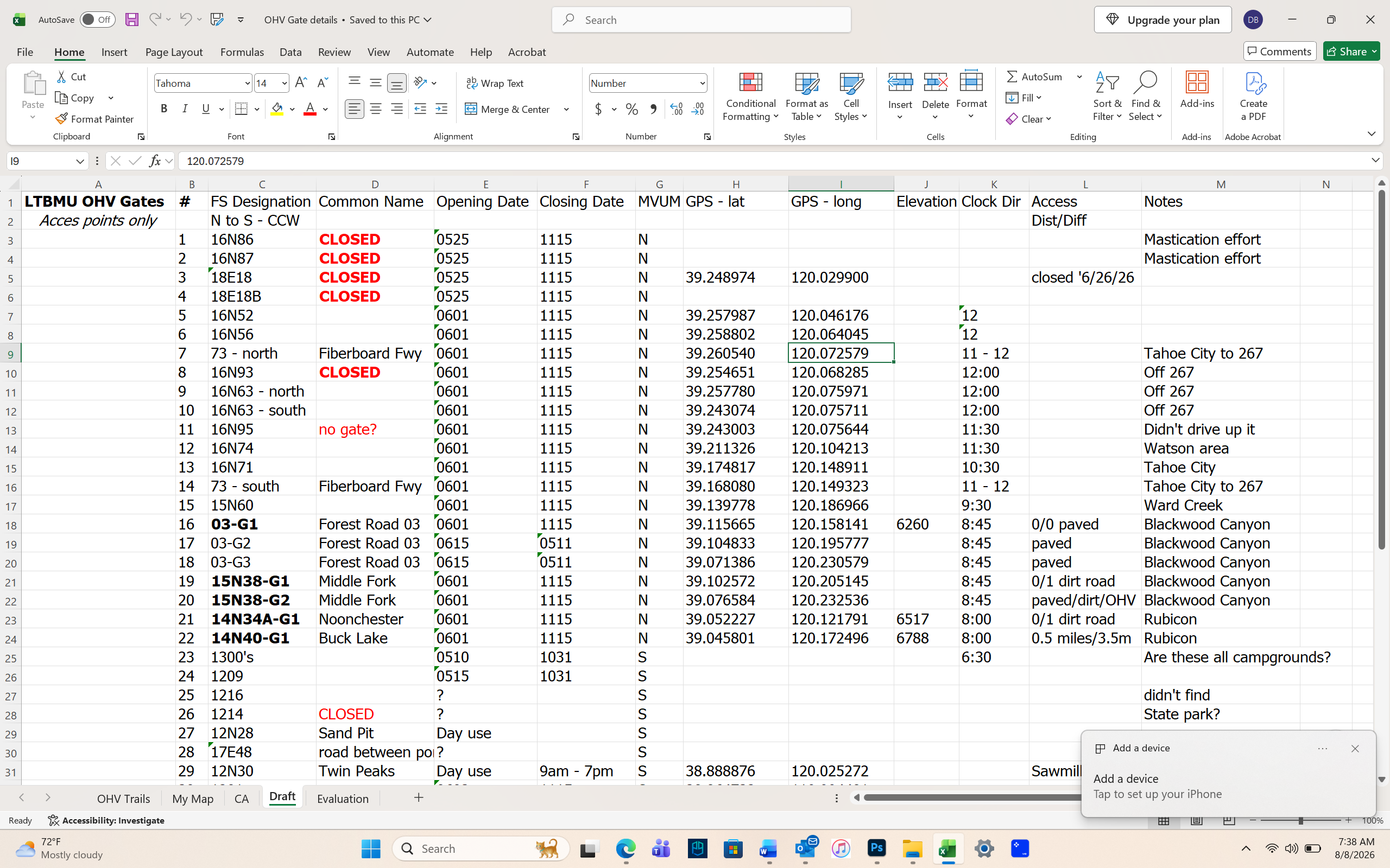
We are scheduled to meet again later this month. I will share this list, and we’ll compare it to the FS list. I have created a check list / spread sheet to use when the FS is checking / opening gates. I’m in the middle of drafting a procedure for opening OHV gates within the Basin so everyone is on the same page and gate open due to a procedure not when someone has the time to drive out there.
There is still plenty of time to get this worked out. The Basin is open to working with the users. Finger crossed, we’ll get this figured out by next season.
.
Rubicon Ronin
Tahoma Parking Issues
Posted: June 30, 2026 Filed under: Uncategorized | Tags: access, illegal, parking, ticket Leave a commentRubithon was held last weekend. I happened to visit the staging area that Friday for another OHV project I’m working on, and I witnessed some very improper parking. Let’s call it what it was, ILLEGAL!
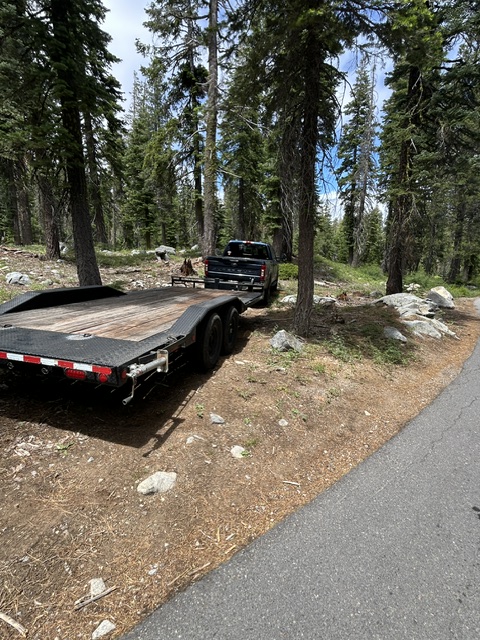
Parking off pavement may or may not be legal, depending on how it is done. I believe you can pull over enough to get off the pavement as long as you are not on any vegetation. We’re talking pulling off the trail one vehicle width; only enough to get off the trail. Don’t quote me on this as I’m not a law enforcement officer.
The parking in these pictures (and I could have taken more pictures) are all illegal. It is either a straightforward illegal parking ticket or a much more expensive resource damage ticket. Again, not a LEO.
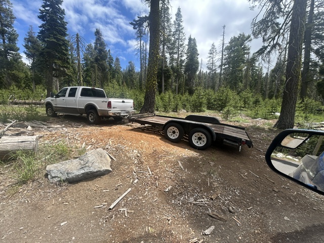
We as OHV users need to do better. Images like this will be used by the anti-OHV crowd to put us in a bad light and get our trails and staging areas shut down. Yes, they might pull these images off and use them against us. For the record, I am not giving anyone permission to use these images, for any reason.
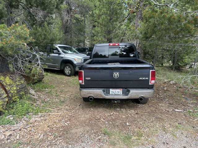
There was/is an effort underway to enlarge the parking at the Tahoma Rubicon staging area. That project is on hold as the Lake Taheo Basin Management Unit (LTBMU) has had people retire and others move to other forests. There is a lack of personnel and thus some projects have slowed to a stop.
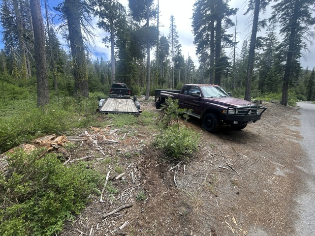
A small parking lot is no reason to park illegally. If you can’t find room at the staging area, drive back out to the residential area and park along the street.
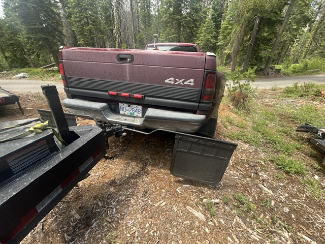
There has been a trend over the last 20+ years to trailer rigs to the trail. Back in the day, everyone drove to the trail. And then drove home! I get not wanting to drive a trail rig a couple of hundred miles, but those living closer should drive. There has been a trend of bringing non-street legal rigs to the trail. And I’m not talking just side-by-sides, but they are growing in number as well.
Everyone comes to the Rubicon Trail for a challenge. Why not take on the challenge of building a rig that can be driven 100+ miles, do the trail without breaking, and then be driven home? Where’s the challenge of building a buggy with an LS, one-ton axles and 42″ tires?
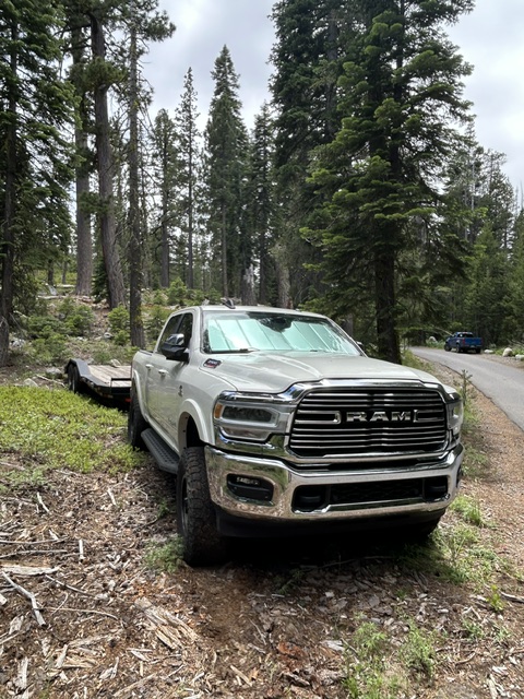
The parking area was paved a number of years ago. At the time, the FS agreed not to stripe the parking area and to allow the users to park as they wished. For the most part, it has worked. Occasionally, someone parks weird and messes up the flow for everyone else.
I believe that the outer ring of the staging area should be a no parking zone. It should be left open as a guaranteed through route for those looking to park and for emergency vehicles. The area directly in front of the kiosk could be a staging area for rigs coming off or entering the trail. Drivers must remain with their vehicles, if parked there.
We can do better. We must do better. Don’t be that guy. Don’t let your buddy be that guy.
.
Rubicon Ronin
Traffic, Gates, Camping, Parking, Fires…
Posted: June 9, 2025 Filed under: Uncategorized | Tags: access, gate, gates Leave a commentI left my house at 6:45 this morning. My laptop told me I had a one hour and eleven-minute drive to the Lake Tahoe Basin Management Unit (LTBMU) offices in South Lake Tahoe. The plan was to walk in as they opened their doors at 8am.
I walked into the headquarters at 9:45. At one point, the entire road was red with traffic on my phone. Yes, I had to drive through that entire traffic jam.

There was more than a one and a half hour delay due to construction, once into the Tahoe basin.
The LTBMU is in disarray. People have left; retired or moved to other forests. Some positions have been filled but they do not have the experience, at the position or on the LTBMU. Misinformation is being communicated within the LTBMU. The phones have been out for five weeks. But, I finally found someone who could help.
Progress was made as the latest employee responsible for opening seasonal gates guaranteed me the gate on 15N38 would be open by the end of the week. She even said she would drive up the west side of the lake today and open the gate. Cautiously waiting on her email.
My plan is to be out tomorrow morning to make sure the Middle Fork Trail is safe and clear. It sounds like some clearing has been done already by one of the Fire Prevention people.
The camping at Kaspian at the lake on Forest Road 03 and the Blackwood campground are now being managed by Vista Recreation. Part of the agreement includes charging for parking for “day use” at the SnoPark lot during the summer. I’m hoping we can stop and use the restrooms without being charged.

There have been numerous lightning strikes over the last few days but the only fires in the basin was a single tree above the Kings Beach area.
We’re close. We’re very, very close to getting our OHV trails open. Please be patient, stay on the trails. “Turn Around, Don’t Turn Around”.
.
Rubicon Ronin
Side Trail Conditions…
Posted: June 2, 2025 Filed under: Uncategorized | Tags: access, snow Leave a commentI was asked about side trails: Buck Lake, Richardson Lake (Sourdough Hill), Ellis, etc. I have not personally been out on those yet.
The people I referred to in the last post about locals getting out in the side-by-sides and clearing trees said they had been on and had “cleared” all of the side trails. Sourdough will have one or two sections with nasty side hills. They said Buck does have a very side hill section before the rocky climb just above the lake. Ellis always has snow later in the season.
Some of the “clearing” they had done was before the last big snow melt. That melt exposed tress we cleared out yesterday. Who knows what’s out there. This time of year you should carry a saw , of some kind, and be prepared to winch trees out of the way.
“Turn Around, Don’t Go Around!”
They were in a well-built set of side-by-sides. I would expect that a street legal rig would have a much more difficult time traversing the snow, especially a side hill snow drift.
The snow will melt very fast. Two weeks will make a HUGE difference.
.
Rubicon Ronin
There’s Still Snow!
Posted: June 1, 2025 Filed under: Uncategorized | Tags: access, gates, snow, trees Leave a commentThe plan was to go in through Blackwood Canyon and up the Middle Fork Trail (15N38) and clear trees to the summit. If we had time, we were going to head down the Red Cabin Trail (upper hobbit/Barker Meadow OHV Trail, 16E79) and then down the actual Hobbit Trail (16E76).
Well, the gate at the bottom of Forest Service Road 03 was still locked. Long story for later. So, we headed over to the Rubicon to go around the back way.

When we got to the intersection of the Rubicon and Forest Road 03-04, we took 03-04 toward Barker Pass. It wasn’t too long before we found trees that needed attention. This is actually the third tree we removed. The first was on the Rubicon and people had stacked rocks to get over it!

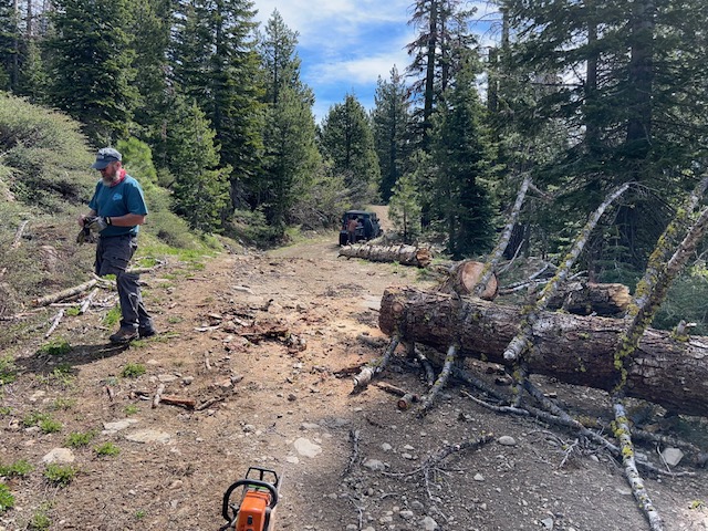
Some were so rotten, we just pulled them to the side. So many times I forgot to get out the camera.
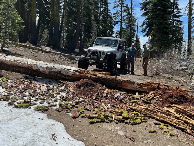
This one took some rigging for the winch to be able to pull it to the side.
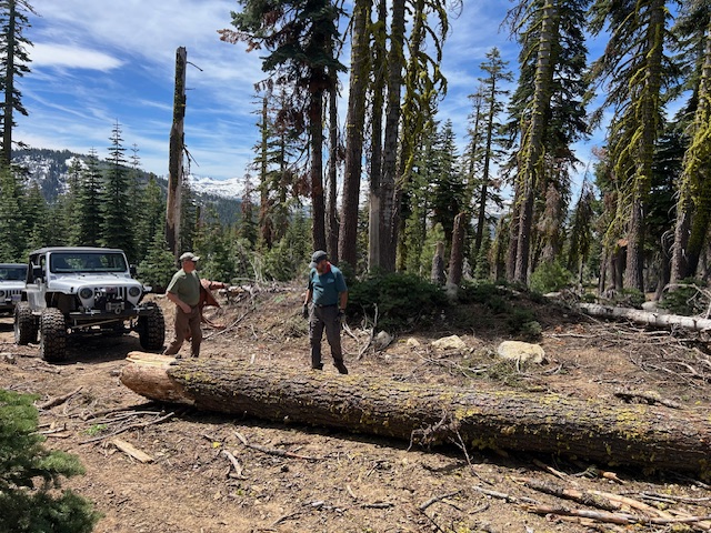
As we got around the north side of Ellis Peak, the snow became deeper. The snow wheeling was actually pretty fun. The snow kept traction as long as you were going stupid slow.
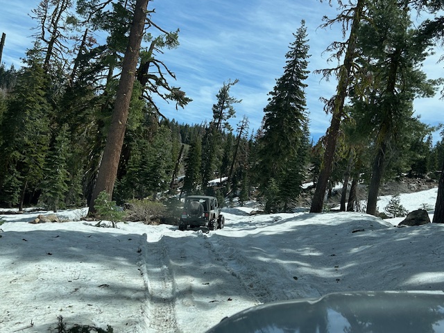
We made it past Bear Lake but the northern aspect protected the snow and it was becoming quite a side hill.
Here is the guy in front of me dropping down the last hill we went down.

We finally came to a downhill section we decided we didn’t want to crawl back up. We turned around and headed home. The side hill was pretty steep right here but it doesn’t show.

We never made it over to any of the three trails we were trying to get to. I will be looking into the situation with the locked gates.
On the way out, We stopped at the Rubicon intersection and met two side-by-sides going out 03-04. They were locals who had been clearing trees on a bunch of side trails for the last three weeks! Awesome.
I need to thank Stan and John for hanging out today. Always safer with others. Maybe we’ll get out next week and clear more trails.
.
Rubicon Ronin

 The 'Other' Rubicon