
Completely off subject…
Posted: October 20, 2017 Filed under: Uncategorized Leave a commentThis was recently emailed to me. (I added the photos.) I felt I needed to share this with others. I have emailed some but thought since I have a place to speak my mind, I should. My apologies for the politics. I promise this won’t happen often. This is the only political piece I’ve ever posted.
Take a stand….
You graduated high school in 2011. Your teenage years were a struggle. You grew up on the wrong side of the tracks. Your mother was the leader of the family and worked tirelessly to keep a roof over your head and food on your plate.
Academics were a struggle for you and your grades were mediocre at best. The only thing that made you stand out is you weighed 225lbs and could run 40 yards in 4.2 seconds while carrying a football. Your best friend was just like you, except he didn’t play football. Instead of going to football practice after school, he went to work at McDonalds for minimum wage.
You were recruited by all the big colleges and spent every weekend of your senior year making visits to universities where coaches and boosters tried to convince you their school was best. They laid out the red carpet for you. Your best friend worked double shifts at Mickey D’s. College was not an option for him.
On the day you signed with Big State University, your best friend signed paperwork with his Army recruiter. You went to summer workouts. He went to basic. You spent the next four years living in the athletic dorm, eating at the training table. You spent your Saturdays on the football field, cheered on by adoring fans. Tutors attended to your every academic need. You attended class when you felt like it. Sure, you worked hard. You lifted weights, ran sprints, studied plays, and soon became one of the top football players in the country.
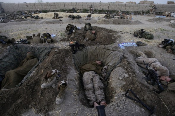
Your best friend was assigned to the 101st Airborne Division. While you were in college, he deployed to Iraq once and Afghanistan twice. He became a Sergeant and led a squad of 19 year old soldiers who grew up just like he did. He shed his blood in Afghanistan and watched young American’s give their lives, limbs, and innocence for the USA.

You went to the NFL combine and scored off the charts. You hired an agent and waited for draft day. You were drafted in the first round and your agent immediately went to work, ensuring that you received the most money possible. You signed for $16 million although you had never played a single down of professional football. Your best friend re-enlisted in the Army for four more years. As a combat tested sergeant, he will be paid $32,000 per year.

You will drive a Ferrari on the streets of South Beach. He will ride in the back of a Blackhawk helicopter with 10 other combat loaded soldiers. You will sleep at the Ritz. He will dig a hole in the ground and try to sleep. You will “make it rain” in the club. He will pray for rain as the temperature reaches 120 degrees.
On Sunday, you will run into a stadium as tens of thousands of fans cheer and yell your name. For your best friend, there is little difference between Sunday and any other day of the week. There are no adoring fans. There are only people trying to kill him and his soldiers. Every now and then, he and his soldiers leave the front lines and “go to the rear” to rest. He might be lucky enough to catch an NFL game on TV. When the National Anthem plays and you take a knee, he will jump to his feet and salute the television. While you protest the unfairness of life in the United States, he will give thanks to God that he has the honor of defending his great country.


To the players of the NFL: We are the people who buy your tickets, watch you on TV, and wear your jerseys. We anxiously wait for Sundays so we can cheer for you and marvel at your athleticism. Although we love to watch you play, we care little about your opinions until you offend us. You have the absolute right to express yourselves, but we have the absolute right to boycott you. We have tolerated your drug use and DUIs, your domestic violence, and your vulgar displays of wealth. We should be ashamed for putting our admiration of your physical skills before what is morally right. But now you have gone too far. You have insulted our flag, our country, our soldiers, our police officers, and our veterans. You are living the American dream, yet you disparage our great country. I am done with NFL football and encourage all like-minded Americans to boycott the NFL as well.
National boycott of the NFL for Sunday November 12th, Veterans Day Weekend
Boycott all football telecast, all fans, all ticket holders, stay away from attending any games, let them play to empty stadiums. Pass this post along to all your friends and family. Honor our military, some of whom come home with the American Flag draped over their coffin.
Governor Signs OHV Bill!!!!
Posted: October 3, 2017 Filed under: Access, Maintenance Leave a commentLong link but I didn’t feel like editing it down.
Regardless, the Governor of CA has signed the bill regarding OHV grant funding. Our funding is now permanent!!!!
Details here…
Morris Rock (The Steps)
Posted: September 30, 2017 Filed under: Maintenance | Tags: Cadillac Hill Leave a commentFor those of you that haven’t seen them, a few new boulders appeared on Cadillac Hill after this past epic winter, just below Morris Rock.
Here’s a photo looking down Morris Rock. The three large boulders on the right are new.

It looks like someone has started to split the new boulders. Look at the three drill marks on the face of the rock with a horizontal face.

The new boulders make the approach a little narrow but I watched a JK with a trailer make it without issues last week.

Rubicon Ronin
OHV Scores a WIN in CA!
Posted: September 21, 2017 Filed under: Access | Tags: CA State Parks, Grant funding, maintenance, OHMVR Leave a commentCalifornia Huge OHV Victory
Future Secured by Bipartisan Legislation
BLUERIBBON COALITION/SHARETRAILS.ORG MEDIA RELEASE
FOR IMMEDIATE RELEASE
Date: September 19, 2017
Contact: Don Amador, 925-625-6287
FUTURE OF OHV RECREATION IN GOLDEN STATE SECURED BY PASSAGE OF BIPARTISAN LEGISLATION
POCATELLO, ID (September 19, 2017) – State lawmakers in Sacramento recently passed Senate Bill 249 that permanently reauthorizes the California OHV Program. This historic vote-which also included Senate Bill 159, a companion bill that contained the funding structure for the program-had precedent setting broad support from both the conservation and OHV communities.
The BlueRibbon Coalition/Sharetrails.org (BRC) was part of a diverse OHV stakeholder group that championed the current OHV program managed by the California Off-Highway Motor Vehicle Recreation Division (OHMVRD) that is an important member of the California State Park family.
Don Amador, Western Representative for the BlueRibbon Coalition/Sharetrails.org, stated, “As a member of the 2007 drafting team that helped create the SB 742-based current program, I believe passage of the new SB 249 legislation honors the spirit and intent of our program that has been heralded as a national model for environmentally responsible OHV recreation.”
“I believe a lot of credit goes to the thousands of OHV enthusiasts, partners such as county sheriffs, and non-profit conservation groups, who took time to write letters and/or make phone calls to legislators and the Governor stating their strong support for the current program that granted monies to maintain trails, support law enforcement, open new riding areas and trails, fund important restoration projects, and pay for valuable rider education programs,” Amador continued.
“Credit should also be given to Senator Ben Allen, author of SB 249, for listening to concerns voiced by the OHV coalition, partners, and rural communities about how changes needed to be made to the original bill as that early version was simply too costly because it imposed an unwarranted level of additional environmental studies, reviews, and reports. The OHV Commission and State Park leadership also had key roles in helping resolve contentious issues with early versions of SB 249,” Amador concluded.
The OHV community and our conservation partners should be proud of the passage of this legislation that finally removes the sunset and makes our OHV program a permanent fixture at State Parks. We look forward to Governor Brown signing these bills in the near future.
Trailer upgrade – bear (storage) box
Posted: September 21, 2017 Filed under: Travel | Tags: bear, storage, trailer Leave a commentFor those of you that are regular followers of this site, this upgrade is a direct result of the bear getting my food earlier this summer.
I picked up a trailer box from Harbor Freight, yeah I know not the best quality but I’m just going to abuse it. I have an unusually long bar for my hitch. Even with the box I can jack knife the Jeep and trailer and not hit the box.

I just bolted and welded up a couple of piece of angel iron for support and there she sits. I’ll pull it apart and clean the edges and paint it later.

So, as long as I have the trailer with me, I have a safe place to store my food. It’ll be good for storing tarps, tie downs and other stuff.
Rubicon Ronin

