
OHMVR Program update
Posted: September 8, 2017 Filed under: Access | Tags: grant, politics, State Parks Leave a commentA little back story, the current system in place to provide funds for OHV trail maintenance, among other things, through green sticker funds was due to sunset or go away. The bill needed to be re-approved, preferably without a sunset date.
Before a pro-OHV bill could be drafted, the anti-OHV people got a bill (actually more than one) drafted dumping the program and benefitting their anti-OHV agenda.
Here is the latest on the possible loss of our OHV grant funding program…
Update on SB 249: with a lot of help and support from many members and supporters of the OHV community, something we initially thought may be impossible has actually been achieved!
Just a few short months ago, we never would have believed we could take out 90% of the objectionable components of SB 249, and rewrite the bill using current law as the basis moving forward. From that point on, our coalition worked with the OHMVR Division looking for improvements to environmental reporting and monitoring of SVRA’s, which will help defend our parks from frivolous lawsuits in the future. SB 249 now calls for removing the sunset, giving us a permanent OHMVR program and grants program both protected by statute!
All because of your calls and communications to your legislators, and justified anger at the original language in SB 249, we were able to convince the author and his sponsors to work collaboratively with us to craft an OHV bill. There is little left in the current SB 249 that was originally contained in the bill, although there are some compromises that won’t hurt the program but benefit the environmental community. We’ve evaluated every word in these bills to make sure there is no hidden language that could hurt our parks, our access or our grant funding to the best of our ability. It’s been a lot of hard work by a united OHV community that brought us to this point.
Now we need you to support both SB 249 and SB 159, the associated bill that renews the greensticker registration program. Call your legislators, and please ask them to support the current versions of these bills with amendments because the author worked collaboratively with OHV representatives to craft a bill the OHV community supports.
I’ve attached the two draft letters written in cooperation of the OHV community stating our united support for SB 249 and SB 159. I am asking all of you to use your contacts with local politicians, law enforcement and county government, along with your elected legislative officials ,and ask them to support both SB 249 and SB 159.
It is very important we get the votes in the legislature to pass both these bills so we get a permanent OHMVR program!
Please contact me with any questions or concerns. I wouldn’t pass along this request unless I firmly believed in these bills.
Amy Granat
Managing Director
California Off-Road Vehicle Association
916-710-1950
Draft letters attached
SB 159_Coalition Letter_Asm Appro_Draft_9-7-17 (Rev)
SB 249_Coalition Letter_Asm Floor_Draft_9-6-17
So here is where we need to support those working so hard to allow us to got wheeling. Email, write and call your elected officials. It doesn’t take much to figure out who your representatives are and to send them an email.
Send an email in your name, your spouse’s name, your kids names, your dog’s name. Flood their office with letter of support for these two bills.
It’s your right. Fight for it or lose it.
Rubicon Ronin
Richardson Lake Trail re-route!
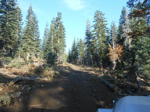
Posted: September 6, 2017 Filed under: Access, Maintenance, Travel | Tags: education, ENF, erosion Leave a commentYesterday, I received an email from a forest service employee boasting some great trail work on the Richardson Lake Trail up to Sourdough Hill. The only pictures he included were those of trails demolished and covered in trees and brush. I was horrified!
The series of pictures looked like this…

The next morning, I was up at 5:15am and out by 6:15am to get to the trail to see what the Forest Service had done to one of my trails.
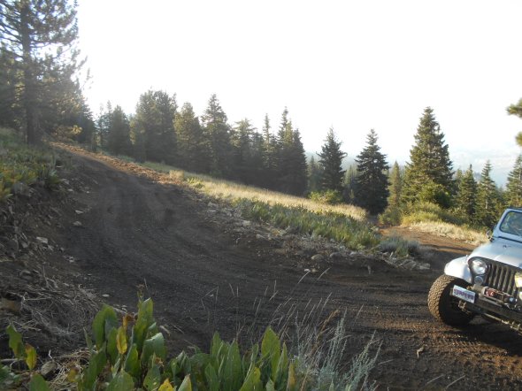
Although the Forest Service had blocked off the last climb to the summit of Sourdough Hill, they had put in a switch back and more than a quarter mile of new trail.
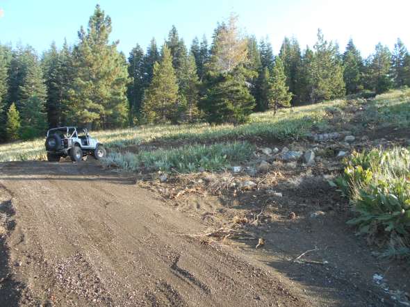
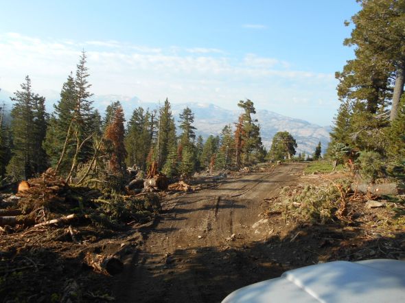
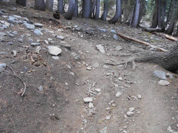
For those of you who’ve never been there, here is a photo of the old route. This does not give you the idea of how steep this trail was originally. The ruts show previous wheel spinning and rain runoff causing erosion.

The old trail can be seen on the right side of the next picture, the new route goes from left to right in front of my Jeep. This reroute was warranted as the old route was a steep, loose, rocky, rutted trail that was causing erosion and was not safe as shown in the previous picture.
A better look up the trail after the switchback…

Here is another look up the blocked off ‘hill climb’…

Up from the switchback…
Back in to the trees. Note the trees cut down in order to create this new trail.

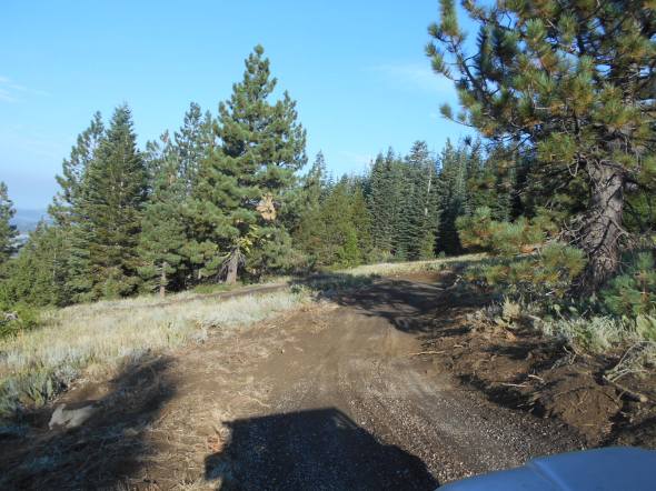
Nearing the summit. Those familiar with the trail should know the radio hut is to your left in this picture. You used to come up to the summit with the hut on your right.

The parking area is the same as before you just approach it from the bottom not the top.
Here is a shot of where the trail used to come up. (The radio hut to my left.)
Poser shot at the summit! A selfie if you count the shadow.

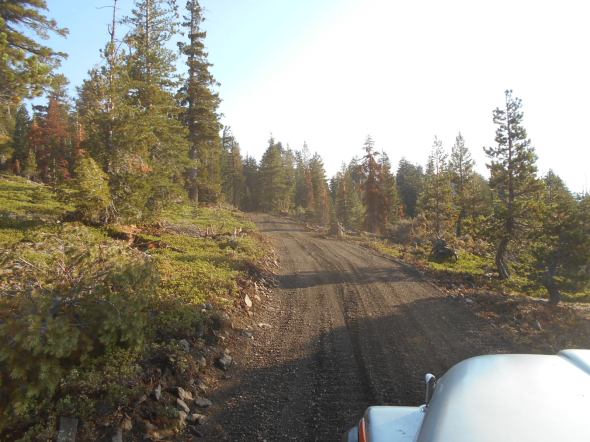
Views on the way down.

Hats off to the Forest Service for the reroute but I need to talk to my contact about communicating the entire story with more pictures.
Rubicon Ronin
Deer Valley Maintenance and opening!
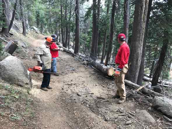
Posted: August 15, 2017 Filed under: Access, Maintenance | Tags: deer valley, education Leave a commentAugust 3rd, the Deer valley Trail officially opened for the 2017 season. The Lake Tahoe Hi-Lo’s jumped at the opportunity to do some trail maintenance and open the trail.
The South County Trail Riders have adopted this trail but they were extremely busy getting the Cal4 Sierra Trek set up and running smooth. My thanks to them for that because Sierra Trek went very smooth. The Motherload Rock Crawlers were also out on the trail working with the Forest Service making final plans for the maintenance scheduled for the last three weekends in Sept.
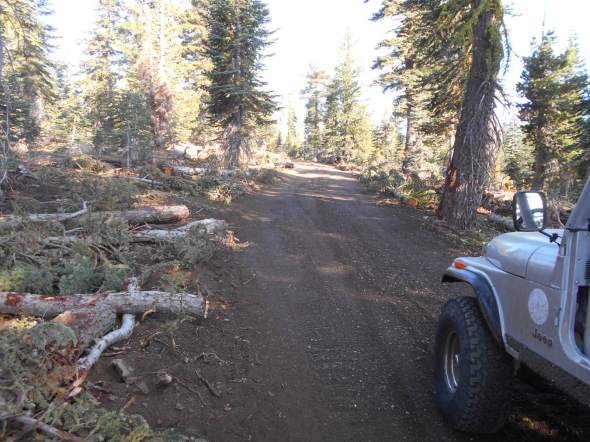
So the Hi-Lo’s went to work. This was typical of what we found, trees either on the ground or ready to fall.

We pulled out our saws and started cutting.

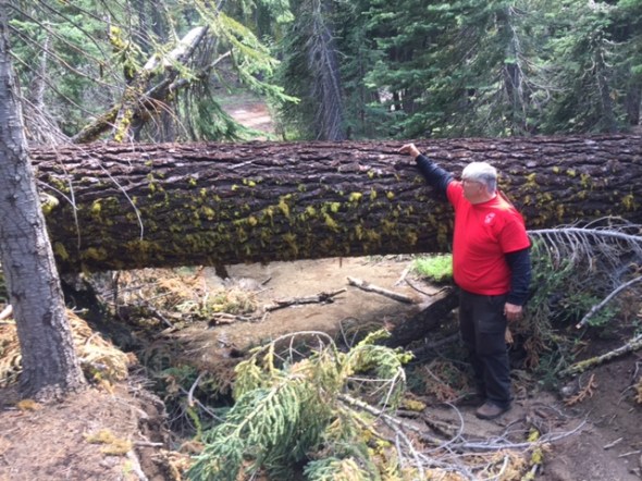
Once we got a system going, it went great. One team took off down the trail to deal with “THE” tree. More later. The second team would cut downed or hanging trees in to manageable lengths and would move on. The third team would clear the trail of the chopped up trees. We removed about 24 trees from the trail.
When I refer to a tree across the trail as “THE” tree, it means it was a really big tree. This tree had been driven around by those breaking the law. We try and educate to fellow users to stay on the trail but there are those who don’t care.
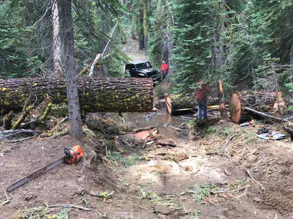
Our crew used the bed of a truck to safely attack the tree.


With a lot of hard work, the first section of the tree was removed.
Some of the guys wanted souvenirs. See the photo of the month.

The last section was removed and the original route was reopened.

The Hi-Lo’s returned to the trail on the 12th and removed even more trees in preparation of our Gambler’s Poker Run on the 19th of August.
Future Maintenance…
The mention of future maintenance refers to three weekends in Sept: 9/10, 16/17, 23/24. The plan is to move several hundred tons of rock to prevent erosion at the two creek crossings.
Please contact the Motherload Rock Crawlers if you plan on attending. Trailers are needed but not required.
https://cal4wheel.com/north-district-clubs/item/motherlode-rockcrawlers
Rubicon Ronin
Sierra Trek 2017
Posted: August 14, 2017 Filed under: Access, Travel Leave a commentOkay, it’s a little outside the normal set of trails I write about but what a trip!
In 2016 I won a free pass to Sierra Trek. I dragged my CJ-7 up and down the mountain and had a great time. So much so I signed up to do it again this year. It was the 50th anniversary of the Sierra Trek.
Three of us from the Lake Tahoe Hi-Lo’s got together and ran the Thursday run. We were off at 7am and got to camp a 6pm. A very slow day. No issues, just slow.
Us at the first water crossing:
The Fordyce Trail has some interesting features, some of the trail looks like it’s been carved from the granite:
It is a 13 mile long trail that has some very hard spots. Our group bypassed Winch Hill One but most of the trail doesn’t have bypasses:
I think this was Winch Hill Two. My CJ-7 had this the easiest as the narrower, the better:
Winch Hill Three:

My Jeep looking up at Winch Hill Four:
Friday and Saturday in camp there was a vendor show. I set up my booth and handed out maps and stickers. There were a lot of people there as there were SUV runs, historic runs and an ATV run. Something for everyone.

It was a great weekend as no one in our group broke anything!
If you have the rig, Sierra Trek is something I highly recommend.
Doug
I finally got out on 16E16!
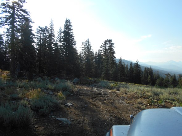
Posted: August 8, 2017 Filed under: Access, Travel | Tags: dual sport, hiking, motorcycle Leave a comment16E16 is the only motorcycle single track in the Rubicon area. I’ve been meaning to get my dual sport out on it for more than a year now. Well, I didn’t get the dual sport out but I did hike the trail.
Although this is an OHV trail, it’s primary users are hikers, although, I did see two mountain bikers. If you ride this trail, expect hikers around every turn, especially on weekends. Ride with caution.
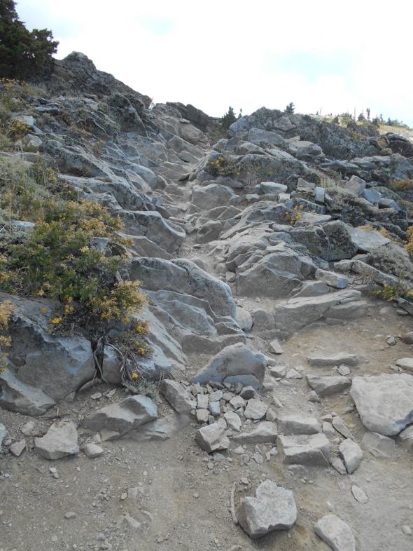
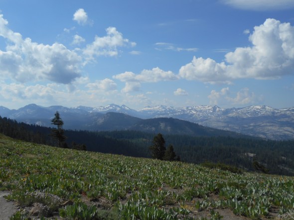
The trail is about three miles long. It start at Barker Pass at the top of Forest Road 03. It ends at Ellis Peak but you need to walk/hike the last bit. There is a existing ‘trail’ that looks like you can ride to the top. Don’t! That trail is not legal. It is a loose rocky trail that is difficult and there is no place to turn around at the top! The first peak gives you a 360 degree view of Tahoe and everything west. You can hike a 1/4 mile or so to the actual Ellis Peak, just to the north, if you want to say you made the summit.
I would suggest riding this from the Rubicon end to the Barker Pass end. I started at the Barker Pass end and the trail started with a VERY steep climb. This climb had switch backs and large wood beams had been used as water bars. Tough but not impossible to negotiate on a motorcycle.

Just a little further up the trail there is a very technical climb.
Once past the early ugliness, the trail is really nice. Tight in places but doable. Look closely for the snow on the trail. It was August 6th.

The views from the Barker end were awesome.
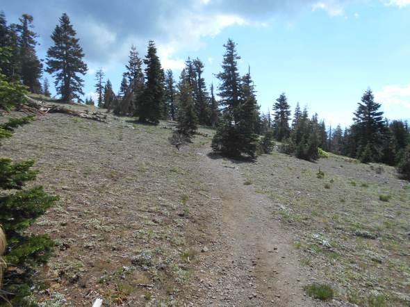
The trail changes from wide open areas…
To a tight in the trees experience…

Again, I would suggest an out and back from the Rubicon or Ellis Peak end of the trail. You can get more then 3/4 of the trail covered without getting in to the tricky stuff. If you do the one-way, again, I suggest Ellis to Barker.
I’ll try to get more pictures and details on the 16E16 page of the website, after Sierra Trek.
Rubicon Ronin

