
The Rubicon Trail has been Reopened!
Posted: September 27, 2022 Filed under: Access Leave a commentThis morning the Lake Tahoe Basin Management Unit released a termination of the forest order closing the Rubicon Trail. Of course, they failed to post it on their website or do a mass press release. But they let El Dorado County know.
El Dorado County then reopened the Rubicon Trail but the wording leaves something to be desired:
“THE RUBICON TRAIL IS NOW OPEN FROM EL DORADO COUNTY TO TAHOMA.”
I first took it as open from the El Dorado County line to Tahoma but I believe that they meant all of El Dorado County.
Here is the LTBMU termination of their previous forest order:
Yesterday morning, I sent a letter to about ten people who support the Rubicon Trail and OHV. I pushed them to find a way to prevent future closures and a way to challenge future closures. So far, not a sinlge person has responded to that email.
.
Rubicon Ronin
Rubicon Trail closed in El Dorado
Posted: September 9, 2022 Filed under: Access, Maintenance | Tags: closed, fire Leave a comment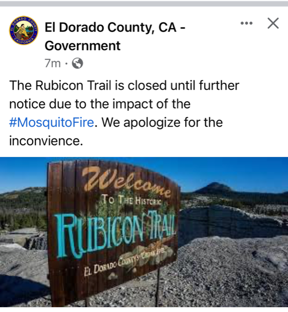
Due to the possible spread of the Mosquito Fire in the direction of the Rubicon Trail, El Dorado County has closed the Rubicon Trail until further notice. There is just a basic ‘closed’ statement on the county website.
https://www.edcgov.us/Rubicon/
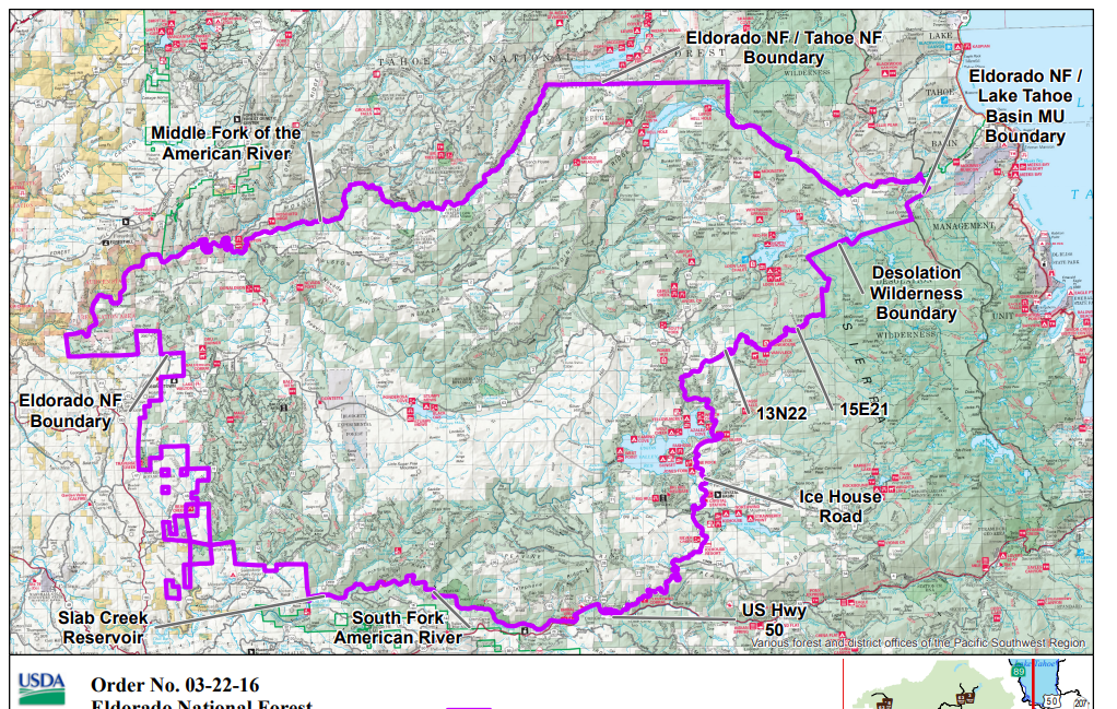
Map of the evacuation and fire boundry:
Please avoid the area and let the firefighters do their job without having to worry about people coming in to the area.
The USFS has issued a closure but it doesn’t appear to include the Rubicon.
.
Rubicon Ronin
UPDATE WITH FURTHER CLOSURES:
The Eldorado National Forest now has a much wider closure for the Mosquito Fire:
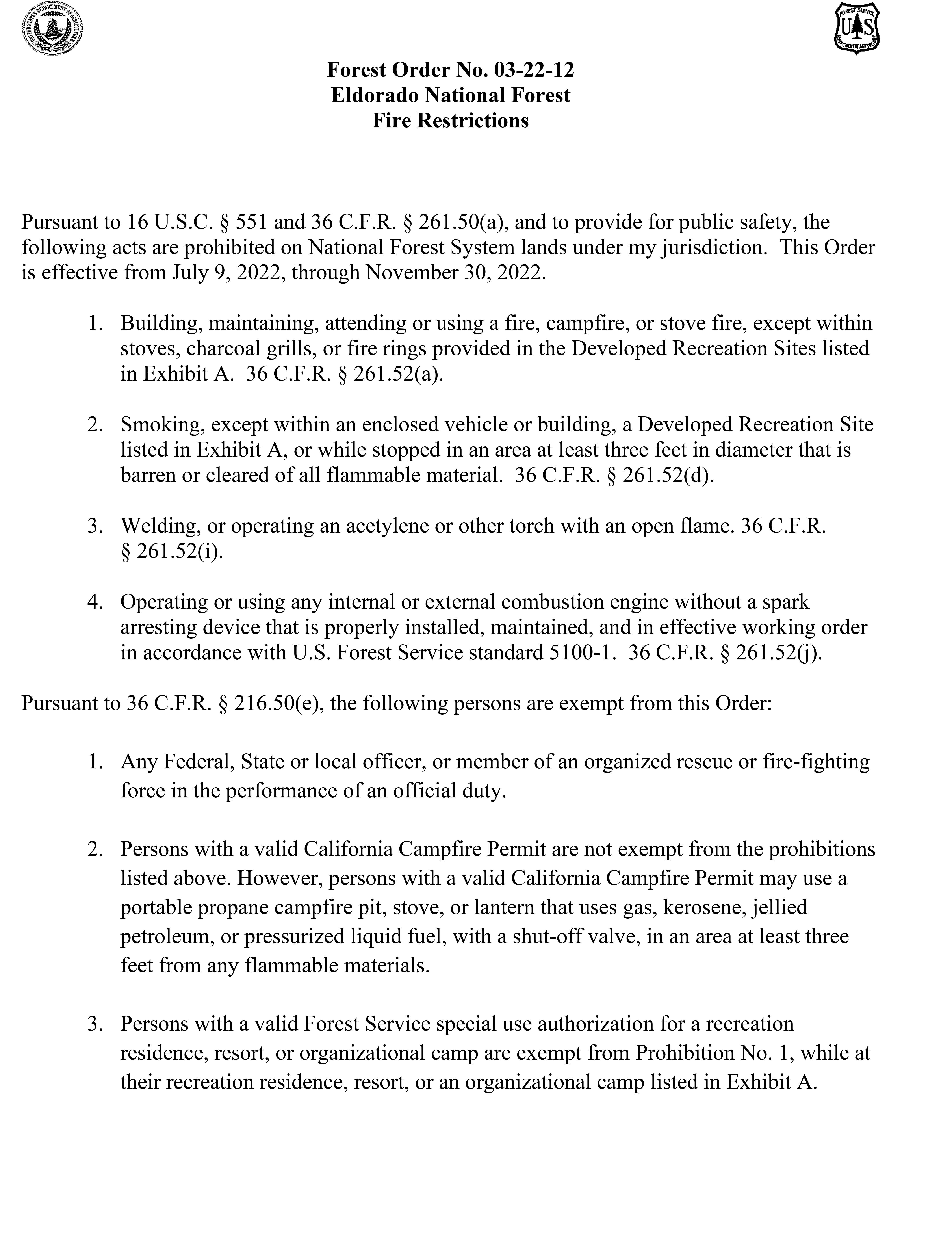
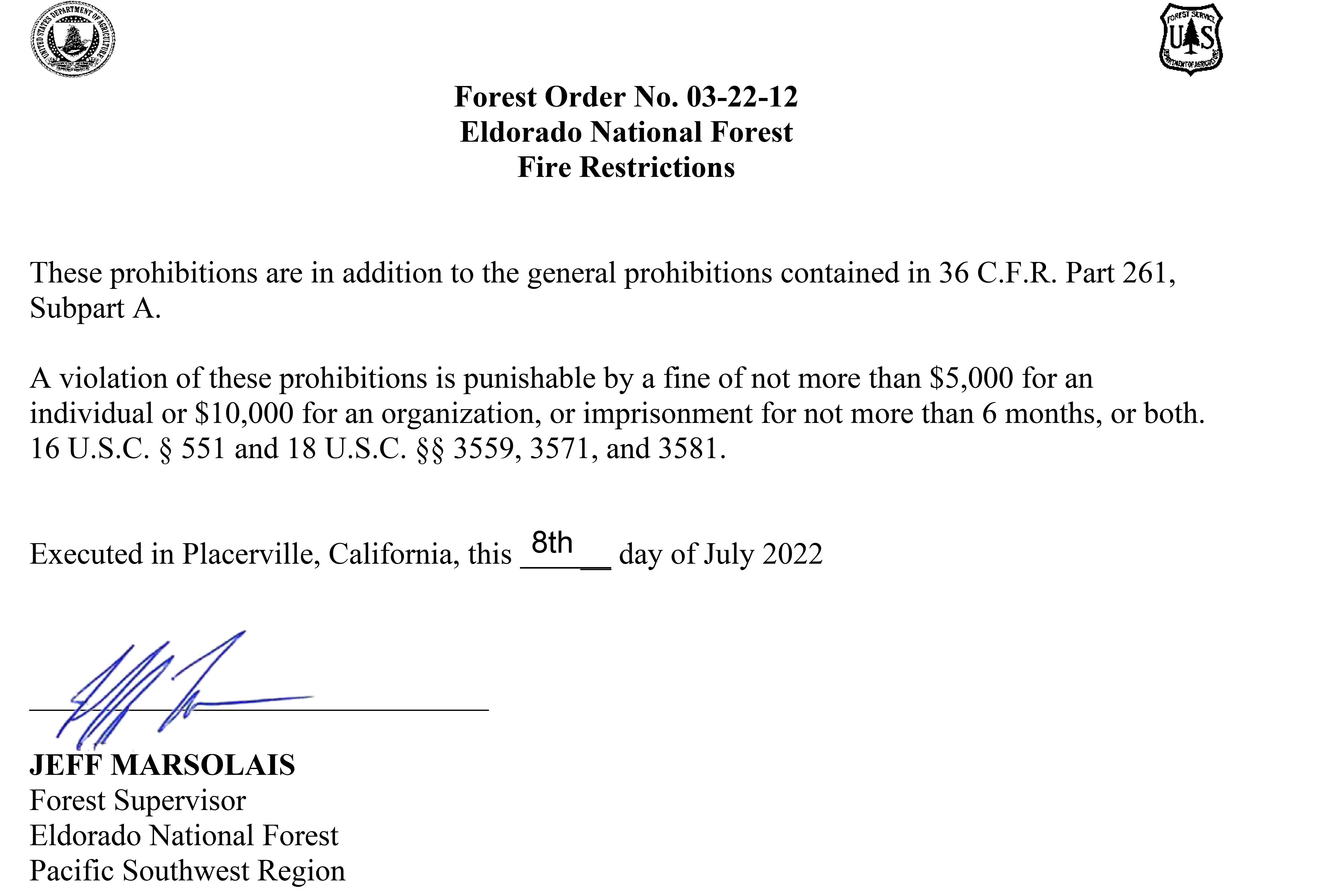
Fire Restrictions in Place!
Posted: July 11, 2022 Filed under: Access, Travel | Tags: fire, restrictions Leave a commentAs of this writing, the Eldorado National Forest (ENF) has implemented fire restrictions regarding the use of fire, stoves and tools within their forest.
https://www.fs.usda.gov/Internet/FSE_DOCUMENTS/fseprd1042394.pdf
The owners at Rubicon Springs have also implemented a no campfire rule for the rest of the summer.
No word yet from the Tahoe National Forest but I’m sure it’s coming soon.
Please be fire safe any time you’re out enjoying our national forests.
.
California’s largest private landowner closes forest access to the public
Posted: June 25, 2022 Filed under: Access | Tags: closure, SPI Leave a commentThis does not directly affect the Rubicon Trail or side trails on the Tahoe side but I think it might affect a few on the Loon Lake side:
CALIFORNIA, Due to the risk of wildfires Sierra Pacific Industries, which owns nearly 2 million acres of forestland in California, has closed public access into its wildlands starting July 1.
Sierra Pacific said that they normally provide public access to their wildlands for hiking, fishing, hunting and other outdoor activities.
“Despite some of the late spring rains, California is experiencing the driest conditions it has had in 1200 years,” said Andrea Howell, SPI spokesman. “To help protect our forest resources and public safety, Sierra Pacific is closing our California lands to public access and recreation.”
Sierra Pacific is citing the following reasons as to why they have closed their lands to the public:
As a fire prevention measure.
To provide for the recovery and restoration of areas impacted by wildfire.
To protect public safety, especially in active harvest areas.
To help prevent erosion of roads.
To deter illegal woodcutting.
To prevent damage to young, regenerated forest stands.
To deter illegal garbage dumping.
To prevent Christmas tree theft.
To protect sensitive research project areas and equipment. Monitoring equipment has been placed in areas where research is under way. Please do not disturb it.
Sierra Pacific said that they will continue monitoring their forests, weather conditions and other scenarios to determine when it will be safe to reopen their forests to the public.
The U.S. Forest Service has also been known to close sections of their forests to also mitigate the risk of wildfire and also allow crews to provided fuel load reduction.
So far this year the forest service has not announced any planned forest closures.
Can My Rig Make It?
Posted: June 22, 2022 Filed under: Access, Travel | Tags: difficulty, trail rating Leave a commentI get this question quite often and recently ran in to it on another website. Let me do my best to answer that question. The problem is there is no easy answer. Driver skill is a huge factor in whether or not you can make it, or more specifically, make it without damage.
Here it is, the last piece of pavement before hitting the trail.

Just a very short drive up the trail, 0.3 miles to be specific, there is what some refer to as a “gatekeeper”. But it’s not. It is a very easy example of what your rig should be able to drive over if you want to run the Rubicon Trail. In the picture below, I stayed on the trail but went around the ‘gatekeeper’.
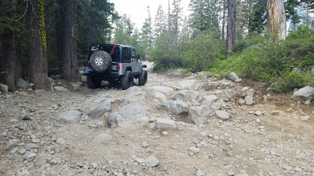
Further up the trail, here is an example of what a lot of the first four miles look like on the Tahoe side. Most of these rocks are more of an inconvenience than a challenge to any high clearance vehicle.

The trail is off and on rocky. After the gatekeeper, this is one of the trickier sections on the way to Miller Lake.

Typically, there are just enough rocks in the trail to prevent users from driving too fast.

Currently, there are many wet sections within the Tahoe National Forest. There is often standing water in this area. Some of the puddles are deep but most of them rocky bottom.

Just over four miles from the staging area is the turn at the “Y”. At the “Y” is mile marker 11.5, that marks 11.5 miles to Loon Lake. Going straight will take you to Barker Pass on Forest Road 03-04. Turning left keeps you on the Rubicon Trail (16E75). (FYI, it wasn’t placer until 2018). The temperament of the trail changes once you make this turn, to harder.

It’s not until you get to what I call the “Potato Patch” at the 5.4-mile mark, that things get serious. This section changes almost weekly. One trip the best line is left and two weeks later the better line is right.

The trail retains this difficulty, on and off, mostly off, until you get on Cadillac Hill and to “The Steps” or “Morris Rock” at mile 8.2, again from the staging area. The next half mile is the most exciting section on your way to Rubicon Springs! At this point, if you have to ask if your rig can make it, don’t try it.
For those wanting to get out in this area, but aren’t sure if they can make it, try it! If you think you can’t make it or just don’t want to try it, turn around. Remember, Turn Around, Don’t Go Around.
A very nice drive in the area is the loop from the Rubicon Trail staging area up and around to Barker Pass. The trail gets easier as you get further away from the Rubicon Trail. I have yet to run that road this season, so I can’t be 100% sure of that.
The Hobbit Trail (16E76) has the difficulty of the Potato Patch. The trick to that trail is to do it without using reverse. It turns left, right, left, through the whole trail, a lot of fun. The (old) Red Cabin Trail (16E79), is more of a dirt road and takes you to Barker Pass proper. From Barker Pass, the Middle Fork Trail (15N38) is on the mild side but pay attention. There is also a paved road down to Highway 89 from Barker Pass.
For the record, my odometer reads high, almost 10%. So, take the measurements as a guide.
Happy Trails!
.
Rubicon Ronin

