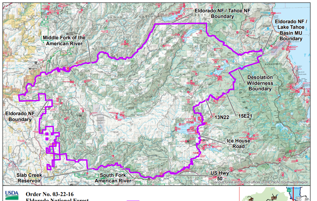
OHV Gates, working on it
Posted: August 8, 2026 Filed under: Uncategorized | Tags: access, closed, gates Leave a commentFor the last three straight years, many of the OHV gates within the Lake Tahoe Basin Management Unit (LTBMU) did not open on time. This is not a new phenomenon. Sadly, it is a regular occurrence. This has always been the gate in question: The Middle Fork Trail 15N38.
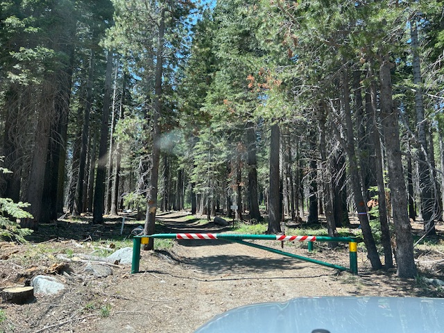
It was so bad in 2025, that I decided to push hard to see that it did not happen again. (I had worked with the Basin previous years without success.) I contacted the LTBMU and had a meeting scheduled to talk about OHV gates in October of 2025. That’s seven months before the OHV gates were to be opened! Well, that was the time the federal government shut down due to lack of funding for about 40 days. No meeting.
Come January, the government is back open. The previous ‘acting’ Forest Supervisor retired. So, I started over with the new ‘acting’ Supervisor. We did meet. I thought we were on the right track. A few meetings, many emails.
But 15N38 was not open on June 1st. I emailed the Basin and I got this in response…
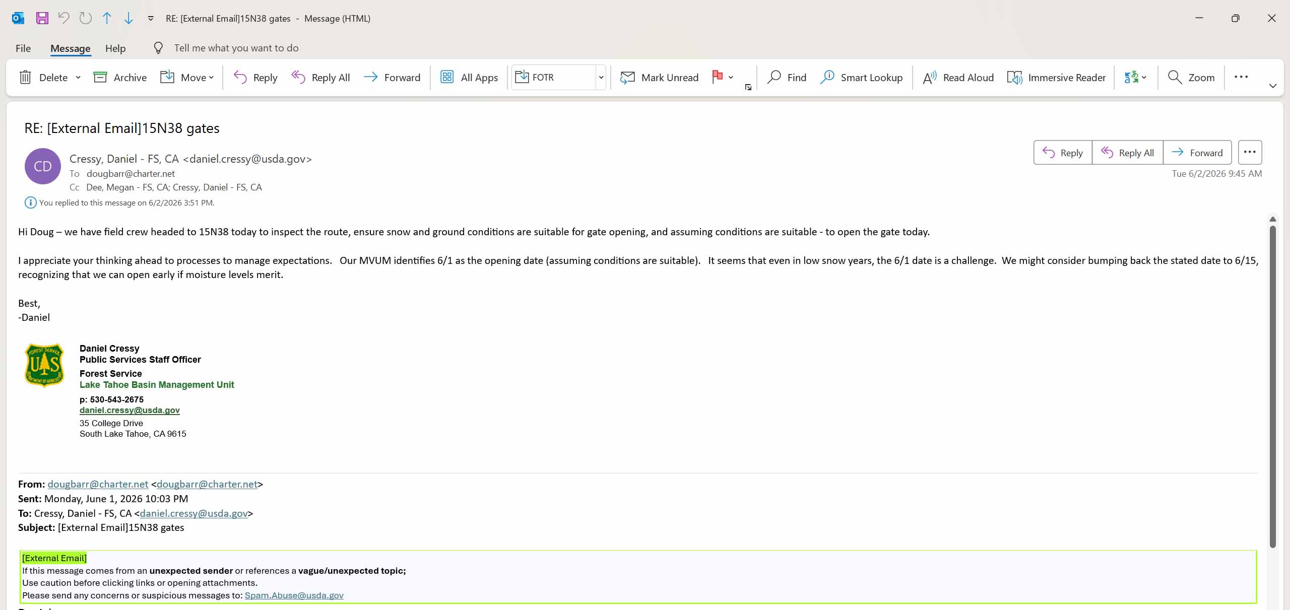
Tough to read but it says they had a crew scheduled to inspect the trail “today”. (6-2-2026). The day AFTER the trail was to open. My response was professional but very heated. A trail should not be scheduled for an inspection, the day after it’s to open.
Another new ‘acting’ Supervisor. More emails. More meetings.
My argument is that people out playing on the Rubicon read the Motor Vehicle Use Map (MVUM), read that the Middle Fork Trail opens June 1st. So, they plan to exit the Rubicon Trail using Barker Meadow OHV Trail (16E76), then Red Cabin Trail (16E79) and head down the Middle Fork Trail (15N38) to Tahoe. But they find 15N38 closed because the Basin has failed to do their job.
The FS is down employees, due to transfers out of the Basin and retirements. They claim to be down on funding and cannot replace people fast enough. So, I’m stepping up and removing some of their excuses regarding why OHV gates do not open on time.
The first step is developing a list of OHV gates. The MVUM lists all the trails, but some don’t have gates and some have two gates. I decided to hit the road/trail and figure it out.
It has been more than one trip to the lake to find and document all the OHV gates and their access and condition. I hadn’t been to Twin Peaks for years but I documented it. For the record, according to the signs, this is still a “day use” area and not one I need to worry about opening seasonally.
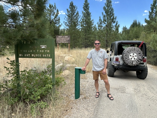
Some trails were campgrounds, not OHV areas. Some were FS cabin track roads, not OHV trails. Some were WAY overgrown and had not opened in years, but still on the MVUM. Those will take more research. But there is now a user created OHV list for the Basin.
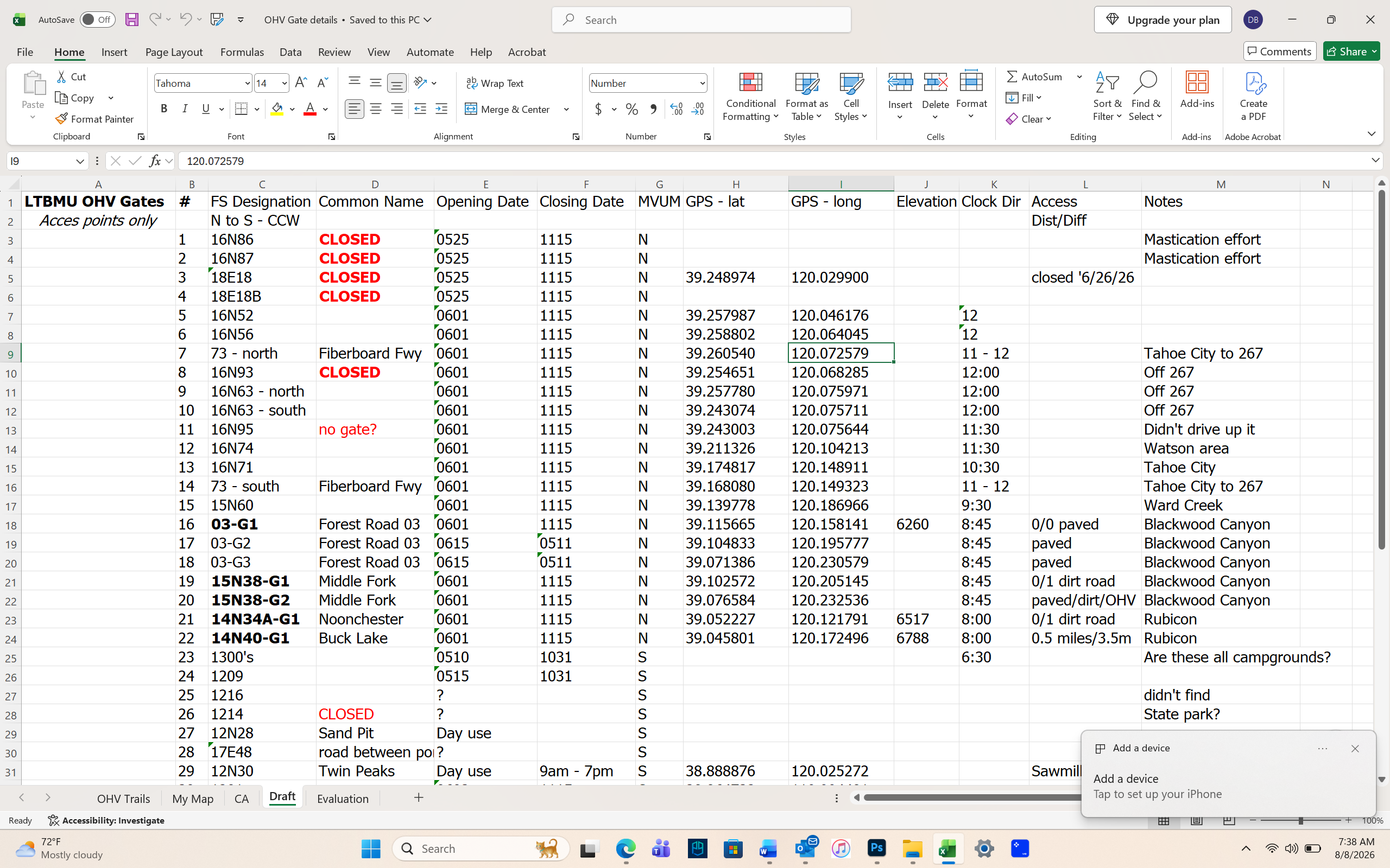
We are scheduled to meet again later this month. I will share this list, and we’ll compare it to the FS list. I have created a check list / spread sheet to use when the FS is checking / opening gates. I’m in the middle of drafting a procedure for opening OHV gates within the Basin so everyone is on the same page and gate open due to a procedure not when someone has the time to drive out there.
There is still plenty of time to get this worked out. The Basin is open to working with the users. Finger crossed, we’ll get this figured out by next season.
.
Rubicon Ronin
Clearing Trees, Finding Snow
Posted: June 16, 2024 Filed under: Uncategorized | Tags: closed, gate, gates, snow, trees Leave a commentToday was supposed to be my annual spring tree clearing trip for the side trails along the Rubicon Trail.
When I got to the bottom of the Middle Fork Trail, I found the gate still locked. It was supposed to be unlocked on June 1st. The gate on the paved road to the top of Barker Pass was also locked. It was supposed to be unlocked on June 15th.
I’ve already sent an email to the Forest Service complaining.
So, not able to clear 15N38, 16E79 and 16E76, I headed for the Rubicon. I went up the Sourdough Trail and cleared eight trees from the trail. I was the first 4-wheeled vehicle to the top this year. But it looked like a pair of motorcycles had already made the journey.
Work smarter, not harder. Fewer chainsaw cuts and more winching.

My reward for clearing that first tree was three down in the same area, right around the corner.

With time on my hands, I tried my luck up the Ellis Lake/Peak Trail. It is quite narrow these days. I was able to get to the area with the open meadow.
This one/group was on the Ellis Peak/Lake Trail. I left it as it was quite large and the go around was not crazy off trail.

Further up the Ellis Trail the snow became more than I was willing to take on. I had already busted through a few drifts and winched over one.
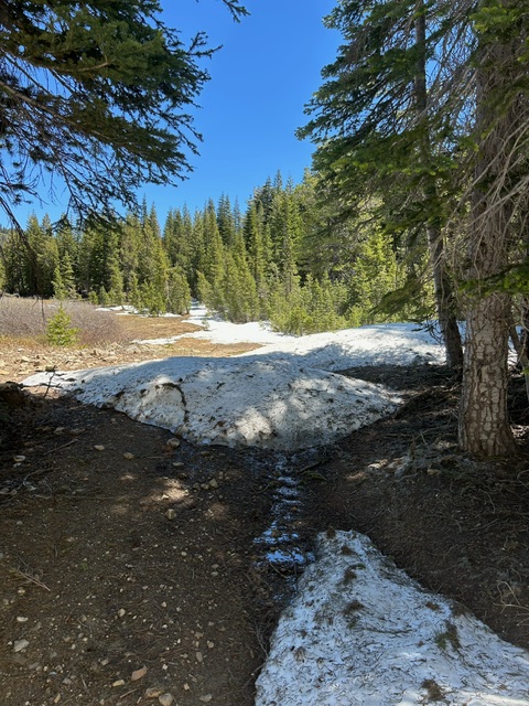
The trail is under all that snow as it goes into the trees! Think side hill on slippery snow, sliding into the trees. No thanks.

I also popped up the Buck Lake Trail but only to the lake, not above. Maybe next week I’n try again, but the FS needs to open a few gates.
.
Rubicon Ronin
ENF pushes back opening date of ‘seasonal’ roads
Posted: April 13, 2023 Filed under: Access, Travel | Tags: closed, snow Leave a commentThe Eldorado National Forest has pushed back the opening for seasonal roads and trails by one month. For the Tahoe side of the Rubicon Trail, this means the Richardson Lake Trail (14N39). As we’re already halfway through the extended closure and the snow is still epically deep, I don’t think this will affect us much.
Expect other forests to do the same. Please check the website of whatever forest you plan on visiting before you head out.
Next week, I’ll post pictures from the trailhead. At this point, only the most well-built rigs should attempt to get on the trail. Memorial Weekend will still bring challenges on the Rubicon Trail.
Please Tread Lightly! if you head out on the trail. Stay on the trail, don’t spin your tires, use tree saver straps to winch, etc.
Rubicon Trail back open
Posted: February 2, 2023 Filed under: Access, Travel | Tags: agreements, closed, snow Leave a commentFrom the El Dorado County website:
“The closure of the Rubicon Trail initiated with Resolution 017-2023 has been lifted effective immediately.
The County waited until the frequent heavy storms that started with the December 30, 2022 atmospheric river event were over before attempting site inspections. During the temporary closure the storms that hit the region consisted of additional atmospheric river events with heavy mixes of rain and snow. Multiple days (1/18, 1/24, and 1/27) were necessary for staff to access and assess the trail. Those assessments show that the trail is currently covered in a substantial amount of snow providing resource protection. After reviewing those assessments, the Director, in consultation with County staff, has determined that no repairs are needed at this time and that the trail is safe for ordinary use.
Be advised that the Rubicon Trail is for year-round public use but users should be prepared for adverse conditions during winter season and during storm conditions. The road may be unpassable during winter/storm conditions and rescue services may be difficult. The County encourages users be mindful of trail conditions and practice appropriate safety measures. The County will continue to monitor trail conditions for the remainder of the 2023 winter season into spring as required per the USFS easement document. If users have any questions on this notice, please feel free to contact the County at 530-621-7538 or 530-621-5554.”
Ok, it’s open but there are many questions…
So, we’re back to water quality as the reason for the closure. But I don’t believe that the County ever visited the proper, if any, sites to determine water flow conditions BEFORE the closure. El Dorado County completely ignored the agreed upon requirements in place in order to close trail. They did it just because they wanted to, and it was not based on any science.
We, the users, need to push back on what happened, how it happened and who made it happen.
Who is “The Director”? Was one single person able to close the Rubicon?
If past signed agreements can be ignored, can we trust any future agreements? If El Dorado County doesn’t play by the rules, the law, should we?
I’m not happy. And I won’t be happy until all of this is settled. I guess I won’t be happy for a long time.
Do you have questions? Call the county at the above-mentioned number. I’m sure they’d love to be swamped by calls.
.
Rubicon Ronin
Rubicon Trail closed in El Dorado
Posted: September 9, 2022 Filed under: Access, Maintenance | Tags: closed, fire Leave a comment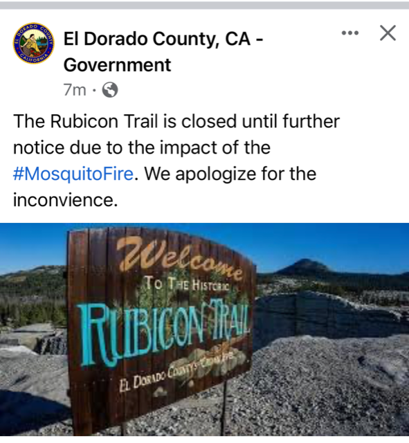
Due to the possible spread of the Mosquito Fire in the direction of the Rubicon Trail, El Dorado County has closed the Rubicon Trail until further notice. There is just a basic ‘closed’ statement on the county website.
https://www.edcgov.us/Rubicon/
Map of the evacuation and fire boundry:
Please avoid the area and let the firefighters do their job without having to worry about people coming in to the area.
The USFS has issued a closure but it doesn’t appear to include the Rubicon.
.
Rubicon Ronin
UPDATE WITH FURTHER CLOSURES:
The Eldorado National Forest now has a much wider closure for the Mosquito Fire: