
Rubicon Re-Route Issues
Posted: March 19, 2026 Filed under: Uncategorized | Tags: FOTR, reroute, RTF Leave a commentThe Rubicon trail Foundation (RTF) just put out a pretty good video answering a lot of questions about the Rubicon Trail reroute. I was very happy about the video…until the last two minutes.
Let me start by challenging the title of the post, something about rerouting the last 7/10ths of the Rubicon Trail. From the Tahoma staging area, you’ll need to drive about five or six miles to get to the “reroute”. With the entire trail running about 22-miles, I’m thinking that reroute is more in the middle of the trail. Remember, FOTR, the R stands for Rubicon, was established to fix and keep open the section of trail within the Lake Tahoe Basin Management Unit (LTBMU). That’s from the residential area to just before Miller Lake: the old car wash, staging area, 28-rolling dips, etc. You’ll need to drive another two or three miles to get to the reroute. It’s not at the “end” of the trail.
Construction is scheduled to begin around mid-August and be completed around mid-September. There’s a lot of information about how RTF got involved, who’s doing the work and how that contractor was picked. I’m good with all of that and RTF made it very clear and transparent about what’s going on. Well worth watching.
The kicker came right after the great news that the Forest Service (FS) will not be formally abandoning the original route. The formal abandonment is a long, costly, legal nightmare that could get the FS sued. So, yea, not abandoning. But the plan is to block both ends of the original that is being bypassed. I took that as eliminating any future use of the original route, even though it is not formally closed. Not cool.
Here’s a question, will the original route still be printed on the Tahoe National Forest’s Motor Vehicle Use Map?
If it is, I’m driving it. If it’s not, maybe we should go after the TNF for denying us of the use of our public lands, without due process.
Link to RTF Facebook page with the latest video
The Friends of the Rubicon (FOTR) annual meeting is this Saturday. It might be very eventful. Join me…
10:00 a.m. to 1:00 p.m. at:
American Legion Post 119
4561 Greenstone Rd
Placerville, CA 95667
.
Doug Barr
Fed and FS Still Shut Down
Posted: November 1, 2025 Filed under: Uncategorized | Tags: gates, reroute, staging Leave a commentWith the federal government shut down, the US Forest Service is shut down. But our OHV trails are NOT shut down. Get out there and enjoy while the weather is awesome and the changing tree colors are beautiful.
Although the shutdown should end somewhat soon, the effects of the shutdown might linger. Three Rubicon Trail projects/issues come to mind.
I’m going to apologize up front. After rereading this post, it is full of rumor, opinion and things I have not been able to confirm. So, take it with a grain of salt.

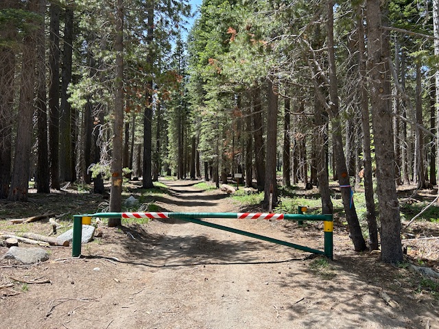
The first project has been discussed for years and was scheduled to start in 2025. This would be the reroute around the Miller Creek shelf road section of the Rubicon Trail. Yes, the government shutdown has currently stopped the project, but I’m hearing that there are other factors stalling the project. I cannot confirm a lawsuit regarding the reroute, but the rumor is out there. There is also talk of repairs to the shelf road rather than the reroute, with one donor offering a lot of money to see the current route repaired rather than do the reroute. For the record, the UDFS has already made the decision not to do a repair but to go forward with a reroute. There is talk of forest service gates being put on the new reroute as it is not part of the county’s recognized ‘right-of-way’, although I have a document that promises not gates on the new section of 16E75, the Rubicon Trail. That will be a fight as decades ago gates were also threatened, fought against and we won. Again, with the FS shutdown, I cannot confirm this.
One of the lesser talked about aspects of the “reroute” project is the decommissioning of several user created routes along Cadillac Hill. I am very much opposed to closing any of these as they allow safe passage of rigs going up and coming down Cadillac Hill. Closure of these short, parallel trails will force users to drive off trail to get around each other.

The second project is the expansion of the Tahoma staging area parking lot. Along with the shutdown of the Lake Tahoe Basin Management Unit, the LTBMU is very short on personnel due to transfers and retirements and cannot complete the work they agreed to do regarding planning and permitting. No idea when the LTBMU can hire and fill positions, bring those individuals up to speed and get their work on the expansion completed.
The third is my effort to talk about the opening of OHV gates. This didn’t even get off the ground as our first group meeting was cancelled due to the shutdown. The good news is we really have until May to get together and produce a plan to get the FS gates open on time. I’m confidant this will get done and our OHV trails will be accessible on time.
Get out there and use our OHV trails. Please remember that in the Sierra, this time of year, any weather is possible. Go prepared to spend the night. Be safe, Think smart.
.
Rubicon Ronin
TNF’s VIRTUAL Open House for OHV Grant ideas
Posted: February 5, 2025 Filed under: Uncategorized | Tags: funding, maintenance, reroute, TNF, USFS Leave a commentEvery year, each national forest applies for funding through a grant program. These forests are required to seek user/public input in order to qualify for these funds.
Sadly, these forests are not required to follow the input of the users when writing the final grant application. But we do the dance in case our particular forest does listen to our input.
The Tahoe National Forest is currently in the driver’s seat regarding the Rubicon Trail and the Fordyce Trail, among many others. It is in our best interest to give our input. The details of how to do that are below. Once the draft grant application has been filled out, there is a public review period. It’s better to get your ideas in before that initial draft than try and get them in afterwards.
There is a needed Rubicon reroute that should get funded through this grant and there may be MAJOR Fordyce work funded through this grant but more likely just Fordyce planning funds.
This year it seems the USFS is still in a covid lockdown as they are only doing a “VIRTUAL” open house.
So, here’s the info…
Tahoe National Forest invites public to provide input on annual off-highway vehicle program grant application
Tahoe National Forest is preparing its annual application to the California Department of Parks and Recreation, Off-Highway Motor Vehicle Recreation Division, to request funding for trail and facilities maintenance, law enforcement and education and safety. The forest invites interested individuals and organizations to a virtual open house on Feb. 13 to learn more about the state OHV grants the Tahoe National Forest is considering applying for and how to provide input.
What: Open house to discuss Tahoe National Forest annual OHV grant proposals Where: Virtual, join on Teams
When: Feb. 13, 2025, 6 p.m. – 7:30 p.m.
Annual state OHV grants provide important funds for the U.S. Forest Service to develop and maintain trails and trailheads, repair winter storm damage and restore trailside environments, as well as provide patrolling, education and monitoring of OHV areas. When finalized, the grants will be available for public review and comment on the State of California’s website ( http://ohv.parks.ca.gov ) from March 4 – May 5, 2025.
Questions, comments or letters can be submitted through the following ways:
- In-person: During the virtual open house meeting via written comments
- Email: Trails Program Coordinator Joe Chavez, joe.chavez@usda.gov
- Mail: Tahoe National Forest, Attn: Joe Chavez, Forest Trails Program Coordinator, 631 Coyote St., Nevada City, Calif. 95959
Feedback on projects and grant opportunities is requested by Feb. 24, 2025.
RTF Update on Reroute
Posted: March 10, 2024 Filed under: Access, Maintenance, Travel | Tags: reroute Leave a commentI posted earlier about this but here it is with more information from the Rubicon Trail Foundation:
I’m of two minds of this reroute. Yes, it needs to happen because one heavy spring rain could wipe out that shelf road. But until it does, I want to keep some form of access to that section of historic trail.
As I mentioned before, the section of the trail just west of 03-04 is not the original trail. Decades ago, the trail was rerouted out of the meadow. So, in reality we’re not losing a half mile of the trail, we’re only losing a couple of hundred of yards of original trail.
It sounds like volunteers will be involved in the building of the reroute. Get on the Friends of the Rubicon (FOTR) email list to stay informed about when volunteers will be needed. I’m hoping they can find some rocky outcroppings to incorporate into the new section of trail. It sounded like RTF wants to make it more than just a dirt road. This should be the link:
.
Rubicon Ronin
Two Rubicon Reroutes In The Works
Posted: January 24, 2024 Filed under: Uncategorized | Tags: access, bypass, reroute, TNF Leave a commentLet’s cut to the chase. Here’s the Forest Service map show the two proposed reroutes:
The first and larger reroute would bypass (in orange) the shelf road above Miller Lake. This has been on the books for some-time but this latest proposal moves the intersection of the Rubicon and Forest Road 03-04 further north-west. The new proposal is longer and would bypass two low spots on the trail along Miller Meadow.
The second reroute (in yellow) would bypass the famous “mud” hole that has been repaired and is now just a water hole with a hardened base. At least I think that’s where that one runs.
Here is the “review” from September 2019:
For the record, there has been a previous reroute at the intersection of the Rubicon and Forest Road 03-04. Here’s a link to a previous post of mine, from 2014!
https://wordpress.com/post/theotherrubicon.com/877
If you were looking closely, this document came out in 2019. I became aware of it today, 1-24-24. If you read the document, “The Other Rubicon” was mentioned on page 3 as a “contacted” or “conferred with” person. Although I have worked with the Tahoe National Forest on several OHV issues, I don’t recall any formal conversations about these reroutes. I certainly do not agree with everything in this document. It would have been nice if the FS had sent me a copy of this document when published in 2019, since the3y mentioned me in it.
So, what do I not agree with? Let’s go through the document page by page.
On the very first page it talks about “activities that restore, rehabilitate”. With out going into detail, I’m not in favor of completely doing away with the sections the FS wants to bypass. The long reroute would restrict access to private property.
I laughed that on the second page the document talks about the “hundreds” of annual vehicles on the trail. It should read tens of thousands of vehicles annually!
Also on page two, “decommission three short, user created bypass trail segments”. All three users created bypasses along Cadillac Hill allow for passing, either in the same or opposite direction. I distinctly remember telling this to Joe Chavez, on the trail, while he was attempting to decommission them with a spider excavator without public input. I talked him out of it that day, I guess I’ll have to do it again.
Timeline – this document was signed in 2019. The grant process is taking place in 2024. The plan is to work the trail in 2025.
There will be a formal open house held by the FS to review all of their grant projects. Here’s the downside, the forest service is under no obligation to listen to the users input. Even if every comment is opposed a certain project, the FS can ignore that input and do the project anyway.
We’ll have to find a new way to change their minds.
.
Rubicon Ronin

