
14N39 to re-open!!!
Posted: July 14, 2014 Filed under: Access, Maintenance | Tags: 14N39, ENF Leave a commentWe should still wait for the official word from the ENF but this past weekend, the FS and two dozen volunteers ‘fixed’ the S&G100 issues along 14N39. At least we fixed the first three issues. The trail should now be open to a point past 14N39-7 but before 14N39-9.

Thanks to everyone involved!
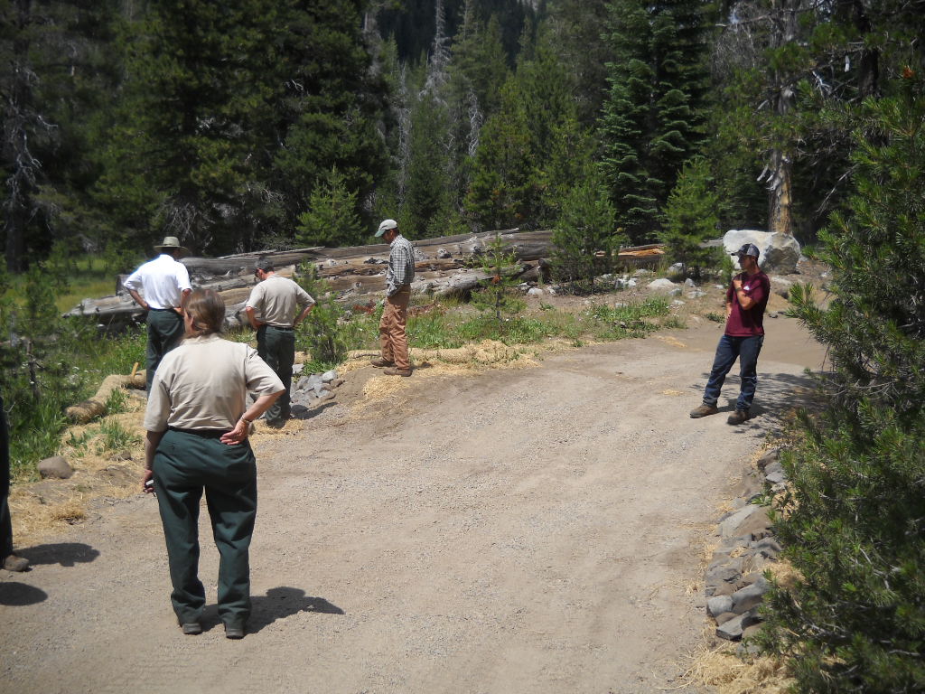
We had a good turnout. Five trailers and one full size pick-up moving gravel (gravel/dirt/binder mix – like road base) the first day and three trailers running the second day. I didn’t count but probably 20 people the first day and 7 or 8 the next day.
The group built to rolling dips with the ‘gravel’, we covered about seven features with gravel, about 150′ of trail. We hand moved rock so the FS could rock line the sediment trap at the first ‘meadow’. Bad photo, but the trap is to the left where everyone is looking.
Once the gravel was dumped (Thank you RTF for the trailers, we had two working both days) the volunteers spread it to the depth required by the FS. The FS then sprayed it with water to activate the binding agent and then ran a ‘vibra-plate’ compactor over every square foot of gravel to pack it down. They were there very late on Sunday finishing that off, we left.
This is meadow 14N39-5. Heavy equipment rebuilt the rolling dip, the volunteers hauled and placed the gravel and the FS compacted it down.
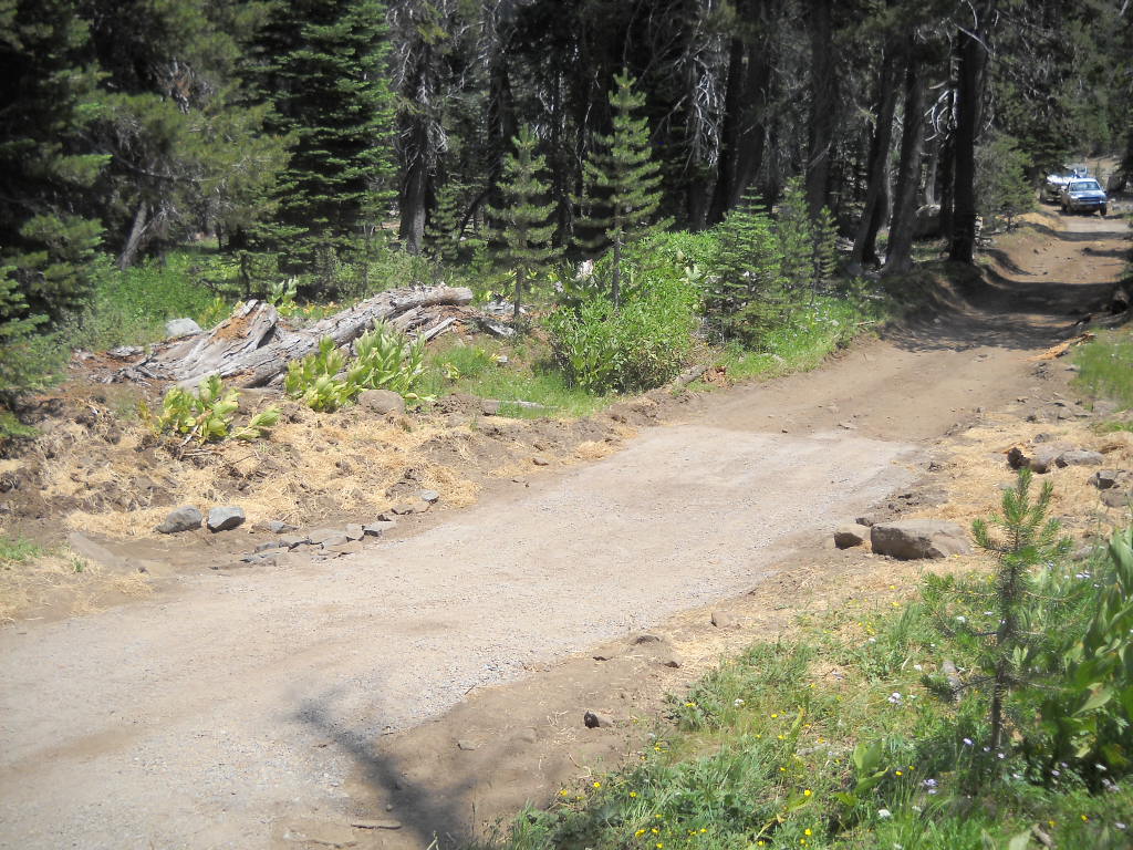
This is meadow 14N39-7 (actually a creek issue). We built two rolling dips and spread forest debris to slow water and promote growth.
Special thanks to Mike for feeding us BOTH days.
The FS did install a fence further up the trail, past the last ‘meadow’ we fixed but before the last ‘meadow’ issue. They were to drive to the last meadow, turn around, drive down and place the gate at the first wide spot (to allow people to turn around) that was not a arch site.

I was the last one through the gate on a tour of 14N39-9 on July 16th.
The last meadow needs a re-route. We will be on the trail Wed to find the new route. There will be NEPA and the rest of the studies that go with it. Best case is we find a route on Wed, study it and plan it over the winter, and build it in 2015. Because it is a brand new road cut in the forest, it will need to ‘winter’ once before it can be driven, so look for it to open in 2016.
I will be pushing HARD for a temporary fix of that meadow so we can access the summit while the re-route is being planned and built. Stay tuned.
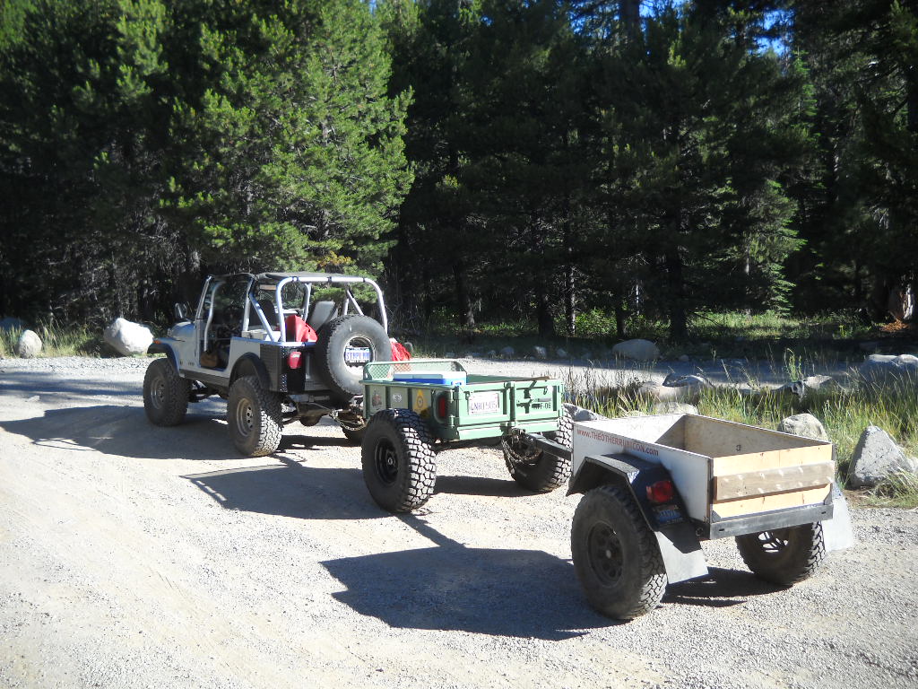
Picture just added but I’ll leave this one. I did have some fun moving trailers around:
Sent out Monday the 14th:
Forest Road 14N39 re-opened today as far as the Pacific Crest Trail. Our hydrologist verified that the Forest is in compliance with S&G 100 at Meadows 14N39-1, -5 and -7 based on the maintenance repairs completed to date. A big thanks to all the volunteers who worked so hard over the weekend!
Richard Thornburgh
Pacific District Ranger
Eldorado National Forest7887 Highway 50
Pollock Pines, CA 95726
😉
14N39 work party
Posted: July 10, 2014 Filed under: Access, Maintenance | Tags: 14N39, ENF, Richardson Lake Leave a commentWe’re still working out the details but there is a work party scheduled for this weekend on the Richardson Lake Trail.
The basic plan is to harden the rolling dips made by heavy equipment last week by covering them and a few sections of trail with a gravel/dirt mix. We will also make at least one rolling dip and spread debris in an open area to slow storm runoff.
Volunteers are need and if you have a trailer, bring it. The FS will provide a front loader to load the trailers. RTF is making their trailers available for use and they have a dump bed which was discussed in an earlier post. RTF Trailer
Please join us at the Tahoma trailhead on this weekend Saturday the 12th and/or Sunday the 13th.
A discussion can be followed on Reno4x4.com
.
Extreme Fire Danger – what it means to the Rubicon and OHV
Posted: May 3, 2014 Filed under: Access | Tags: ENF, LTBMU, Rubicon, TNF Leave a commentThe winter of 2013/14 was a dud. The governor of California declared a drought for California in January. Mid-summer fire conditions existed in January and continue to get worse. The fire danger on the Rubicon and other trails this coming season will be extreme and fire restrictions will come very early. Unless we get a huge late snowfall, it could be a short wheeling season.
In 2007, the Tahoe National Forest (TNF) declared extreme fire danger and with a July 2nd forest order closed the entire forest to internal combustion engines. That closure included chainsaws, motorcycles and jeeps. This closure rekindled my interest in building an electric Jeep, but that’s a topic for another article.
Due to continued hot, dry, and windy weather, fire restrictions in the Tahoe National Forest (TNF) will be increased beginning Monday, July 2, 2007…the restrictions will affect several activities:
* Fireworks – Absolutely no fireworks are permitted in the National Forest.
* Campfires – Only permitted in those campgrounds that have water systems, metal campfire rings, fire engine accessibility and regular patrols by campground hosts. Visitors can contact any TNF office for a list of campgrounds where campfires are permitted.
* Portable Stoves and Lanterns – Permitted in all campgrounds and the backcountry with a valid campfire permit.
* Woodcutting – Check the woodcutting hotlines each day to determine if chainsaws are
* Off-Highway Vehicle Use – Only permitted on designated roads; the Prosser Pit area near Truckee; and the Sugar Pine OHV area north of Foresthill. (Not permitted on trails other than the areas mentioned.)
* Smoking – Limited to vehicles, buildings, and in a 3-foot cleared area.
* Contract/Permittee Operations – Any operation or permittee that uses internal combustion engines or fire, must have an approved fire plan.
Thankfully, in 2006, the Placer County Board of Supervisors voted to recognize the Rubicon Trail as a “public trail”. That vote transferred control of the Rubicon Trail from the forest service to Placer County. Both forests involved were okay with Placer County claiming the Rubicon Trail as a public trail and thus controlling management of the trail.
WHEREAS the “McKinney Rubicon Trail” is a world renowned off-highway vehicle trail
that is partially located on federal lands within Placer County; and
WHEREAS the Trail has been in public use for at least 150 years; and
WHEREAS the Trail provides valued recreational asset for the citizens of Placer
because of the technically advanced driving conditions that exist in the open space
environment for off-road vehicle enthusiasts; and
WHEREAS the County desires that the Trail continue to be available for public use into
the future;
BE IT HEREBY RESOLVED by the Board of Supervisors of the County of Placer, State
of California, that this Board recognizes the “McKinney Rubicon Trail” as a public trail;
AND HEREBY states its intent to use all reasonable measures available to it to ensure
continued public access.
If Placer County had not voted in favor of the “public trail”, the Rubicon would have been closed in 2007 to vehicular traffic, including both Jeepers Jamborees.
A similar order in 2014, by any one of the three forests along the Rubicon, could close some of the side trails off the Rubicon. So, if you have any intention of wheeling any of these routes, do it early. Fire restrictions are progressive, they start with banning camp fires, then move to ban any open flames (including cigarettes) and progress until they ban all internal combustion engines.
Components of Stages
There are two fire restriction stages: Stage I and Stage II. There is one closure stage: Stage III. To reduce confusion and standardize the restrictions, the following conditions, by stage, should be used in all restriction documents. Additional elements may be added as conditions dictate.
Stage I
The following acts are prohibited:
- Building, maintaining, attending, or using a fire or campfire except within a developed recreation site, or improved site. 36 CFR 261.52(a).
- Smoking, except within an enclosed vehicle or building, a developed recreation site or while stopped in an area at least three feet in diameter that is barren or cleared of all flammable materials. 36 CFR 261.52(d).
- Operating or using any internal or external combustion engine without a spark-arresting device properly installed, maintained, and in effective working order meeting either the USDA Forest Service Standard 5100-1a (as amended), or appropriate Society of Automotive Engineers (SAE) recommended practice J335(b) and J350(a) (36 CFR 261.52(j)).
Stage II
The following acts are prohibited, in addition to the prohibitions of Stage I:
- Building, maintaining, attending, or using a fire or campfire. 36 CFR 261.52(a)
- Smoking, except within an enclosed vehicle or building. 36 CFR 261.52(c)
- Possessing, discharging, or using any kind of firework or other pyrotechnic device.
36 CFR 261.52(f)
- Using an explosive. 36 CFR 261.52(b)
- Operating a chainsaw or other equipment powered by an internal combustion engine between 1:00 p.m. to 1:00 a.m. 36 CFR 261.52(h).
- Operating or using any internal or external combustion engine without a spark arresting device properly installed, maintained and in effective working order meeting
either:
- USDA Forest Service Standard 5100-1a (as amended); or
- Appropriate Society of Automotive Engineers (SAE) recommended practice
J335 (b) and J350 (a). 36 CFR § 261.52(j) and 43 CFR § 9212.1(h);
- Welding, or operating an acetylene or other torch with open flame. 36 CFR 261.52(i)
- Possess or use a motor vehicle off: Forest System Roads (36 CFR 261.56) Except when parking in an area devoid of vegetation within 10 feet of the roadway; and except for parking overnight in developed campgrounds and at trailheads.
Stage III
The area is closed to all entry (36 CFR 261.52(e)) other than as follows:
- Persons with a written fire entry and activity permit that specifically authorizes the otherwise prohibited act. This may include such persons as grazing-permit holders when entry is needed to gather, move, or otherwise manage their permitted livestock, special-use authorization holders when access is needed to maintain emergency or other communications operations, and others.
- Any federal, state, or local officer, or member of an organized rescue or firefighting force in the performance of an official duty.
- Resident owners and lessees of land within the closed area.
Dates for fire restrictions being put in place on the TNF over the last decade or so range from June 1st to August 18th and in in 2011 I don’t think they EVER had fire restrictions due to the huge and late winter. Dates for lifting the ban on camp fires range from September 1st to October 23rd.
So, get out early this season. Make sure you rig is good to go now so you can take advantage of the early opening dates of the trails in the Sierras. Don’t wait for the waters and air temperatures to warm up because by the time things warm up, they might be closed.
Bring extra layers to wear instead of starting a camp fire every night even if they are still allowed. Eat sandwiches instead of steaks and cereal instead of bacon and eggs. Or have a contest with your buddies to see who can build the better solar cooker for your next camp out.
Working with the Eldorado National Forest?
Posted: April 21, 2014 Filed under: Access, Maintenance | Tags: 14N39, ENF, Richardson Lake Leave a commentAs the only pro-OHV appellant from the east side of the Sierras, I have taken a personal interest in getting the Richardson Lake Trail, 14N39, reopened. One of my clubs, The North Tahoe Trail Dusters, often would organize a mid-week after work run to the top of Sourdough Peak for a BBQ and to watch the sunset. We’d then wheel down in the dark.
Trying to work ‘with’ the Eldorado National Forest (ENF) to get this trail reopened has been a challenge. My fallback line to them has been “Partnership Not Pushback” but it seems I get more pushback than partnership.
Early on, before the Record of Decision (ROD), I had organized a tour of 14N39. Scheduled to be there were all the right people from the ENF and the users to drive them. The day before the tour the head ENF ranger, Lawrence Crabtree, pulled the hydrologist to another project. We went anyway and documented the ‘meadow’ issues and how each could be fixed.
The ENF later changed the rules and claimed that no planning could be done on any fixes until the forest hydrologist could visit the trail and get eyes on the issue. They couldn’t read our notes and draft something; they couldn’t look at our photographs and draft something; they couldn’t work from the first hydrologist’s notes and draft something.
Read as a “How can we, the ENF, delay the reopening of this trail?”
But the hydrologist was not available later on to make it to the trail. Then the Lake Tahoe Basin Management Unit tried to help by sending their hydrologist to look at the trail. But an early snow flurry covered the trail the day before the scheduled tour. Let’s not discuss the fact that it didn’t snow again for months.
Read as a “How can we, the ENF, delay the reopening of this trail?”
So the winter went by with the ENF not willing to talk about possible fixes, not willing to talk about possible reroutes, not willing to talk about possible temporary fixes to the last meadow, not willing to talk about any possible maintenance, basically not willing to do anything that move this project forward. Pushback not partnership.
Read as a “How can we, the ENF, delay the reopening of this trail?”
Over the winter, I’m thinking about possible fixes to both the minor water issues and the last meadow reroute. I email a few questions to the ENF and don’t hear back. I finally email the boss of my ENF contact and I hear back from my contact. They snapped back about other things going on and being short staffed, etc. Pushback not partnership. They never did answered my questions.
Read as a “How can we, the ENF, delay the reopening of this trail?”
Spring arrives. I’ve already drafted a plan for the inevitable tour with the ENF and this time the hydrologist. Its three pages long: goals, objectives, list of possible attendees, communications plan, medical plan, timeline, etc. So, I contact the ENF to lay the groundwork for this tour that is still a month away due to snow.
I receive an email basically telling me that the ENF will send a group to tour the trail and then put out a plan of what the fixes will be. A second tour could be scheduled if needed for the appellants. Then there would be a comment period.
Read as a “How can we, the ENF, delay the reopening of this trail?”
There were so many ‘issues’ in this one email from the ENF that I contacted them and later drove over the hill to meet with them in person.
At the end of the meeting, I had still not got my way but had made a little ground. The ENF would still send out a team without users or appellants and would schedule a second tour with appellants, within a week, prior to drafting and publishing a plan. This would allow input from individuals outside the FS to comment prior to the ENF coming to a decision on how to fix any issues.
There are still many issues to ‘discuss’ with the ENF. The primary one being to start working on possible ways to temporarily ‘fix’ the last meadow issues to allow users to drive to the summit while the years long reroute gets completed.
Don’t worry, I’m still pushing. I’m aiming for a partnership but I’ll take anything as long as I can keep things moving forward.
Good news, bad news.
Posted: March 29, 2014 Filed under: Access | Tags: 14N39, ENF, Richardson Lake Leave a commentThe good news is…
On April 1st, the Eldorado National Forest will allow the scheduled opening of its OHV trails that were closed for the “wet” season. The forest has the option of extending the seasonal closure if they feel the trails are still too wet.
The bad news is…
The only ENF trail that is near the Rubicon on the Tahoe side, 14N39 The Richardson Lake Trail, remains closed due to four sections of the trail not meeting “Standard & Guideline 100” for meadows.
My goal is to work with the ENF and Reno/Tahoe volunteers to get at least the first three ‘meadow’ issues fixed. Optimistically, I’d love to see them open for Memorial Weekend; Fourth of July at the latest. As for the last ‘meadow’, I’d love to see a temporary fix in place before the end of the season. That section will require a reroute and that will take YEARS to finish.

