
Camping & Fire Restrictions
Posted: September 9, 2020 Filed under: Access, Travel | Tags: camping, fire Leave a commentAnd if you haven’t heard, the Eldorado, Tahoe and Lake Tahoe Basin are all banning camping and any type of flame, even propane.
This after the Region 5 closed all forests in Southern CA.
https://www.fs.usda.gov/detail/tahoe/news-events/?cid=FSEPRD799358
https://www.fs.usda.gov/eldorado
Fork Fire Update…
Posted: September 9, 2020 Filed under: Travel | Tags: fire Leave a commentThe Eldorado Forest just put out an update…
 U.S. Forest Service Eldorado National Forest 100 Forni Road Placerville, CA 95667 530-303-2412 www.fs.usda.gov/eldorado U.S. Forest Service Eldorado National Forest 100 Forni Road Placerville, CA 95667 530-303-2412 www.fs.usda.gov/eldorado  News Release For Immediate Release September 9, 2020 Media Contact: Jennifer Chapman, (530) 957-9660 El Dorado County Sheriff’s Office, (530) 213-3899 Fork Fire Information, (530) 303-2455 www.facebook.com/EldoradoNF Twitter:@EldoradoNF Fork Fire Update – September 9, 2020 – 10AM Fork Fire Information: (530) 303-2455 Inciweb: https://inciweb.nwcg.gov/incident/7165/ Fire Size / Containment: 2,500 acres, 0%-containment – **Acreage is an estimate only; perimeter mapping is in progress** Overnight Fire behavior:There was active fire behavior on the Fork Fire last night with moderate to rapid rates of spread; the fire has spotted into the Rubicon drainage. Resources: 5 engines, 1 dozer, 2 hand crews, 2 water tenders – **Includes resources added since the IAP was published.** Critical resource needs: Type 1 / Type 2crews, dozers, and engines; also Overhead until incoming Incident Management Team takes command. Planned actions / priorities: Full suppression strategy with confine/contain tactics; minimize fire spread within Rubicon River drainage; protect communities of Volcanoville, Quintet, Stumpy Meadows and Georgetown; protect private timber sales; protect critical hydroelectric infrastructure and a critical high voltage KV line that provides power to the Sacramento region. Injuries: 0 Evacuations: El Dorado County Sheriff’s Office issued a mandatory evacuation for Volcanoeville, Quintet and Stumpy Meadows last night, affecting approximately 600 residents; an evacuation service center has been set up at the Cool Community Church at 863 Cave Valley Rd. in Cool, CA. **Please note, the community of Georgetown is NOT under the evacuation order at this time.** Power Shutoff: a power outage affecting the fire area is also causing safety concerns; infrastructure inspections and power restoration where possible will be in progress today Road Closures: check forest websites for Eldorado NF and Tahoe NF Weather:excessive heat, low RH, and changing pressure gradientDry, offshore winds with critical fire weather through Wednesday eveningRed Flag Warning in effect Wind Advisory in effect for the northeast foothillsSmoky conditions across the region due to multiple large wildfiresOther pertinent info: a Type 2 Incident Management Team is enroute; minimal resources are available for the next 48 hrs / operational period; other large fires in the geographical area are causing strain on federal, state, and local government resources. ### News Release For Immediate Release September 9, 2020 Media Contact: Jennifer Chapman, (530) 957-9660 El Dorado County Sheriff’s Office, (530) 213-3899 Fork Fire Information, (530) 303-2455 www.facebook.com/EldoradoNF Twitter:@EldoradoNF Fork Fire Update – September 9, 2020 – 10AM Fork Fire Information: (530) 303-2455 Inciweb: https://inciweb.nwcg.gov/incident/7165/ Fire Size / Containment: 2,500 acres, 0%-containment – **Acreage is an estimate only; perimeter mapping is in progress** Overnight Fire behavior:There was active fire behavior on the Fork Fire last night with moderate to rapid rates of spread; the fire has spotted into the Rubicon drainage. Resources: 5 engines, 1 dozer, 2 hand crews, 2 water tenders – **Includes resources added since the IAP was published.** Critical resource needs: Type 1 / Type 2crews, dozers, and engines; also Overhead until incoming Incident Management Team takes command. Planned actions / priorities: Full suppression strategy with confine/contain tactics; minimize fire spread within Rubicon River drainage; protect communities of Volcanoville, Quintet, Stumpy Meadows and Georgetown; protect private timber sales; protect critical hydroelectric infrastructure and a critical high voltage KV line that provides power to the Sacramento region. Injuries: 0 Evacuations: El Dorado County Sheriff’s Office issued a mandatory evacuation for Volcanoeville, Quintet and Stumpy Meadows last night, affecting approximately 600 residents; an evacuation service center has been set up at the Cool Community Church at 863 Cave Valley Rd. in Cool, CA. **Please note, the community of Georgetown is NOT under the evacuation order at this time.** Power Shutoff: a power outage affecting the fire area is also causing safety concerns; infrastructure inspections and power restoration where possible will be in progress today Road Closures: check forest websites for Eldorado NF and Tahoe NF Weather:excessive heat, low RH, and changing pressure gradientDry, offshore winds with critical fire weather through Wednesday eveningRed Flag Warning in effect Wind Advisory in effect for the northeast foothillsSmoky conditions across the region due to multiple large wildfiresOther pertinent info: a Type 2 Incident Management Team is enroute; minimal resources are available for the next 48 hrs / operational period; other large fires in the geographical area are causing strain on federal, state, and local government resources. ###  The U.S.D.A Forest Service is an equal opportunity employer. The mission of the Forest Service is to sustain the health, diversity, and productivity of the nation’s forests and grasslands to meet the needs of present and future generations. The U.S.D.A Forest Service is an equal opportunity employer. The mission of the Forest Service is to sustain the health, diversity, and productivity of the nation’s forests and grasslands to meet the needs of present and future generations. |
Fire Near Rubicon Trail!
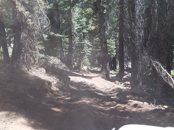
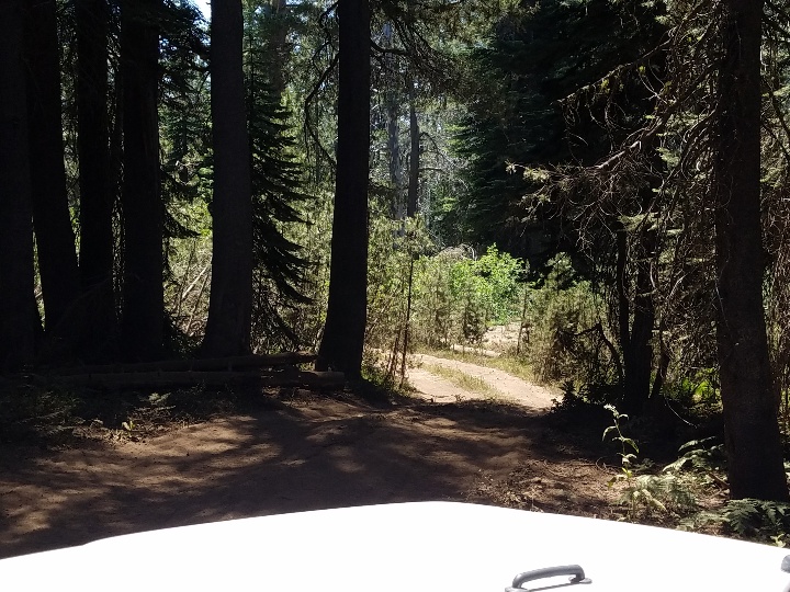
Posted: September 9, 2020 Filed under: Travel | Tags: fire Leave a commentThere is a fire burning west of Loon Lake, north of Union Valley Reservoir. Way too close to the Rubicon Trail.
Evacuations have been made for the greater area to the west. El Dorado County has closed the Rubicon Trail. People on the trail are being asked to exit through Tahoe.
Here is my go to website about current fires: https://inciweb.nwcg.gov/
This image is from the Rubicon Gazette Facebook page. That website is probably the best source of info right now as many people are posting.

The current size (9/9/20 @ 10:15am) is 2500 acres.
Weather: high temperatures in the high 70’s for the week. Winds from the east until Thursday night, then they swing to the west. It’s burning near the old King fire burn now, which should slow growth. When the winds swing to the west, it should (hopefully) burn back on itself.
Click on the Bunker Hill camera: http://www.alertwildfire.org/tahoe/?camera=Axis-Bunker

This was the screen shot 9/9/20 @ 10:45am
I was on the trail Labor Day weekend (the day before it started) and thankfully, traffic was very low. I’m thinking everyone is off the trail by now.
Let’s all keep our fingers crossed that this doesn’t explode.
.
Rubicon Ronin
Highway 50 to close at Echo Summit
Posted: August 16, 2020 Filed under: Access, Travel Leave a commentThe Rubicon Gazzette Facebook page had a posting about road construction on Highway 50 that will restrict and then close the road in September.
One-way traffic control is scheduled for U.S Highway 50 to start, Sunday, Sept. 13 24/7 for bridge demolition work of the existing structure.
Full closure of U.S Highway 50 over Echo Summit is scheduled for Sept. 18 – Oct. 2.
The construction zone will extend from the Caltrans Echo Maintenance Station, east for 1.2 miles.
Here’s the link to the website with the details: https://www.way2tahoe.com/?fbclid=IwAR2_sap8HYLv-16wgCJ3E3P-r00PbDo-Yn4R7iXiJauFmfPSv8ZPq73Mjxw
Please plan accordingly.
.
Rubicon Ronin
Official Rubicon Bypass
Posted: July 16, 2020 Filed under: Maintenance, Travel | Tags: bypass, mud Leave a commentSo, I’m not seeing where I posted about the large mud hole on the Tahoe Side of the Rubicon, but there was one. It was so bad, 4 of the 5 in our group the day we encountered it got stuck. We were all in well built rigs on 35’s or more.
The users created an illegal bypass but it was blocked off by ‘those in charge’. Unfortunately, ‘those in charge’ did nothing to FIX the mud hole.
Guess what? ‘Those in charge’ just created a “temporary bypass” around the mud hole until it can be properly repaired.
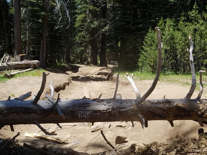


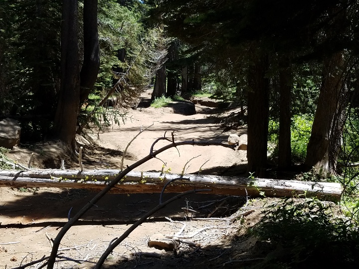
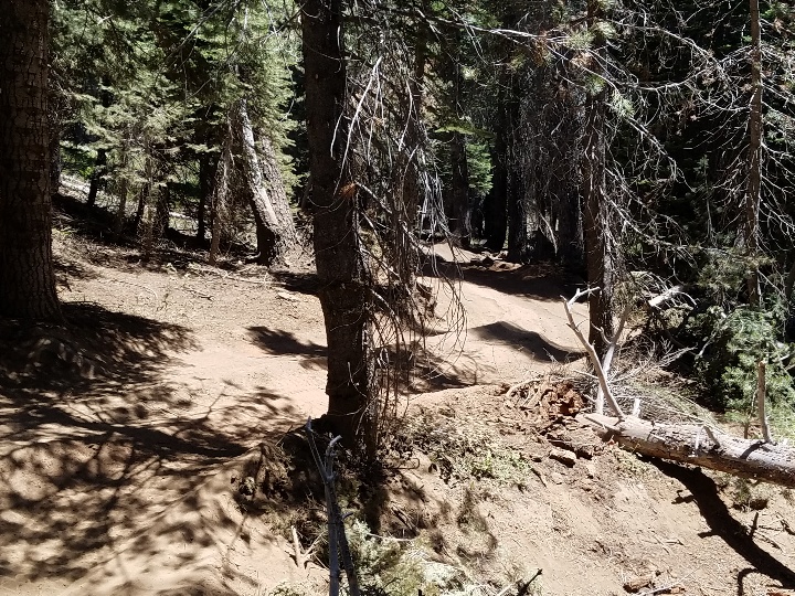


There has been no word on when repairs to the mud hole might take place.
.
Rubicon Ronin

