
The Season Has Begun
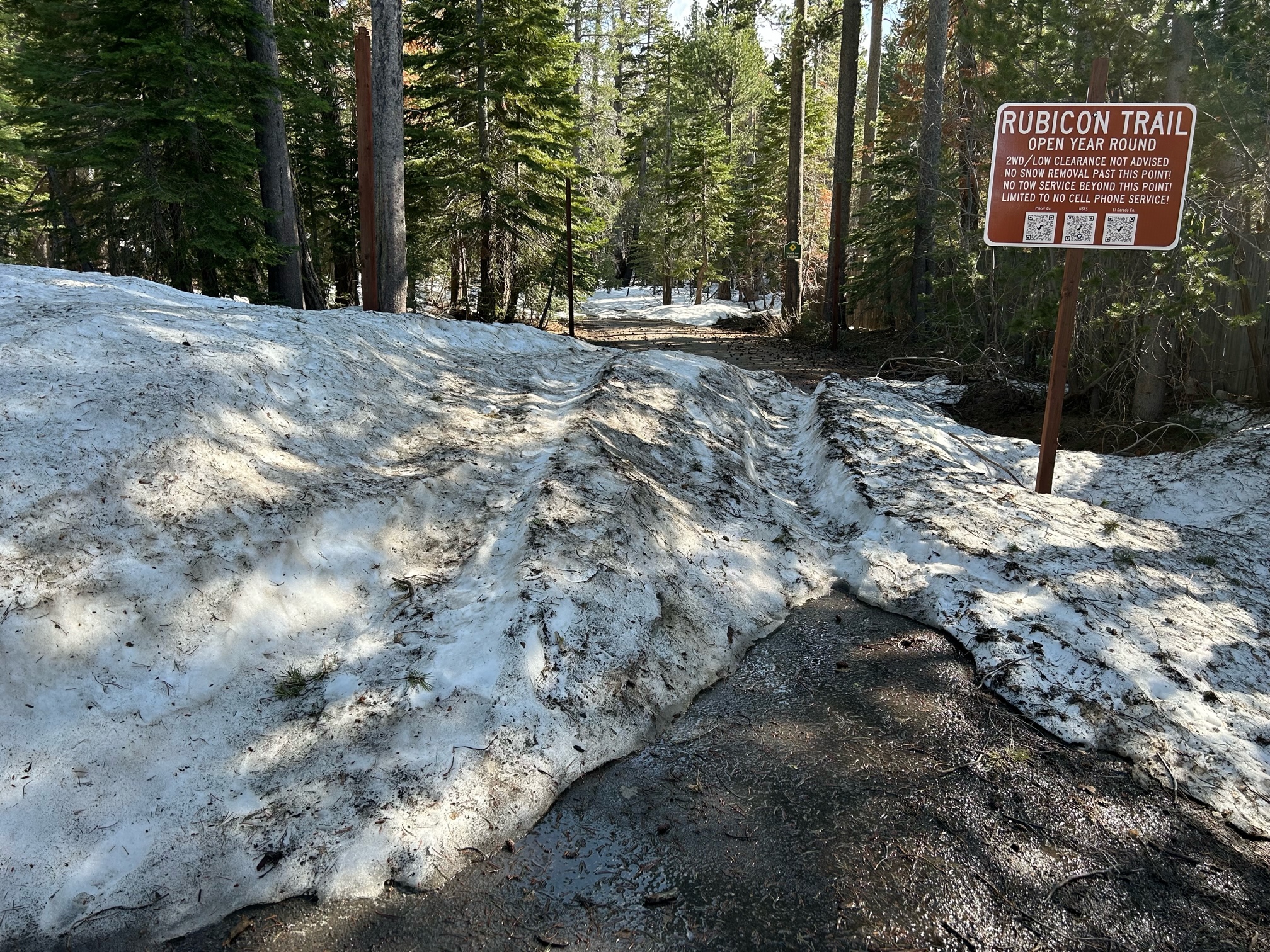
Posted: June 3, 2023 Filed under: Access, Travel | Tags: snow, water Leave a commentWe met at the entrance in the residential area at 9am, because we didn’t know how much snow was going to be on the paved road into the staging area. Turns out not much. On our way out, there were tow rigs with trailers parked in the staging area.

By next weekend there will be zero snow on the paved road in to staging.
The staging area is virtually clear. I restocked the TP in the toilets.

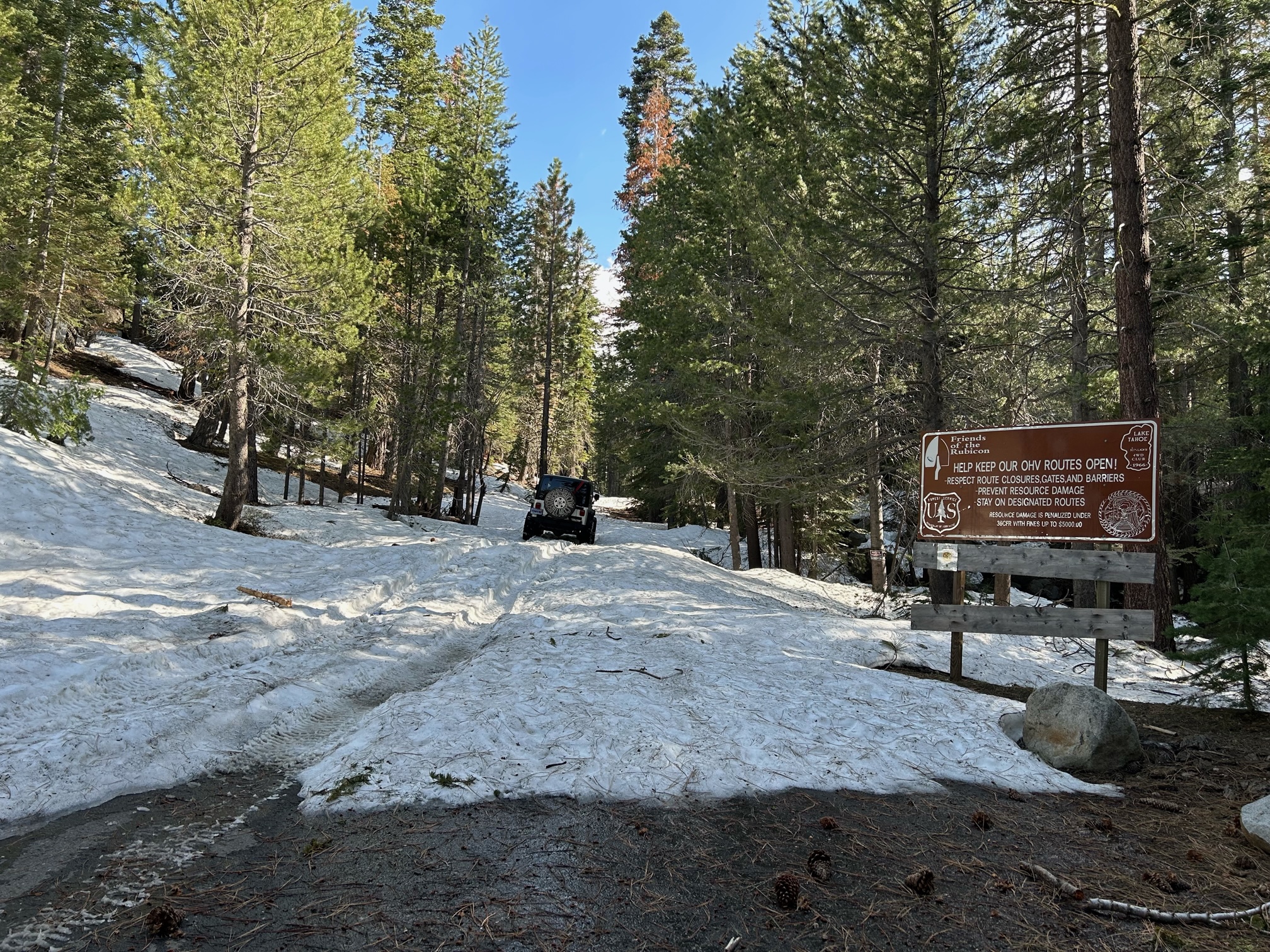
Literally, the first snow pile out of the staging area caught two of our drivers off guard and they had to be strapped off of it.
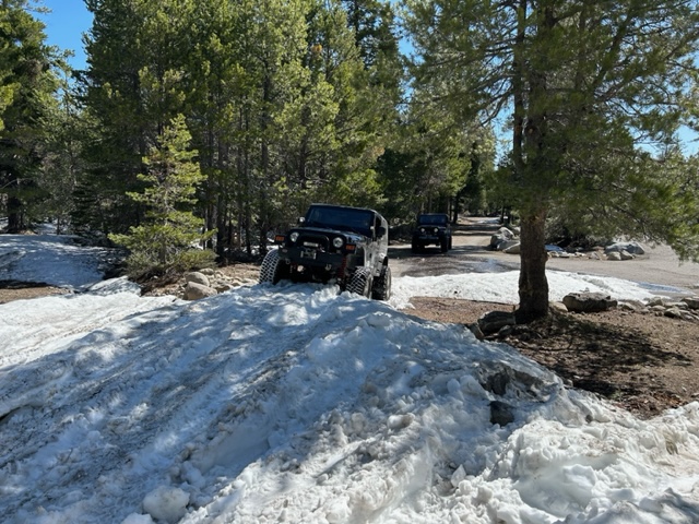
The first 100 yards has some very off camber sections. There were more of those further up the trail.

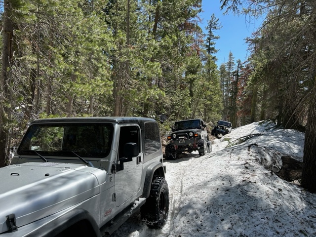
In the areas that were typically shade we had snow…

Where there had been sun, a lot of the snow had melted…

Being very early in the season, there was debris on the trail. We moved two or three and cut two or three more and were able to drive around others, while still staying on the trail.

It was slippery, but we pressed on, always sliding to the right.

There was one climb that was just too steep. One strap around a tree and we each took turns using our own winches to get up it. All four rigs were locked front and rear. Most on 35s, one on 37s.

It was great to finally get out on the trail.
Of course, you want to know how far we got. We started on the snow around 9:30, and turned around about noon, stopped there for lunch and then headed out. Two and a half hours in and half an hour out. On our way out, we came across a bunch of rigs and quads struggling up the very first snow climb. Hint: start as early as possible before the snow starts to melt and gets really slippery.
Looking backwards, this is as far as we got. I estimate water bar number 22. It’s before the climb that takes you to Lilly Lake.

I walked a little further up the trail and saw a log across the trail and decided we were done for the day. I did have a chainsaw with me, but we weren’t out to work that hard. The further log is off the trail, you turn left just before that. The closer one would have given us trouble.
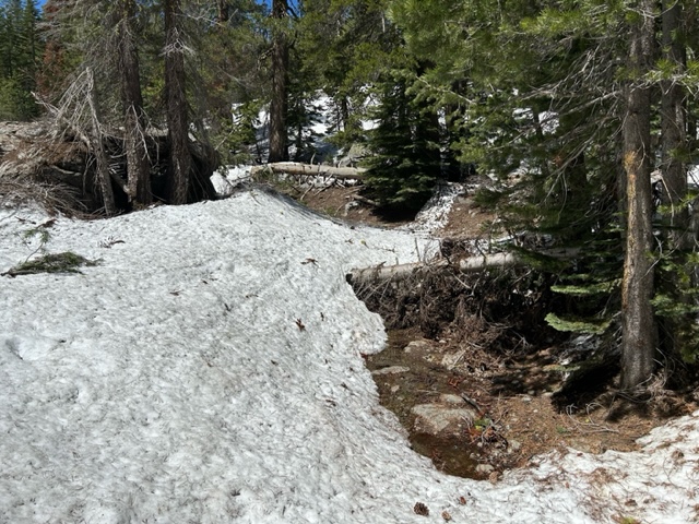
On the way out, two side-by-sides went in. They claimed they had been a mile past Miller earlier in the week. I don’t know how they will navigate that log, but they said they had a saw.
Two more Jeeps passed us, so maybe someone will clear it.
The quads were not prepared to be out on the trail but they had strength in numbers, about ten of them!
There will be water on the trail for months. The rolling dips seem to be working pretty well.
Always be prepared. Thunder storms are predicted for later in the week. Be ready to spend the night if something goes wrong.
Enjoy!
.
Rubicon Ronin
Time to Snow Wheel
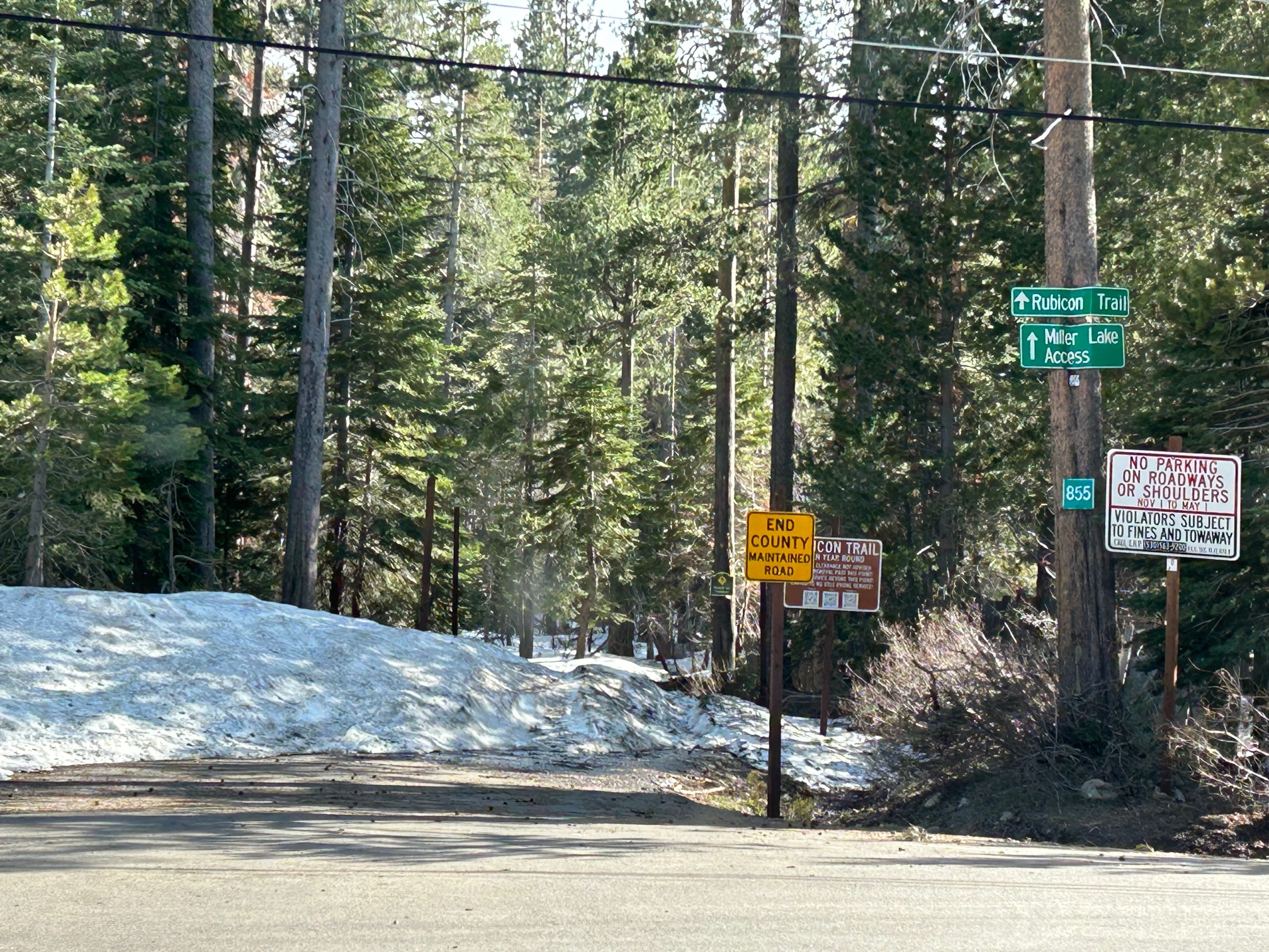
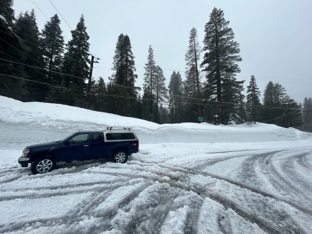
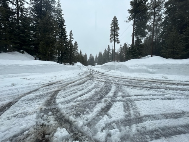
Posted: May 24, 2023 Filed under: Access, Travel | Tags: snow Leave a commentYesterday, I stopped by the Rubicon trailhead in Tahoma. Although the snow has melted a lot, there is still a tremendous amount of snow on the trail.
Note that residential parking is now allowed if you bring your rig on a trailer.
The first snow bump is a little off camber but with the ruts in the snow, I didn’t slip to the side. The sign would have stopped me if I had.
Just a little further in, there is evidence of some unprepared wheelers who got stuck and needed to bring in pieces of wood to place under the tires to get unstuck. At some point they were successful as there were no rigs still on the trail.

I only went in a couple of hundred yards. I was alone, it was late afternoon, the snow was slippery from the sun. Just to get that far, I went back and forth a dozen times, slowly creeping forward. Even at this time of day, the snow in the shade provided more grip than the snow in the sun. And I didn’t want to get stuck in the snow, on the Rubicon, on the way to my 4wd club meeting…again. Yea, it happened two years ago and I self-rescued and made the meeting on time.
Although I didn’t get very far, I am assuming that there will be a great amount of water on and along the trail. Please Tread Lightly! if you venture out.
All the same things apply: be prepared, stay on the trail, use a tree saver when winching, don’t go alone.
This is Memorial Weekend coming up. The trail will be busy. There will be those that are not ready for this type of wheeling. Be polite, help them out, go on your way.
“Turn Around, Don’t Go Around”
Be safe.
.
Rubicon Ronin
El Dorado County to vote on Rubicon Resolution
Posted: April 29, 2023 Filed under: Access, Travel | Tags: closure, El dorado, emergency, fire Leave a commentOn Tuesday, May 2nd, 9am, the El Dorado County Board of Supervisors will vote on a resolution to determine who can close the Rubicon Trail and for what reasons.
This applies to El Dorado County only, not Placer County.
The Rubicon Trail Foundation and many, many other Rubicon Trail users and advocates worked with the county to get something written that actually makes sense. Below is the video put out by RTF to explain how we got to where we are. Ken Hower did a very good job of explaining situation. It’s worth seventeen minutes of your time.
Thank you to everyone who had a hand in making this happen.
.
Rubicon Ronin
ENF pushes back opening date of ‘seasonal’ roads
Posted: April 13, 2023 Filed under: Access, Travel | Tags: closed, snow Leave a commentThe Eldorado National Forest has pushed back the opening for seasonal roads and trails by one month. For the Tahoe side of the Rubicon Trail, this means the Richardson Lake Trail (14N39). As we’re already halfway through the extended closure and the snow is still epically deep, I don’t think this will affect us much.
Expect other forests to do the same. Please check the website of whatever forest you plan on visiting before you head out.
Next week, I’ll post pictures from the trailhead. At this point, only the most well-built rigs should attempt to get on the trail. Memorial Weekend will still bring challenges on the Rubicon Trail.
Please Tread Lightly! if you head out on the trail. Stay on the trail, don’t spin your tires, use tree saver straps to winch, etc.
Groundhog Day on the Rubicon
Posted: March 11, 2023 Filed under: Access, Travel | Tags: melt, snow, spring Leave a commentAs I said in my last post, not much has changed. Looks like I had a weird filter on the phone when I took this but there was 7-8 feet of snow at the Tahoma entrance. The notch is almost gone. The snow is stupid wet. Maybe after a few dozen thaw freeze cycles we might be on the trail. But there are not a bunch of freezing cold days forecast.
The roads along the west shore were still unplowed. More snow on the way and it’s going to even wetter. Don’t travel unless you have to. This weather pattern is going to be with us for another four days.
For the record, I was at my cabin, on the roof, in the rain, shoveling…

After clearing a path on the deck to get the ladder in place, I started in on the roof. There will be a round two on Monday to remove more snow. We’re expecting more than a foot by Monday. The worry is the added weight from the rain we’re getting. The snow just soaks it up.

Be patient. The trail will always be there. Summer will happen. We will get on the trail.
.
Rubicon Ronin

