
Stupidest Thing I’ve Ever Done, in a Jeep
Posted: April 13, 2026 Filed under: Uncategorized | Tags: snow, STORM, Travel, winter Leave a commentSpring was here, but winter wanted one more shot. And it happened over the weekend.
The latest winter storm dropped several feet of snow over the Sierra. I wanted to know how much the Tahoe Side received.
Unable to rally any of my fellow wheelers, I went in alone. Not only single vehicle, but single person. But I had all the gear: “Go Bag”, sleeping bag, food, water, recovery gear, parts, communications (ham), etc. What tipped me off that it was a bad idea was while I was loading the snow shoes.
Traffic in Truckee was at a stop because of chain controls over the summit.
Traffic lightened again as people turned into Squaw Valley. But at 9am, if you’re still on the road, you’re late for the fresh powder.
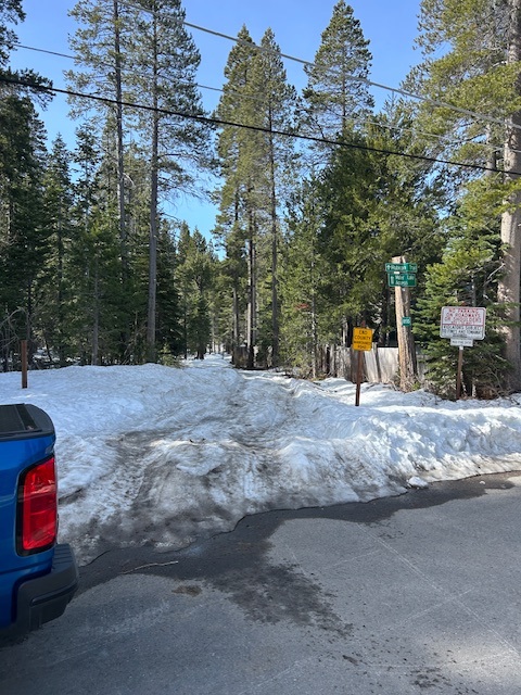
The Tahoma neighborhood was half plowed. Ed Dorado County had been there and cleared their streets. Placer County had not yet made it through the neighborhood.
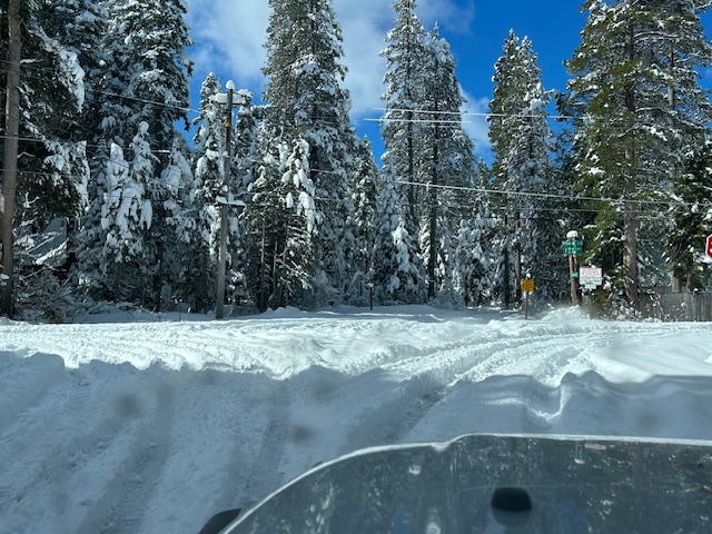
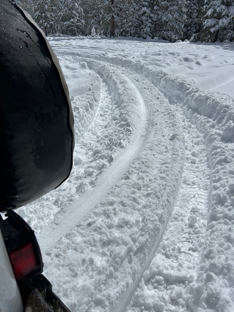
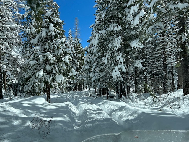
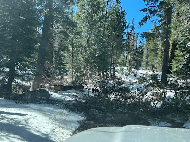
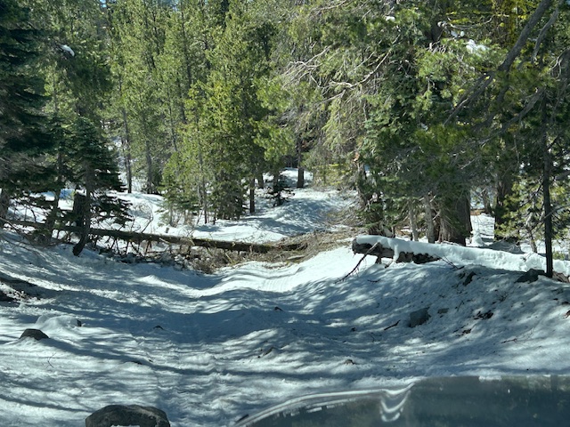
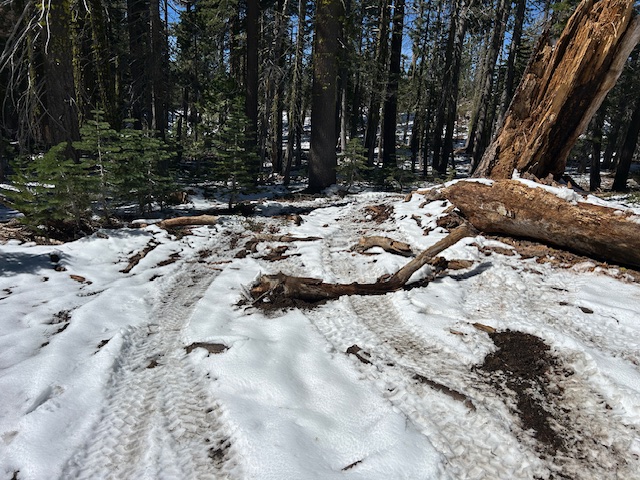
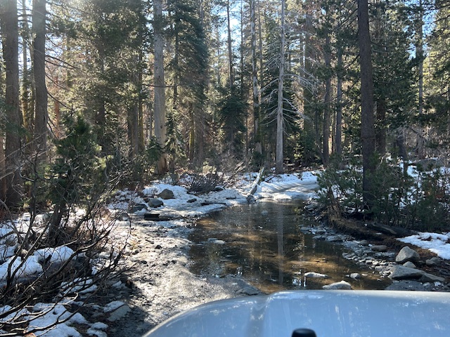
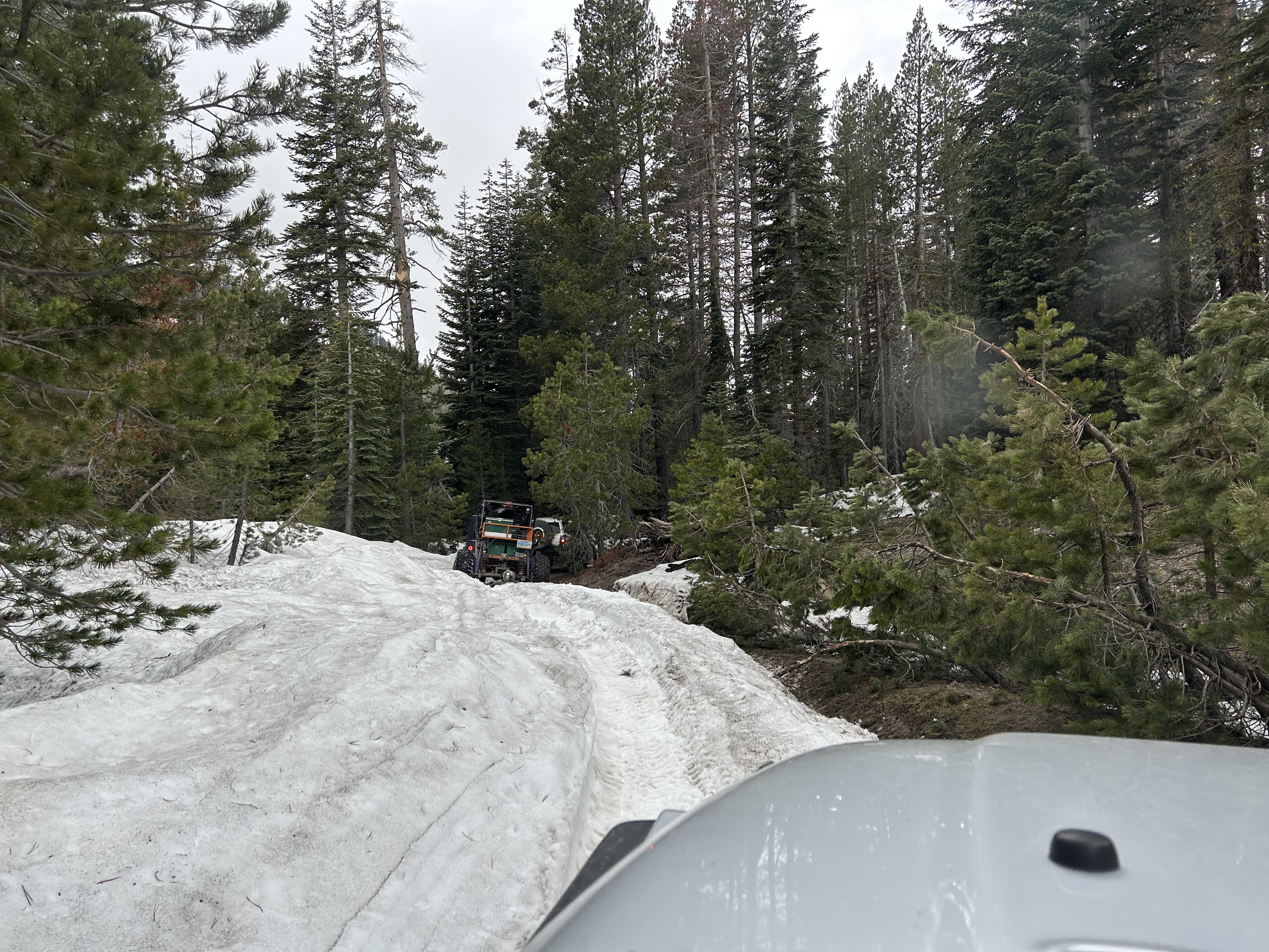
I didn’t slow much as I entered the trail, I just reached down and put it in 4wd. And I didn’t bother to air down.
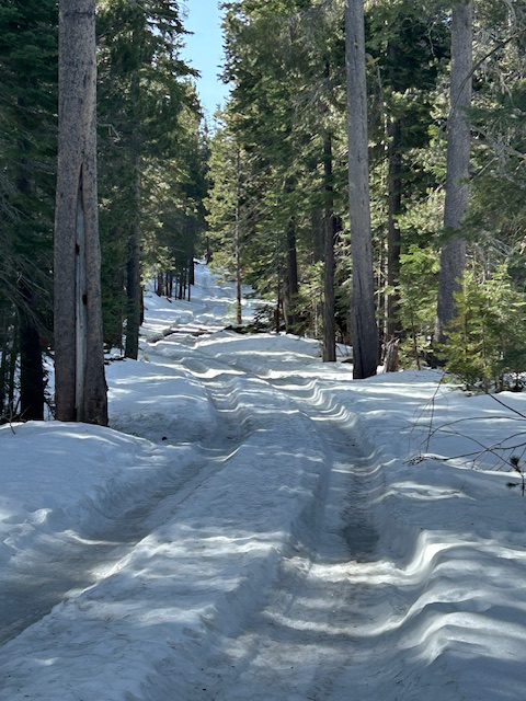
There had been two rigs in before me but that was yesterday. I was making fresh tracks on the snow that fell overnight.
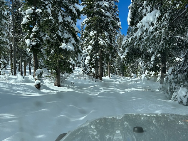
The tracks I was following were not helping. The snow was so soft that you really had to work to stay in the grove.
I had confidence because I knew that there was asphalt under all that snow.
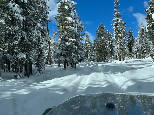
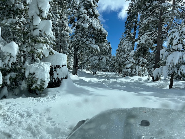
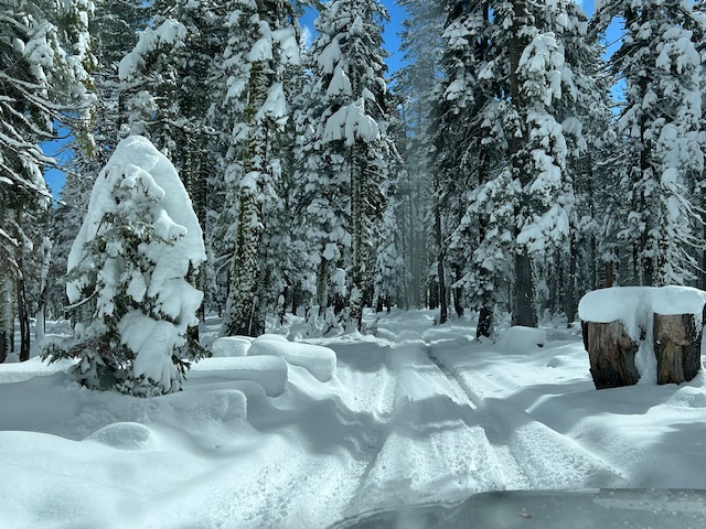
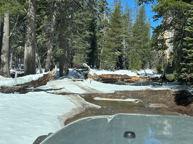
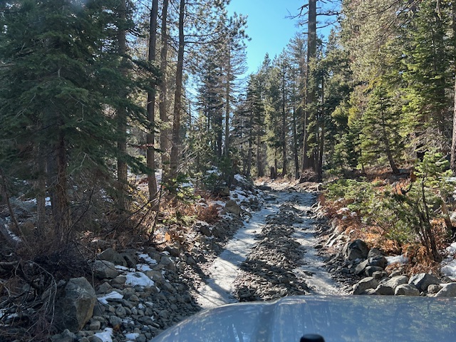
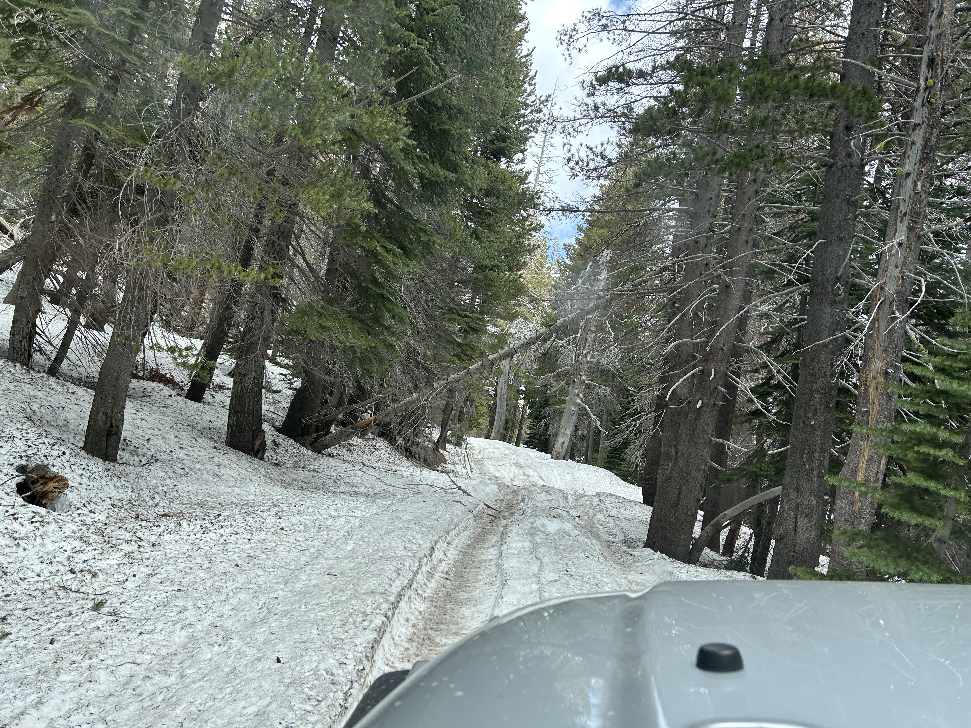
I finally made the staging area. There were tracks going further up the trail but this was a far as I was willing to go.
Even on 35″ tires, I was dragging my diff almost the whole way in.
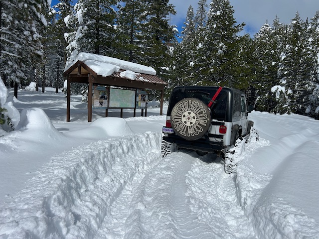
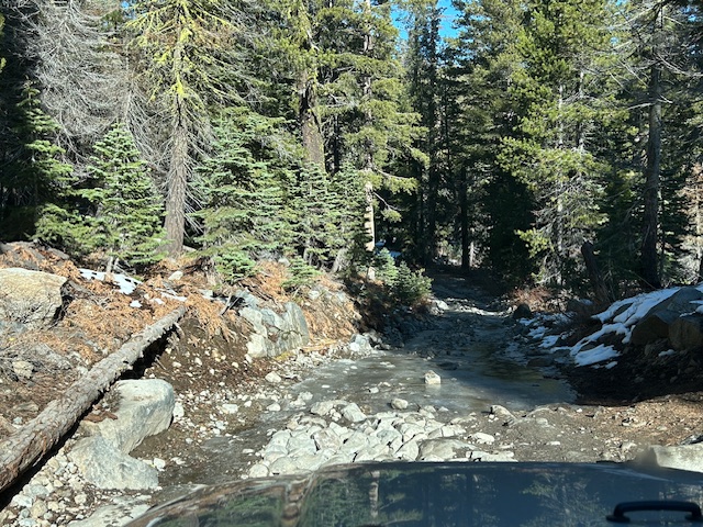
I was a little nervous that I’d encounter a group coming in on my way out, so I didn’t linger and headed out after a few pictures.
I did score first tracks for about 100 feet on my way out.
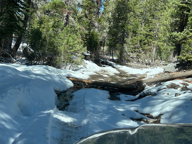
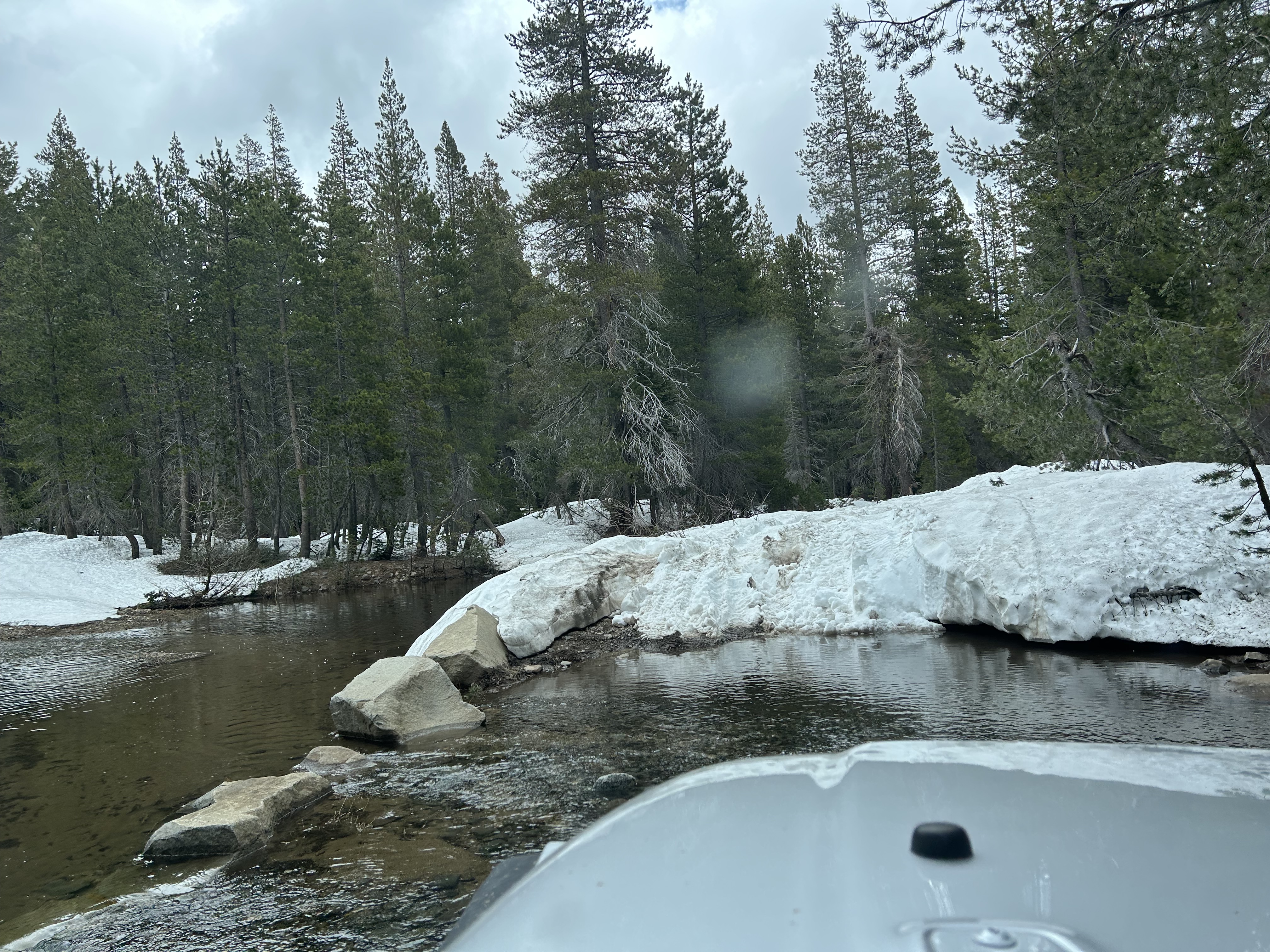
The bridge over McKinney Creek.
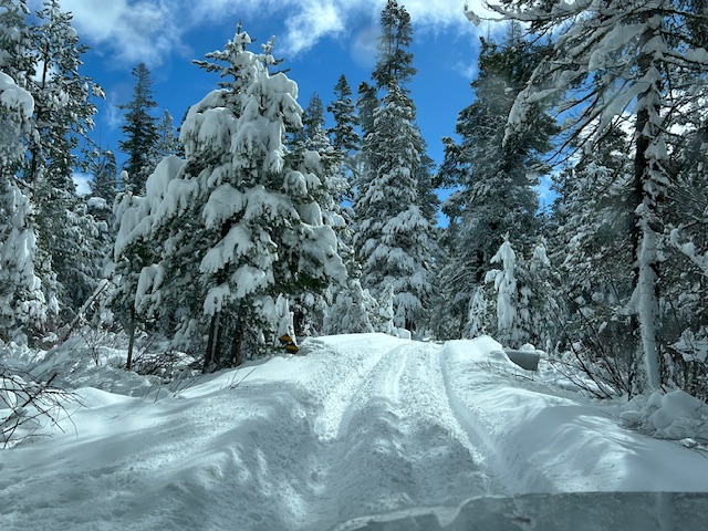
Very cool being out there alone.
Very quiet…
Except for the Southern Rock playing on my stereo.
Okay, so I was stupid. But I was a prepared for stupid, if something stupid had happened. Next time I’ll give my friends more warning that I’m headed out.
.
Rubicon Ronin
Stompers hit the Rubicon
Posted: April 5, 2026 Filed under: Uncategorized | Tags: snow, trees, winter Leave a commentHappy Easter!
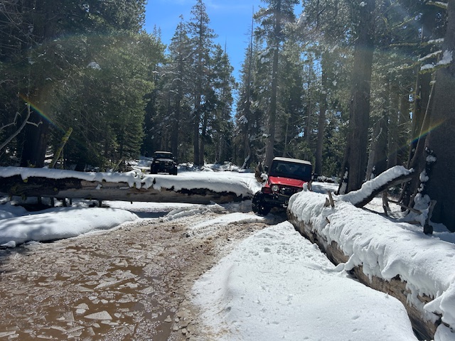
Yesterday, one of my four-wheel drive clubs hit the Rubicon Trail. Granted, there were only three of us but it worked out well.
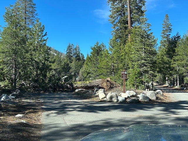
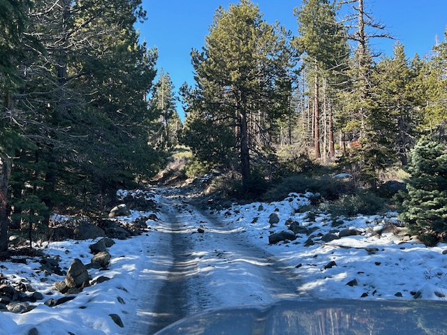
The snow has really melted. There is still plenty to play in but it’s dry all the way to the staging area. There are trees down alongside and somewhat encroaching on the paved road. There are also some large potholes on the paved road. Keep your eyes open.
Once you get to the staging area, the first entrance is blocked by a rather large tree. I have notified the Forest Service. There’s really no issue as the other two entrances are fully functional.
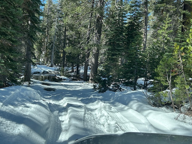
There were probably a few places where I dragged my diff in the snow. There were tracks of a few rigs before us, since the last snow fall. I was surprised that we didn’t see another rig all day.
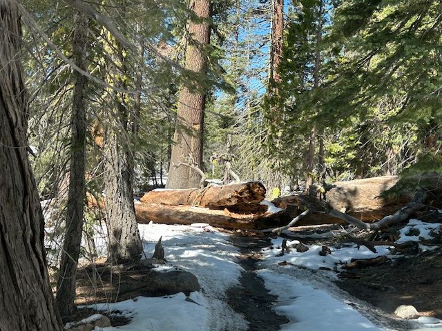
There were many. many trees down across the trail. I had my saw out a few times. This one moved with having to be cut.
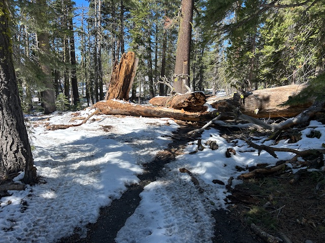
This is at the east end of Miller Meadow. I thought we were done because I wasn’t cutting that tree.
But there was just enough room to squeeze through. It took a bunch of Austin Powers turns to get lined up correctly to get through.
A picture of the classic shelf road, soon to be lost to the reroute. I’ve never seen it with snow on it before.
I pitched this trip as a scouting run not a work party. We skirted past this tree without moving it.
Again, not a work party, we drove over this one. I’ve been in touch with FOTR about getting a group out to clear these trees. maybe next weekend?
This time, we were done. This is about five miles in. Again, I wasn’t going to attempt to clear this with my little electric chainsaw. The motto of this website is “Turn Around, Don’t Go Around”. Practicing what I preach, our group turned aropund.
Now, many had already gone around. But I couldn’t.
The go around doesn’t go through a wetlands, or over bushes. I have sent this information to FOTR and the Tahoe National Forest. My thought is to allow the user created bypass to stay, as it isn’t worth the effort to move the tree.
I’m assuming that Observation would have been an easy reach. If you want a long day, you could make Rubicon Springs.
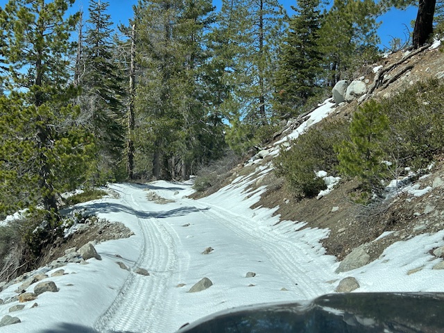
The only place we really had an issue was coming out, just before the intersection with Forest Road 03-04. There is a tree down across the low side of the trail. Going in, we skirted left and stayed high. no problems.
On the way out, the first guy crawled the snow to the right and stayed high. The second guy tried but kept slipping left toward the tree. With a little skinny pedal, at the right time, he made it to the high side. Playing tail-gunner, I went last after the second guy chewed it up a little. On my third attempt, I used the skinny pedal and made it without assistance.
Overall, it was a great day. Beautiful weather, some challenging driving, good friends, nobody got stuck.
As always, I had my “Go Bag”, sleeping bag, food and drinks in case I had to stay the night. It’s still below freezing overnight. Go prepared.
.
Rubicon Ronin
March Madness
Posted: March 10, 2026 Filed under: Uncategorized | Tags: ice, snow, winter Leave a commentOkay, it’s not about basketball.
More appropriately, March Miracle? A few years back we got hammered with a few late winter storms. We can hope.
But until then, maybe use the good weather to go out and enjoy the trail. I was there today on my way to the Forest Service office. More on that in a future post. The trail was frozen solid. The warm daytime weather has melted the snow, and the overnight lows have frozen it in to ice.
Since my last conditions report, many users have been out on the Tahoe side. Alas, again, I was alone and didn’t venture out on the trail. I can only assume that the climb out of the staging area is ridiculously slick. In the afternoon, with sunlight and warmer weather, I would think you would have no control coming back down that grade.
Although the weather looks great for the next week or so, always plan for the worst case scenario. Bring the right gear to spend the night, maybe a few nights. Tell someone where you’re going and when you will return. Get a ham radio and a license.
The road to the staging area will soon be down to pavement. Hopefully, the bathrooms will be opened when that happens.
.
Rubicon Ronin
No Snow
Posted: December 11, 2025 Filed under: Uncategorized | Tags: icce, snow, winter Leave a commentOkay, there was a little bit of snow and some ice. Actually, lots of ice. I’ve been waiting for a good dump of snow to be able to go play in a foot of snow, but it hasn’t come. I haven’t waxed my skis and I have yet to get out the snowblower and prep it for the season.
On the road in, it’s back down to pavement. But beware, the bathrooms are locked. They should be open as long as users can easily drive in to the staging area.

The first climb out of the staging area was ice covered but a simple enough climb. I didn’t bother airing down because I was only doing a short trip in to Miller Lake.
Pooling water was frozen over in some places, not in others.
As I said, ice.

Here’s where it got interesting. Just before the end of the trail you see below, in the shade, the TJ slipped a few times. It actually got a little sideways. Locked the rear, locked the front, shifted to the side to get off the ice and on the rocks. No problem.
Here’s a picture coming back out. Lowest gear, very slowly.
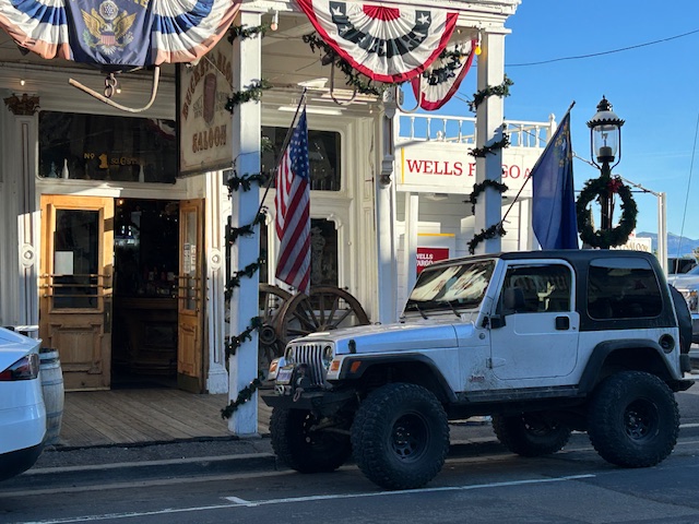
I had my nephew with me from Oregon, so we played tourist, took 89 around Emerald Bay, 50 over to Carson City and drove up to Virginia City from the Dayton side. Call us tourists, parked in front of the Bucket of Blood Saloon.
If the snow ever comes, remember, there is ice underneath. Although there is no snow in the foreseeable future, it will come. If you go out, be prepared to spend the night in below freezing temperatures.
.
Rubicon Ronin
Another Beautiful Snow Run
Posted: May 17, 2025 Filed under: Uncategorized | Tags: snow, water, winter Leave a commentMay 17, 2025. 43 degrees. Overcast. 9am start. Seven rigs. Awesome day!
The climb out of staging is clear.

There is still a ton of water on the trail. If you go, please Tread Lightly! and stay on the trail.

As you climb, you will find lots of snow. It will be around for probably two or three weeks. Memorial weekend will probably be chaos with too many people trying to get out. We were out at 9am and half the group turned around at 1pm. The first rig we saw was at 1:30 on our way out.

The snow drifts and the way they melt shifted us to the side of the trail a number of times. Many off camber sections.
We did cut a few trees from the trail. We drove over a few that we didn’t have time to deal with.

I failed to take a picture of the largest tree we cut and winched off the trail. Carry a saw as there will be more trees to deal with as the snow melts and there was at least one widow maker that could come down at any time.
We got to the Arizona (concrete) crossing just west of the Ellis Peak Trail at the pond. The group split here and three rig continued on for another hour of so; the other four of us turned back.

Here is as far as most of the group got. If you’re wondering, that’s “Space Junk”. It’s got a front wheel drive engine mounted sideways, no transfer case, no low range and works really well. He did make it up the ledge, as did many of us, but most turned around as we were done.

Here is the pond on the way out. Really slushy snow driving out in the afternoon.
No real issues on the trip. Yes, a few people needed a strap. At the end of the day, I realized I had forgotten to reload my air hoses. Oops. Thankfully, I was with friends who shared theirs with me.
And the bathrooms at staging had been opened, cleaned and stocked.
.
Rubicon Ronin

