
Blackwood campground
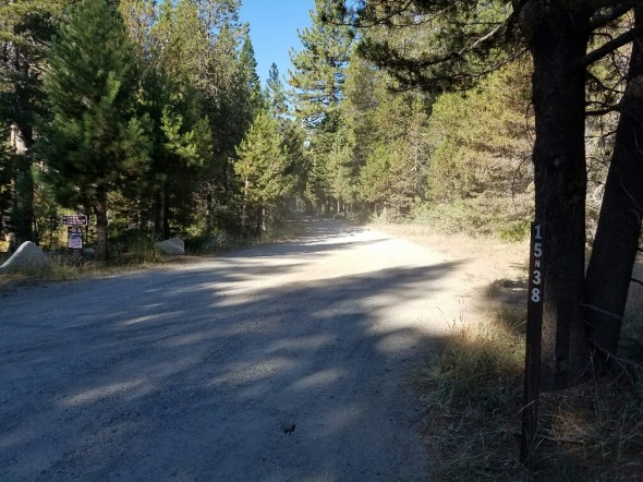
Posted: September 20, 2016 Filed under: Access, Travel | Tags: access, camping, LTBMU Leave a commentFor a more formal (minimally) camping experience in the Rubicon area, one of my suggestions is the Blackwood Campground. To get there, drive two miles up Blackwood Canyon on the paved forest road 03, then keep right on to forest road (trail) 15N38, the Middle Fork Trail. The first section of the trail to the camp area is a flat dirt road. Okay, it has a few low rollers and too many potholes, but a motorhome could get there.
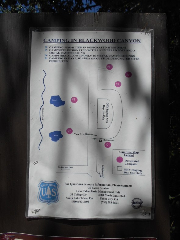
This is a designated camp area so you are only allowed to put up a tent and stay over night in one of the six designated campsites. It’s a first come, first serve, no reservation area. There are two pit toilets and plenty of parking for large groups. Although the FS only allows six people per campsite per this sign posted at Blackwood but bearing the name of “Luther Pass”:

There is a large day use meeting/cooking area. Please check fire restrictions before using the BBQ. It would be a great place to have a group meet up as an alternative to the Rubicon staging area.

The campground map:
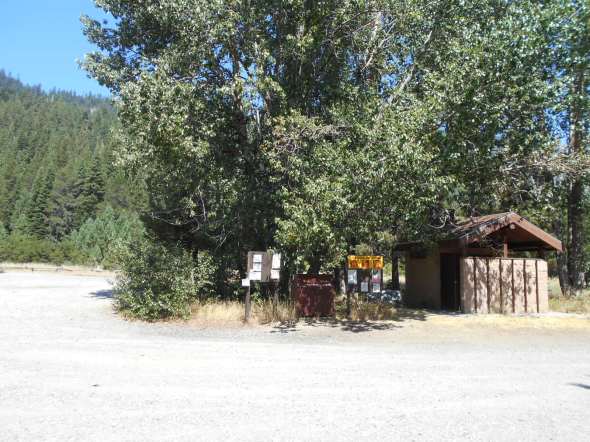
The pit toilets and ample parking.
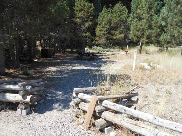
Photos of the campsites, some are in the trees more than others. Bear boxes, fire pit with grill and a picnic bench are provided in each site.


Now the signs don’t say anything about parking regulations. So here’s a thought, if the Rubicon staging area is full, park here and either drive the highway down to the Rubicon or if you’re in a green sticker vehicle, drive the LONG drive on forest road 03 over to the Rubicon. It’s probably 15 miles.
You could take 15N38 (Middle Fork) to the summit, then 16E79 (Upper Barker Meadow) to 03, then drop down 16E76 (Lower Barker Meadow) to the Rubicon. Lower Barker Meadow OHV Route is a kick in the pants. If you haven’t done it, check it out. You will never hold the steering wheel straight.
Rubicon Ronin
Ellis Lake Trail
Posted: July 31, 2016 Filed under: Access, Travel | Tags: access, camping, TNF Leave a commentSo, it officially starts as the Ellis Peak Trail (03-04012-05), that’s the right turn past Miller Lake, the range fence and just after the “pond”. There is one dead-end trail that is not marked and not yet blocked, stay left. When you get to a four-way intersection, that should be better marked by Aug 5th, go straight (16E18) don’t turn right.
This route will take you to Ellis Lake.
I was there mid-July and there was still a snow drift or two.

This is a perfect camp for someone who wants to sleep in. The towering ridge to the east, that includes Ellis Peak, shelters you from the morning sun.

I have no idea if there are fish but it would be a great float late in the afternoon. I’ve heard there might be a bug issue in the area too early in the season.

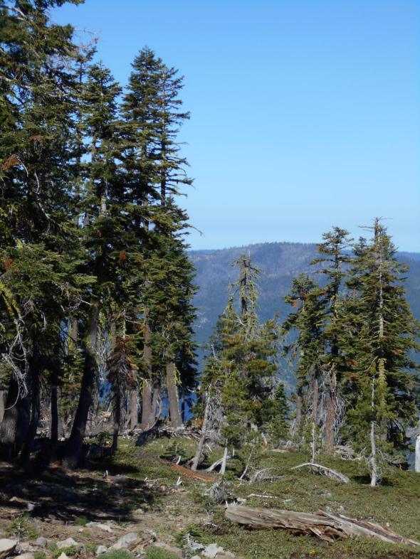
A very short walk provides a view of Blackwood Canyon.
West towards Barker Pass:

Further east towards the entrance of the canyon at the Kaspian Camp ground:

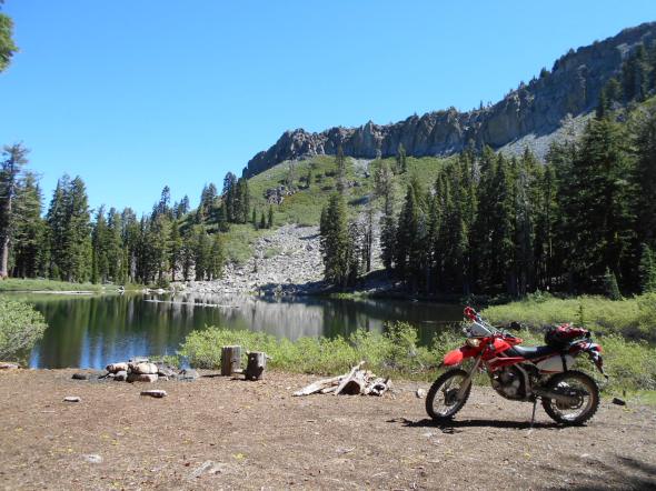
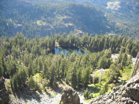
Here’s a view of Ellis Lake from Ellis Peak. Note the severe drop off on what would be the north west corner of the lake.
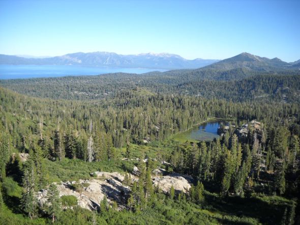
And a view of Buck Lake and the south end of Lake Tahoe from Ellis Peak.
If you or your club, group business or whatever would like to “Adopt” this trail and campsite, please let me know.
This is just one of many examples of what is out there in the Rubicon Trail area. Get out there and find enjoy it all.
“Turn Around, Don’t Go Around”
Forest Road 03-06-02
Posted: June 26, 2016 Filed under: Access, Travel | Tags: access, camping, TNF Leave a commentSo I bought a dual sport. A 2009 Kawasaki KLX250s. Well, this past Saturday I finally got some decent time on it. Earlier, I took the bike up the Rubicon but didn’t get too far. This time it was two and a half hours. I went out exploring the OHV trails around the Barker Pass area.
This writing is specifically about forest road 03-06-02. It is the trail that ventures the furthest west past Barker Pass. At one time, this trail looped around to the south and hooked up with forest road 03. Then came the Granite Chief Wilderness area.
But it almost makes it better for camping because nobody goes out there!
The drive/ride along forest road 03 to get to 03-06 and then 03-06-02 gives you some great views of the valley that runs from Rubicon Springs to the Hell Hole reservoir. That’s the valley of the Long Lake Trail, 16E12, another trail to check out.
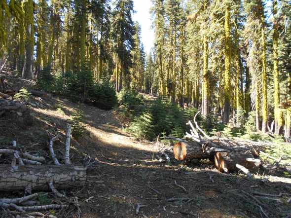
There are a few trees down towards the end of the trail. This is only the first.

A short hike down the trail, past the first tree blocking the trail, which I am sure if far from the end of the trail, you get a glimpse of Hell Hole Reservoir through the trees.
With a 50 yard hike from the trail you get some great views of Hell Hole. You might not be able to tell but you can see evidence of the King fire on the far bank of the lake.

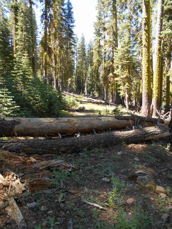
Further down the trail there are more trees.

This is where I think the trail officially ends. It is not pictured well but there is an unnatural dirt berm attempting to block the trail.
Past the official end of the trail there are still more trees blocking the trail.
We’ll see if I can work with the Tahoe National Forest and get an accurate GPS of the end of the trail and then clear any trees blocking access to the true end of the trail.
I suggest that you get out and explore sections of our public lands you haven’t seen before. Here’s a hint, look for the trails that dead end far away from other trails.
Adopt-A-Campsite Update
Posted: December 15, 2015 Filed under: Maintenance | Tags: access, camping, maintenance, TNF Leave a commentAdopt-A-Campsite Update
This past OHV season marked the beginning of a new Adopt-A-Campsite program on the Truckee District of the Tahoe National Forest.
For the first year of the program, it went well. We had six different campsites adopted by five individuals or groups.
Here is the list of current volunteers:
- Jon & Jan Briggs
- Tahoe Donner 4 Wheelers Club http://gerb58.wix.com/td-4-wheelers-#!
- Doug Barr www.TheOtherRubicon.comThe Other Rubicon
- Sierra Stompers http://www.sierrastompers.org/
- Dominic Bruno
While working with the Forest Service (FS) to get the paperwork straight for each particular site, we discovered that the FS had miss marked the three ‘new’ sites near Miller Lake. So, one of the adopted sites is not yet an official site, as is another that has yet to be adopted.
Hopefully, the FS will get these sites added to the MVUM very soon. My understanding is that the FS is not asking for these sites to be blocked off to motor vehicle access at this time.
For those of you interested in adopting a site, click the link on the right side of my website and look around for a site you’d like to maintain. There is a well shaded site along Miller Lake available as is Observation Point itself. Please email me (TheOtherRubicon@charter.net) if you’d like to adopt on of these two or any of the sites listed.
Duties are much less than adopting a trail. You need to complete the appropriate paperwork to adopt the site and then ensure that paperwork is done for each individual helping you maintain your site. An email letting me know, and I will let the FS know, what you have planned in the way of maintenance and a report at the end of the year is the rest of the paperwork required.
Basic on the ground duties include visiting/maintaining the site at least twice a year to pick up trash, clean out the fire pit (if there is one) and ensure that the site is not growing using logs and boulders to define the borders.
Fire restrictions lifted on the Eldorado National Forest
Posted: October 6, 2015 Filed under: Travel | Tags: camping, education 1 CommentThe Eldorado National Forest has lifted fire restrictions on the forest as of October 5, 2015.
Although the forest is still extremely dry, the fire danger was reduced by recent rains. I would suggest you don’t have a fire unless you actually need one. The risk/reward analysis does make a campfire worth the risk of a wildland fire.
Please be smart with fire. Read and obey the rules on the fire permit, which is required to have a campfire. Have water and a shovel at the fire just incase.

