
TNF open house for 2018 OHV grants
Posted: February 11, 2018 Filed under: Access, Maintenance | Tags: education, grant, law enforcement, TNF Leave a commentThe Tahoe National Forest will be holding an open house for users to voice their opinions on what needs to be done to our TNF trails. I’m going to try and make this one but I won’t stay the full three hours.
I encourage everyone to stop by and talk OHV with those that manage our resources. It’s a great time to et to know those involved.
U.S. Forest Service Pacific Southwest Region TAHOE NATIONAL FOREST 631 Coyote Street Nevada City, CA 95959 www.fs.usda.gov/tahoe/
News Release
Contact: Joe Flannery 530-478-6205 or 530-587-3558 jflannerye@fs.fed.us February 5, 2018
Open House Planned for Tahoe National Forest Off-Highway Vehicle Program Grant Application
NEVADA CITY, Calif. – The U.S. Forest Service has scheduled an open house in preparation for an annual application to the California Department of Parks and Recreation, Off-Highway Motor Vehicle Recreation Division, to request funding for trail maintenance, restoration, development of facilities, law enforcement, and planning for off-highway vehicle (OHV) access.
On Thursday, February 15, 2018, the Forest Service will host an open house from 4:00 p.m. – 7:00 p.m. for individuals and organizations to provide input and review proposals for the application.
“I encourage anyone interested in the OHV program to drop by this informal open house to discuss their ideas on these proposals,” said Joe Chavez, Tahoe National Forest Trails Program Coordinator. Written comments are encouraged by February 23.
These annual grants provide important funds for the Forest Service to develop and maintain trails and trailheads, repair winter storm damage and restore trailside environments, as well as provide patrolling and monitoring of these areas. When finalized, the grants will be available for public review and comment on the State of California’s website (http://ohv.parks.ca.gov) from March 6 – April 2, 2018.
What: Open House to discuss off highway vehicle grant proposals
Where: Tahoe National Forest Headquarters
631 Coyote St., Nevada City, CA 95959
Upstairs conference room (enter from upper parking lot behind building)
When: Thursday evening – February 15, 2018
4:00 p.m. – 7:00 p.m.
Questions, comments or letters can be directed to:
Joe Chavez, Forest Trails Program Coordinator
Tahoe National Forest, 631 Coyote St., Nevada City, CA 95959
Email: joetchavez@fs.fed.us
(530) 478-6158
OHV grants available to clubs
Posted: January 20, 2018 Filed under: Access, Maintenance | Tags: education, grant Leave a commentExtreme Terrain has a program for helping clubs with projects on their local trails. They call it the “Clean Trail Grant Program”. They will award up to $250 to a club doing trail maintenance on a public trail. There are very few requirements and the grant application is (pardon the pun) extremely short and simple to fill out.
Along with awarding grants to clubs, Extreme Terrain has donated to the Lake Tahoe Hi-Lo’s raffle that we hold every year at our annual Poker Run. Here’s a link to our Poker Run if you haven’t signed up yet:
https://www.laketahoehilos.com/gamblers-poker-run-registrati
This summer, I’m hoping to use this grant program for local trails in the Lake Tahoe Basin area. The Hi-Lo’s will go through the process and I’ll report back on how smooth it works out.
If you’d like more information on the “Clean Trail Grant Program” click the link below and go to the Community Support section and click on the “Clean Trails” photo.
https://www.extremeterrain.com/clean-trail-initiative-program.html
It’s free funding for the projects you’re already planning to go out and do. Why not let Extreme Terrain help with the funding?
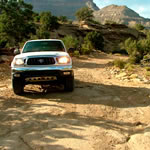
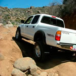
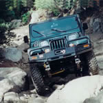
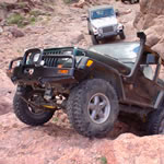
Rubicon Ronin
Trail ratings from “Overland Journal”
Posted: December 2, 2017 Filed under: Travel | Tags: education Leave a commentThis is something I’ve been thinking about for years. I wanted to be able to rate the trails in the Rubicon area to give those new to the area an idea of what they will encounter before they get there.
I looked in to different scales from different groups: 0-10, 0-5, 1-10, etc. Each had something the other didn’t, I didn’t want to be that guy that says “This is how it will be!”
Luckily, I recently came across a scale from a group I greatly respect. The Overland Journal. I was there getting lined up to give a subscription as a Christmas present. Poking around the website, I came across their trail rating schedule:
http://store.overlandjournal.com/trail-rating-guide/
TRAIL RATINGS
(Copied directly from the Overland Journal website)
1 |
Improved/Graded Dirt RoadPassable by most standard vehicles, excluding those with low hanging body panels or that are designed for on-road sport driving with ultra low ride and tire section height. |
 |
1.5 |
Graded Dirt RoadStill passable by most 2WD vehicles. However, caution is required and lower speeds may be necessary for vehicles with less clearance. Small rocks (less than 5″) may be embedded in road surface. Sufficient room for passing on most of the road. Some steep grades possible. AWD required if road is wet or icy. |
 |
2 |
Formed TrackNot passable by standard passenger vehicles. High clearance preferred, AWD preferred. Steep grades present, larger rocks embedded in trail (less than 7″). Some loose trail surfaces and shallow water crossings possible. A spotter may be required on the most challenging portions to prevent body damage on vehicles with less clearance. Sand and dry washes may challenge available traction requiring lower air pressure on some vehicles. Trail may be narrow and require backing to allow other vehicles to pass. |
 |
2.5 |
Rugged TrackNot suitable for 2WD vehicles, or low clearance cross over vehicles. AWD required, low range gearing preferred. Rutted, crossed axle terrain possible, with loose, steep climbs required. Deep sand possible. Some rock crawling possible on loose rocks up to 8″ in diameter. Some larger rocks may be present, possibly requiring a spotter to negotiate. Small ledges possible, with larger embedded rocks present. Water crossing to 12″ possible. Loose surfaces will be present, with tight clearance, smaller margin for error, and the possibility of body damage. Within the capability of any high clearance stock SUV or truck. AWD cross-over vehicles will struggle and may suffer damage due to lack of low range gearing. |
 |
3 |
Formed TrailHigh Clearance SUV or Truck required with low range gearing. Trail will be very rough and heavily eroded, with large, loose rocks present and steep, loose climbs requiring good traction and driver skill to negotiate. Wheel placement critical. Skid plates required, along with larger tires (31″+) necessary to prevent damage. Deeper water and mud crossings possible. Parts of the trail may be entirely in a wash, with loose sand and large rocks present. Possibility of rock ledges, and severe crossed axle obstacles. Good suspension articulation required to maintain traction. Rear limited slip differential or traction control system recommended to limit trail and vehicle damage. |
 |
3.5 |
Rugged TrailHigh clearance SUV or truck required, taller suspension and tires recommended. Few stock vehicles capable of completing the trail without damage. Very large rocks exceeding 12″ present throughout trail requiring a spotter or heavily modified vehicle to traverse. Very loose and cambered climbs present, also heavily rutted requiring good suspension travel. Tall ledges present requiring good clearance or rocker panel protection. Little margin for error, and possibility of body damage. Tires must be 31″+ with aggressive tread and strong sidewalls. Lower tire pressure, skid plates, and limited slip or traction control required to prevent vehicle or trail damage. Rear locking differential and 32″+ tires recommended. |
 |
4 |
Challenging TrailHigh clearance modified vehicle required. Not within the capability of a stock vehicle without damage. Trail likely in river or wash bottom with very large rocks present. Deep mud possible requiring aggressive tires and higher speeds. Water crossings in excess of 24″ possible. Heavily rutted and crossed axle terrain present, with large ledges and very steep hills with embedded and loose rocks. Body protection required to prevent damage, with good skid plates and stronger (or spare) steering components necessary. Winching and extraction possible. 32″ tires, rear locking differential and flexible suspension required. 33″ tires and front locking differential recommended. |
 |
4.5 |
Extreme TrailHeavily modified vehicle required. Extreme rock crawling, with very large ledges present requiring winching for shorter wheelbase (SWB) vehicles. Body and drivetrain damage likely. Very cambered terrain may cause rollovers. Water crossings may be hood high, and mud will be very deep and heavily rutted. Vehicles will require heavy modifications. 33″+ tires required, along with front and rear locking differentials in upgraded axles. 35-37″ tires recommended. Winch required on SWB vehicles. Roll cages or full metal roof required. Driver must be experienced. |
|
5 |
No Trail!Custom vehicle, very experienced driver required. Competition-level vehicles on insane terrain with frequent rollovers and drivetrain damage. Full custom vehicles with massive axles, 37″+ tires, cutting brakes, very low gears, 1-ton drivetrain, and custom chassis. |
|
So, applying this to trails around the Rubicon:
Trail rating of 1:
-Forest Road 03: It’s paved from the lake (Tahoe) to the summit. After that it is an improved dirt road due to the gravel put down, at least to the kiosk and bathroom area.
Trail rating of 1.5:
-Forest Road 03 past the kiosk area. Graded by not improved.
-03-04: This is the road from Barker Pass to the Rubicon Trail. It starts as a 1.5, well graded, large rolling dips. BUT, it finishes as a 2.5!
Trail rating of 2.0:
I’m going to put most of the Rubicon Trail from the Tahoe staging area to the turn at Forest Road 03-04. There are a few 2.5 sections as you climb out of the basin, but doable in 2wd by a skilled driver.
-14N39 Richardson Lake Trail: this has been worked on by the Forest Service over the last few years in order to meet S&G100 issues and to reroute an erosion prone climb near the summit.
-16E79 Upper Barker Meadow OHV Trail: this is a rolling trail that doesn’t offer much challenge
Trail rating 2.5:
The Rubicon Trail from the turn at Forest Road 03-04 to Observation Point.
-16E76 Barker Meadow OHV Trail
Trail rating 3.0:
The Rubicon Trail from Observation down to Morris Rock (or The Steps)
Trail rating 3.5:
The Rubicon from Morris Rock to the Springs
Trail rating 4.0:
One could argue that a few of the obstacles on Cadillac are 4.0 but I’ve seen less build rigs maneuver through without issues. It takes a very skilled driver but it can be done.
Trail rating 4.5:
I’m putting the Fordyce Trail in this category. Now not the entire trail but it has MANY sections or obstacles that rate a 4.5.
Trail rating 5.0:
It’s my website, so I would put trail such as those in Johnson Valley in this category. Competition level stuff.
Remember that weather can change a trail rating in a heart beat. Just a little rain on a slab of granite, turns that fine dust in to micro ball bearings. And if that water freezes on that slab, look out. Always travel prepared to spend the night: food, water shelter, etc.
Over the winter, I’ll try and update each trail page with a better description and a trail rating.
Happy Holidays,
Rubicon Ronin
Richardson Lake Trail re-route!
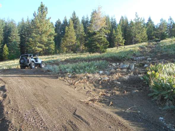
Posted: September 6, 2017 Filed under: Access, Maintenance, Travel | Tags: education, ENF, erosion Leave a commentYesterday, I received an email from a forest service employee boasting some great trail work on the Richardson Lake Trail up to Sourdough Hill. The only pictures he included were those of trails demolished and covered in trees and brush. I was horrified!
The series of pictures looked like this…

The next morning, I was up at 5:15am and out by 6:15am to get to the trail to see what the Forest Service had done to one of my trails.
Although the Forest Service had blocked off the last climb to the summit of Sourdough Hill, they had put in a switch back and more than a quarter mile of new trail.
For those of you who’ve never been there, here is a photo of the old route. This does not give you the idea of how steep this trail was originally. The ruts show previous wheel spinning and rain runoff causing erosion.

The old trail can be seen on the right side of the next picture, the new route goes from left to right in front of my Jeep. This reroute was warranted as the old route was a steep, loose, rocky, rutted trail that was causing erosion and was not safe as shown in the previous picture.
A better look up the trail after the switchback…

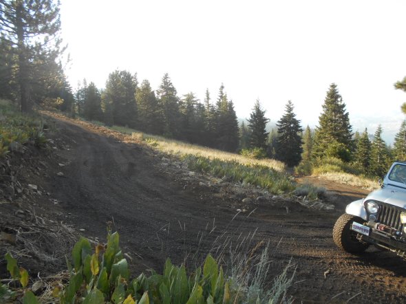
Here is another look up the blocked off ‘hill climb’…

Up from the switchback…
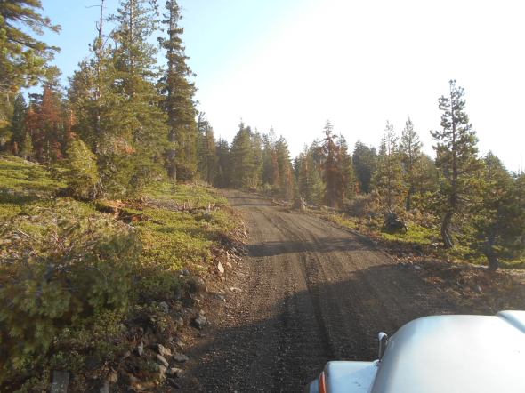
Back in to the trees. Note the trees cut down in order to create this new trail.

Nearing the summit. Those familiar with the trail should know the radio hut is to your left in this picture. You used to come up to the summit with the hut on your right.

The parking area is the same as before you just approach it from the bottom not the top.
Here is a shot of where the trail used to come up. (The radio hut to my left.)
Poser shot at the summit! A selfie if you count the shadow.

Views on the way down.

Hats off to the Forest Service for the reroute but I need to talk to my contact about communicating the entire story with more pictures.
Rubicon Ronin
Deer Valley Maintenance and opening!
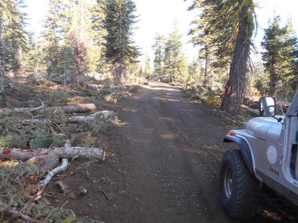
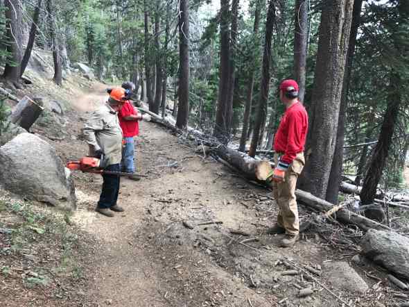
Posted: August 15, 2017 Filed under: Access, Maintenance | Tags: deer valley, education Leave a commentAugust 3rd, the Deer valley Trail officially opened for the 2017 season. The Lake Tahoe Hi-Lo’s jumped at the opportunity to do some trail maintenance and open the trail.
The South County Trail Riders have adopted this trail but they were extremely busy getting the Cal4 Sierra Trek set up and running smooth. My thanks to them for that because Sierra Trek went very smooth. The Motherload Rock Crawlers were also out on the trail working with the Forest Service making final plans for the maintenance scheduled for the last three weekends in Sept.
So the Hi-Lo’s went to work. This was typical of what we found, trees either on the ground or ready to fall.

We pulled out our saws and started cutting.

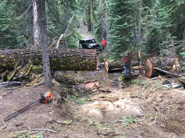
Once we got a system going, it went great. One team took off down the trail to deal with “THE” tree. More later. The second team would cut downed or hanging trees in to manageable lengths and would move on. The third team would clear the trail of the chopped up trees. We removed about 24 trees from the trail.
When I refer to a tree across the trail as “THE” tree, it means it was a really big tree. This tree had been driven around by those breaking the law. We try and educate to fellow users to stay on the trail but there are those who don’t care.
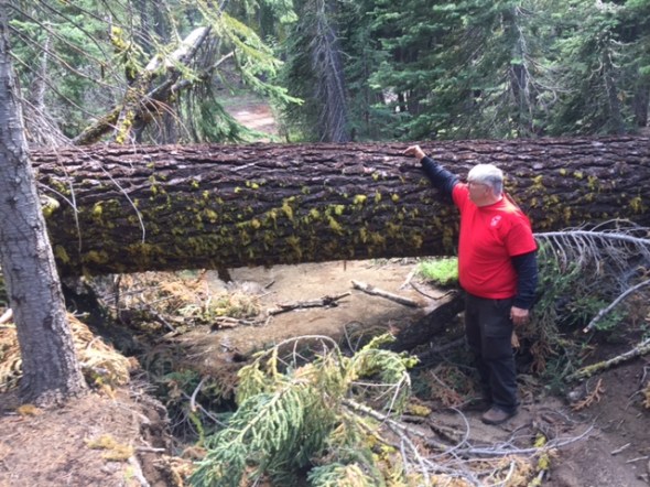
Our crew used the bed of a truck to safely attack the tree.


With a lot of hard work, the first section of the tree was removed.
Some of the guys wanted souvenirs. See the photo of the month.

The last section was removed and the original route was reopened.

The Hi-Lo’s returned to the trail on the 12th and removed even more trees in preparation of our Gambler’s Poker Run on the 19th of August.
Future Maintenance…
The mention of future maintenance refers to three weekends in Sept: 9/10, 16/17, 23/24. The plan is to move several hundred tons of rock to prevent erosion at the two creek crossings.
Please contact the Motherload Rock Crawlers if you plan on attending. Trailers are needed but not required.
https://cal4wheel.com/north-district-clubs/item/motherlode-rockcrawlers
Rubicon Ronin

