
Rubicon Re-Route Issues
Posted: March 19, 2026 Filed under: Uncategorized | Tags: FOTR, reroute, RTF Leave a commentThe Rubicon trail Foundation (RTF) just put out a pretty good video answering a lot of questions about the Rubicon Trail reroute. I was very happy about the video…until the last two minutes.
Let me start by challenging the title of the post, something about rerouting the last 7/10ths of the Rubicon Trail. From the Tahoma staging area, you’ll need to drive about five or six miles to get to the “reroute”. With the entire trail running about 22-miles, I’m thinking that reroute is more in the middle of the trail. Remember, FOTR, the R stands for Rubicon, was established to fix and keep open the section of trail within the Lake Tahoe Basin Management Unit (LTBMU). That’s from the residential area to just before Miller Lake: the old car wash, staging area, 28-rolling dips, etc. You’ll need to drive another two or three miles to get to the reroute. It’s not at the “end” of the trail.
Construction is scheduled to begin around mid-August and be completed around mid-September. There’s a lot of information about how RTF got involved, who’s doing the work and how that contractor was picked. I’m good with all of that and RTF made it very clear and transparent about what’s going on. Well worth watching.
The kicker came right after the great news that the Forest Service (FS) will not be formally abandoning the original route. The formal abandonment is a long, costly, legal nightmare that could get the FS sued. So, yea, not abandoning. But the plan is to block both ends of the original that is being bypassed. I took that as eliminating any future use of the original route, even though it is not formally closed. Not cool.
Here’s a question, will the original route still be printed on the Tahoe National Forest’s Motor Vehicle Use Map?
If it is, I’m driving it. If it’s not, maybe we should go after the TNF for denying us of the use of our public lands, without due process.
Link to RTF Facebook page with the latest video
The Friends of the Rubicon (FOTR) annual meeting is this Saturday. It might be very eventful. Join me…
10:00 a.m. to 1:00 p.m. at:
American Legion Post 119
4561 Greenstone Rd
Placerville, CA 95667
.
Doug Barr
2026 FOTR Meeting this month
Posted: March 1, 2026 Filed under: Uncategorized | Tags: AAT, adopt-a-trail, FOTR, maintenance Leave a commentI just got the official word from Friends of the Rubicon (FOTR) about the 2026 planning meeting…
Saturday, March 21st, 10am, Placerville
Hello Friends of the Rubicon!
We’re thrilled to announce our Friends of the Rubicon Annual Meeting on Saturday, March 21st, from 10:00 a.m. to 1:00 p.m. at:
American Legion Post 119
4561 Greenstone Rd
Placerville, CA 95667We’ll be discussing key projects on both the Tahoe and El Dorado sides of the trail, as well as FOTR and Adopt-A-Trail collaboration for the 2026 season.
We’re thrilled to announce our Friends of the Rubicon Annual Meeting on Saturday, March 21st, from 10:00 a.m. to 1:00 p.m. at:
I would like to extend a special invitation to all Adopt-A-Trail clubs to attend and share your input on the future of the program. We welcome your thoughts and ideas on how we can improve moving forward. There are also sections of trail currently in need of a steward, if your club is interested.
We will also be holding an election for FOTR Trail Boss. If you would like to run for Trail Boss, please let me know in advance so we can include your name on the agenda. If you have any questions about the position, feel free to reach out directly at fotrtrailboss@gmail.com.
RTF will be providing lunch, so please RSVP to help us with a headcount.
Important: The American Legion has requested that there be no alcohol at the meeting or in the parking lot. Please respect their wishes.
Please bring your ideas, questions, and suggestions — we look forward to seeing everyone there!
Thank you,
Shannon Chard.
This is your opportunity to speak out about what you would like to see done with the Rubicon Trail and to step up and volunteer to help maintain the Rubicon Trail
The main project for the Rubicon Trail this season is to build a bypass around some very wet sections of trail and to bypass the shelf road above Miller Creek. I’m sure that the Rubicon Trail Foundation (RTF) will be on hand to answer any questions you many have about this project.
.
Rubicon Ronin
Almost made it…
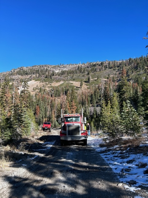
Posted: October 30, 2023 Filed under: Access, Maintenance | Tags: FOTR, maintenance, snow Leave a commentThis morning, I met up with a few fellow FOTR volunteers at the entrance to Blackwood Canyon. The goal was to meet the dump truck full of twelve yards of rock for the upcoming FOTR maintenance effort on November 5th.
Well, we met up with the truck, but we failed to get the truck to the dump spot. The drive was tight.

The very last grade was a LONG north aspect that actually had the big rig slipping towards the edge and drop off. He correctly backed down and we decided the correct line of action was to turn around.
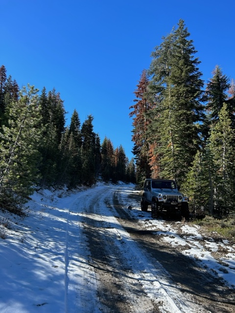
This was as far as the rig made it.
On a side note, even if you have a mobile ham radio mounted in your rig, always bring your handheld as a back-up. This antenna set-up does not work without the whip installed.

This is how I store the antenna when not in use, as it fits better in the garage.

But at some point, over the last few days, I lost the whip. About to call the Ham Radio Outlet to order a replacement. Maybe Amazon can next day deliver? If not, I’ll have my handheld.
Shannon is trying to work out the details to get rock delivered to keep the FOTR work party on the 5th on track. Stay tuned.
.
Rubicon Ronin
Control of the Placer Side
Posted: October 11, 2019 Filed under: Access, Maintenance | Tags: El Dorado County, FOTR, maintenance, Placer, RTF, transparency Leave a commentControl of the management and maintenance of the Placer County side of the Rubicon Trail is being decided right now. Literally, right now.
Until recently, Placer County has denied any authority over the Rubicon Trail. Lately, they have decided they want or have a hand in it but don’t want the day to day responsibility of applying for grants and to manage the maintenance of the Rubicon Trail.
Placer County and El Dorado County are currently working on an MOU (memorandum of understanding) that will allow El Dorado County the full legal authority to manage the Placer County side of the Rubicon Trail. To be clear, this will give El Dorado County authority over the entire length of the Rubicon Trail. My understanding is that they are very close to making this a done deal.
On the surface, this is a good thing. Placer has failed to apply for and receive steady grant funding and really has been hands off for years. Read as no maintenance has been done on the Placer side for years. El Dorado County has been extremely successful in getting grant money for the Rubicon Trail.
The down side is the lack of transparency. El Dorado County is currently working with Placer County, the Tahoe National Forest (TNF), the Lake Tahoe Basin Management Unit (LTBMU) and who knows who else, in order to decide what maintenance gets done and when.
The Rubicon Trail Foundation (RTF) had been the representative for the users for 15 years. Lately, El Dorado County cuts ties (probably not the best term) with RTF. I’m not sure, but I’m betting that RTF is not in the room when these negotiations are being made. I do not know of any user representative that is in the room.
Worse, projects that had been on the books to take place this summer season have been cancelled. The LTBMU cancelled the installation of a new kiosk at the Tahoma staging area along with cancelling the paving of the staging area. They literally waited until the last moment to inform some of the users. Note, the funding for these two projects ahs been in the LTBMU’s control for years. The RTF had scheduled to bring in a contractor to rebuild the 28 rolling dips within the LTBMU this fall. Again, at the last moment, the project was cancelled. They didn’t tell anyone until I went asking about it.
Friends of the Rubicon (FOTR) who normally had worked closely with El Dorado County on trail maintenance projects has been dropped as a close partner and relegated to just another volunteer, ignoring their 20 year history of maintaining the Rubicon Trail.
I have been asking for information on what’s going on, where we’re going and who’s involved in making these decisions. I was told to call Vickie Sanders of El Dorado County. I replied that I didn’t want information for me but for all users. I asked that any and all information be posted for the public to view 24/7. El Dorado County and RTF have pushed back and said if you want information, call us.
El Dorado County is about to control our trail. All I’m asking for is for them to explain how that process is going to work, how they will keep the users and volunteers informed and how they will allow the users in to the decision-making process.
I don’t think I’m asking too much.
.
Rubicon Ronin
V-Rock now U-Rock
Posted: August 29, 2016 Filed under: Access, Maintenance | Tags: Cadillac Hill, FOTR, maintenance, Placer, RTF, Rubicon Leave a commentSo, I made it down Cadillac Hill this past weekend and noticed that quite a bit of work has been done. Cadillac Hill was easier than I can ever remember.
As you all know, there are several ‘famous’ obstacles along the climb up Cadillac Hill. One of those is V-Rock. V-Rock is (was) a granite slope from above the trail down to the edge of the trail with a large boulder outcropping at the edge. The angle between the granite slope and edge of the boulder created a “V” that users needed to navigate.
So here are two before any work was done. Unfortunately, not all from the same angle. The granite slope on the right slopes up more than the photo implies.
Special nod to Randy for posting a picture of his rig the last time it was running. Note the deep “V” at his front right tire.

Some work was done over the last few years to get the condition below. The “V” still has loose rock so the depth can vary. Drive it as is if so equipped; fill in a bunch of rock if you’re lower or limping out broken.

But now, after a whole bunch of concrete and rock were placed in the “V”, the “V” is now a “U”. And it’s concrete so no chance for a difficult line.
![DSCN0558[1]](https://theotherrubicon.com/wp-content/uploads/2016/08/dscn05581.jpg)
I asked before on a public forum “Who Decides?” That thread was started about a rock on Cadillac that was drilled and split, without any formal permission. The answer was if it’s a safety issue, take care of it.
What would happen if an individual made the Soup Bowl ‘safe’?
Now there are rumors that even more rocks will be split, removed, dealt with, etc. on Cadillac Hill; during the dark of night with no formal permission or discussion. Does Placer know? FOTR? RTF? TNF?
There is a new bypass on Cadillac Hill in the ‘trees’ section. I can only assume the tight turn was too much for some drivers or some rigs so they went straight through the trees. This is an illegal users created bypass and will be blocked.
In both photos below, you can see a former bypass that was blocked on the right. In the first photo right through my rear view mirror. In the second photo far right and half way up.
Bypass straight ahead, original trail to the right:
![DSCN0513[1]](https://theotherrubicon.com/wp-content/uploads/2016/08/dscn05131.jpg)
Bypass left of the tree, original trail around to the right:
![DSCN0514[1]](https://theotherrubicon.com/wp-content/uploads/2016/08/dscn05141.jpg)
I thought people drove the Rubicon Trail for a challenge?

