
New Rubicon Area OHV Trails Map
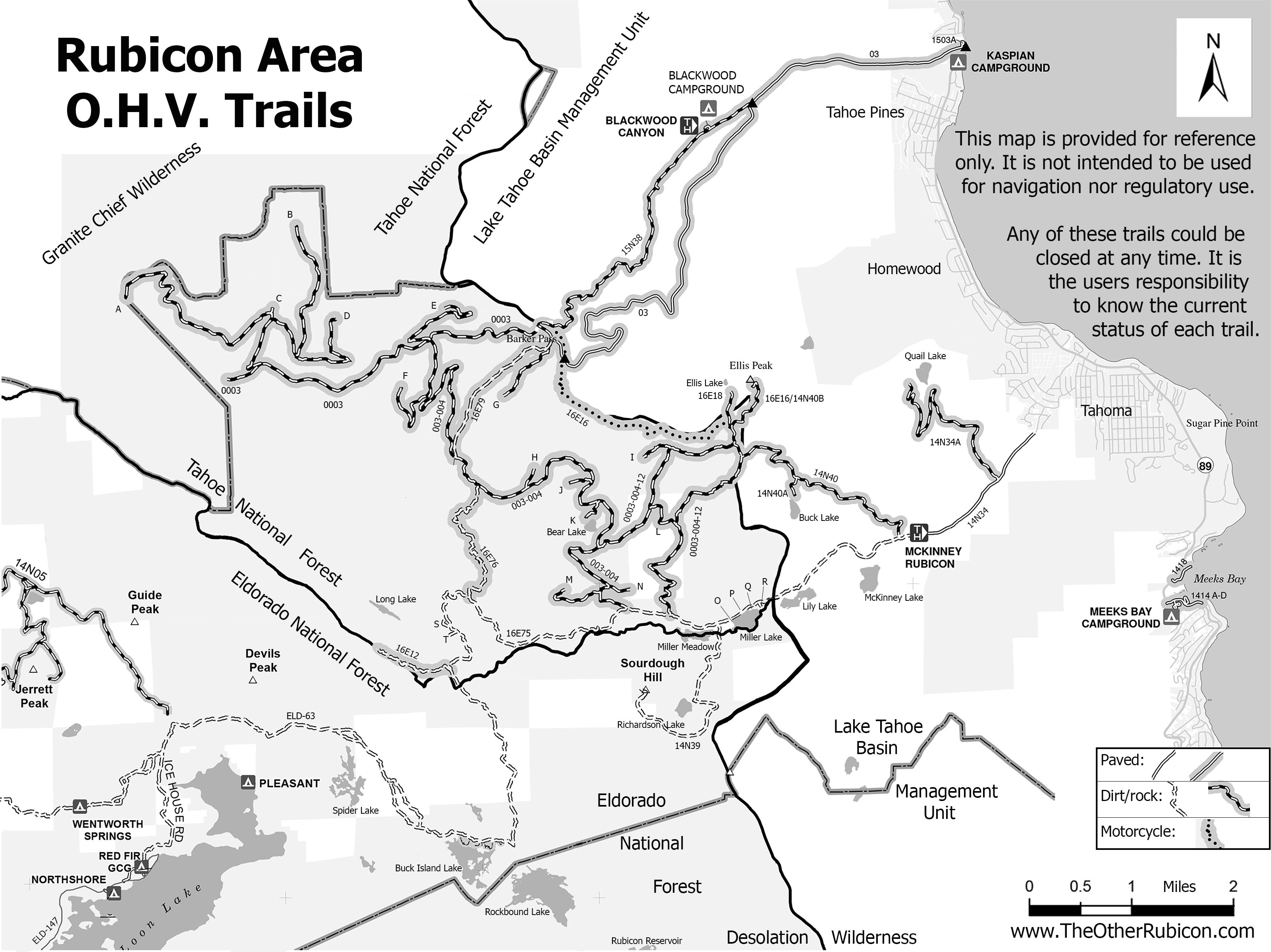
Posted: March 18, 2015 Filed under: Access, Travel | Tags: access, education, ENF, LTBMU, rubicon trail, TNF Leave a commentSo, some time ago, I posted a new map of OHV trails in the area of the Tahoe side of the Rubicon Trail. Since then, I’ve learned a lot about using Photoshop. The old map was 72dpi, the new map was 300dpi. The old map was a cluttered mess. The new map is leaner and cleaner.
I’ve bounced different drafts off a lot of people including those within the Forest Service (FS). Some in the FS were not overwhelmingly in support. Some had concerns over the possible differences between my map and current MVUM provided by the FS.
I’ve gone further to distance this map from the official FS MVUM. The FS MVUM is a legal document used to notify the public as to what trails are open for public use. This new map is not intended for navigation nor is it to be used to determine what trails are currently open. This map displays ALL the OHV trails in the area but does not report which are open and which are closed. All but the Rubicon are seasonally closed. At least one is partially closed due to meadow issues.
It is the users responsibility to know where they are at all times and the status of the trail they are driving. Please visit the forest website and read all forest orders that may apply.
Hot off the presses:
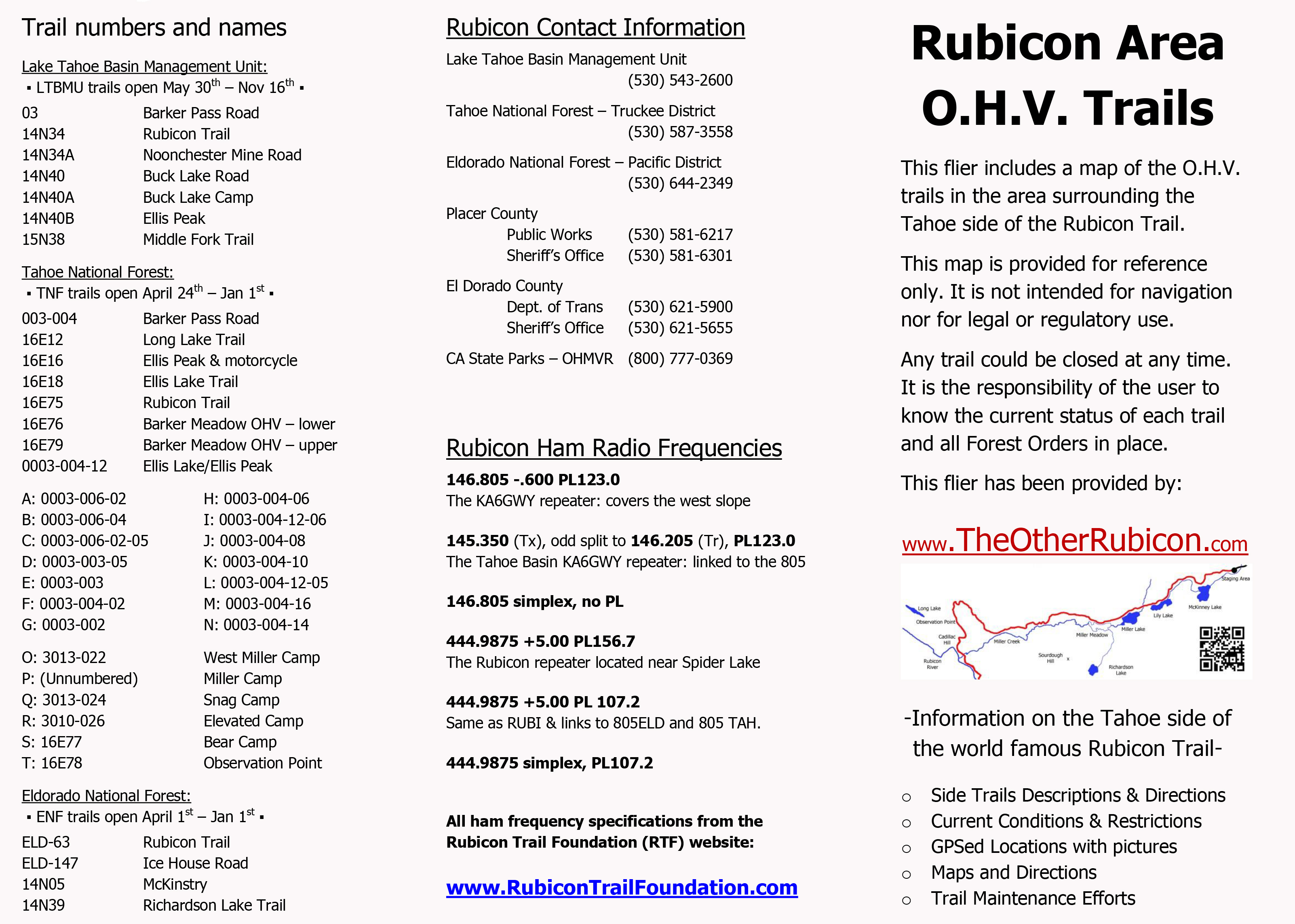
I’ve created a flier from this map to be handed out to users. Here is the front side of the flier with information on the names of trails, seasonal dates for the opening of those trails (which could be changed at any time), ham freqs, agency contact information, etc.
I’ll be handing this map out at the Reno Motorsports Show this Friday and Saturday. The maps will be there Sunday but I have to work. Stop by and pick up a few. I’m still open to comments about what could make this a better map for the users.

