
Rough weekend on the ‘Con
Posted: September 7, 2016 Filed under: Access, Travel Leave a commentSo, I was out with the Hi-Lo’s on the Rubicon and Long Lake Trail Labor Day weekend. We went in from Tahoe Friday morning early, 7:30am at the staging area. It was nice having the trail to ourselves.
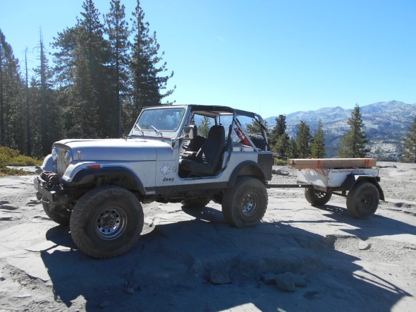
We made camp on the Long Lake Trail at the campsite along the Rubicon River.
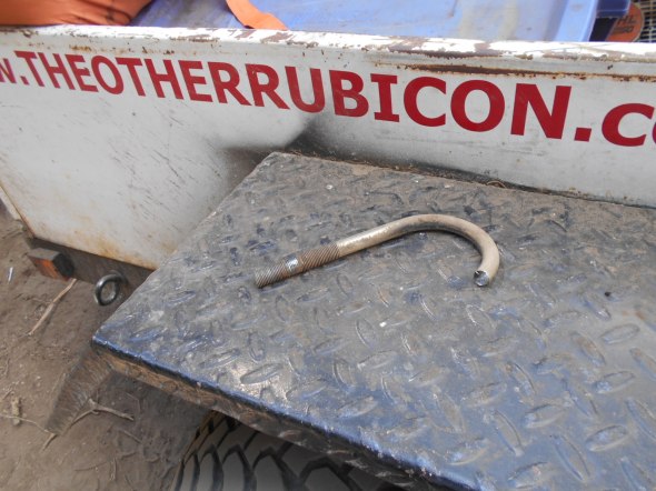
I didn’t have to look too hard to see my first issue of the weekend. My hitch had bent pretty good. This is the second time the Great Lakes Forge hitch has bent like this. I didn’t try and bend it back, I just prayed it would make it home. It did.

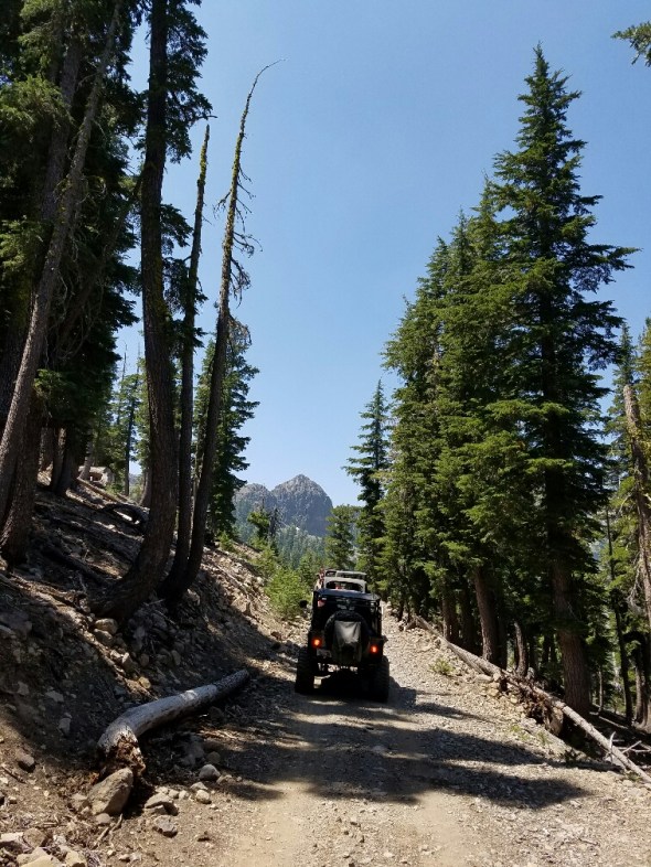
After a two days of trail maintenance, we broke camp Sunday morning around 8am and headed out. Along the flat portion of the Long Lake Trail, I noticed a ‘clunk’ from under my rig. So, before turning on to the Rubicon, I climbed under the rig to find out what it was making that noise.
Now, I had done the Fordyce Trail during Sierra Trek a month earlier. After that, I felt a very slight vibration but couldn’t find the source. Two weeks later I drove in to the Springs and back out with no issues. And up to this point, this weekend, I had driven down Cadillac and out the Long Lake Trail with no catastrophe. Thankfully.
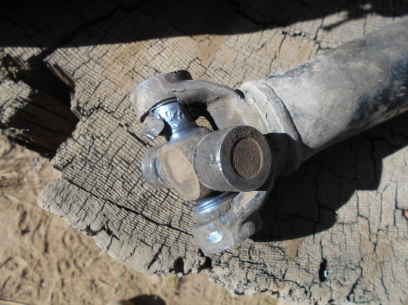
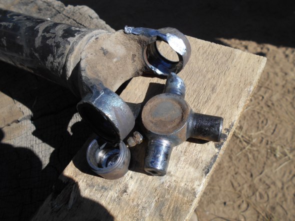
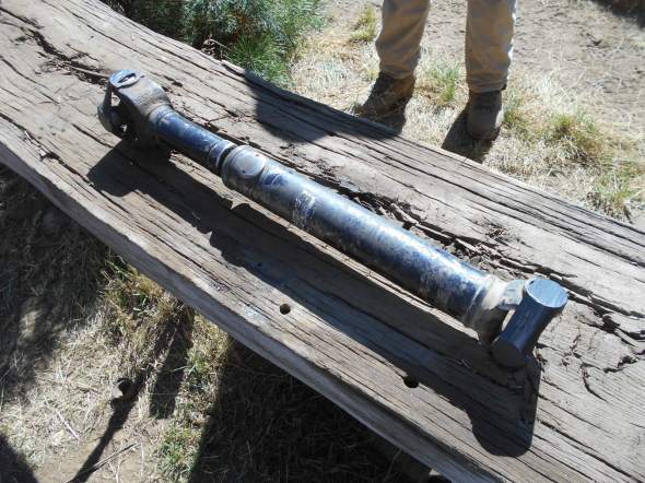
There it was, I had lost all the needle bearings out of the rear u-joint on the rear driveshaft. It looked like it had been banging around for sometime. But no problem, I had a spare u-joint with me. After dropping the drive shaft, I had the bright idea of driving in to the Springs to use a large vise I’m sure they had in the mechanics shed. A Hi-Lo was sitting in as caretaker for the week and I knew he’d let me use it.
It’s a different feeling being a passenger on the Rubicon. No steering wheel to hang on to and you had to guess which route the driver will take. But we made in to the Springs no problem.
Unfortunately, the caretaker was running out to Observation Point for parts for his Toyota and his wife didn’t know the combination to the lock. Out came the hand tools (big hammer and a few sockets) and I swapped out the u-joint there in the mechanics area.
Back on the road to my Jeep, just out of main camp, here comes the caretaker back in to camp. Too late, I was done and headed out.
I threw the driveshaft back on the Jeep, now eager to get going after a short delay. Before I climbed out from under the Jeep, I looked around. Good thing, but bad news. My leaf spring and perch were not tight against each other. Sure enough, one of my u-bolts had broken.
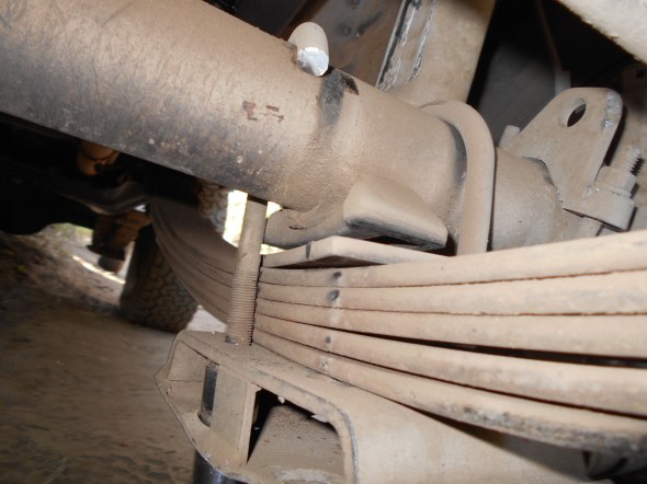
No problem, I have one of those. Actually, I carry three because there are three different sizes on my Jeep: AMC 20 has one size but the Dana 30 front has two sizes.
I told my buddy to get out his lawn chair and I climbed back under the Jeep. It was a pretty straight forward replacement and we were soon on the road.
I don’t know if it was my blog about V-Rock becoming U-Rock but the revenge of the U-problems hit me pretty good; a u-joint and a u-bolt at the same time.
Rubicon Ronin
Pole Creek / Cabin Creek Trails
Posted: August 3, 2016 Filed under: Access, Maintenance, Travel | Tags: TNF Leave a commentOkay, so this is not really a Rubicon Area trail but it’s in the neighborhood, sort-of. The trail runs from near Truckee along highway 89 south of highway 80 to below Squaw Valley.
It has a very narrow window of opportunity due to private property and the mating season of some animal I can’t remember. But, on Monday August 1st, the Pole Creek / Cabin Creek Trail officially opened.
The previous Saturday, the Tahoe Donner Four Wheelers did a trail maintenance run. 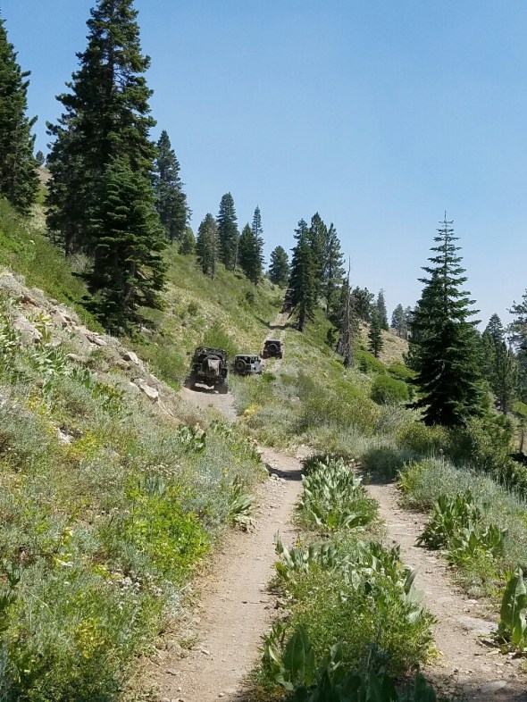
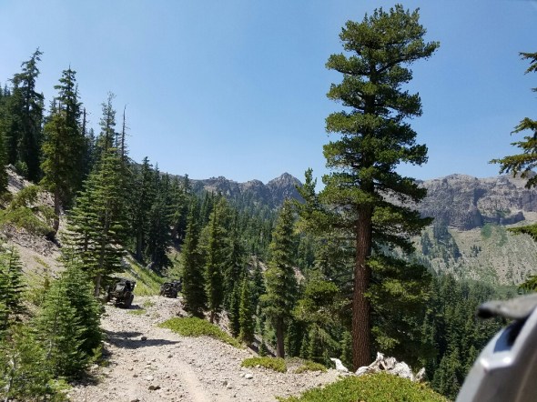
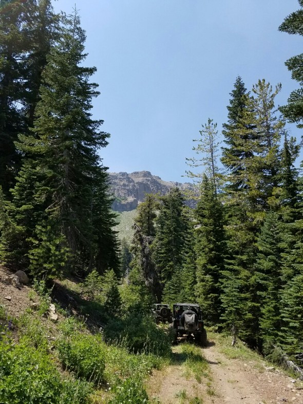
The trail is not difficult but full width vehicles or really long wheelbases are not recommended. The trail is narrow and has two very tight switchbacks near the north end.
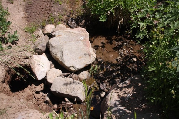
I didn’t take pictures but the club trimmed back quite a bit of brush and at one water crossing filled a growing hole with rock from the area. Before and after:

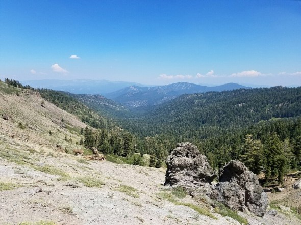
Did I mention the views were awesome:
And these aren’t the tight switchbacks.


Not a great picture of the back side of Squaw but this is where they do the cliff jumping for the Warren Miller ski films. You really get a good idea of how those jumps work with the tremendous run out after the fall.
Cool formations where we stopped for lunch near the north end.
Behind me there is a trailhead that leads up to Tinkers Knob. It an hour to an hour and a half round trip.

At the end of 16E84, at the north gate, we moved a bunch of logs to block a few illegal routes going around the gate. We’ll be back to harden those barriers before winter.
So, getting there can be a little tricky. Pick up the latest MVUM. Here’s a link for now: TNF South MVUM.
We ran it south to north. Catch forest road 08-01 off highway 89. There is a sign board there and the road starts off paved. This road takes you up to a cabin and bathroom which I missed the name of.
Further up the trail, you will make a left turn on to forest road 08. That is the south gate we had to unlock for the season. The trail you’re really looking for is 16E84.
As I said, the trail is not difficult but it is narrow and there are a few off camber sections. Water does cross the trail in several places. The Tahoe Donner Four Wheelers are working to harden these crossings.
When you reach the other gate, be mindful of the views off to the north west. You can see highway 80 in the distance near Donner Lake.
Getting back to pavement gets a little tricky. The intersections are not yet well marked but you’re looking for 01-06 and then 01 to get you back to Cabin Creek Road. That’s the road to the dump.
Along the way there are several old cabins from hunters or shepherds of days go by. There will be a series of rock walls in the trees to your right that I have no idea why they were built.
You can travel further north before dropping down to 89 by taking 01-03 down to 89.
Carry a map. In our group, some of the GPS units had the trails programmed, so that’s also an option.
Here’s a link to a set of photos taken by Bill Ratcliff the day of our maintenance run: Google Photo Link
“Turn Around, Don’t Go Around”
Ellis Lake Trail
Posted: July 31, 2016 Filed under: Access, Travel | Tags: access, camping, TNF Leave a commentSo, it officially starts as the Ellis Peak Trail (03-04012-05), that’s the right turn past Miller Lake, the range fence and just after the “pond”. There is one dead-end trail that is not marked and not yet blocked, stay left. When you get to a four-way intersection, that should be better marked by Aug 5th, go straight (16E18) don’t turn right.
This route will take you to Ellis Lake.
I was there mid-July and there was still a snow drift or two.

This is a perfect camp for someone who wants to sleep in. The towering ridge to the east, that includes Ellis Peak, shelters you from the morning sun.

I have no idea if there are fish but it would be a great float late in the afternoon. I’ve heard there might be a bug issue in the area too early in the season.

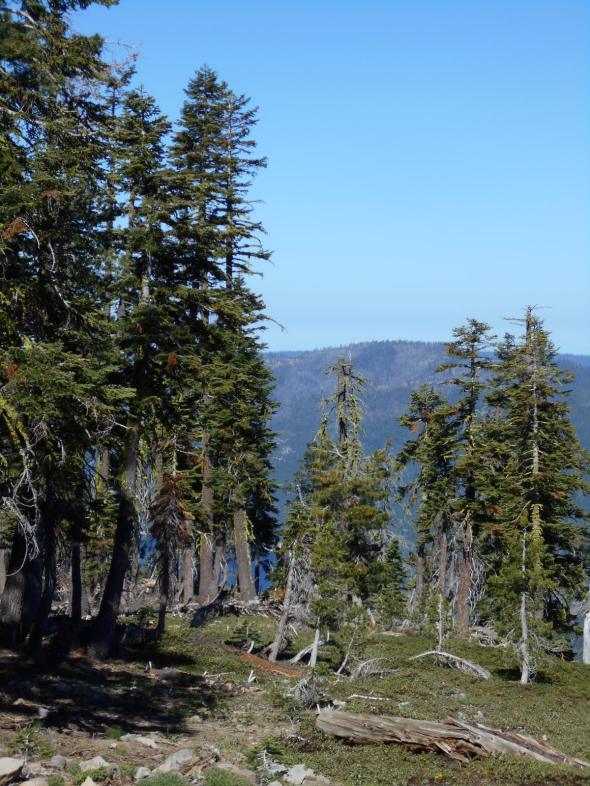
A very short walk provides a view of Blackwood Canyon.
West towards Barker Pass:

Further east towards the entrance of the canyon at the Kaspian Camp ground:

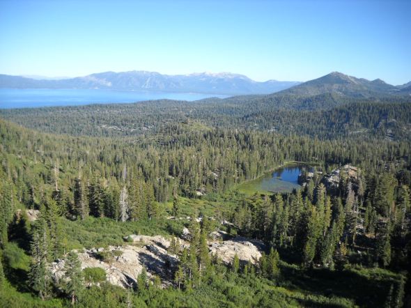
Here’s a view of Ellis Lake from Ellis Peak. Note the severe drop off on what would be the north west corner of the lake.
And a view of Buck Lake and the south end of Lake Tahoe from Ellis Peak.
If you or your club, group business or whatever would like to “Adopt” this trail and campsite, please let me know.
This is just one of many examples of what is out there in the Rubicon Trail area. Get out there and find enjoy it all.
“Turn Around, Don’t Go Around”
Forest Road 03-06-02
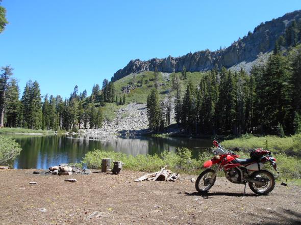
Posted: June 26, 2016 Filed under: Access, Travel | Tags: access, camping, TNF Leave a commentSo I bought a dual sport. A 2009 Kawasaki KLX250s. Well, this past Saturday I finally got some decent time on it. Earlier, I took the bike up the Rubicon but didn’t get too far. This time it was two and a half hours. I went out exploring the OHV trails around the Barker Pass area.
This writing is specifically about forest road 03-06-02. It is the trail that ventures the furthest west past Barker Pass. At one time, this trail looped around to the south and hooked up with forest road 03. Then came the Granite Chief Wilderness area.
But it almost makes it better for camping because nobody goes out there!
The drive/ride along forest road 03 to get to 03-06 and then 03-06-02 gives you some great views of the valley that runs from Rubicon Springs to the Hell Hole reservoir. That’s the valley of the Long Lake Trail, 16E12, another trail to check out.
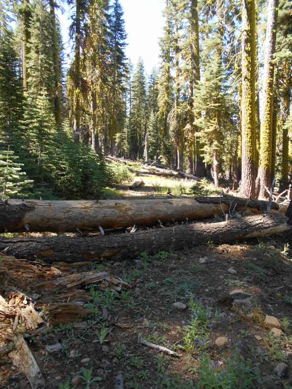
There are a few trees down towards the end of the trail. This is only the first.

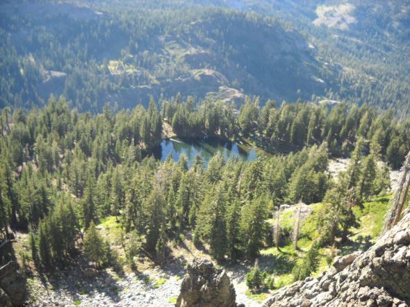
A short hike down the trail, past the first tree blocking the trail, which I am sure if far from the end of the trail, you get a glimpse of Hell Hole Reservoir through the trees.
With a 50 yard hike from the trail you get some great views of Hell Hole. You might not be able to tell but you can see evidence of the King fire on the far bank of the lake.

Further down the trail there are more trees.

This is where I think the trail officially ends. It is not pictured well but there is an unnatural dirt berm attempting to block the trail.
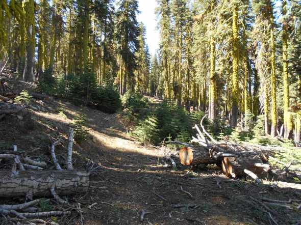
Past the official end of the trail there are still more trees blocking the trail.
We’ll see if I can work with the Tahoe National Forest and get an accurate GPS of the end of the trail and then clear any trees blocking access to the true end of the trail.
I suggest that you get out and explore sections of our public lands you haven’t seen before. Here’s a hint, look for the trails that dead end far away from other trails.
New signage at trailhead
Posted: June 26, 2016 Filed under: Maintenance, Travel Leave a commentJust an FYI…
There is new signage posted at the Rubicon trailhead. Looks like the old faded MVUM and RTF map were taken down. The RTF map was replaced with a smaller version, while the map of the “Rubicon Area OHV Trails” was replaced with a larger version that is now being printed in color and has local hiking trails.
![DSCN0393[1]](https://theotherrubicon.com/wp-content/uploads/2016/06/dscn039311.jpg?w=590)
Across the bottom of the sign are logos of some of the participating clubs, groups and government agencies. There are probably more that should be recognized.
The same old Forest Service notices still remain.

