
100mph Meadow
Posted: August 5, 2014 Filed under: Travel | Tags: history, TNF Leave a commentLong before I started running the Rubicon (I first drove the Tahoe side in 1985) there were a few special spots along the Tahoe side that no longer exist today. In 1984 a tremendous amount of work was done by the FS and volunteers. Mud holes were filled in (bottom dollar hole), a bridge was built over McKinney Creek (eliminating the “Car Wash”), gabions were installed (users added a “pet rock prison” sign), etc. I’m not sure when the reroute happened but “100mph Meadow” went away.
100mph Meadow cut the corner of the intersection of the Rubicon and Barker Pass Road (Forest Road 03). The story goes, that after crawling up Cadillac at one mile per hour, the Jeeps would reach the ‘meadow’, switch in to high range and open up the throttle. The meadow floor was of such a consistency that it did not develop bumps and you could really clean out the carburetors.
Here is where the trail broke out of the forest and headed across the meadow. With the current S&G100 issues, I’ve learn a little about meadows. They have a built in way to ward off other plant/tree species. So when the Jeeps stopped driving on the trail the trees moved in. They didn’t move in to the meadow, which can protect itself, they moved on to the Jeep trail that had nothing living on it, it was dirt. So, the trees grew ON the trail from seeds probably left by Jeeps.
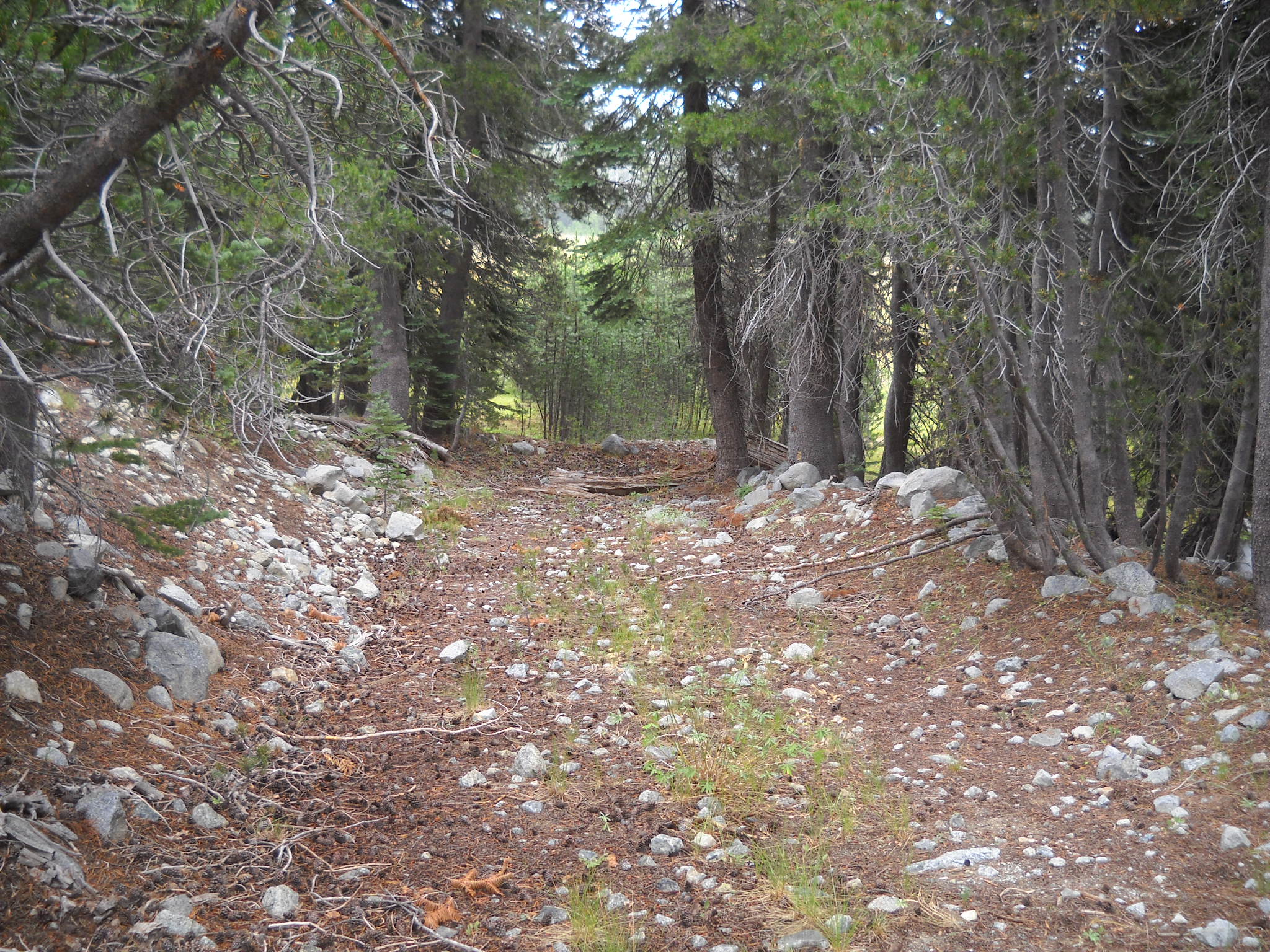
Here is a shot looking across the meadow and then south to Sourdough Hill:


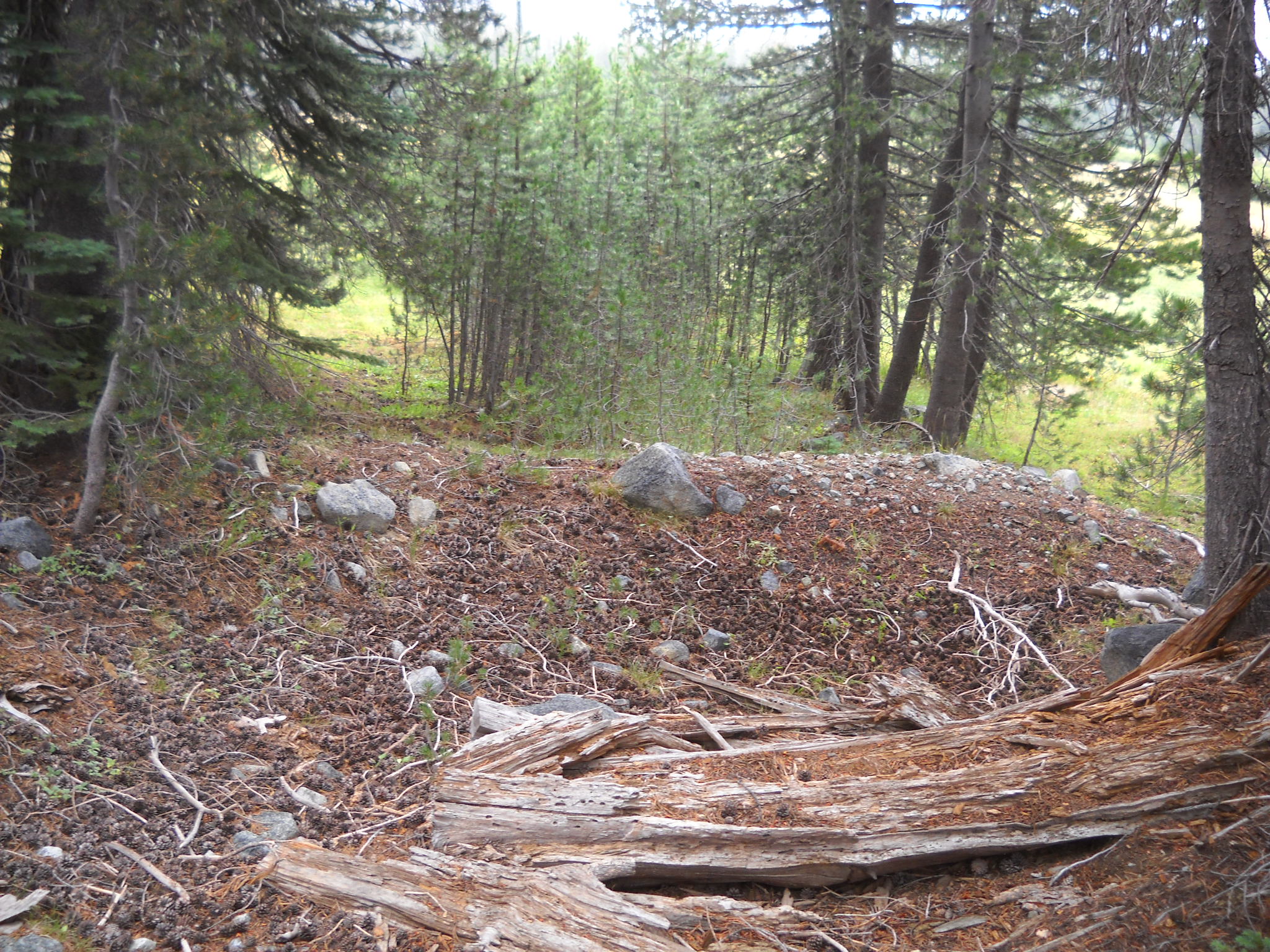
The second half of the meadow and evidence that I was on the trail, an old Jeep rim.


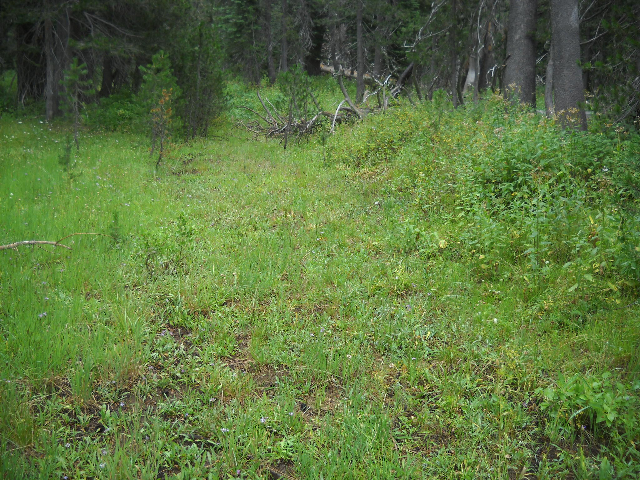
Trees growing ON the trail on the east end of the meadow and the trail disappearing in to the forest.

It was cool to get out and walk around and check things out. I found another old logging road that would be cool to reopen but don’t hold your breath.
Trailers on the Rubicon
Posted: July 20, 2014 Filed under: Maintenance, Travel | Tags: recovery, Rubicon, trailer Leave a commentA few years ago, the Lake Tahoe Hi-Lo’s, working with FOTR, moved more than 70+ cubic yards of rock to fill “The Mud hole”.

Last weekend, a group of volunteers moved 16 cubic yards of gravel (with road base and a binder), up the Richardson Lake Trail. Many projects in between have used trailers.
Just about everything you can imagine have been hauled along the Rubicon with a trailer, okay, almost everything. Even people down the river…
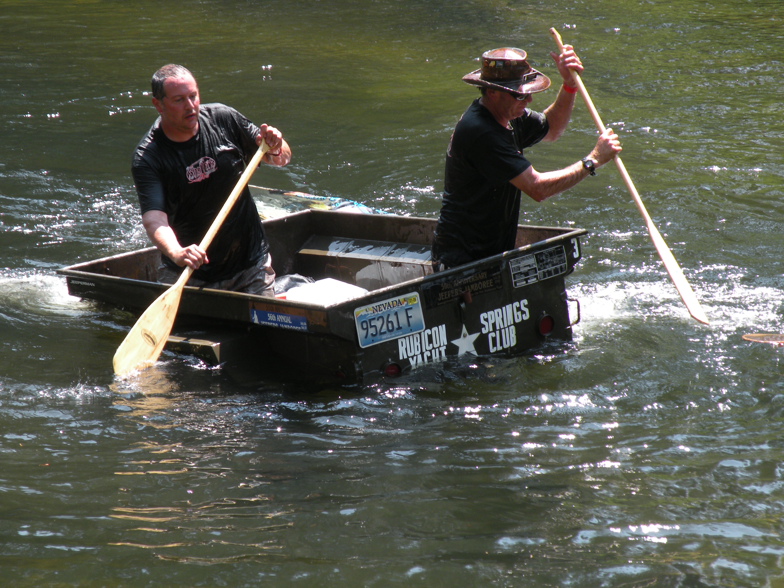
Hi-Lo’s in the trailer races at Jeepers Jamboree!
Trailers are so important to the Rubicon and its maintenance that RTF used an OHV grant to buy six of them. They were featured in a previous post. (RTF Trailers)
Over the last few days, FOTR moved 90 bags of concrete to Cadillac Hill for a project they did this morning. I helped out a week earlier by taking a trailer load of concrete to just above Morris Rock.
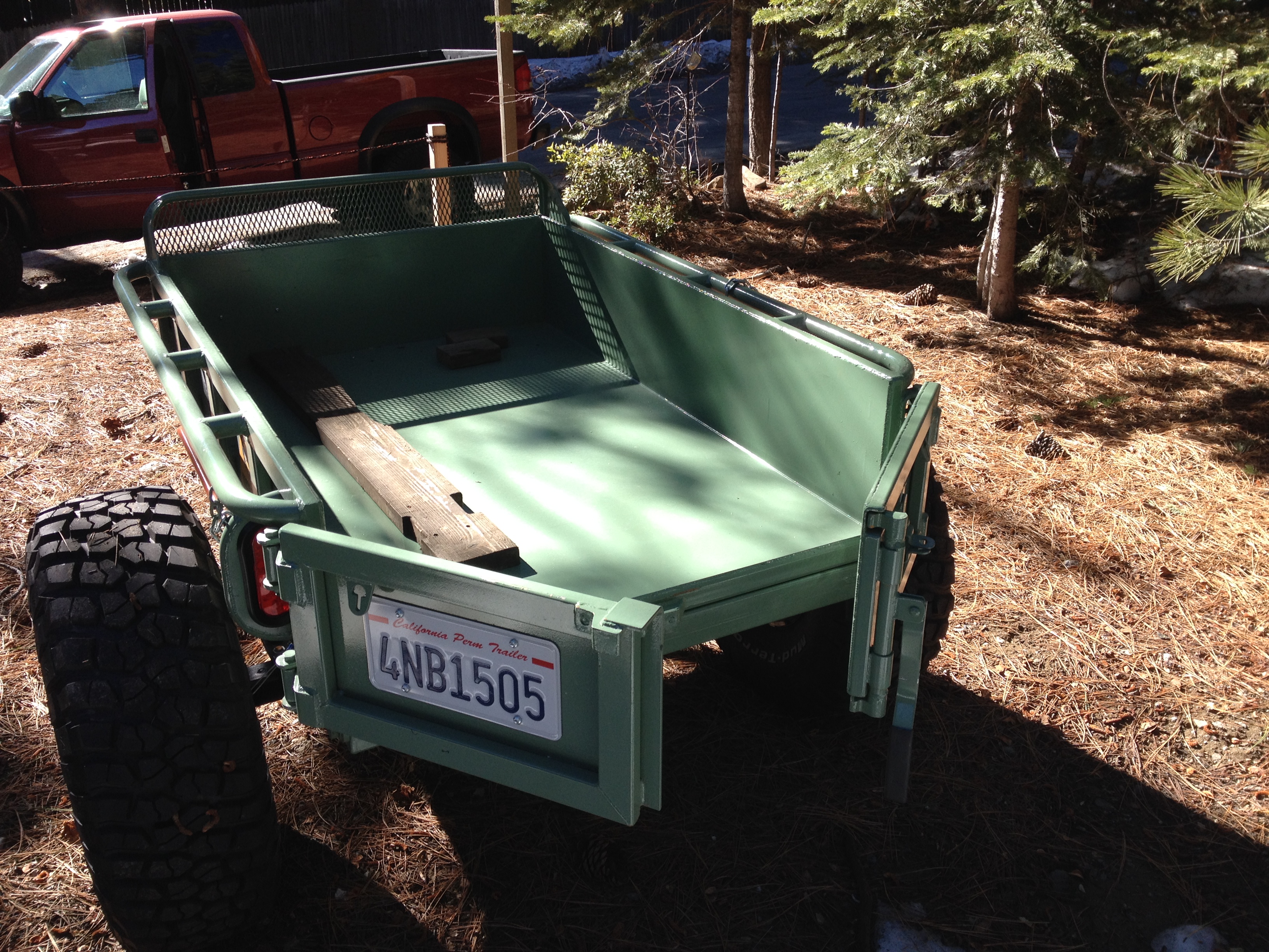
The trip started okay. I stopped by Steve Morris’ cabin, where the concrete was being staged and loaded up 12 bags in to my trailer. I have an old highway lighting trailer that was gutted and sold at auction. I bought it from a guy who had a bunch of them from that auction. I cut down the front panel to match the sides and welded up and installed some channel tubing for a slide in tailgate. As pictured before, I used it to haul in the new sign for the Long Lake Trail (16E12).
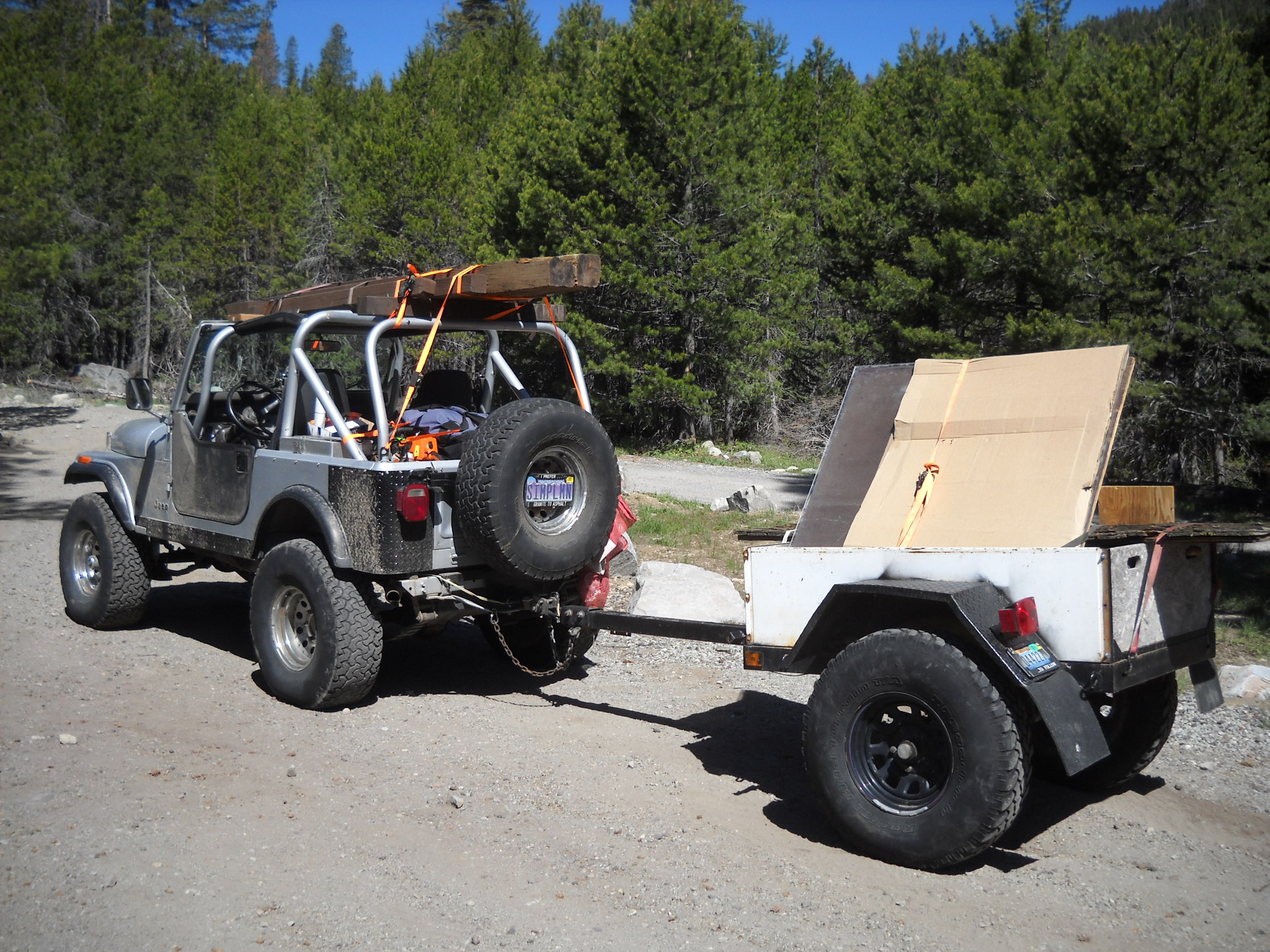
Bringing the new trailhead sign in for TKS-11
After loading the trailer with 12 bags of concrete, I headed for the staging area. I thought it was going to be a quiet Thursday morning drive in to Morris Rock but it was Friday morning and the Auburn Jeep Club and the Dirty Dozen Jeep Club were both getting ready to hit the trial. I aired down as quick as I could to get in front of them. But some got out in front of me. It was a slow drive even for a guy hauling a trailer of concrete.
The drop went okay and I left the trailer and checked out the Long Lake Trail at the bottom of Cadillac Hill. Still a fun side trip. Coming back up Cadillac, I got hung up at the hairpin turn. Even with 35″ tires, there is an undercut just past the halfway point through the turn while you’re trying to climb on to the slab on the left while avoiding the stub of a rock sticking up on the right. I had to stack a few rocks but got through it.
I picked up my trailer and headed home. After getting to Observation I breathed a sigh of relief, grabbed another gear and speed up down the trail. That was a mistake. I wasn’t 50 yards past Observation and felt a good, quiet, tug on the Jeep. As I looked over my right shoulder, I saw the left tire of my trailer sticking straight up in the air. The trailer was on it’s way over and I couldn’t do anything about it. While the trailer was loaded, it towed fine. Unloaded, it was bouncing off every rock in sight. By speeding up, I was now applying enough force to flip the trailer. The left tire hit a rock and up and over it went.

Story to follow…
The point of the large rock in the picture put a small hole in the bed of the trailer and then broke out the tailgate as I couldn’t stop in time. I figured I didn’t have much time before someone was going to drive by so I had to get it righted and quick. Being alone, I had to double time it. I pulled my recovery gear bag, and the winch line.
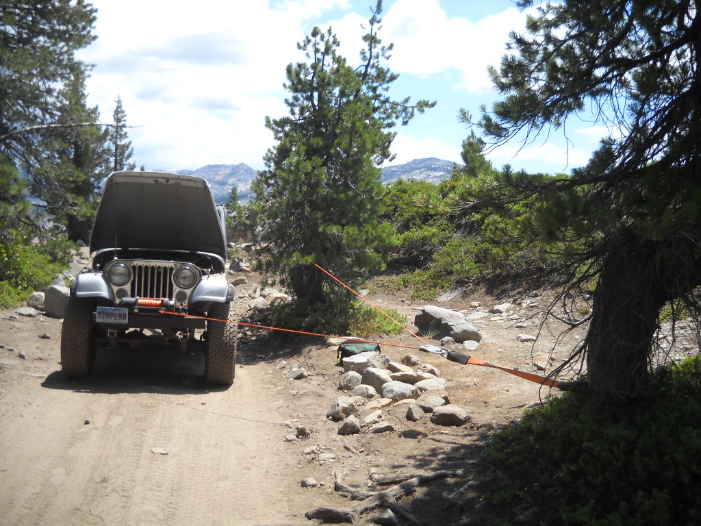
A snatch block off the tree in front for a change in direction. And a second snatch block off the tree at the trailer to actually pull it back over.

A quick run of the winch and it was back to the rubber side down. I was able to get it righted before anyone came along.
Now I had to replace the tailgate before I was to haul gravel the next day. John Briggs helped me out by pulling out and old piece of plywood and 2×6 to get me back in the game for the Richardson Lake Trail project the next day.
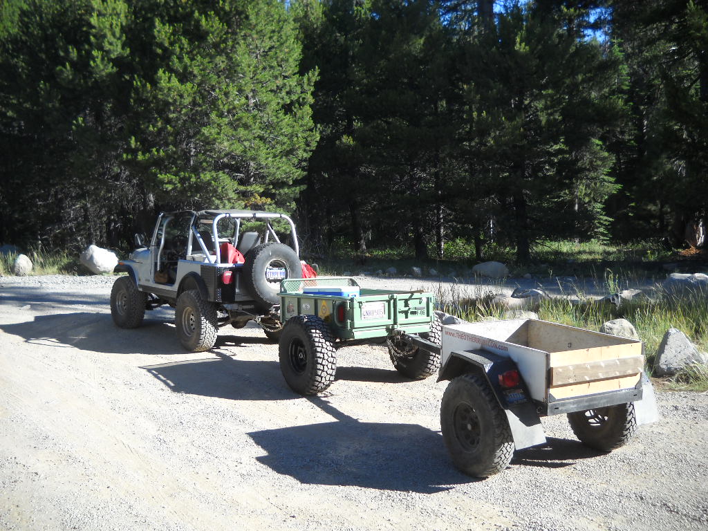
Here I am pulling “doubles”. We had left the trailers at Miller Lake Saturday night. I had run up to Miller early Sunday morning and hauled both back to the staging area for Sunday’s effort. What a noisy run down that trail.
Lesson learned, don’t be in a hurry while towing a trailer on the Rubicon and always carry enough gear for a self recovery.
.
FOTR work party on Cadillac Hill
Posted: July 14, 2014 Filed under: Access, Travel | Tags: FOTR, Placer Leave a commentFriends of the Rubicon will be conducting a work party on Cadillac Hill on Saturday the 19th. They will be pouring concrete in order to secure the trail to the hill side. Don’t get bent out of shape. There has been concrete on Cadillac Hill for decades in about half dozen different spots.
Friday the 18th, they will be moving bags of concrete to the site and prepping the area.
Saturday morning, from dawn to when the concrete finally cures, the trail will be CLOSED!
Details of the project and how to jump in and help are available at the following link:
http://www.pirate4x4.com/forum/rubicon-trail/1779170-july-fotr-work-party.html
Please let Eric Agee of FOTR know if you can help out. Without these types of projects, the trail would have closed years ago. Please be supportive and plan your trip around the work being done.
A summary of the work project has been posted on Pirate:
http://www.pirate4x4.com/forum/rubicon-trail/1838481-july-fotr-work-party-summary.html
.
LTBMU Starts Fire restrictions
Posted: July 2, 2014 Filed under: Travel | Tags: fire, LTBMU Leave a commentA week late, but I finally got around to posting it…
On June 26th, 2014, the LTBMU implemented fire restrictions.
Permits are required for propane stoves.
The details are linked on the “Conditions” page under fire restrictions.
Be safe.
Tahoe NF Motor Vehicle Use Map Released!
Posted: May 26, 2014 Filed under: Access, Travel | Tags: Rubicon, TNF Leave a commentThe Tahoe National Forest (TNF) finally released the latest Motor Vehicle Use Map (MVUM). The forest had been without one for years. It had released and then retracted one previously.
There are ten maps for the four different districts within the Tahoe National Forest. The Rubicon Trail is documented on the Truckee District -south map. Hard copies of these maps are available for free at any of the TNF offices.
The Rubicon is listed as 16N75. Although the Rubicon is listed on and has been given a Forest Service (FS) number, it is still a county right of way. The FS gave it a number as the trail needed to be listed to have the rest of the area trails make sense.
New in this version of the MVUM, Observation Point (16E78) is officially recognized by the FS as being a 163 foot long ‘trail’. Previously undocumented, the turn out has always been allowed by the FS.
Also new are four camp sites:
3013-026 is an elevated area from the Rubicon before the old water hole. The FS documented this ‘road’ as 64 feet long.
3013-24 is at the east end of Miller Lake just past the old water hole. The FS documented this ‘road’ as 29 feet long.
3013-22 is at the west end of Miller Lake and is truly lake front. The FS documented this ‘road’ as 62 feet. It’s more of a turn out.
16E77 is just east of Observation. It’s know as Bear Camp and in the early spring is under six inches of water. It’s 50 feet long or deep, depending on how the FS measured it. It is documented as a ‘trail’.
And for the first new OHV trail in a long time on the TNF, the Long Lake Trail, previously known as TKS-11, is now officially 16E12.
I want to thank the TNF for getting this out to the public. It took a lot of hard work to get this right. The last map was actually printed but because there were so many flaws the forest decided not to release it and to make the needed corrections. It’s worth the wait.
Now get out there and try a trail you’ve never been on before!

