
LTBMU doesn’t change grant
Posted: May 10, 2015 Filed under: Maintenance | Tags: access, education, grant, LTBMU, maintenance Leave a commentThe Lake Tahoe basin Management unit (LTBMU) wrote a CA State Parks OHV grant for repairing and maintaining a mountain bike trail. There was nothing in the grant for any 4wd trails. The single track mountain bike trail did allow motorcycle use so technically the grant was legal but way off track.
The users commented. In a process where grants usually gets one or two comments, this grant received 16 comments. One was posted under the LEO grant or it would have been 17. All were negative. All wanted more than just the mountain bike trail funded for the 2015 grant cycle.
I just learned that the LTBMU asked CA State parks about adding a “general fund” request to the current mountain bike grant. The LTBMU was told that would not be approved as CA State parks prefers detailed grants for specific projects. The LTBMU did not submit any detailed additions to the mountain bike grant. They did ask for funding to keep the pit toilets open on the shoulder seasons weather permitting.
The LTBMU did not listen to the users. That or they were just lazy and didn’t want to take the time to write out a few specific grant additions. These additions were listed for the LTBMU in the comments of the users: the Sand Pits, Twin Peaks, Rubicon Trail, etc. It can’t take that long to write a request for Twin Peaks: boulders/rock – $5000, equipment to move rock – $10,000; signage – $2000. Or the Rubicon: Hand crew for vegetation along paved road – $2000, signage – $3000, engineering oversight for working with Placer county to maintain rolling dips – $8000.
The LTBMU continues to avoid managing OHV. The LTBMU has a duty to maintain and manage OHV trails regardless if the personal views of the workers there are anti-OHV. The LTBMU continues to claim poverty. They even asked me if any of my clubs would have funds available to purchase signs for the trails! The LTBMU is obligated to properly manage OHV regardless of their funding woes. And when the LTBMU knows the views of the users and the needs of the OHV trails and fails to write a grant to fully fund the proper and professional management of those trails, they have failed as managers.
The problem with the LTBMU failing as managers is that we may lose trails. I continued to point out that the Eldorado National Forest had 42 trails closed as the result of a lawsuit, only because those trails were not regularly maintained. The LTBMU’s management game of “whack-a-mole” is reactionary. We need to become pro-active about OHV management in our forests, not just the LTBMU.
I’m not sure of the direction I think we should take on this issue. I will make an effort to sit down with the head ranger, Jeff Marsolas, to make sure THE boss knows of our OHV concerns. If you have any thoughts on how we can ‘motivate’ the LTBMU to more properly and professionally manage OHV, please let me know.
How to comment on CA State Parks OHV grants
Posted: March 6, 2015 Filed under: Access, Maintenance | Tags: education, grant, LTBMU, Placer Leave a commentGo to the CA State Parks OHV division page
Click on “GRANTS”
http://ohv.parks.ca.gov/?page_id=1164
Click on the “Click here to provide public comments”
http://olga.ohv.parks.ca.gov/egrams_ohmvr/user/home.aspx
On the new page, you will see this line:
“To review preliminary applications and to provide public comments, click here”
http://olga.ohv.parks.ca.gov/egrams_ohmvr/user/ReviewProjects.aspx
Click on the three dots (…) between the two blank grey screens to the right of “Agency”;
a smaller screen will appear
Type out the name of the agency you want to comment on
IE: Tahoe, Placer, Eldorado, etc.
Tahoe will get you both the Tahoe National Forest and the Lake Tahoe Basin Mgnt Unit
Placer will get you the Department of public works and the Sheriff’s office
Click “lookup”
You’ll need to click in the yellow box for the grant you’d like to read and comment on
Click on the paperclip to the right of the grant you want to read, or, Click on the small white card with the green cross for the grant you want to comment on
These are comments not votes. Comments need to be thoughtful, stating your approval with reasons or you disapproval with reasons.
Don’t just say you want more money spent on OHV. Be specific: I’d like to see more money spent on OHV signage, specifically at the staging area for the Middle Fork Trail up Blackwood Canyon.
Or: I don’t believe that the funding of this grant is in the best interest of OHV trails and users. The grant sites a restoration of an area nowhere near any current or past OHV trail system.
I believe that you can comment multiple times. So, rather than type out ALL of your issues with a grant, make a single point in each comment.
Remember, every comment will be able to be seen by the general public. Be polite and professional.
Link to posted public comments
Grants are out for comments
Posted: March 3, 2015 Filed under: Maintenance | Tags: education, grant, LTBMU, maintenance, OHV State Parks, TNF Leave a commentGrants are out for comments
I’ll apologize up front, this is a long one. Grant funding is hugely important and honestly, I haven’t been active enough over the years. I’ve tried to hit the high points for you. Please take the time to comment on these and other OHV grants currently in the system. If we don’t comment, they won’t hear us.
Let’s start with Placer County.
In 2013, Placer got a nearly $300,000 grant from CA State Parks for the Rubicon Trail. It ran from Oct of 2013 to Oct of 2014. Placer County did not apply for a grant in 2014. I’ve already posted about how the work done under that grant fell short of many peoples and government agency expectations.
The community was hoping that Placer would learn from the 2013 grant and move forward with a follow up grant to finish the work done in 2014, specifically with greater oversight. That didn’t happen.
I’m hearing lots of rumors but nothing has been confirmed. So, I type this as speculation. I’m hearing that El Dorado County wrote and submitted Placer County’s grant proposal on behalf of Placer County. Good news, bad news. I’m good with that because the last I heard, Placer was not going to apply for ANY grant funding. The bad part is it is only a “Planning” grant with NO money for “Ground Operations”.
So, this Placer County grant funds three main points:
“Task 1 – Hydrological Inventory
This task will be performed by professionals with backgrounds in hydrology and geology. This task is of particular importance since, due to drought and climate change conditions, where the water bar and drainage crossings occur on the Rubicon Trail have likely changed and/or are in a dynamic state. The hydrologists will determine and inventory all crossings, including ones potentially impacted by drought conditions.”
“This task will consist of a full determination of all water crossings beginning where the Rubicon Trail begins at the exit of the McKinney residential neighborhood, to the El Dorado–Placer County Line after Cadillac Hill and before Rubicon Springs.”
“Task 2 – GIS Mapping
From the eastern neighborhood entrance, GPS point locations of the water crossings will be obtained and inventoried. This task is important as the locations will be subsequently used in a map to more accurately determine maintenance needs, potential water quality issues, as well as to direct Contractors or those unfamiliar with the Trail to locations along the Trail.”
“Placer County will also solicit input from user groups to include pertinent and some common Trail places of interest. It is important that all GPS point locations given will be relative to a consistent datum. These points will be field checked.”
“Task 3 – Hydrological Assessment
Using the information from Task 1 above, hydrologists and engineers will determine what and where would be the best location for the water to cross the Trail, as well as an assessment of the current functionality of the water crossing. This task will assess if water bars are properly cited, need to be upgraded or replaced, combined, under-sized, or are obsolete.”
“This task is ultimately a maintenance assessment that will be used in subsequent years to plan maintenance improvements for water quality and sediment erosion control. An additional future task would be to re-numerate the water crossings with markers. The re-marking would occur after the assessment, since it is probable that some of the current water bars can be eliminated. Marking and identifying the water crossings on the Trail, will be key in maintaining water quality in future years.”
The money plays out as follows: $89,000.00 in grant funding; $33,400.00 in matching funds by Placer County. That might include volunteer hours/work as matching funds; for a total grand grant of $122,400.00.
Although just a “Planning Grant”, this work will be a great step in repairing and maintaining the Rubicon Trail. I have heard, rumor only, that Placer County is willing to fund some ground work this summer, the summer of 2015.
All three of these points should be supported by OHV users, as I support them.
We’ll move on to the Tahoe National Forest (TNF).
The TNF grant is structured a little differently. The grant cycle for the TNF is January 1st to January 1st. The grant being applied for in 2015 will actually fund the OHV year of 2016.
This “Ground Operations” grant is designed and written to provide “funding to enable Tahoe National Forest (TNF) to meet annual baseline OHV operation, maintenance and monitoring needs from 1/1/2016 to 12/31/2016.”
It covers a vast list of projects and needs:
- Management of the OHV and OSV programs on all four districts.
- Contracts, equipment, salaries, services and supplies
- Monitoring: Soil, water quality, wildlife, plants, cultural sites
- The following activities will occur on or adjacent to the OHV routes (as needed):
- Repair/armor stream crossings
- Erosion and sediment control
- Removal of brush, loose rocks and down logs from the trail corridor
- Installment, repair and replacement of OHV barriers
- Tread maintenance to provide for safety, resource protection, etc
- Purchase, installation and replacement of signs
- Purchase and installation of gates
- Purchase and distribution of OHV trail maps
- Cleaning toilets and other staging area facilities (1-2 times/week)
- Hazard tree removal
- Toilet pumping
- Facility maintenance and repair
- Trash and litter removal
- Posting and maintenance of bulletin boards, signs and other visitor education services
- Water system testing and maintenance
- Purchase of two motorcycles for the Yuba River RD
- Purchase of minor equipment and supplies (hand tools, chainsaw supplies, beacons, safety riding gear, etc.)
If you read that list closely, you saw that it does contain the word “gate”. We don’t like gates. Unfortunately, gates are now part of an OHV reality. They are primarily used for closing seasonal trails, forest service access roads and roads to private property. Let’s stay on top of all forests and make sure that is the only use of gates.
The way I read the grant, the TNF has no major projects in mind with this grant just regular OHV trails maintenance, so, no bridges.
The money equation plays out as follows: $625,701.00 in grant funding; $220,509.00 in matching funds for a total of $846,210.00.
That’s quite a bit of money. But the TNF funds many OHV positions with OHV grant funds. Jeff Wiley in the Susanville office and Susanne Jensen in the Truckee office are just two examples. I wish the LTBMU would fund a dedicated OHV person for the Basin.
The TNF also has a grant for “Planning”. This grant covers:
- Identify existing public motorized access easement “gaps” in the Tahoe NF’s network of OHV/OSV designated trails and roads.
- Prioritize the identified easement “gaps” based on importance to OHV/OSV users for potential future acquisition.
- Develop cost estimates for future acquisition of priority easements.
- Develop a plan that identifies a prioritized list of easements, with cost estimates, to acquire for public motorized use, which would then become the basis for a future OHMVR Division Acquisition Grant request.
It reads as the forest wanting to connect a lot of bits and pieces of OHV trails around the forest. Hopefully, this will lead to more through routes and less dead ends.
The money plays out as follows: $55,360.00 in grant money; $21,390.00 in matching funds for a total of $76,750.00.
I will comment on and support both of these grants submitted by the TNF.
Last and possibly least, the Lake Tahoe Basin Management Unit:
This one really makes me wonder about the grant process. Here we go…
Work will occur on the following trails: (Note: all of these trails are open to mountain bikes!)
- Corral Trail – (1 mile) open to Motorcycle and ATV
- Cedar Trail – (2 miles) open to Motorcycle and ATV
- Sidewinder Trail – (1.5 miles) open to Motorcycle
- High Meadows OHV Trail – (1 mile) open to Motorcycle
Conservation activities include:
- Vehicle barriers- Repair of existing and installation of additional barriers to prevent OHV use off the trail system. A gate will be installed to limit vehicle access into restricted areas during seasonal travel closures and large rocks and logs will be used to protect natural and cultural resources.
- Restoration of unauthorized parking areas (approximately 2,500 square feet)
Trail maintenance activities include:
- Brushing (removal of vegetation from within the trail corridor).
- Tread restoration
- Shaping and Compacting soils
- Tread Armoring
- Trail signage
- Informational kiosks
- Volunteer workdays will be offered throughout the trail season
This all sounds like really good stuff. And in reality, it is good stuff. But let’s take a closer look at the details.
The total cost of the entire OHV grant is $137,000. That is the total sum of money the LTBMU has asked for to maintain the entire OHV system within the Basin.
Further in to the details, we learn that this grant is only written to repair/maintain five and a half (5.5) miles of OHV trails. Again, those five and a half miles are motorcycle/ATV routes that are open to mountain bikes. At $137,000 for 5.5 miles equals $4.50 per FOOT!!!!
So, the Basin has asked for no money for any other OHV trails, specifically, no money for any four wheel drive trails. No money for the Rubicon corridor, including the staging area. No money for the Twin Peaks area. No money for the Buck Lake Trail or the Middle Fork Trail near the Rubicon.
No money for management or supervision. For as long as I can remember, there has been no lead person for dealing with OHV within the Basin. Every time you approach them about OHV, you speak to someone new. They need a ‘point’ person for all things OHV. Grant funding can do that for them but they don’t ask for it.
The volunteer group listed within the grant is TAMBA. That’s the Tahoe Area Mountain Bike Association. Is this an OHV project or a mountain bike project? Why is there no motorcycle or ATV group associated with this grant?
Where is the money for four wheel drive clubs? Just to mention a few: the Hi-Lo’s, North Tahoe Trail Dusters, South Tahoe Sami’s, Rubicon Trail Foundation, FOTR, Cal4, United, BRC, etc.
Detailed within the grant is a contract with Sierra Buttes Trail Stewardship (SBTS). This group has done a lot of trail maintenance work all over the Sierras. All of that work has been mountain bike trails. Some of the trails also allow motorcycles but not all of them. The kicker, the contract is worth $68,500!!!! Again, an OHV grant or a mountain bike grant?
Do you know what a four wheel drive group could do with $68,500? We could buy a lot of rock and protect a lot of creek crossings and meadows in order to prevent future closings. And be sure, there will be future closings. Some anit-OHV person will sue and the Basin will say they have no money to deal with the issue and the trails will close.
I do not like this grant. I feel it is the LTBMU using OHV money to maintain mountain bike trails and not getting ANY money for four wheel drive trails. The grant is legal and follows the rules, but it stinks!
The Basin has many OHV groups that have adopted trails and many groups that are trying to get more adopted. The Basin doesn’t want more OHV trails, staging areas and signage adopted. Trust me, I’ve tried.
Please comment on this grant more than any other. The Basin needs to hear from OHV users. There is money out there for OHV. Pressure the Basin to apply for that money. Pressure the Basin to use that money for OHV not mountain bike trails.
So, now you know about the grants pertaining to the Tahoe side of the Rubicon Trail. Give me a day or so and I’ll let you know how to comment on these grants.
Comments are due before April 6th.
Start here:
Money, Money, Money
Posted: February 13, 2015 Filed under: Access, Maintenance | Tags: grant, OHV State Parks, Placer, TNF Leave a comment
Okay, actually, “Grant, Grant, Grant”, literally, a Tahoe National Forest OHV grant.
Yesterday, the Tahoe National Forest (TNF) held an open house in Nevada City to get input from the users regarding the upcoming OHV grant cycle. My apologies for not posting about this meeting BEFORE the meeting, moving forward, I will make every effort to inform you of upcoming important meetings. The good news is that you still have time to comment on how you would like to see the 2015 grant money spent. (Details at the bottom of this post)
The TNF was very open and welcoming to the users and listened to every comment and suggestion. There were specific tables set-up for each district. Maps were plentiful.
Unfortunately, Placer County has decided NOT to pursue a grant during this cycle. This will be the second straight cycle they have decided not to apply for a group. Last year, Placer County had contractors working on the Rubicon using OHV grant funding. Not all of the identified work was completed and some of the work done was done incorrectly or in the wrong place.
The Tahoe National Forest has been made aware of this and is willing to step up and work some of the areas needing immediate attention.
My focus is the Rubicon Trail and the surrounding OHV trails. My letter to the TNF is posted below. Please remember that the TNF also has to maintain the Fordyce Trail and the trails around Boca and Stampede Reservoirs.
The grant outlines are due in early March. They will be made available to the public to review March 3rd -Apr 6th at http://ohv.parks.ca.gov/
Joe Chavez
JoeTChavez@fs.fed.us
TNF Trails Specialist
February 13, 2015
Joe,
Yesterday afternoon, I attended the TNF open house on OHV grant funding. I want to thank the forest for continuing to be open to and welcoming of ideas from the users. Everyone there was happy to address the concerns brought to their attention.
That being said, here are the suggestions I have for the upcoming grant cycle:
1) Continue to fund the positions held by Jeff Wiley and Susanne Jensen. Without these dedicated and professional individuals, the state of OHV within the TNF would be much worse off.
2) Unfortunately, Placer County has decided not to pursue OHV grant funding at this time. I would like to ask the TNF to survey the work done on and near the Rubicon Trail in order to identify possible immediate needs due to the work, some incomplete, done last summer by Placer County’s contractor, specifically, restoring natural seasonal creek crossings across the Rubicon Trail.
3) Another need that I know has been on your list for a few years, is the needed maintenance on Forest Road 03-04, commonly known as Barker Pass Road. Although I’m told it’s not an ‘OHV trail’, but as a ‘road’ it provides access to OHV trails and a quicker route for the delivery of materials needed to perform maintenance to the areas OHV trails.
As a professional firefighter, I’d like to see the road improved so that fire protection and other emergency personnel can access the area in safe and timely manner, improving the ability to protect and serve the OHV trails and users in the area.
4) The last issue I’d like to bring up is signage in the area of the Rubicon Trail and Forest Road 03-04. Along the Rubicon, side trails like the Richardson Lake Trail (mostly, but not completely in the ENF), Ellis Peak Trail, Barker Meadow OHV Trail and the Long Lake Trail could use specific USFS ‘carsonites’ with FS trail numbering, two of the four have proper signage but not FS numbering.
FYI, the Richardson Lake Trail is being adopted, through the ENF, by a Carson City businessman and his company. It would be great if the TNF allowed him to post a sign at the start of the Richardson Lake Trail, on the TNF, in order to better educate the users of that trail and other trails in the area. (I’ll get in touch with Susanne Jensen with this request once she returns to her seasonal position in April.)
The intersection of Forest Road 03-04 and the Rubicon Trail needs the sign replaced. I think it finally has disappeared altogether after many years of being pushed over and or thrown in to the forest. The sign provided directions and distances to Blackwood Canyon and the Tahoma staging area.
Along Forest Road 03-04 and just after the Rubicon Trail, a “No Outlet – Nov 1st thru May 31st” sign is needed. As more and more users recreate on the Rubicon Trail in the winter, I think it’s only a matter of time that a winter user tries to ‘exit’ the area using Forest Road 03-04, only to find not one but three gates before getting to Highway 89. The 03-04 road itself needs FS numbering as well, as it’s not really clear to a new user which way the Rubicon turns.
Further along Forest Road 03-04 there are many, many side trails. Although lower on my personal wish list, these side trails should be numbered to better let users know where they are as they drive 03-04 or if they are looking for a specific side trail.
Again, I would like to thank the TNF for the opportunity to voice my opinion regarding the upcoming OHV grant cycle. I look forward to another successful OHV season working with the TNF.
Doug Barr
www.TheOtherRubicon.com
Lake Tahoe Hi-Lo’s
North Tahoe Trail Dusters
Comments are being accepted through February 23, 2015.
Please send your thought to Joe Chavez. JoeTChavez@fs.fed.us
Placer contractor finishes grant work
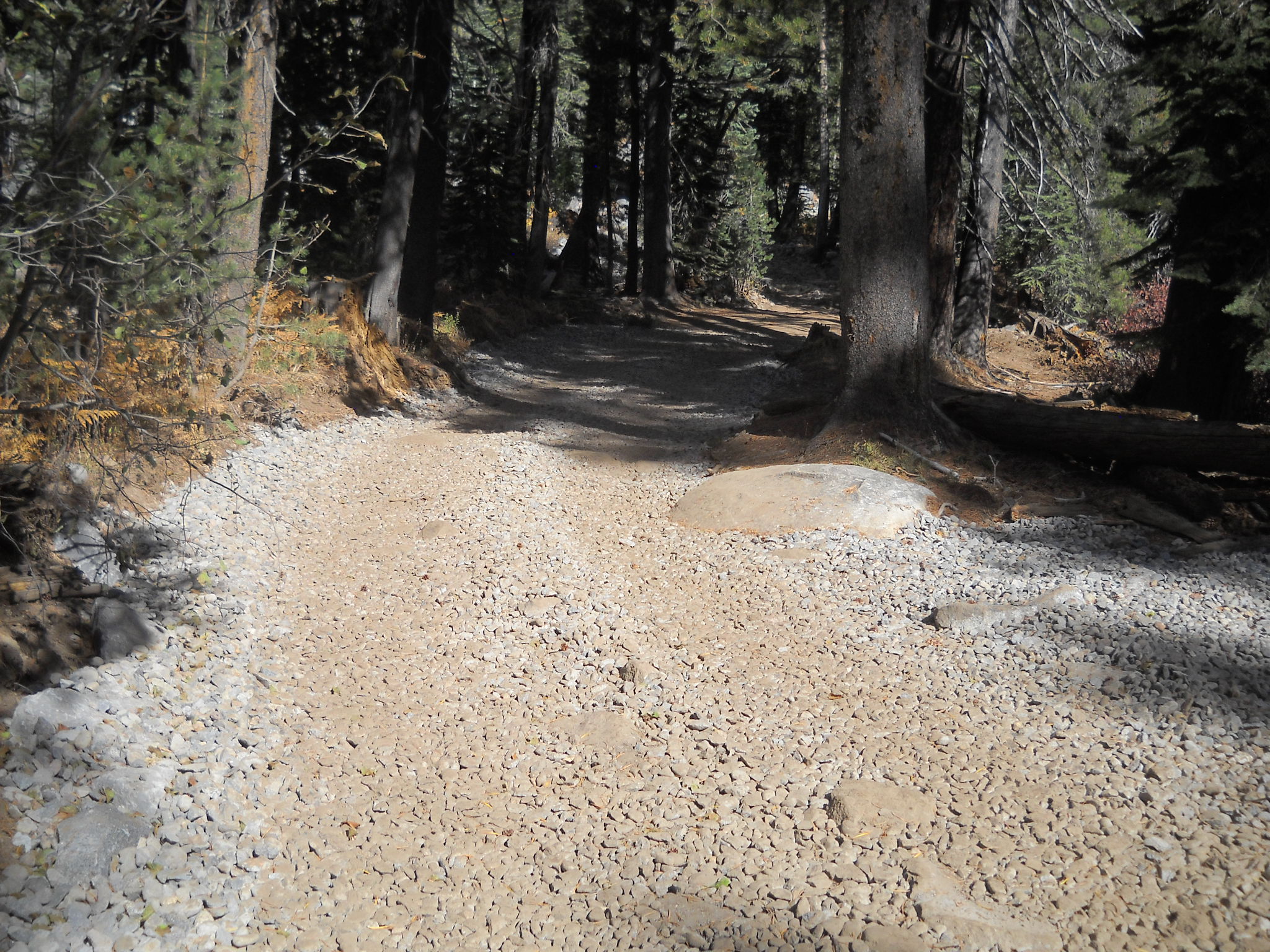
Posted: October 31, 2014 Filed under: Maintenance | Tags: grant, Placer, Rubicon Leave a commentLast year, Placer County was awarded a $294,000 OHV grant through the CA State Parks OHMVR program. The work funded by that grant was recently completed. Although the funding didn’t cover everything on the to do list, it was a step in the right direction.
Along the paved portion of the trail between the residential area and the staging area, a dozen or so spots of asphalt were cut out repaved. At the same time, the low spots along the edge of the road, particularly the inside turns, were filled in and compacted. This will provide a smoother and safer ride as trailer tires will not drop off the edge of the road.


More importantly, additional low spots along the trail were filled in. The primary scope of this portion was from the TNF/LTBMU border to the intersection of the Rubicon Trail and Forest Road 03-04 (Barker Pass Road).
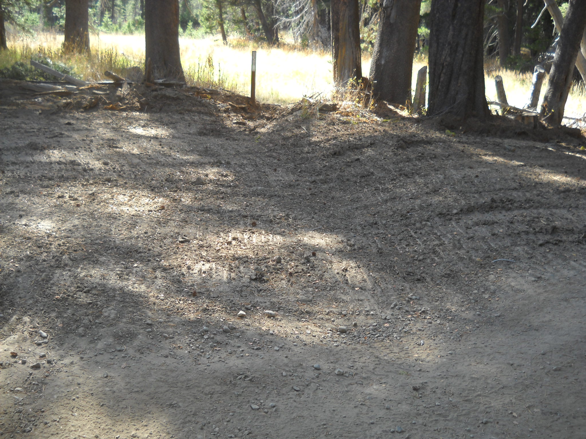
Here are two pictures from an area right along Miller Lake. In the first two pictures you can see the standing water on the trail. The second photo shows the attempts of those who didn’t want to drive/ride through the water. That illegal bypass as been blocked off.
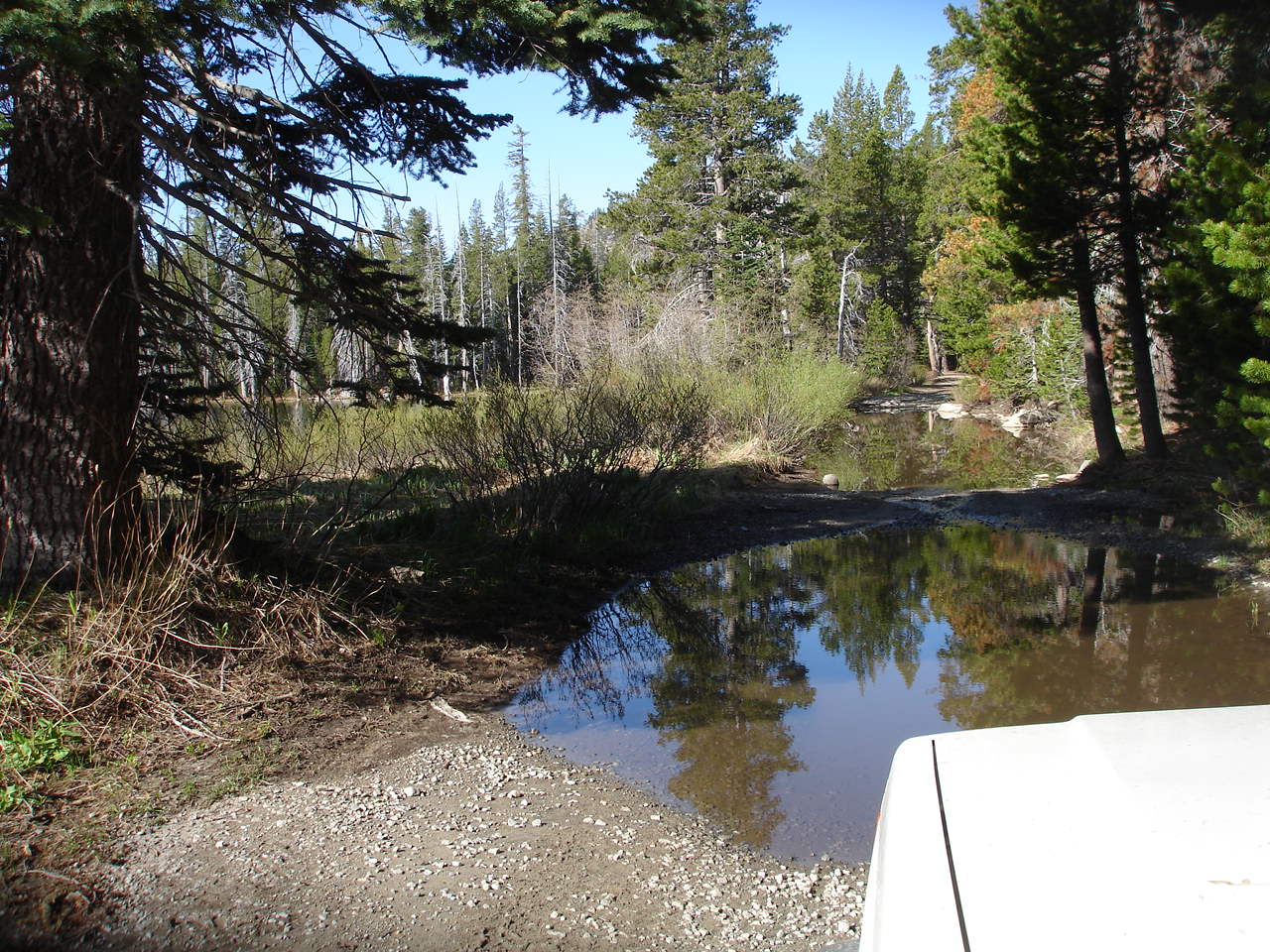

This picture shows the same route (different angle) filled in to prevent any water from pooling on the trail. This will keep the mountain bikes, motorcycles, quads and side-by-sides on the trail.

Further down the trail, just before the Range Fence, there was a HUGE water hole. The signs on either side cautioned that the bottom was bumpy but not muddy and it was only about a foot and a half deep. Those signs kept most people from driving off trail. The Range Fence stopped the rest.
Before:

After:
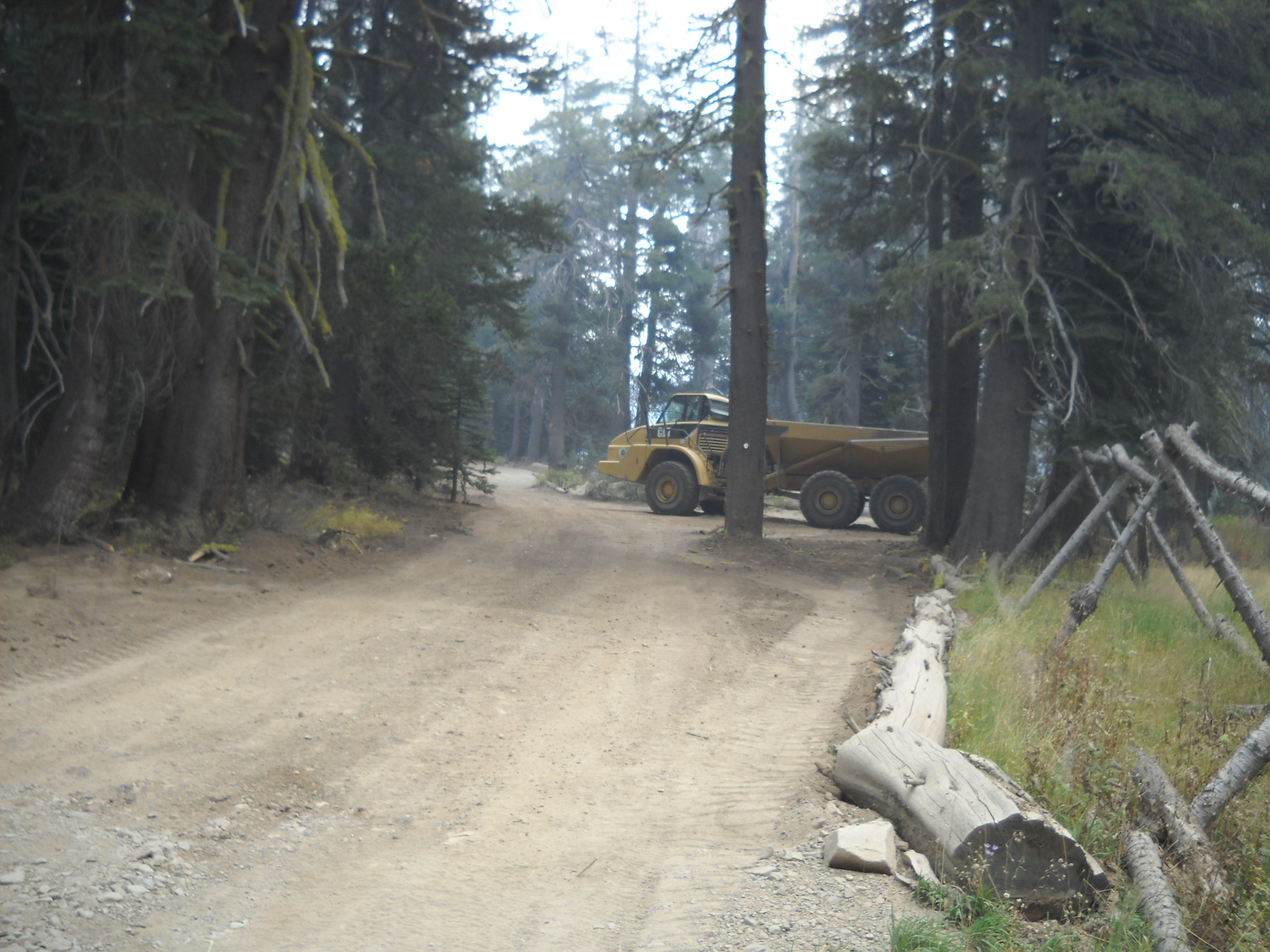
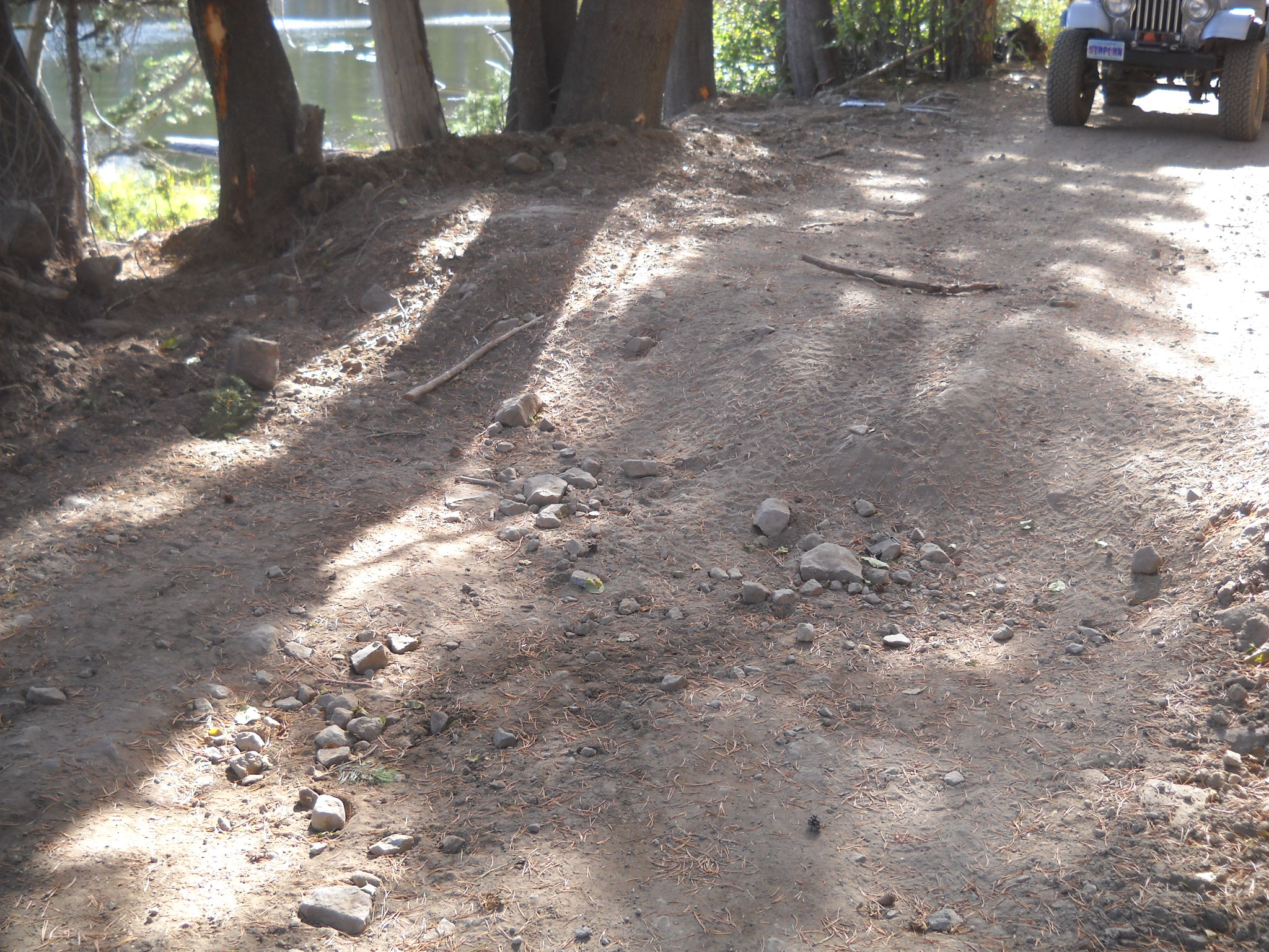
Sorry that these photos all seem to be from different angles. But you get the point. A lot of dirt was moved on to the trail to build up the low spots. Approximately 1000 cubic yards of dirt was placed at this spot alone. Future work might include armoring some of the still vulnerable areas.
The one spot outside the scope that received a great deal of work was the old Mud Hole west of the Potato Patch. A few years ago, the Lake Tahoe Hi-Lo’s lead an FOTR effort to fill and drain the water hole. We moved almost 80 yards of rock to armor and raise the bottom and trenched a drain away from the trail. The final effort lower the water level by several feet.
This spot was still a concern as water would still pool, so Placer drew up specific plans to fill in more of the hole, further armor the bottom of the hole (and drain) and re-establish the drain in to the forest.
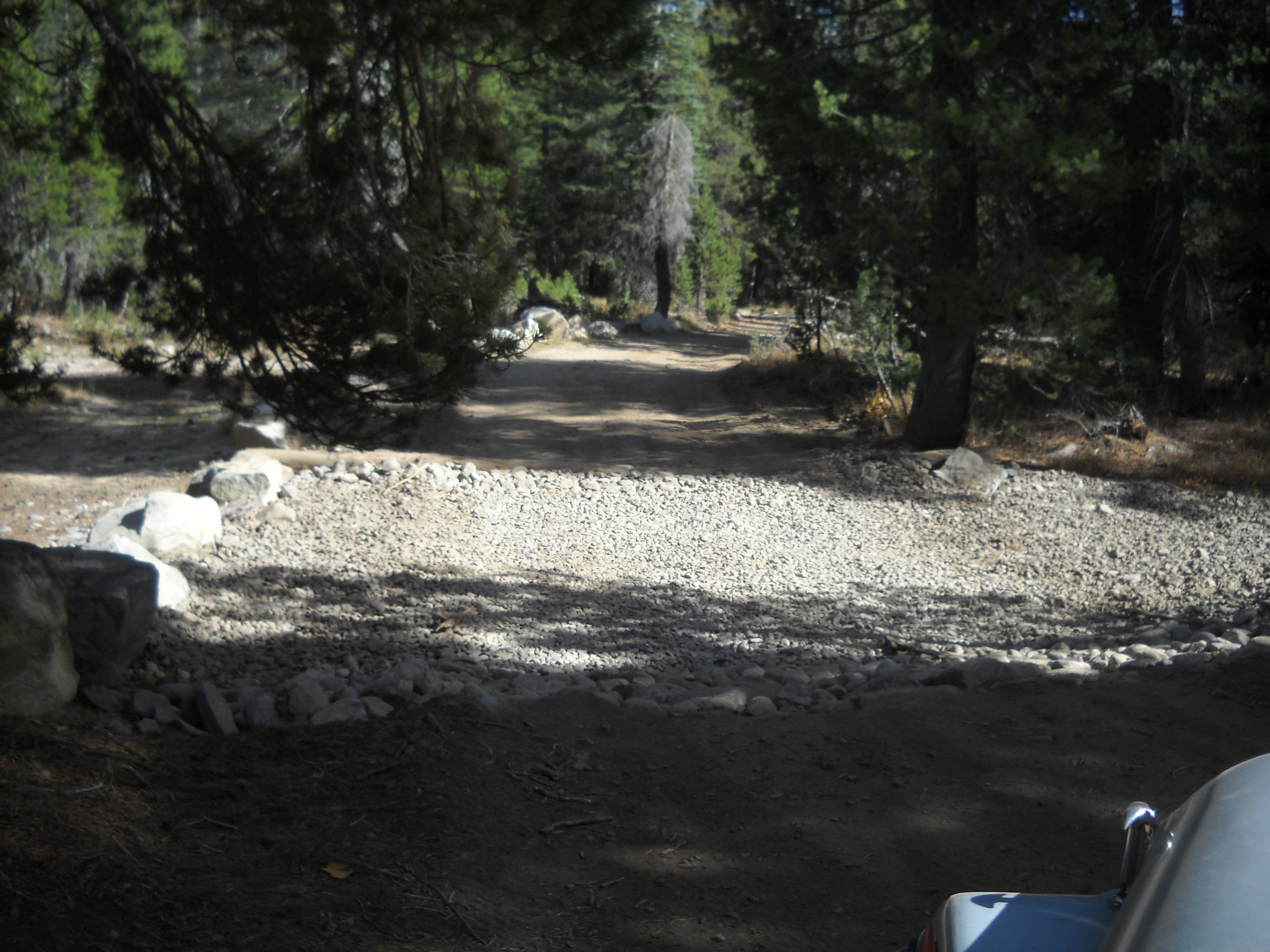
So, here is the current view from the west. The old bypass is to the right. In the distance you can see the fill material.
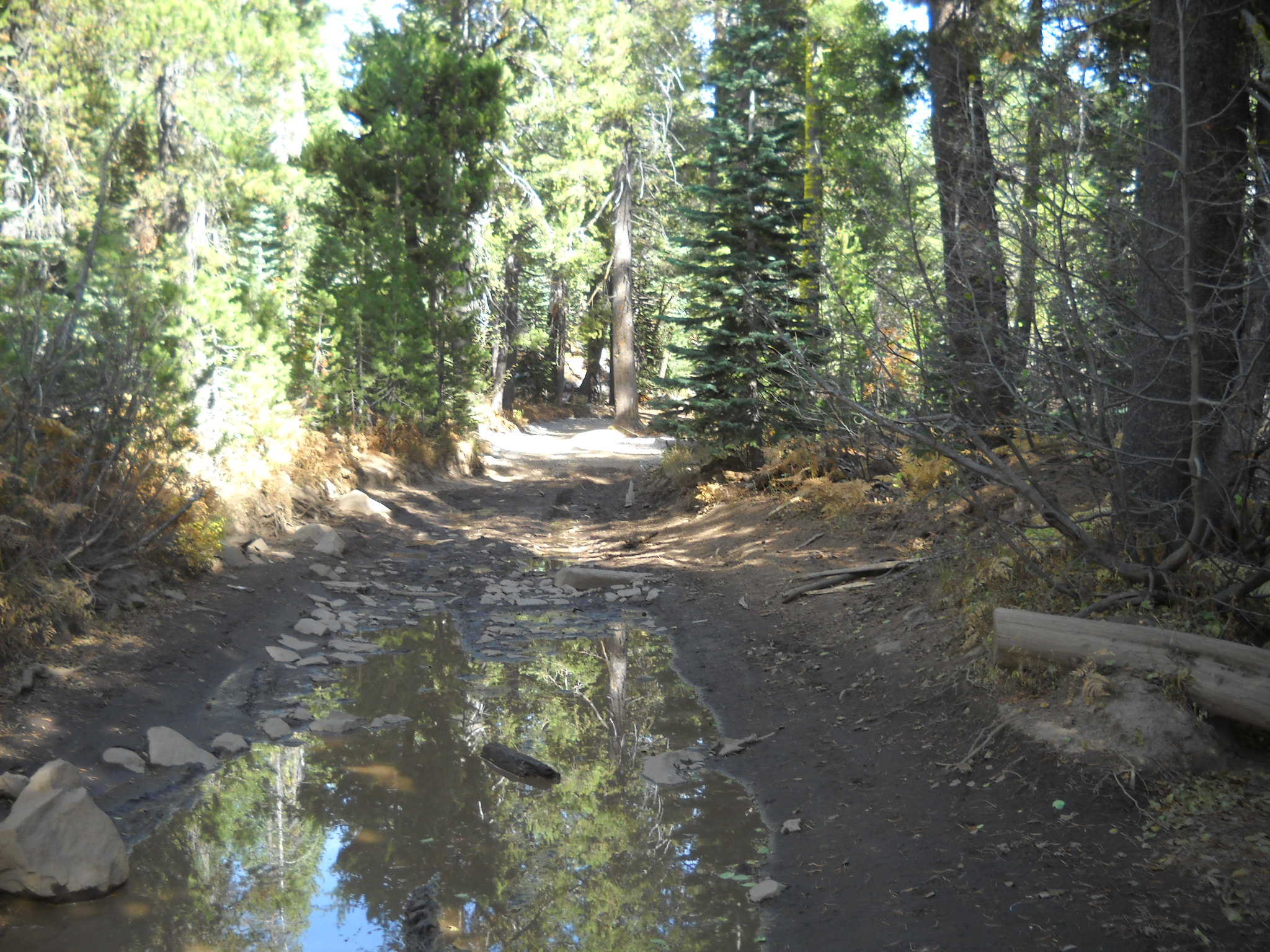
Here is shot from the trail looking down the drain. The rock in the photo is the sediment trap lined by the contractor.

This rock will be used to line the rest of the drain area. Hopefully before winter sets in.

So, if you hadn’t noticed, the fill material came up a little short. The contractor maybe got half way. We think he calculated enough material to line the mud hole then ended up trying to fill the mud hole. This project will have to be revisited next season.
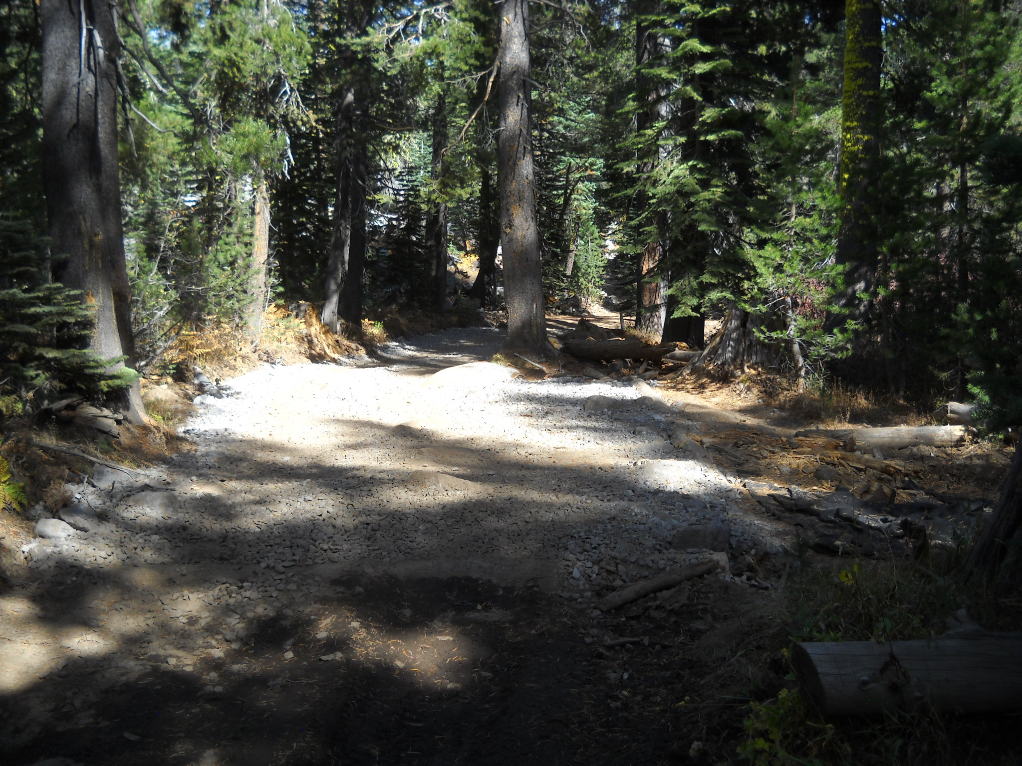
A close up of the area that was filled to the rim.
One of the last pieces to this puzzle was to create several rolling dips and drains along the trail to further prevent water from pooling on the trail. Here are some examples:
Even the outlet of the seasonal pond at the Ellis Creek Trail got lined:
Unfortunately, not all project get done perfectly. This project is no exception. As I said before the mud hole needs more fill material and there were a few seasonal creek crossings that did not get rolling dips. Things that are easily finished next summer.

