
TNF Fire Restrictions
Posted: July 27, 2017 Filed under: Uncategorized Leave a commentOn July 25th, the Tahoe National Forest implemented fire restrictions…
https://www.fs.usda.gov/detail/tahoe/news-events/?cid=FSEPRD551387
Although there is still snow in the highest points of the sierras, the lower elevations are drying out. Restrictions in the Eldorado should happen soon.
The Lake Tahoe Basin Management Unit does not allow dispersed camping anywhere, thus, the only place you can have a camp fire is in a designated campground within a Forest Service provided fire pit. Fires and charcoal BBQs are not allowed on Lake Tahoe’s shoreline.
Please be fire safe.
Post Winter Hazards
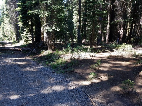
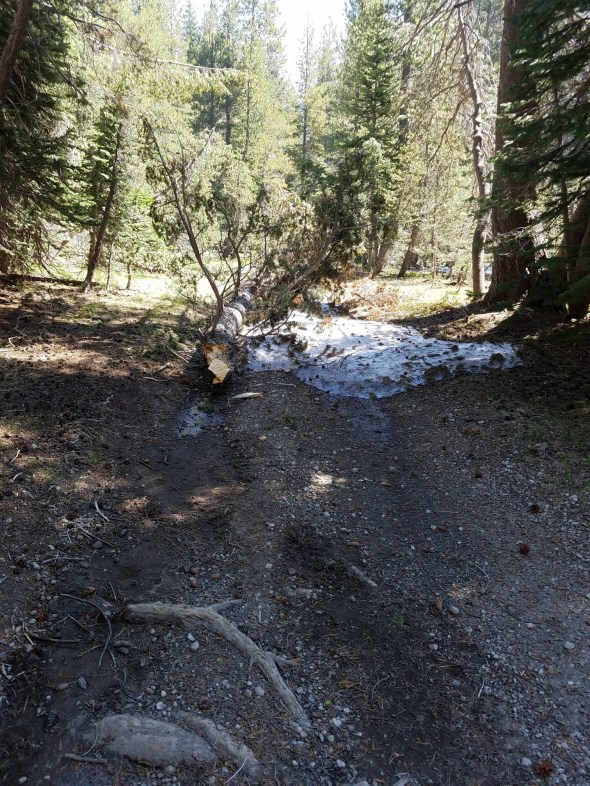
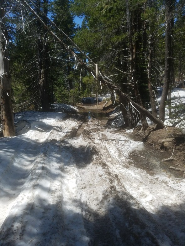
Posted: July 21, 2017 Filed under: Access, Maintenance, Travel | Tags: snow, STORM, winter Leave a commentIt’s been a long winter. We all want to get out on our trails. Feel free to do so but travel with caution. Although the trail below looks inviting, look closer at the tree across the trail 100 yards out.

The picture below is why I really stopped here. This is the Middle Fork Trail up Blackwood Canyon. It parallels the paved Forest road 03 to Barker Pass. I’ve actually asked the FS to close the trail until repairs can be done.

My fear is someone not paying attention, more likely at night, might drive off the road,

Back to the pictured tree across the trail. There is evidence that people are going off trail to get around the tree. My motto: “Turn Around, Don’t Go Around”. If you come across such an obstacle, use your winch or a strap to clear the problem. If you can’t stay on the trail and clear the obstacle, turn around.
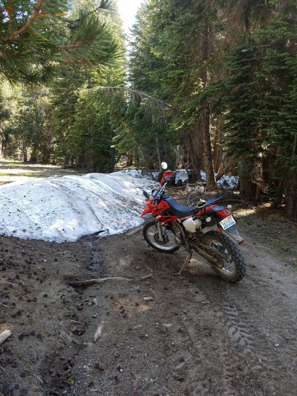
On upper Barker Pass Road, there is still a little snow wheeling to be done.
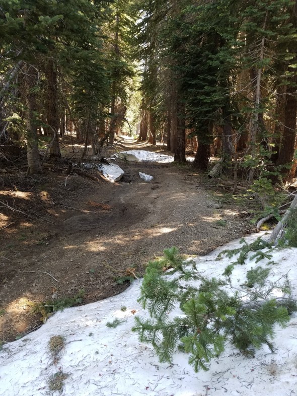

I didn’t take picture of all the downed trees I came across. Most were smaller or not blocking the entire trail. On a motorcycle, it’s much easier to get around a tree in the trail without doing resource damage.
There are plans in the works to get out to all the side trails off the Rubicon to clear the obstacles. We’ll leave the snow for you though.
Rubicon Ronin
Deer Valley to officially re-open!
Posted: July 6, 2017 Filed under: Access Leave a commentI just received this email from the forest service:
On June 23rd the snow sensor at Blue Lakes recorded snow water content of less than 1 inch (https://wcc.sc.egov.usda.gov/nwcc/site?sitenum=356). As stated in the Final Decision Notice for the Deer Valley 4wd Trail Meadow Restoration and Blue Lakes/Meadow Lake Road Maintenance Project, the Deer Valley 4wd trail (19E01) will be opened for wheeled motorized vehicle use 6 weeks after documented snowmelt. This means that the Forest expects the trail to be open to the public on August 3rd this year.
The Forest is also planning a number of volunteer work days in September to help implement trail work and meadow restoration along the Deer Valley 4wd Trail. Individuals interested in assisting with the repair/restorations should contact Sean McGinness (smcginness@fs.fed.us) for additional information.
Matt Brown Botanist
Forest Service
Eldorado National Forest
p: 530-647-5390 mrbrown@fs.fed.us
4260 Eight Mile Road Camino, CA 95709 www.fs.fed.us
Of course, I worry about lines like this one: “the Forest expects the trail to be open”
What the heck does that mean? Will they find another reason to close the trail? Will someone else step in and file another lawsuit?
Stay tuned!
Rubicon Ronin
Rubicon area conditions
Posted: June 29, 2017 Filed under: Access, Maintenance | Tags: education, Rubicon, snow, TNF, winter Leave a commentBasically, winter seems to be hanging around.
There is still a ton of water on and around the trails. Snow drifts will be found in the shade. Mud in other places. Please Tread Lightly!
Here is the pond at the Ellis Peak Trail intersection. This was taken on June 19th, so most of this is probably gone, but it’s a heck of a lot of snow for June!

The Lake Tahoe Basin Management Unit has a list of closed trails on their website. Those trails include, but are not limited to Noonchester, Buck Lake, Middle Fork, Forest Road 03, Twin Peaks, 16E16, etc. It is the users responsibility to know what trails are open or closed regardless of trail and gate conditions.
Although the Tahoe National Forest has not published a list of closed roads, be aware that most of the TNF trails in the Rubicon area will have deep snow drifts for some time.
There are a lot of snags in the forest right now. John Briggs and I spent five hours on June 19th cutting back downed trees along the Rubicon. And that was only between the staging area and the turn for the Ellis Peak Trail at the pond. Be prepared to remove trees from the trail both on the way in and on the way out. Trees could fall after you’ve past and you’ll need a way to get out.
We were able to pull down this snag by hand and cut it up and throw it off the trail. There is plenty of firewood to be had. Go to the Tahoe National Forest office in Truckee for the permit.
Do not drive around downed trees. The motto of this website is: “Turn Around, Don’t Go Around”. That means don’t drive off trail to get around an obstacle be it snow, a tree or just a tough section of trail. The anti-OHV people will use such incidents against us to get our trails closed.
There is a report of a HUGE boulder on the trail below Morris Rock. It would be great to split it up and harden the trail with a few smaller obstacles. Until that boulder is moved or reduced in size, Cadillac Hill will be very tough to get up.
Another report had Miller Creek flowing at 48″ deep. I find this hard to believe but if it’s anywhere near true, it will be tough to cross. The section west of there will be VERY wet and very deep in places. Check the depth before you charge in to any water holes.
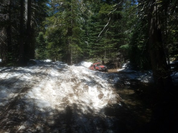
There was a report of four rigs stuck on the trail, two with blown motors. One of those was in that wet section described above. I’m hoping work has been done to start the removal of those rigs. The two snow bound rigs were removed earlier and both driven out under their own power.
I believe that this one had a blown motor. If you look closely, the trail is up on the snow bank. But the snow bank is a little off camber and thus the heightened pucker factor. The rig it technically off trail. Remember, “Turn Around, Don’t Go Around”.
Rubicon Ronin
Rubicon reopens
Posted: June 4, 2017 Filed under: Uncategorized Leave a commentThe Rubicon Trail was temporarily closed before Memorial weekend due to excessive water running down the trail between Wentworth and the Ellis Creek intertie.
Those flows have now subsided and the entire trail ‘system’ is now open.
Enjoy!

