
FOTR work party on Cadillac Hill
Posted: July 14, 2014 Filed under: Access, Travel | Tags: FOTR, Placer Leave a commentFriends of the Rubicon will be conducting a work party on Cadillac Hill on Saturday the 19th. They will be pouring concrete in order to secure the trail to the hill side. Don’t get bent out of shape. There has been concrete on Cadillac Hill for decades in about half dozen different spots.
Friday the 18th, they will be moving bags of concrete to the site and prepping the area.
Saturday morning, from dawn to when the concrete finally cures, the trail will be CLOSED!
Details of the project and how to jump in and help are available at the following link:
http://www.pirate4x4.com/forum/rubicon-trail/1779170-july-fotr-work-party.html
Please let Eric Agee of FOTR know if you can help out. Without these types of projects, the trail would have closed years ago. Please be supportive and plan your trip around the work being done.
A summary of the work project has been posted on Pirate:
http://www.pirate4x4.com/forum/rubicon-trail/1838481-july-fotr-work-party-summary.html
.
14N39 work party
Posted: July 10, 2014 Filed under: Access, Maintenance | Tags: 14N39, ENF, Richardson Lake Leave a commentWe’re still working out the details but there is a work party scheduled for this weekend on the Richardson Lake Trail.
The basic plan is to harden the rolling dips made by heavy equipment last week by covering them and a few sections of trail with a gravel/dirt mix. We will also make at least one rolling dip and spread debris in an open area to slow storm runoff.
Volunteers are need and if you have a trailer, bring it. The FS will provide a front loader to load the trailers. RTF is making their trailers available for use and they have a dump bed which was discussed in an earlier post. RTF Trailer
Please join us at the Tahoma trailhead on this weekend Saturday the 12th and/or Sunday the 13th.
A discussion can be followed on Reno4x4.com
.
Range Fence Repairs
Posted: June 23, 2014 Filed under: Access, Maintenance Leave a commentLast week, a buddy of mine and I did some quick repairs to the range fence on the Rubicon.
It had started to look pretty bad after a few winters of abuse:
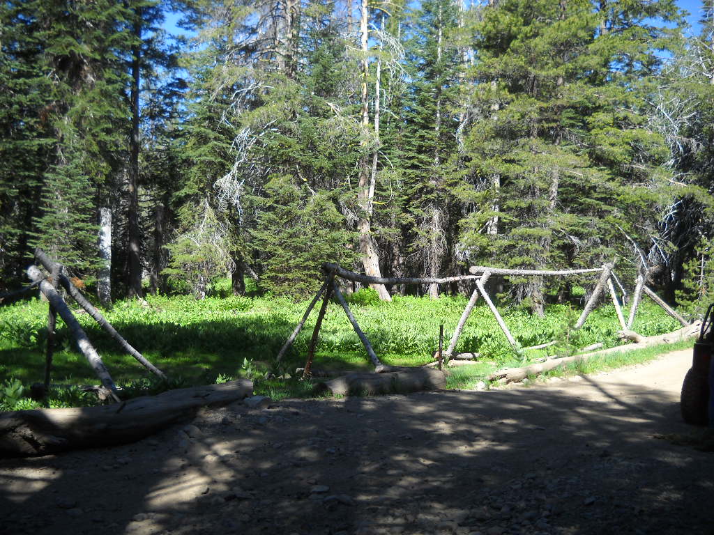
After scrounging a few trees blown over this last winter, we were able to unbolt the broken section and then drill and replace them with new ones.

If you’re not familiar with this project, a few rigs had driven off trail in this area to get around a large snow drift early one Spring. This range fence helps users recognize the edge of the trail in deep snow conditions while allowing snowmobilers to navigate around the area as needed.
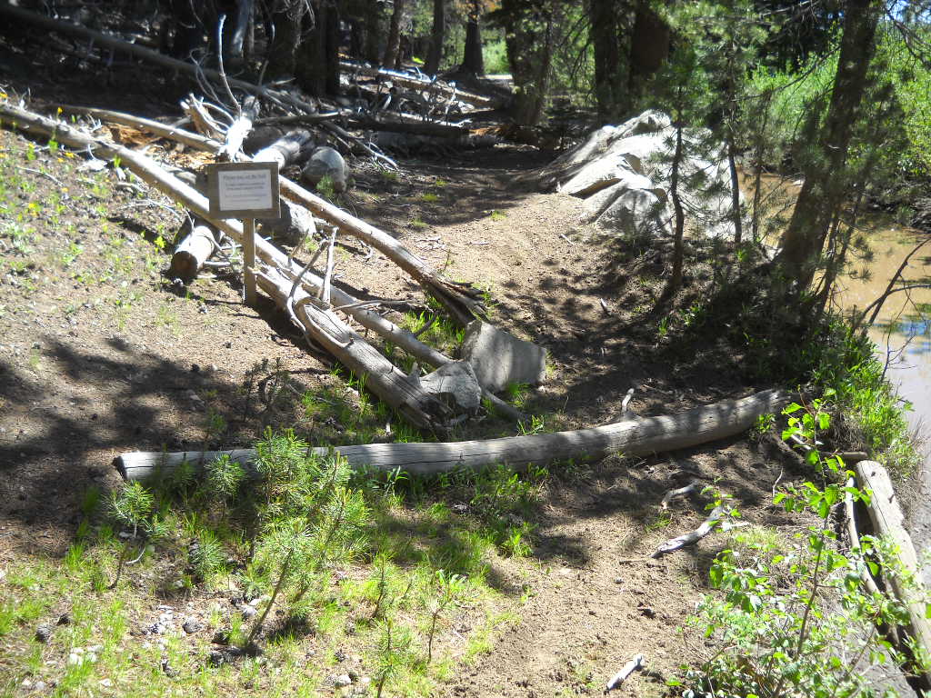
Blocking a bypass (again)
Posted: June 16, 2014 Filed under: Access, Maintenance Leave a commentLast fall, I took the time to block two illegal single track bypasses along the Rubicon Trail. These bypasses were created by motorcycles and later enlarged by quads. They were “needed” because the Rubicon Trail had standing water on it. That should be read as tongue in cheek because these bypasses were not needed. All OHV users should stay on the trail. My line, that I should turn in to bumper stickers and t-shirts is “Turn around, don’t go around”.
Here are pictures from one of the two worked last fall. Before…

After…

I even took the time to wire tie most of the logs together to really let those who wanted to dismantle it know that they were going to have to work at it a if they wanted to break the law again.
Well, this spring, the logs were moved by those who didn’t have the skill to ride/drive through the water. I had put up signs asking that those who wanted to help maintain the Rubicon Trail for ALL types of users should contact FOTR. I never heard that anyone wanted to help do that work.
So, round two.
Only one of the two bypasses was blocked off this time around because only one water hole still had water. I’m hoping Placer County will come through with the grant and fix the trail so this is no longer an issue. But until then…
Before…


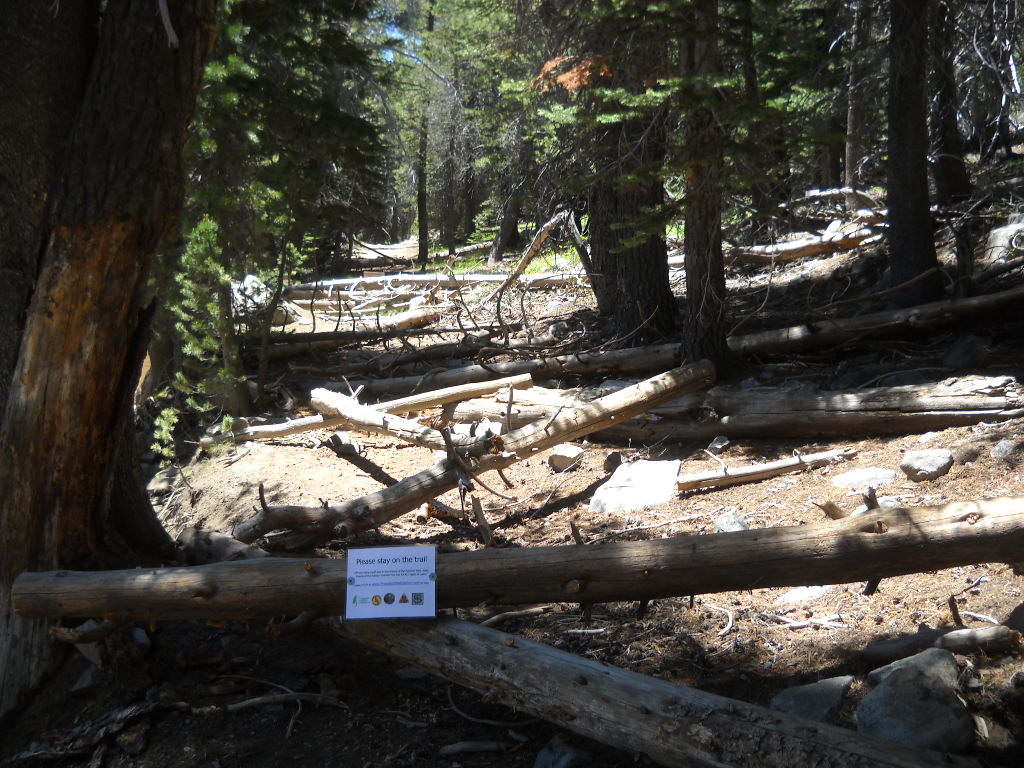
This time, some of the logs were drilled and anchored to the ground or each other with rebar.
Again, signs were placed stating to contact FOTR in order to help maintain the trail.
I’m all for ALL types of users on the Rubicon Trail and the surrounding trails but everyone needs to follow the rules. During discussions about users driving off trail, the idea of having Placer County close the trail if they can’t keep users on the trail was brought up. It was not seriously considered but it was discussed.
We need to educate each other about proper etiquette and the consequences of breaking the rules. Please take the time to politely educate anyone you witness breaking the rules.
Turn around, don’t go around.
Tahoe NF Motor Vehicle Use Map Released!
Posted: May 26, 2014 Filed under: Access, Travel | Tags: Rubicon, TNF Leave a commentThe Tahoe National Forest (TNF) finally released the latest Motor Vehicle Use Map (MVUM). The forest had been without one for years. It had released and then retracted one previously.
There are ten maps for the four different districts within the Tahoe National Forest. The Rubicon Trail is documented on the Truckee District -south map. Hard copies of these maps are available for free at any of the TNF offices.
The Rubicon is listed as 16N75. Although the Rubicon is listed on and has been given a Forest Service (FS) number, it is still a county right of way. The FS gave it a number as the trail needed to be listed to have the rest of the area trails make sense.
New in this version of the MVUM, Observation Point (16E78) is officially recognized by the FS as being a 163 foot long ‘trail’. Previously undocumented, the turn out has always been allowed by the FS.
Also new are four camp sites:
3013-026 is an elevated area from the Rubicon before the old water hole. The FS documented this ‘road’ as 64 feet long.
3013-24 is at the east end of Miller Lake just past the old water hole. The FS documented this ‘road’ as 29 feet long.
3013-22 is at the west end of Miller Lake and is truly lake front. The FS documented this ‘road’ as 62 feet. It’s more of a turn out.
16E77 is just east of Observation. It’s know as Bear Camp and in the early spring is under six inches of water. It’s 50 feet long or deep, depending on how the FS measured it. It is documented as a ‘trail’.
And for the first new OHV trail in a long time on the TNF, the Long Lake Trail, previously known as TKS-11, is now officially 16E12.
I want to thank the TNF for getting this out to the public. It took a lot of hard work to get this right. The last map was actually printed but because there were so many flaws the forest decided not to release it and to make the needed corrections. It’s worth the wait.
Now get out there and try a trail you’ve never been on before!

