
The LTBMU fails to get any OHV funds
Posted: June 9, 2016 Filed under: Access, Maintenance, Travel | Tags: access, FOTR, grant, Hi-Lo's, LTBMU, maintenance, OHV grant, OHV State Parks, Placer, TNF Leave a commentThis OHV season, the CA State Parks OHV Division made available almost $11 million dollars for OHV issues, projects, maintenance, law enforcement, education, etc.
The Lake Tahoe Basin Management Unit (LTBMU) failed to obtain a single penny of it. In comparison, the Eldorado National Forest (ENF) received $438k and the Tahoe National Forest (TNF) received $650k.
There is a 30 day grace period for the agency requesting funds to ask that their grant be reviewed and rescored but don’t hold your breath. This is the second straight year the grant writers and administrators at the LTBMU have fallen short. I think it’s safe to say the LTBMU needs a new grant writing staff.
Here’s the problem, even though the LTBMU didn’t receive CA State Parks grant funding, they are still required to manage OHV on their forest. It’s just going to be that much more difficult without specific funding for OHV.
I’m using this lack of funding problem to push the LTBMU to reinstate the Adopt-A-Trail program they dumped two years ago.
If you or your club, group, business or organization would like to adopt an OHV trail within the LTBMU, email them, call them, hound them, do not take no for an answer, Right now I only know of the Twin peaks Trail in South Lake Tahoe, the Buck Lake Trail off the Rubicon and the Middle Fork Trail up Blackwood Canyon (just north of the Rubicon) that historically have been adopted.
That list doesn’t include the pre-Placer County Rubicon when the Lake Tahoe Hi-Lo’s had the entire east side of the trail adopted. For adopting a section of the Placer side of the Rubicon Trail, contact the Rubicon Trail Foundation.
Here is a list of OHV trails within the basin from the LTBMU website. Not all trails are listed. Check the Motor Vehicle Use Map (MVUM) for more trails.
Lake Tahoe – East Shore
- Genoa Peak Road 14N32
- Kingsbury Stinger 18E39.3
- Logan House 14N33
Lake Tahoe – North Shore
- Kings Beach 18E18
- Mt Watson 73E
Lake Tahoe – South Lake Tahoe
- Corral Trail 18E14
- Hellhouse Road 12N01D
- High Meadows Trail 18E33A
- Power Line Road 12N08
- Sand Pit 12N08
- Sawmill Pond 12N30
- Twin Peaks 12n30
Lake Tahoe – West Shore
- Buck Lake Road – 14N40
- McKinney / Rubicon Trailhead
- Noonchester 14N34A
Please step up, adopt a trail, push the LTBMU to work with the users!
Campfires
Posted: June 6, 2016 Filed under: Maintenance Leave a commentSo as the camping season begins, so does the wild fire season.
There have already been a number of fires in the Sierras, one just outside Placerville.
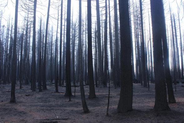
King Fire: September 2014 outside Pollock Pines, Rubicon Trail closed for weeks
Campfire permits are required for any fire on federal lands. That includes propane BBQs. Permits can be issued by the US Forest Service (USFS), Bureau of Land Management (BLM), National Park Service (NPS), and the California Department of Forestry and Fire Protection (CAL FIRE).
Here is a link to the Cal Fire page about permits: Fire Permit Link, from there you can get a permit online.
The thing to remember about campfires, it’s not out until it’s cold and out. The Forest Service permit says to use the back of your hand to see if the fire is still warm. Hotshots and other wildland firefighters will actually run their hands through the ashes to make sure the fire is COLD!
Fire restrictions can change at any time. It is the users responsibility to know the current restrictions. I try and keep up to date information on fire permits on my “Conditions” page.
Clearing all flammable material from around the fire is a no brainer. Building on a granite slab is the best way to go but that is not always possible. If you build on dirt, make sure it is dirt. Duff consists of shed vegetative parts, such as leaves, branches, bark, and stems, existing in various stages of decomposition above the soil surface. It doesn’t burn well, but it does burn.
I have come across a campfire with smoke coming up from the ground six feet from the pit. The fire had traveled through the duff layer, finally surfacing six feet away as a whisp of smoke.
I have personally seen a forest service LEO write a ticket for not having someone at the fire at all times. The one guy who was left at camp was sleeping one off in his tent and the LEO didn’t buy the argument that one the smoldering fire wasn’t a fire and two the guy in the tent was “watching” the fire. Don’t turn your back on a campfire.
Use four times as much water as you think you need to put out a fire. Pour and stir. Pour and stir. Make sure it’s out.
You don’t want to be the one that burns the Rubicon Trail.
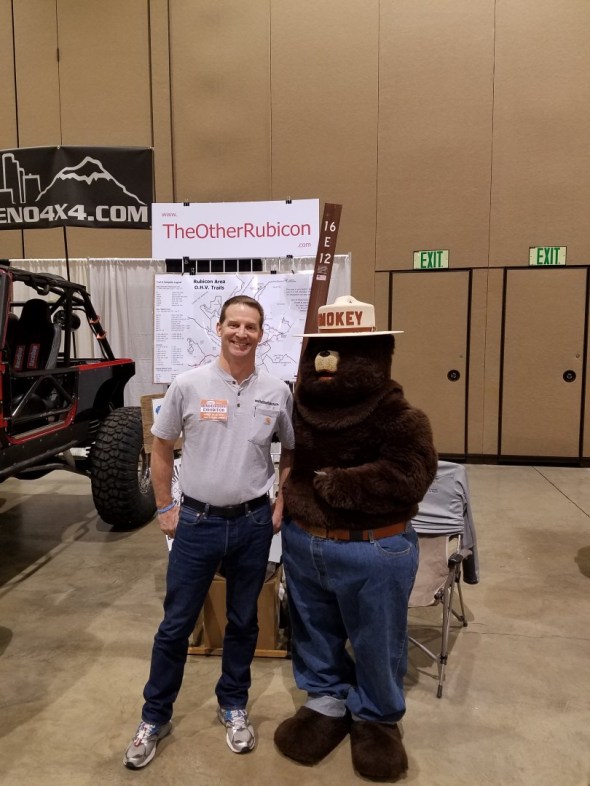
Here I am, hanging out with Smokey Bear at the Reno Motorsports show:
Challenging the Richardson Lake Trail
Posted: June 1, 2016 Filed under: Maintenance Leave a commentAfter dropping off the county and engineering firm employees, our group of four rigs headed back up the Richardson Lake Trail, 14N39.
Here is John Briggs going over the Rolling Dip installed in 2014 near the cabin. (To be clear, this is the old hunters or grazing cabin that has the tree in to the roof at Miller Meadow, not the Ludlow Hut much further up the trail at Richardson Lake.)

This is looking up the trail from the cabin.

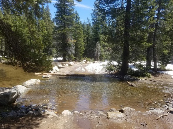
Don and Galen crossing the Arizona Crossing.

We crossed this puddle but turned around just on the other side. The trail runs to the left of the trees in the center of the picture. I drove past them to turn around and slid down to them as I drove past. Pin striping by nature.

This is where we turned around. I had a nasty side hill which slid me in to some small tress along the side of the trail. This is looking up the trail not too far past the Arizona Crossing just past the cabin.
Note the side hill. Just around the corner in the distance, the trail climbs. That would not be fun. Also, it was three in the afternoon and we didn’t really have time to play.

On the way out, we decided to pull a log to the trails edge to prevent further travel off the trail. The snow drift doesn’t look like an issue in this photo but in previous trips John said the drift was six feet tall and really wanted to send you in to the sediment trap in the lower left corner.


Later in the year, we should move the log over a little more to better protect the two trees along the trail’s edge. This will be a stopping point early in the spring due to the shade that creates the steep side hill.
Remember, the snow will eventually melt. “Turn Around, Don’t Go Around”. Come back a few weeks later and the trail will be passable.
Another Day on the Rubicon
Posted: June 1, 2016 Filed under: Maintenance Leave a commentToday I worked with a group of volunteers and we took out some Placer County representatives and some employees of the firm Placer has hired to work on addressing the water crossings within Placer County. John Briggs of FOTR worked with Placer to organize the day. Don from the Tahoe Donner 4wdc was there along with Galen from the Hi-Lo’s.
The trail is very wet, many puddles along the trail. Tread Lightly! Please stay on the trail. Do not drive around snow drifts, downed trees or puddles. “Turn Around, Don’t Go Around.” Be prepared for anything.
The group was testing the equipment that will be used to GPS the Tahoe Side. They were also learning what the Rubicon Trail was all about.
This shot is looking east at the border between the Tahoe National Forest and the Lake Tahoe Basin Management Unit. Right at the end of all the water bars. It was the first snow we encountered on the trail.

Further up the trail, again looking east, just past Miller Lake. Sort-of deep water and snow drifts. Please keep your speed down when driving through water.

Here is the pond and the outlet, again looking east. Snow in the back ground on the trail. The log on the east side of the outlet has broken free and will need to be put back in place or replaced with boulders. It broke and was pushed out of place.
The trail up to Ellis has a snow berm at the entrance and I’m sure more snow in the shaded areas.

Further up the trail there were more snow drifts but we didn’t go any further. After dropping off the ‘workers’ at the staging area, we headed but up the trail to explore the Richardson Lake Trail.
Monthly OHV Reports
Posted: April 12, 2016 Filed under: Access, Maintenance, Travel Leave a commentI just finished up-loading over a dozen OHV Reports I have presented to my local clubs over the last year and a half. I’ve created a link on the right side of the page under, of all places, LINKS.
As Vice President of two local 4wd clubs, I present a monthly report about what’s going on around the Tahoe area regarding OHV, including Deer Valley and the NV 4WD Association.
The reports are usually read to the members attending the meeting and I fill in a lot of details as I read and answer questions of the audience. So, the reports may read, not incomplete but sparse. It’s more of an outline.
Please feel free to ask me question about anything in the current minutes and I might not remember details from a meeting several months ago.
Here is the new page: OHV Reports (monthly)

