
Middle Fork Trail is OPEN!
Posted: June 2, 2026 Filed under: Uncategorized | Tags: 15N38, gates Leave a commentJust received this from the Lake Tahoe Basin Management Unit…
Hi Doug – FYI 15N38 and 03 were opened today.
Best regards,
-Daniel
Daniel Cressy
| Daniel Cressy Public Services Staff Officer |
| Forest Service Lake Tahoe Basin Management Unit |
| p: 530-543-2675 daniel.cressy@usda.gov |
| 35 College Drive South Lake Tahoe, CA 9615 |
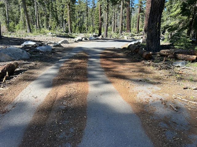
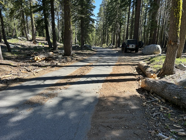
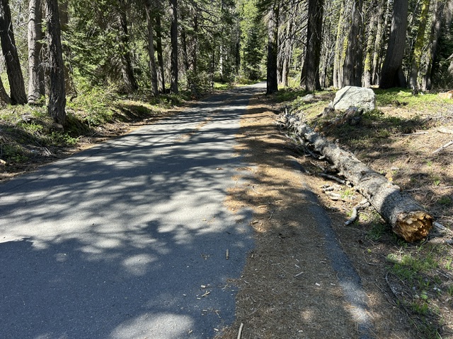
Today is June 2nd, got the email about 4:30pm. That means both the paved road and the dirt road to Barker Pass are open for use.
There are still details to work out about the late opening of the trail. I will be having many meetings with the Basin to make sure the trail never opens late again.
Get out there and enjoy,
.
Doug
Trail Clearing – Part II
Posted: May 31, 2026 Filed under: Uncategorized | Tags: snow, trail clearing, trees Leave a commentSadly, there will be a part III.
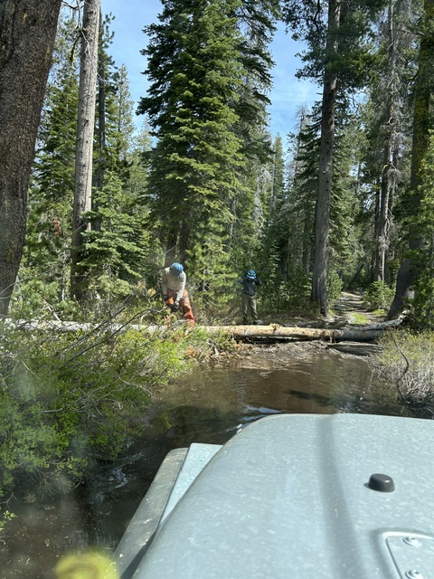
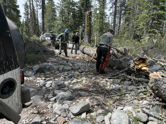
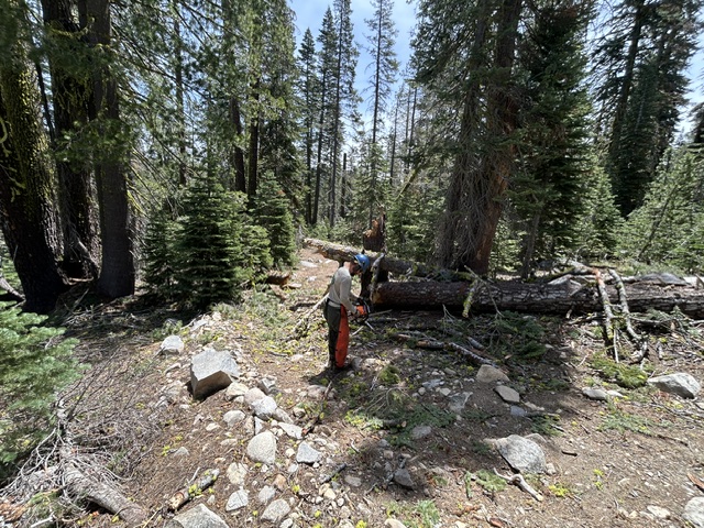
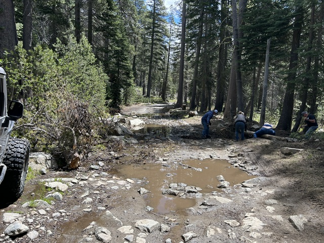
A huge shout out to the Tahoe Donner 4-Wheel Drive Club. We had seven members out today, in six rigs. We were on the trail from 9:15 until 5:30! Most was work but we did take the fun way home.
The start of a great day.
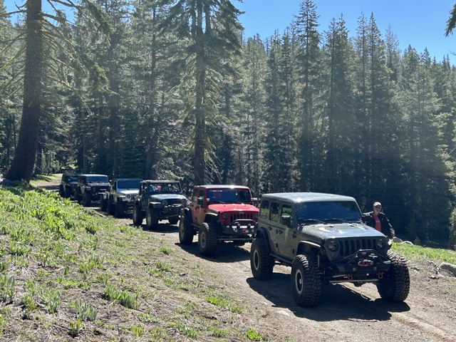
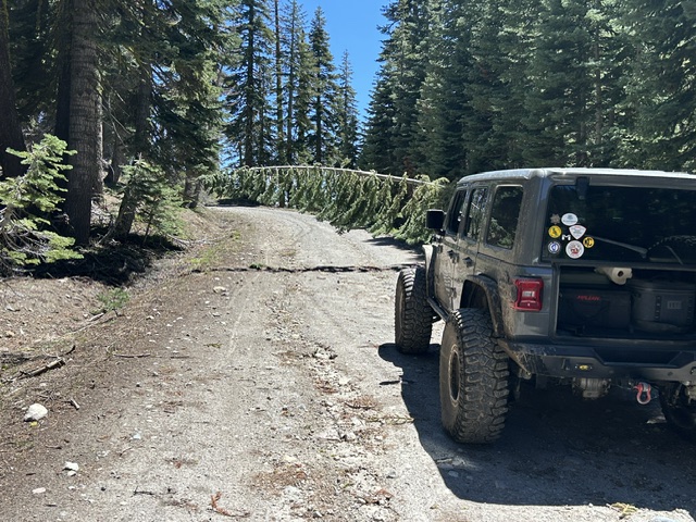
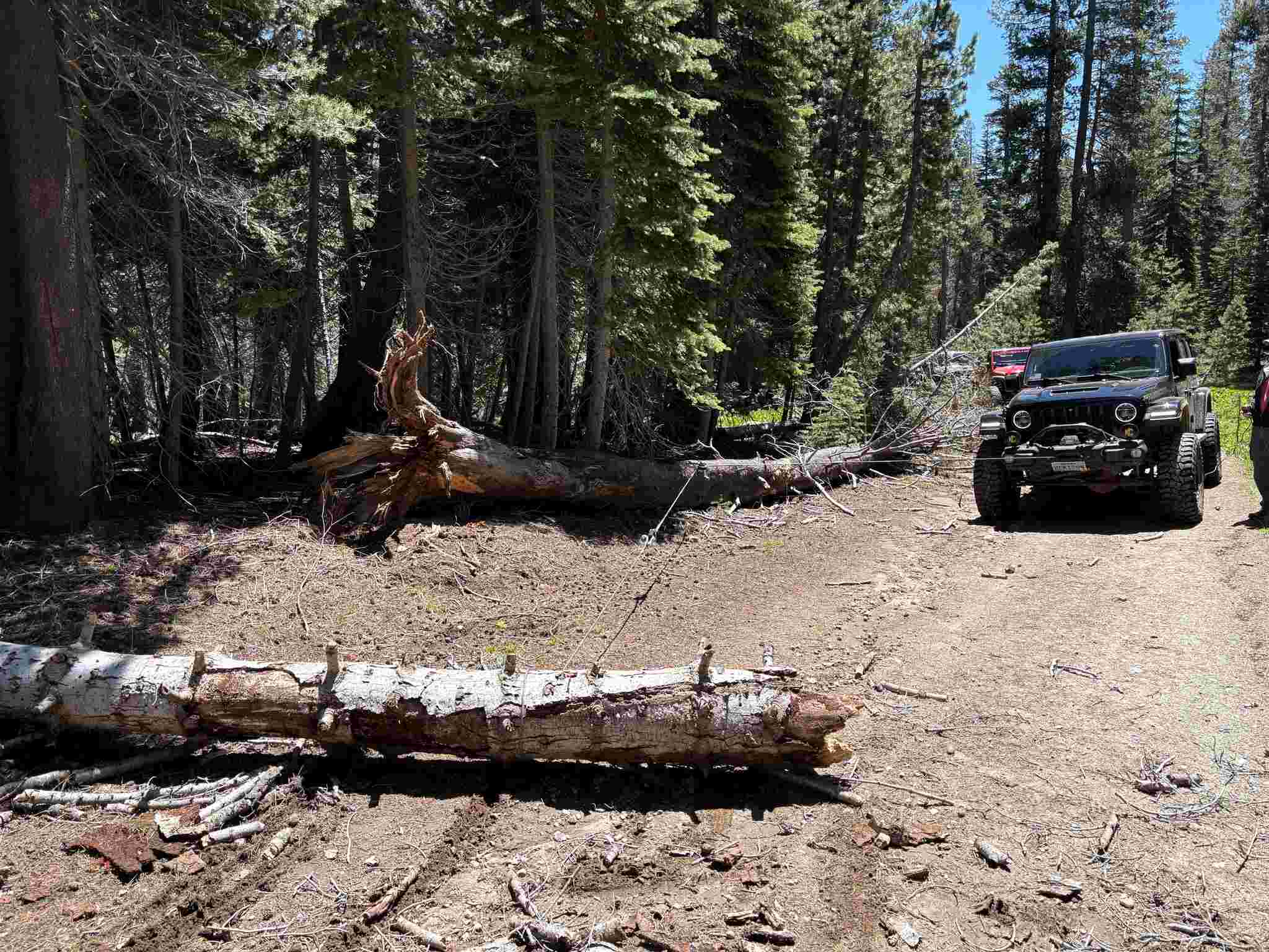
We headed up the Rubicon to Forest Road 03-04. We started in where we left off last week. Someone had moved that first tree but not well enough. We had many trees still down on 03-04 to clear. We were the first to drive most of that road.
When we got to 16E79, the first downed trees were right at the turn.
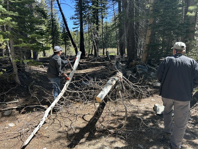
Just a short way in, we had more. Cutting and winching was the plan of the day. If they broke when they fell, we skipped the cutting and just dragged them to the side.
A ways up the trail, we came across a rather large snow drift. Due to the side hill, we turned around and went back to 03-04. We took that all the way to Barker Pass. 16E79 was doable, with winch work, but not worth the effort to get six rigs across. Next time.
Back on 03-04 and then on to Forest Road 03.
I almost left this one to get the dust off top of the rigs, but I was out voted.
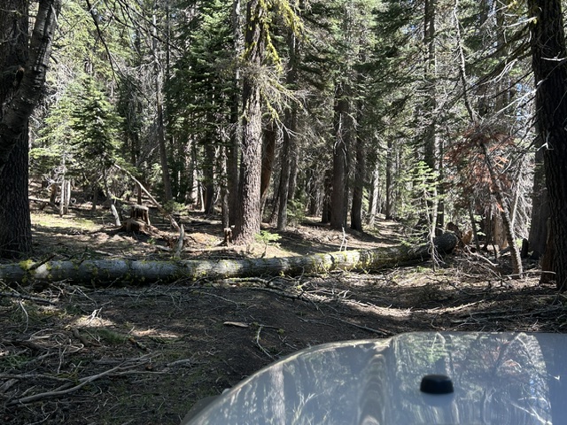
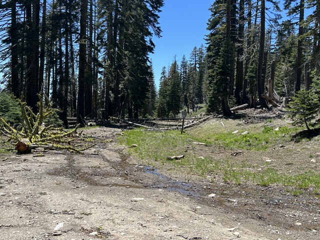
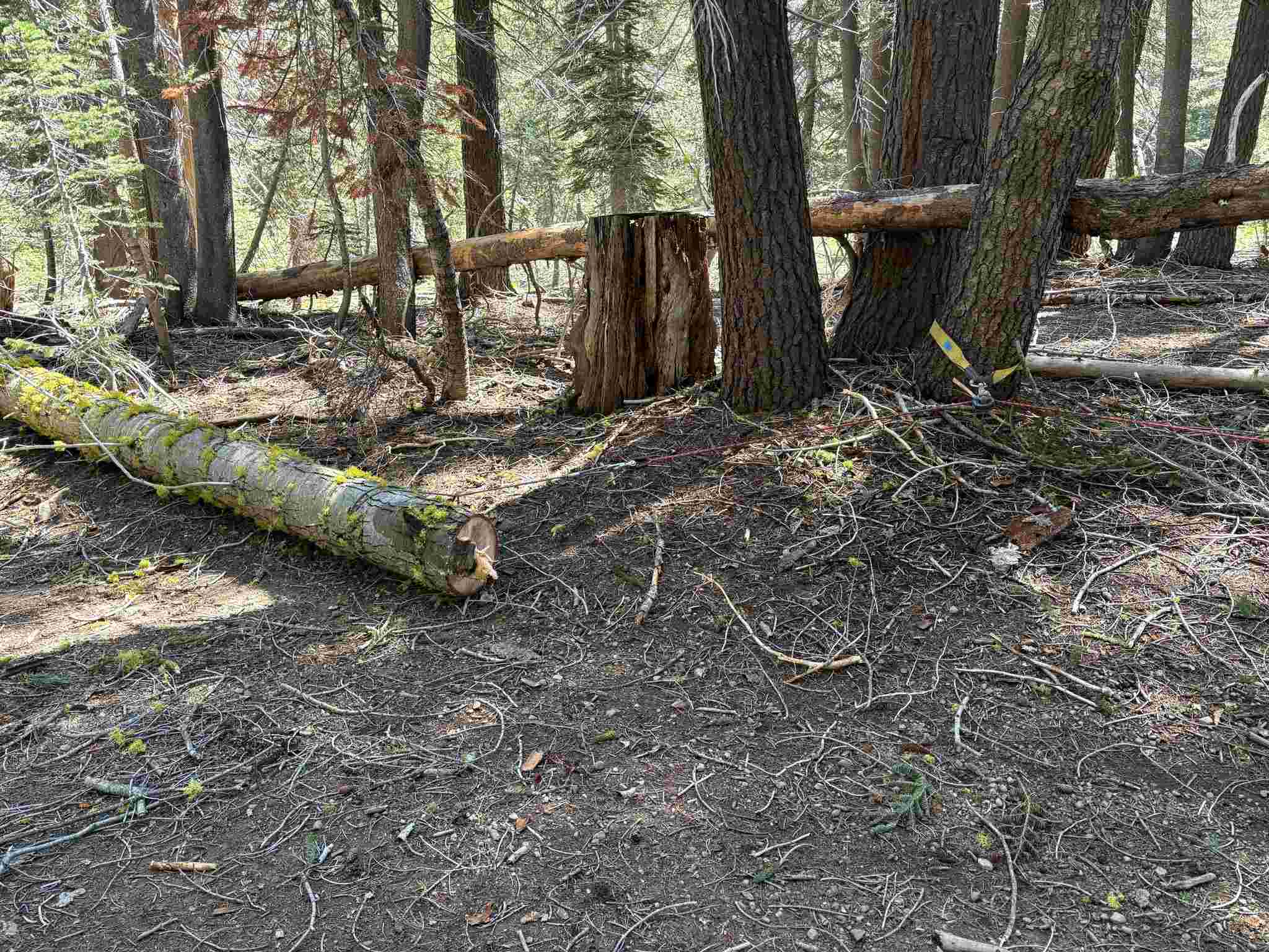
Looking further down Forest Road 03, to the west, there are still trees down. Even along the trails we had already cleared, more three had fallen, some were cleared some we had to clear. Always be ready for anything.
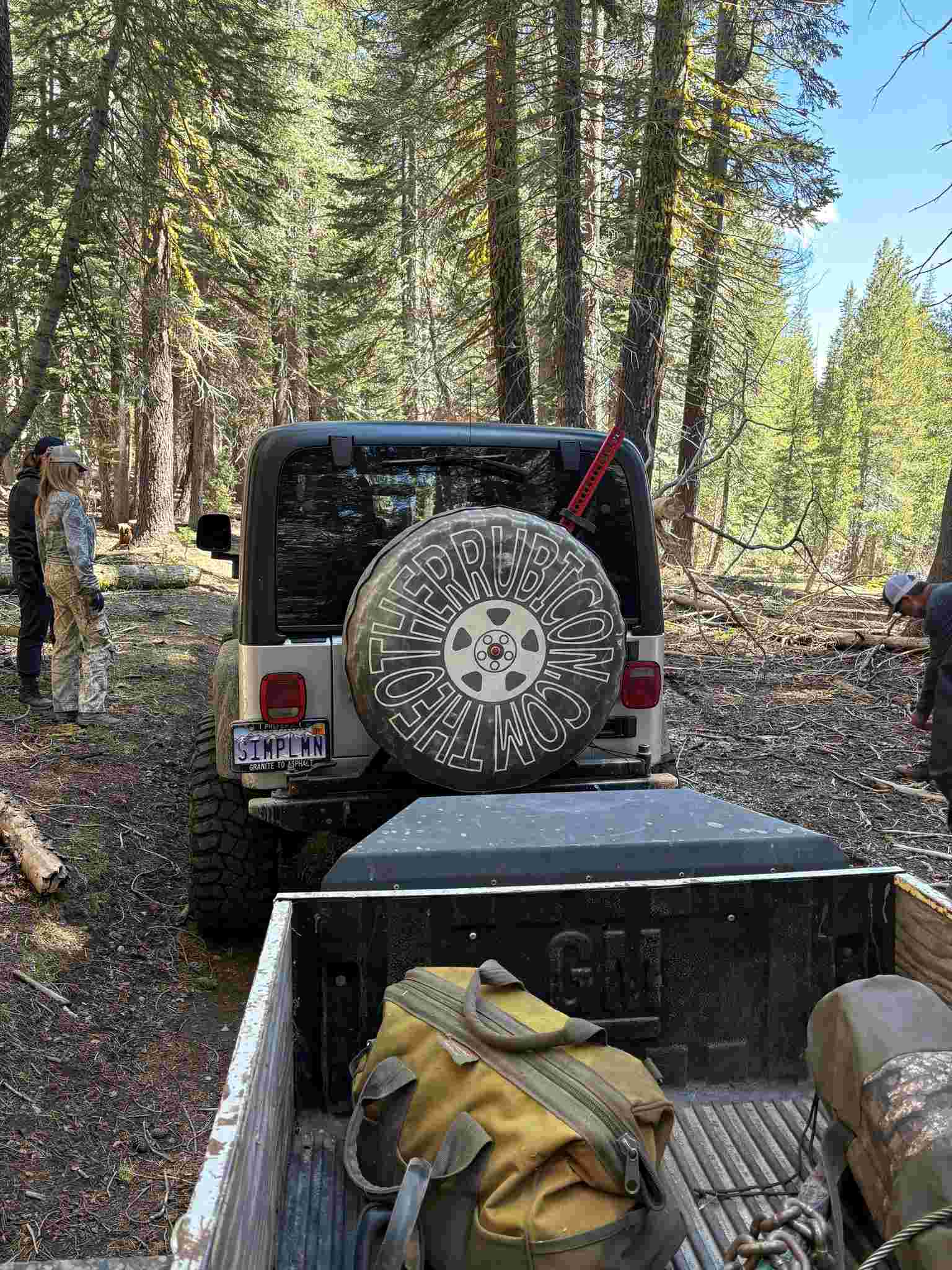
Once to the summit of Barker Pass, we took a well-deserved break. Unfortunately, the drive home was back down 03-04. When we got to the Hobbit Trail (16E76) we took it for the fun ride down to the Rubicon. What you need to know is that I had brought my trailer to have better access to the gear for doing the trail clearing. It was a bit of a challenge doing the Hobbit Trail with a trailer. Not my first time, not my last.
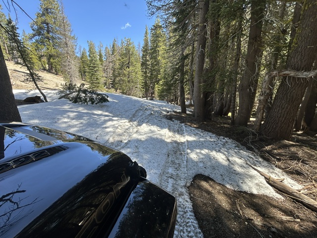
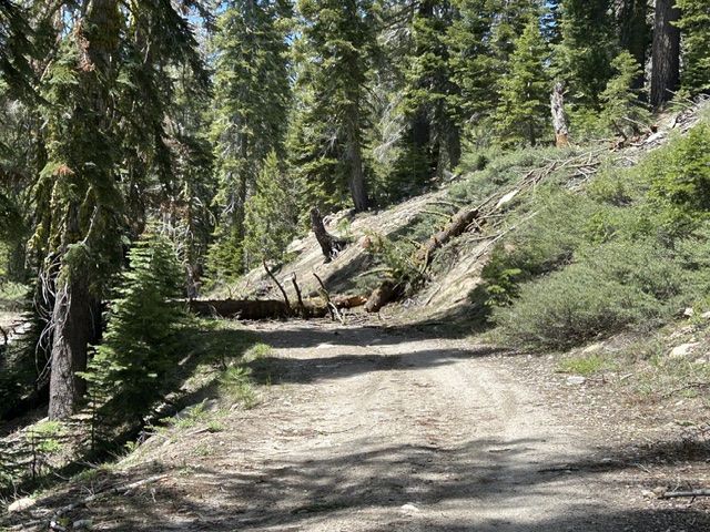
The Middle Fork Trail (15N38) should open tomorrow (Monday) morning! There will probably be snow in the north aspect shadows. The paved road to Barker Pass doesn’t open until June 15th.
Again, 16E79 is doable but be prepared for trees and snow. Turn Around, Don’t Go Around. )3-04 is clear until the next tree falls.
With any luck, I’ll be out again this week to finish clearing 16E79 and to check that 15N38 is open and passable.
.
Rubicon Ronin
.
More photos from other volunteers that day…
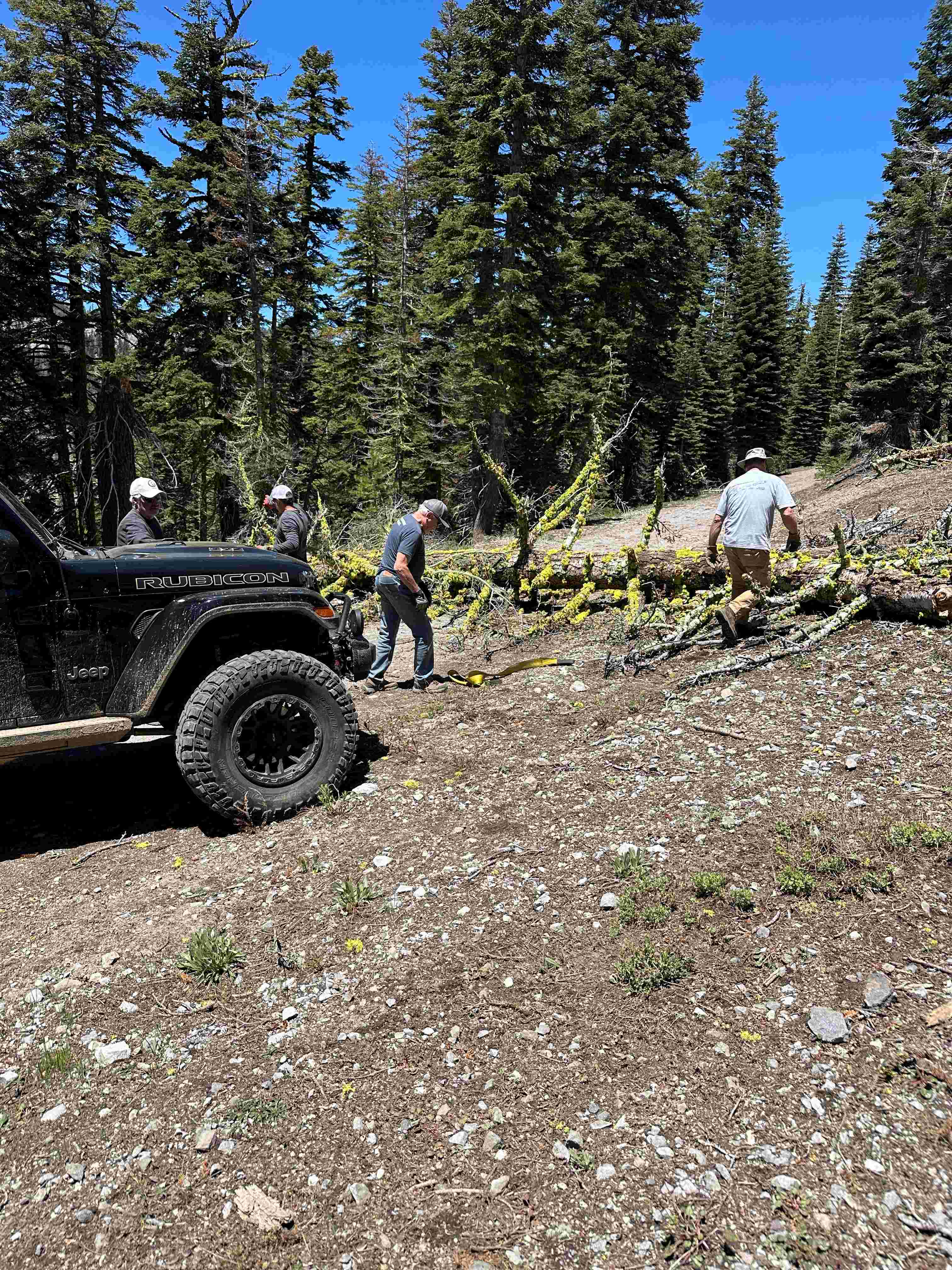
Setting up for another pull
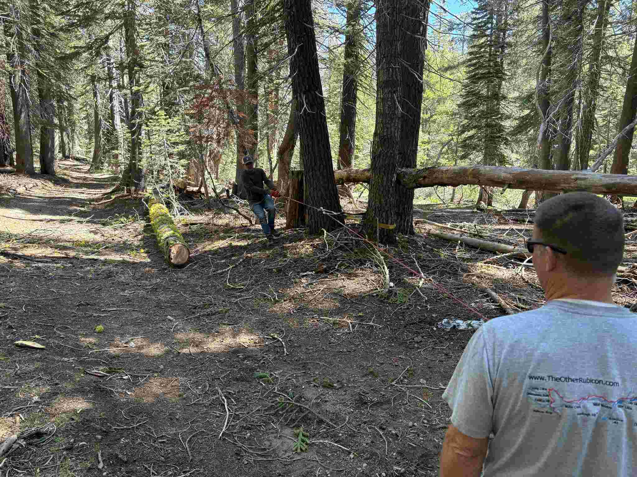
Winching is better than a chainsaw. Don could have angled his rig better for a straight pull into his winch.
A snatch block secured to a tree helps drag the log where you need it
The trailer made an appearance to have easier access to the tools
Sometimes a simple pull is quicker than the winch. This particular tree decided to break into many pieces as we pulled it off the trail.
Street Closure on the way to Staging
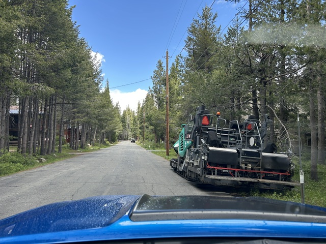
Posted: May 28, 2026 Filed under: Uncategorized Leave a commentBellevue Ave, the first left turn off McKinney Rubicon Springs Road, on your way to the Tahoma staging area, is currently being resurfaced. No parking Mon-Fri, 5/26-6/4.
My suggestion is going in Gray Avenue off 89, one block south of the normal entrance.
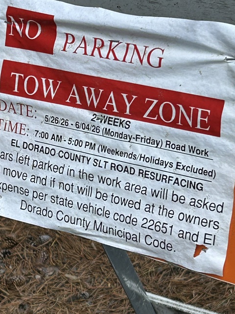
Although it says no parking, a few of those days the road will close for the actual resurfacing.
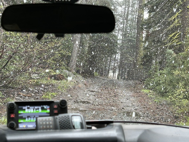
We were out on the trail gathering data for a work project for later in the summer. Just a little on the chilly side today.
.
Rubicon Ronin
Tree Clearing: Part I (we need to go back)
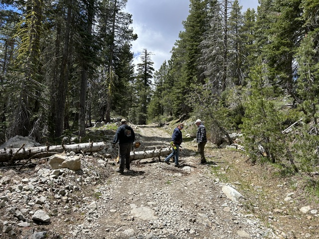
Posted: May 20, 2026 Filed under: Uncategorized | Tags: 16E76, 16E79, tree clearing Leave a commentWhat a day on the trails. 9:30 departure from the staging area, back at 5pm. We worked our asses off, just to keep people on the trail. Six people, four rigs, 30+ trees cleared. And only one and a half trails cleared.
The plan was to clear Barker Meadow OHV Trail / Hobbit Trail (16E76), then the Red Cabin Trail (16E79) and given time, take 03-04 back to the Rubicon Trail.
Well, any war plan only survives until the first shot.
We drove out to Barker Meadow and turned north, The trail is very wet. If you don’t NEED to travel it, please put it off and give it a chance to dry out.
The Forest Service showed up with their Rubicon Jeep and a couple of helpers. Myles, the sawyer, got quite the workout today.

A big shout out to the Tahoe Donner 4-Wheelers. They had three member show up to help. Sorry, no pictures of the members.
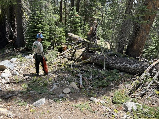
This was one of 30+ trees we cleared from 16E76 and 03-04. The sawyer cleared the snag and then dropped the bad leaner. We only did enough to make sure there was a safe path on the trail. Future groups could clear trees a little further off the trail.
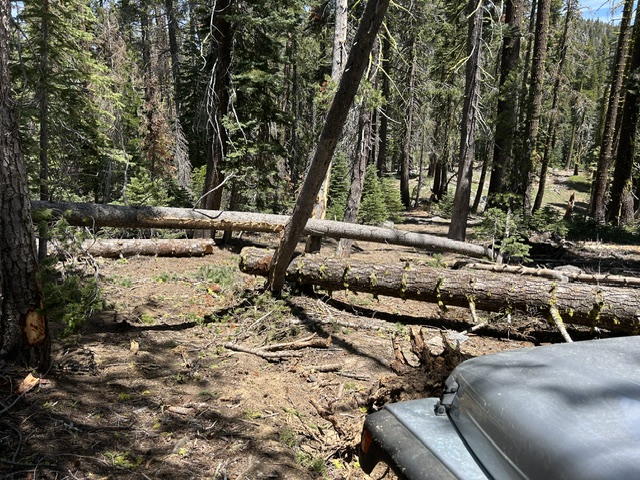
We finally finished clearing Barker Meadow OHV Trail (16E76). We started north on 03-04, hoping to get to 16E79. No luck.
Sadly, further up 03-04, the downed trees continued. Looking at the clock, we turned around and followed 03-04 back to the Rubicon. We cleared trees the whole way. 03-04 will remain closed north of Bear Lake until we can get back out there to clear the trail. That means access to 16E79 is not yet available. The plan is to complete the clearing before the June 1st opening of Blackwood Canyon.
More trees down along 03-04 on our way back to the Rubicon.
The trees never seemed to end!
There were a few snow drifts that gave us a challenge on the way back toward the Rubicon along 03-04. I chose a winch, everyone else muscled through.
No injuries. No breakage. Lots of trees cleared. It was a very fulfilling day getting so much done.
It was a pleasure to work with such a great group of people.
.
Rubicon Ronin
Trail Clearing, Lost Keys
Posted: May 18, 2026 Filed under: Uncategorized | Tags: drainages, FOTR, keys, trees Leave a commentYesterday, FOTR worked the Rubicon Trail from the residential area to the new (yet to be constructed) intersection of 16E75 (The Rubicon) and 03-04.
There were maybe a dozen volunteers, from a few different clubs. Paul even cooked burgers for us at the end of the day! The hot burgers were awesome as the temperatures dropped and a few snowflakes started to fall.
Two of us retreated from the staging area to the beginning of the trail to clear some logs from the edge of the trail to make sure there is room for wide trailers.
Yes, it could use a good stiff broom but the cyclists can come in behind us and sweep.
Not pictured is the large and growing pothole just before the bridge over McKinney Creek. We’ll let the Basin know they need to address that one.
I didn’t get too many pictures on the trail but here we had just winched that large mass of downed tree to the side of the trail behind the Jeep. Others worked to clear the drains along the trail. This was just one of many drainages cleared.
This is as far in as we went. It’s just past where the new intersection of 16E75 and 03-04 will be. We got a report that there are many more trees down further up 03-04.
I will be back out on Wednesday with the TNF to clear 16E76, 16E79 and 03-04, given time. I’ll post up with a report as soon as I get home on Wednesday.
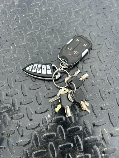
At the end of the day, a Jeep pulled into the staging area and left FOTR a set of keys that were found between “The Step” and “Hummer Bend”. Send me a comment if you know who they belong to and I’ll work to get them to the owner.
Great day on the trail. Positive attitudes. Capable rigs. Motivated people.
That’s how a volunteer day is supposed to work.
.
Rubicon Ronin

