
Open letter to Jeep/Chrysler
Posted: September 17, 2016 Filed under: Access, Maintenance, Travel | Tags: access, maintenance, Rubicon Leave a commentThis is an open letter to the Jeep/Chrysler Corporation regarding the recent running of the Rubicon Trail by the newest Trailhawk, the “Trail Rated” badge Jeep has been using for years and their lack of support to the Rubicon Trail and those who work so hard to keep it open and accessible year round for all types of users:
Chrysler Corporation
1000 Chrysler Drive
Auburn Hills, Michigan
48326
September 17, 2016
Hey Chrysler,
The story goes that Jeep drove two brand new, absolutely stock, Grand Cherokee Trailhawks through the world famous Rubicon Trail this past summer:
http://expeditionportal.com/jeep-grand-cherokee-trailhawk-edition-tackles-the-rubicon/
What an accomplishment! I only wish I had a Subaru Forester handy to follow you down the trail to show how easy your crew made the trail. As rumor has it, you had a bunch of professional Jeepers Jamboree ‘rock rollers’ ensuring that the Cherokee never had more than a four inch obstacle in its path.
Having been involved in Rubicon trail maintenance for more than 15 years, this year I noticed a change in the east end of the Rubicon Trail, specifically Cadillac Hill, after your Grand Cherokees drove the trail. In my 31 years of Jeep ownership and experience on Cadillac Hill, I’ve never experienced Cadillac Hill so easy.
Now, I understand that some rock stacking takes place during a trip through the Rubicon Trail. I even threw a few rocks for myself on the Fordyce Trail this summer during Sierra Trek. But when your crew literally throws the larger rocks off the trail and over the cliff that changes the trail for everyone forever as those rocks are never going to be replaced.
It’s sad enough that Jeep has used the Rubicon name for years and has never done anything to support the maintenance efforts on the Rubicon Trail. But the complete opposite has now happened; you came to the Rubicon Trail and literally paved it for an advertisement plug and walked away from any responsibility of not having followed the time honored and respected motto of Tread Lightly!
As far as I’m concerned, you have lost credibility in the OHV world with your vehicle, by your actions on the Rubicon Trail and your inactions in regards to maintaining the Rubicon Trail.
Would you like to see Jeep as an actual player in the OHV world? Would you like to see current OHV users talk positively of the Jeep/Chrysler Corporation? Would you like to start Jeep back on a path to the glory days that Bantam and Willys started? Yes? Good! Here’s some advice:
Work with the clubs, groups, organizations, individuals and agencies that have been working for decades to ensure year round access to the Rubicon Trail for all types of OHV users.
Build a model without the wood insets and automatic climate controls and with a solid front axle under it, even if it’s just a limited run of a special “Rubicon” edition with $1000 of each sale going to the maintenance and future preservation of the Rubicon Trail.
If you aren’t willing to make those changes, contract a ‘builder’ in the Reno or Sacramento area to build 500 Rubicon Editions by taking a stock Grand Cherokee and letting the builder modify the vehicle to really make it honestly “Trail Rated” with a solid front axle, lift kit, larger tires, etc. Detroit did a lot of this back in the 60’s and 70’s with muscle cars. Again, I would expect a donation with the sale of each vehicle to go to the Rubicon Trail.
Bottom line, it’s time Jeep steps up and does something to payback for what Jeep has benefitted from regarding the Rubicon Trail and those who built, drove and loved the Jeep product for decades.
Doug Barr
www.TheOtherRubicon.com
Currently owned Jeeps: ’85 CJ-7, ’84 CJ-7, ’47 CJ-2A
Previously owned Jeeps: ’87 Wrangler, ’52 Willys PU, ’83 CJ-5, ’89 Cherokee, ’98 Cherokee
V-Rock now U-Rock
Posted: August 29, 2016 Filed under: Access, Maintenance | Tags: Cadillac Hill, FOTR, maintenance, Placer, RTF, Rubicon Leave a commentSo, I made it down Cadillac Hill this past weekend and noticed that quite a bit of work has been done. Cadillac Hill was easier than I can ever remember.
As you all know, there are several ‘famous’ obstacles along the climb up Cadillac Hill. One of those is V-Rock. V-Rock is (was) a granite slope from above the trail down to the edge of the trail with a large boulder outcropping at the edge. The angle between the granite slope and edge of the boulder created a “V” that users needed to navigate.
So here are two before any work was done. Unfortunately, not all from the same angle. The granite slope on the right slopes up more than the photo implies.

Special nod to Randy for posting a picture of his rig the last time it was running. Note the deep “V” at his front right tire.

Some work was done over the last few years to get the condition below. The “V” still has loose rock so the depth can vary. Drive it as is if so equipped; fill in a bunch of rock if you’re lower or limping out broken.

But now, after a whole bunch of concrete and rock were placed in the “V”, the “V” is now a “U”. And it’s concrete so no chance for a difficult line.
![DSCN0558[1]](https://theotherrubicon.com/wp-content/uploads/2016/08/dscn05581.jpg?w=590)
I asked before on a public forum “Who Decides?” That thread was started about a rock on Cadillac that was drilled and split, without any formal permission. The answer was if it’s a safety issue, take care of it.
What would happen if an individual made the Soup Bowl ‘safe’?
Now there are rumors that even more rocks will be split, removed, dealt with, etc. on Cadillac Hill; during the dark of night with no formal permission or discussion. Does Placer know? FOTR? RTF? TNF?
There is a new bypass on Cadillac Hill in the ‘trees’ section. I can only assume the tight turn was too much for some drivers or some rigs so they went straight through the trees. This is an illegal users created bypass and will be blocked.
In both photos below, you can see a former bypass that was blocked on the right. In the first photo right through my rear view mirror. In the second photo far right and half way up.
Bypass straight ahead, original trail to the right:
![DSCN0513[1]](https://theotherrubicon.com/wp-content/uploads/2016/08/dscn05131.jpg?w=590)
Bypass left of the tree, original trail around to the right:
![DSCN0514[1]](https://theotherrubicon.com/wp-content/uploads/2016/08/dscn05141.jpg?w=590)
I thought people drove the Rubicon Trail for a challenge?
Traveling 03-04 early in the season
Posted: June 13, 2016 Filed under: Access, Maintenance | Tags: education, maintenance, Rubicon, TNF Leave a commentOn June 12th, at 7am, I headed out from the cabin in Carnelian Bay.
It’s not a long drive around the west side of the lake, only 15-20 minutes, but it was early and there was a chill. Trips like this are why I always have my old ski jacket with gloves and a hat in the Jeep.
Although I was looking forward to the drive time alone on the Rubicon and Forest Road 03-04, it was a work trip. As a volunteer with the Tahoe National Forest (TNF), I have agreed to place trail markers along the Rubicon and on the side trails in the area of Forest Road 03-04. That’s the road from the Rubicon, past Bear Lake that goes to Barker Pass at the top of Blackwood Canyon.
Today, I had a new mileage sign for the intersection of 03-04 and the Rubicon, a no outlet sign for 03-04 (did you read my last post?) and two 03 markers for Barker Pass Road where is meets 03-04.

Using a post hole digger in the Sierra Nevada mountains is not a straight forward process. I start one hole and got about 20″ down when I hit granite. I filled that one in and started another; only got ten inches down. Started a third; eight inches. I went back to the first hole and dug it out again. I figured I’d place a bunch o0f rock around the base to make up for the short hole. I was hoping to get them down at least 24 inches. That was the mileage sign.

I moved up 03-04 to start the “No Outlet 11/6 – 6/14”, the granite rock in the hole were smaller and the center of the hole kept shifting to get around the rocks. But the sign is up.

The day before, I had driven as far north as Bear Lake with the Tahoe Donner 4wdc. Today I would go further and by myself. Yes, I’m setting a bad example. But I had food, drink, shelter, fire starter stuff and a working ham radio.

Just north of Bear Lake, in a downhill section on a northern aspect, there was a sizable snowdrift. I went down it no problem but I knew I’d have trouble on the way out, even if I wasn’t pulling a trailer like I was that day.
I drained a few puddles along the way and had to cut two trees off the trail. The snow drifts were narrow and thus fun to pop over. There were a few longer ones that posed a small challenge but weren’t a problem.

The dirt at the intersection of 03-04 and 03 was very soft for digging but didn’t pack to well after placing the posts.
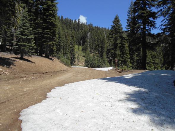
As predicted, on the way out, I had trouble in the large snow drift. Let the winching scenario begin. Of course I wanted to go straight up the trail, there are no trees right in the middle of the trail. So I winched a little to the right and then a little to the left and then once more to the right. But it worked.

The plan was to turn left on 03-04-12 and place some carsonite markers as well but there was a very large drift a short distance up that trail. Maybe in a week or two I’ll try again.
Snowgate!
Posted: March 30, 2016 Filed under: Access | Tags: access, Placer, Rubicon Leave a commentSo I have the honor of contradicting myself.
February 1st, I published a blog about the “snowgate” at the entrance to the Rubicon Trail on the Tahoe end of the trail. Since then, I heard a story, learned a few things and spoke with Placer and local snow removal contractors.
The story, second or third hand, told by someone who knew someone who heard something about a few guys snow wheeling on the Rubicon this winter:
Three rigs were working their way over the snowgate in order to access the Rubicon Trail for a day of legal, wheeled, motorized recreation.
A plow driver (not even sure it was a county plow) stopped and started giving the guys a bad time about driving over the snowgate. He claimed they were not allowed to drive there. That plow driver was not expressing himself in a professional manner. The guys replied in a similar unprofessional manner, expressing their belief that the trail was open year round.
The three rigs made it over the snowgate and wheeled out as far as the intersection of the Rubicon and the Richardson Lake Trail. Upon their return to the entrance of the Rubicon, the rigs encountered a sheer six foot cliff. It seems the plow driver had come back and created the cliff, knowing the rigs were still on the trail.
Thankfully, the drivers were driving responsibly and realized the cliff was there before driving off it. They broke down the edge of the cliff and exited the Rubicon safely.
I shared this story in an email to Supervisor Montgomery.
According to Placer County, their snowplow drivers are not dumping or piling snow at the entrance. But, according to the local snow removal private contractors, Placer County is dumping and piling snow at the entrance.
I met with Supervisor Montgomery after exchanging a few emails and she confirmed that no one is allowed to dump snow on a public right of way. And that Placer County would keep an eye out for anyone attempting to dump snow at the entrance to the Rubicon.
I contacted the Rubicon Trail Foundation and asked for their help in securing year round access, which is in their mission statement. They declined to get involved and wanted to see how it played out.
Unless things change, the piling of snow at the entrance is a thing of the past.
Please enjoy your wheeling responsibly. Pack-it-in. Pack-it-out. Tread Lightly! Turn Around, don’t go around. Stay on the trail.
OHV trail markers
Posted: December 21, 2015 Filed under: Maintenance, Travel | Tags: education, Rubicon, TNF Leave a commentOne of my goals for the 2015 summer OHV season was to start marking every side trail along the Rubicon Trail and Forest Road 03-04 within the Tahoe National Forest (TNF). The US Forest Service (USFS) uses carsonite markers for most of these types of markers. These are the brown, three four foot long and four inch wide, fiberglass stakes.
Below is the marker for the Long Lake Trail that I didn’t get around to installing:

Having a USFS Motor Vehicle Use Map (MVUM) in hand while drive through our forests is great, it doesn’t help much if the intersections are not marked as to which trail is which. On the east end of the Rubicon Trail, you need three MVUMs to navigate the area: Tahoe National Forest (TNF), Lake Tahoe Basin Management Unit (LTBMU) and the Eldorado National Forest (ENF).
My flier combines the essential trails near the Rubicon Trail. See flier here
Working closely with Susanne Jensen of the TNF, we were able to put up thirteen markers along the Rubicon and Forest Road 03-04.


Next summer, we plan on completing the installation of trail markers on the TNF. I hope to work with the LTBMU and the ENF to ensure all trails in the area are properly marked.

