
Snow on the ‘Con
Posted: November 22, 2016 Filed under: Travel | Tags: Rubicon, TNF Leave a commentA funny thing happened on the way to the forum, I mean Hi-Lo’s meeting…
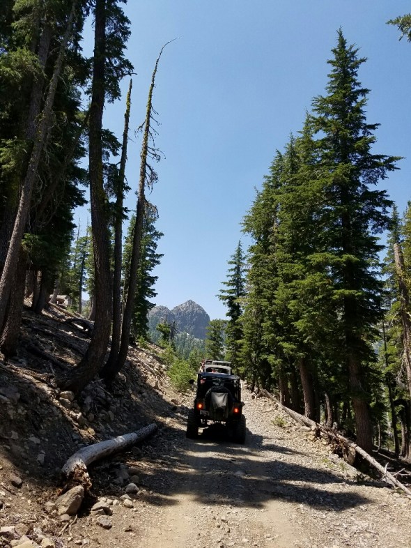
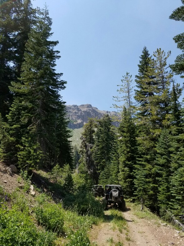
I took a short trip up to the Rubicon staging area just to see what was up. I got there and there wasn’t as much snow as I thought there would be. So I headed up the trail.

It was a beautiful drive. Still a little bumpy at lower elevations but it smoothed out as the snow got deeper.
Miller Meadow was partially frozen over.

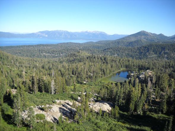
Miller Lake hadn’t started to freeze yet.

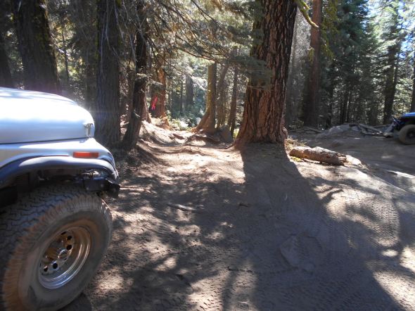
I turned around at the wide intersection of Ellis Peak and the Rubicon. There were tracks further up the trail but I had a meeting to go to. On the trip out, I could see that my diff was dragging on the snow. I am running 33″ tires on the Colorado.

As always with winter travel, be prepared for anything. Here is one example. Not only is there a snag over the tail that will come in to play with more snow, but there is a tree down on the edge of the trail that will soon be covered with snow. If someone were to drive over it, they would puncture their tire.
My advice, stay in the middle of the trail.

This snag will surely fall over the winter. Always carry a saw in case it falls after you’ve passed and need to remove it to get out.

Remember the side trails within the Lake Tahoe Basin Management Unit are already closed. That means the Buck Lake Trail, Middle Fork Trail and the Noonchecter Mine Trail. Not all have gates, and not all gates are closed, even if they should be. It is the users responsibility to know where they are and if the trails are open.
The Richardson Lake Trail is open until January 1st, as is Ellis Peak Trail and other in the Tahoe National Forest.
Always be prepared to spend the night: heat source, shelter, sleeping bag, food, water, etc.
Rubicon Ronin
Cadillac Hill bypass blocked
Posted: September 20, 2016 Filed under: Access, Maintenance, Travel | Tags: access, education, law enforcement, maintenance, Placer, Rubicon, TNF Leave a commentAuthor’s note: I was going to hold off on this just to space out my posts but a conversation online just now made me decide to post it. For the record, I don’t alter the trail. I repair the trail. My work is pre-approved by the Tahoe National Forest or involves getting water off or across the trail in order to minimize erosion. (Also pre-approved; generally not specifically.)
Unfortunately, there are those out there that alter the trail for their own personal gain, either making the trail easier or making the trail harder. Some are trying to do good work but skip too many steps and the work doesn’t last and sometimes hurts.
In order for keep our trails open, safe and maintained properly, we must all speak up when our opinions are being asked. We should volunteer when we can. Comment on grants, attend your local FS meetings, join organizations that fight for your ‘pursuit of happiness’! Rant Off.
A new illegal bypass has appeared on Cadillac Hill this summer. I don’t know when it appeared or who started it but it’s not the first of it’s kind. Not twenty yards from this one was a previous attempt to bypass the trail around a difficult section.
You can see the ‘new’ bypass looking straight in to the photo. The top of the old bypass is in front of the bumper of the Jeep on the right side of the photo.
I get that people are tired and sometimes broken when they are driving out, but that doesn’t mean you are allowed to make an easier route. Please stay on the trail.
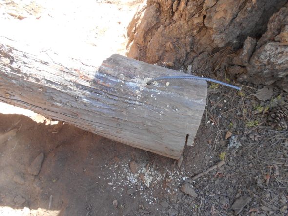
The bypass was blocked by moving a rather large log to block the route.

Both ends of the log were drilled and rebar was placed to prevent the removal of the log. I know this will not prevent those who really want to remove it from removing it but they will have to work at it and they will know they are doing something wrong.

Signs were placed on both sides of the log to let people know that this is the will of the forest service, not an individual.
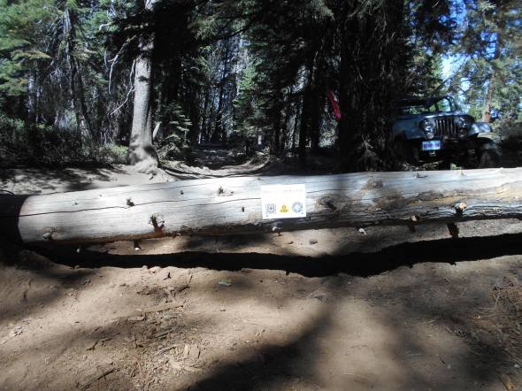
Not wanting to hide from the work I perform under the guidance of the forest service, I put the logo of this website on the sign along with the USFS logo and the CA State Parks logo because they mange and fund respectively a large portion of the maintenance of our OHV trails.
We are our own worst enemy sometimes. Driving off trail and creating new route just gives the anti-OHV people more ammunition to use against us and to close our trails.
We need to work together. There are those who illegally modify the trail to make it harder and there are those who illegally drive off trail to find an easier route. We need to find a middle ground.
If you would like to discuss this issue further, please email me TheOtherRubicon@Charter.net.
Rubicon Ronin
Long Lake campsite
Posted: September 7, 2016 Filed under: Access, Maintenance | Tags: access, education, Hi-Lo's, Long Lake Trail, maintenance, TNF Leave a commentThe Lake Tahoe Hi-Lo’s have adopted the Long Lake Trail (16E12) since it was officially recognized by the USFS in 2014. Since 2011, we have been working with the USFS by bringing FS personnel out there and doing trail maintenance to the point they would accept it, including removing an outhouse and hardening a seasonal creek crossing.
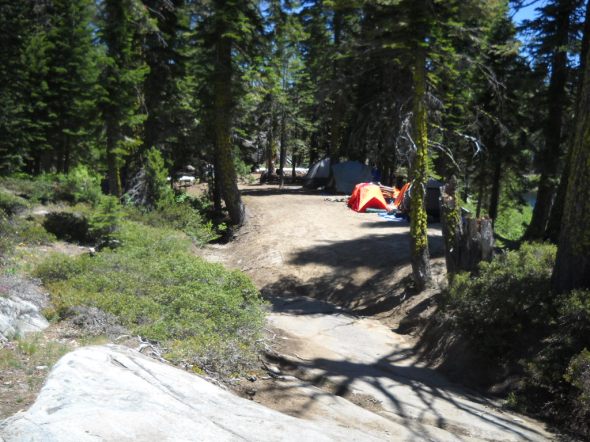
There is a campsite off the trail about halfway down the trail. It is a sharp U-turn to the left and brings you right down along the Rubicon River. This campsite is great for larger groups and offers a quiet change of pace from Rubicon Springs.
Here is the hard left U-turn:
Looking down the campsite, the Rubicon River on the right:
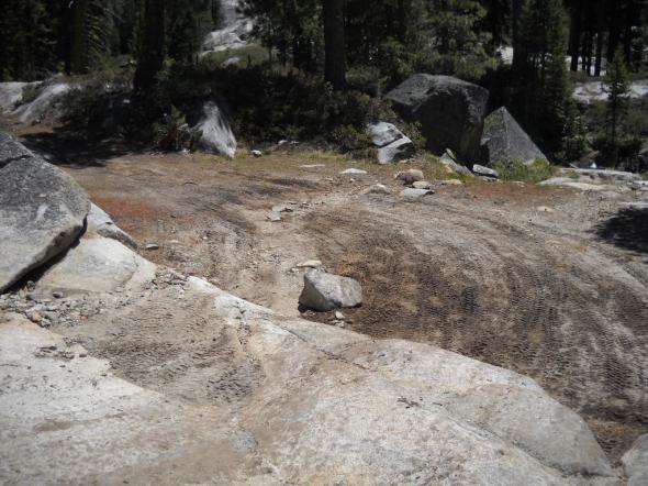
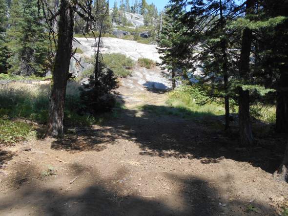
Unfortunately, some people have tried to make this a drive through site by driving off trail, down a granite slab and through a marsh (in spring time). The Forest Service will not allow this ‘through route’.
This was one of three turns off the Long Lake Trail in to the back of the campsite:

This is the ‘backdoor’ in the campsite that in the spring time is a wet muddy marsh:
The Hi-Lo’s have now blocked the ‘through route’ several times. This time we added 4×4 posts with signage explaining the campsite boundary and the possible consequences if the off trail driving continues.
There is now no mistaking this as a possible route to the campsite:

Within the campsite, we added some educational materials to the 4×4 posts:

Having the campsite as a one way in/out is much nicer than a through route. I wouldn’t want anyone driving through my camp at 1am trying to figure out where the actual trail runs.
Also, please note that the trail is only 0.91 miles long. It ends before a 90 degree right turn, an extremely steep climb up a granite slab and another 90 degree left turn; which leads to a boulders strewn seasonal waterfall.
Driving past the recognized end of the trail could result in fines.

Although I do not promote or support driving off trail, the Long Lake Trail is not well defined past the campsite. There are easy routes and extreme routes to get to the end of the trail.
When driving the Long Lake Trail at night, please be extremely cautious. There are steep drops all along the trail. It’s best to have someone walk the trail in front of your rig in order to prevent accidents.
Link to a Photo Journal of the Long Lake Trail.
All I ask is that you always Tread Lightly!
- Don’t drive over bushes
- Don’t leave oil spills on the granite
- Use a WAG bag when camping on granite slabs
- Don’t spin your tires so much you leave marks on the granite
- Leave a clean camp
- Make sure your fire is out cold (Have fires only when restrictions lifted)
- Keep the music down after 10pm
- Pack-it-in, pack-it-out
- Respect other campers
This trail has something for everyone. As long as we respect the trail and each other, we will all be able to enjoy it.
Rubicon Ronin
Pole Creek / Cabin Creek Trails
Posted: August 3, 2016 Filed under: Access, Maintenance, Travel | Tags: TNF Leave a commentOkay, so this is not really a Rubicon Area trail but it’s in the neighborhood, sort-of. The trail runs from near Truckee along highway 89 south of highway 80 to below Squaw Valley.
It has a very narrow window of opportunity due to private property and the mating season of some animal I can’t remember. But, on Monday August 1st, the Pole Creek / Cabin Creek Trail officially opened.
The previous Saturday, the Tahoe Donner Four Wheelers did a trail maintenance run. 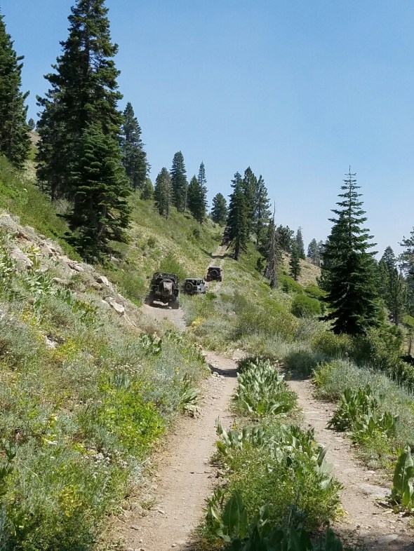
The trail is not difficult but full width vehicles or really long wheelbases are not recommended. The trail is narrow and has two very tight switchbacks near the north end.
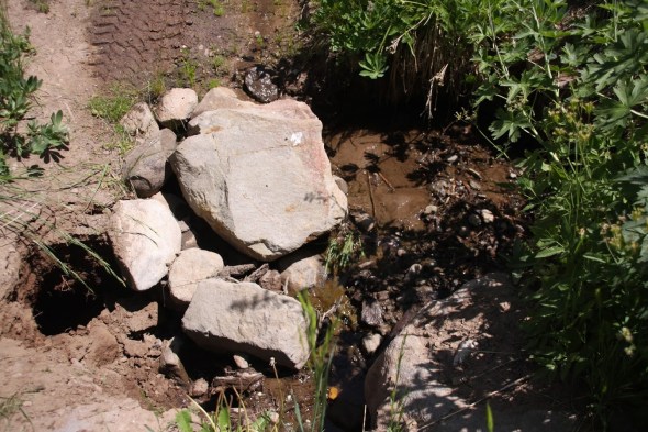
I didn’t take pictures but the club trimmed back quite a bit of brush and at one water crossing filled a growing hole with rock from the area. Before and after:

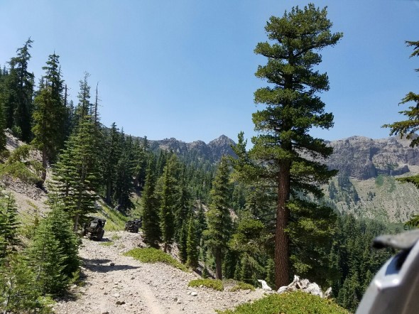
Did I mention the views were awesome:
And these aren’t the tight switchbacks.


Not a great picture of the back side of Squaw but this is where they do the cliff jumping for the Warren Miller ski films. You really get a good idea of how those jumps work with the tremendous run out after the fall.
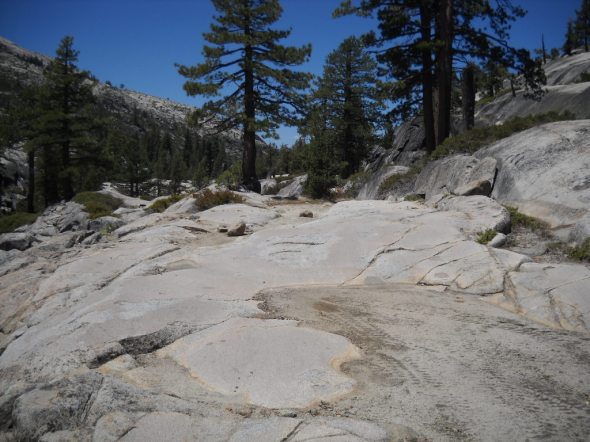
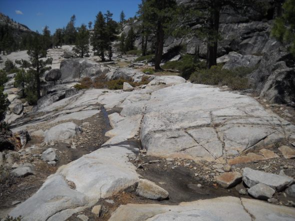
Cool formations where we stopped for lunch near the north end.
Behind me there is a trailhead that leads up to Tinkers Knob. It an hour to an hour and a half round trip.

At the end of 16E84, at the north gate, we moved a bunch of logs to block a few illegal routes going around the gate. We’ll be back to harden those barriers before winter.
So, getting there can be a little tricky. Pick up the latest MVUM. Here’s a link for now: TNF South MVUM.
We ran it south to north. Catch forest road 08-01 off highway 89. There is a sign board there and the road starts off paved. This road takes you up to a cabin and bathroom which I missed the name of.
Further up the trail, you will make a left turn on to forest road 08. That is the south gate we had to unlock for the season. The trail you’re really looking for is 16E84.
As I said, the trail is not difficult but it is narrow and there are a few off camber sections. Water does cross the trail in several places. The Tahoe Donner Four Wheelers are working to harden these crossings.
When you reach the other gate, be mindful of the views off to the north west. You can see highway 80 in the distance near Donner Lake.
Getting back to pavement gets a little tricky. The intersections are not yet well marked but you’re looking for 01-06 and then 01 to get you back to Cabin Creek Road. That’s the road to the dump.
Along the way there are several old cabins from hunters or shepherds of days go by. There will be a series of rock walls in the trees to your right that I have no idea why they were built.
You can travel further north before dropping down to 89 by taking 01-03 down to 89.
Carry a map. In our group, some of the GPS units had the trails programmed, so that’s also an option.
Here’s a link to a set of photos taken by Bill Ratcliff the day of our maintenance run: Google Photo Link
“Turn Around, Don’t Go Around”
Ellis Lake Trail
Posted: July 31, 2016 Filed under: Access, Travel | Tags: access, camping, TNF Leave a commentSo, it officially starts as the Ellis Peak Trail (03-04012-05), that’s the right turn past Miller Lake, the range fence and just after the “pond”. There is one dead-end trail that is not marked and not yet blocked, stay left. When you get to a four-way intersection, that should be better marked by Aug 5th, go straight (16E18) don’t turn right.
This route will take you to Ellis Lake.
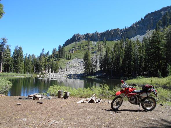
I was there mid-July and there was still a snow drift or two.

This is a perfect camp for someone who wants to sleep in. The towering ridge to the east, that includes Ellis Peak, shelters you from the morning sun.

I have no idea if there are fish but it would be a great float late in the afternoon. I’ve heard there might be a bug issue in the area too early in the season.

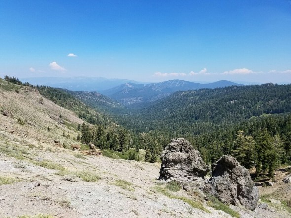
A very short walk provides a view of Blackwood Canyon.
West towards Barker Pass:

Further east towards the entrance of the canyon at the Kaspian Camp ground:

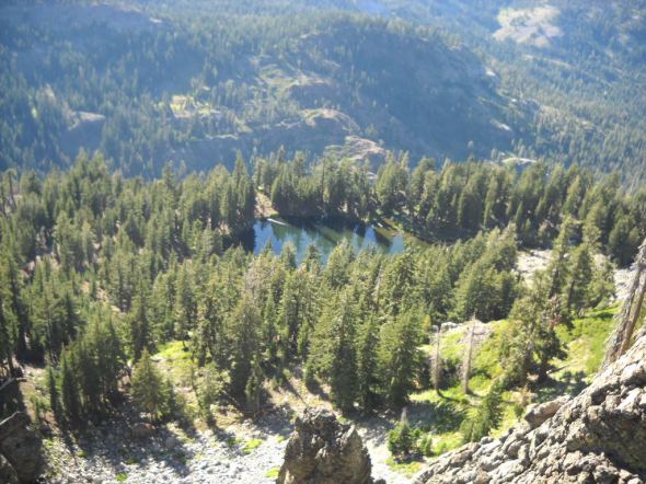
Here’s a view of Ellis Lake from Ellis Peak. Note the severe drop off on what would be the north west corner of the lake.
And a view of Buck Lake and the south end of Lake Tahoe from Ellis Peak.
If you or your club, group business or whatever would like to “Adopt” this trail and campsite, please let me know.
This is just one of many examples of what is out there in the Rubicon Trail area. Get out there and find enjoy it all.
“Turn Around, Don’t Go Around”

