
Money, Money, Money
Posted: February 13, 2015 Filed under: Access, Maintenance | Tags: grant, OHV State Parks, Placer, TNF Leave a comment
Okay, actually, “Grant, Grant, Grant”, literally, a Tahoe National Forest OHV grant.
Yesterday, the Tahoe National Forest (TNF) held an open house in Nevada City to get input from the users regarding the upcoming OHV grant cycle. My apologies for not posting about this meeting BEFORE the meeting, moving forward, I will make every effort to inform you of upcoming important meetings. The good news is that you still have time to comment on how you would like to see the 2015 grant money spent. (Details at the bottom of this post)
The TNF was very open and welcoming to the users and listened to every comment and suggestion. There were specific tables set-up for each district. Maps were plentiful.
Unfortunately, Placer County has decided NOT to pursue a grant during this cycle. This will be the second straight cycle they have decided not to apply for a group. Last year, Placer County had contractors working on the Rubicon using OHV grant funding. Not all of the identified work was completed and some of the work done was done incorrectly or in the wrong place.
The Tahoe National Forest has been made aware of this and is willing to step up and work some of the areas needing immediate attention.
My focus is the Rubicon Trail and the surrounding OHV trails. My letter to the TNF is posted below. Please remember that the TNF also has to maintain the Fordyce Trail and the trails around Boca and Stampede Reservoirs.
The grant outlines are due in early March. They will be made available to the public to review March 3rd -Apr 6th at http://ohv.parks.ca.gov/
Joe Chavez
JoeTChavez@fs.fed.us
TNF Trails Specialist
February 13, 2015
Joe,
Yesterday afternoon, I attended the TNF open house on OHV grant funding. I want to thank the forest for continuing to be open to and welcoming of ideas from the users. Everyone there was happy to address the concerns brought to their attention.
That being said, here are the suggestions I have for the upcoming grant cycle:
1) Continue to fund the positions held by Jeff Wiley and Susanne Jensen. Without these dedicated and professional individuals, the state of OHV within the TNF would be much worse off.
2) Unfortunately, Placer County has decided not to pursue OHV grant funding at this time. I would like to ask the TNF to survey the work done on and near the Rubicon Trail in order to identify possible immediate needs due to the work, some incomplete, done last summer by Placer County’s contractor, specifically, restoring natural seasonal creek crossings across the Rubicon Trail.
3) Another need that I know has been on your list for a few years, is the needed maintenance on Forest Road 03-04, commonly known as Barker Pass Road. Although I’m told it’s not an ‘OHV trail’, but as a ‘road’ it provides access to OHV trails and a quicker route for the delivery of materials needed to perform maintenance to the areas OHV trails.
As a professional firefighter, I’d like to see the road improved so that fire protection and other emergency personnel can access the area in safe and timely manner, improving the ability to protect and serve the OHV trails and users in the area.
4) The last issue I’d like to bring up is signage in the area of the Rubicon Trail and Forest Road 03-04. Along the Rubicon, side trails like the Richardson Lake Trail (mostly, but not completely in the ENF), Ellis Peak Trail, Barker Meadow OHV Trail and the Long Lake Trail could use specific USFS ‘carsonites’ with FS trail numbering, two of the four have proper signage but not FS numbering.
FYI, the Richardson Lake Trail is being adopted, through the ENF, by a Carson City businessman and his company. It would be great if the TNF allowed him to post a sign at the start of the Richardson Lake Trail, on the TNF, in order to better educate the users of that trail and other trails in the area. (I’ll get in touch with Susanne Jensen with this request once she returns to her seasonal position in April.)
The intersection of Forest Road 03-04 and the Rubicon Trail needs the sign replaced. I think it finally has disappeared altogether after many years of being pushed over and or thrown in to the forest. The sign provided directions and distances to Blackwood Canyon and the Tahoma staging area.
Along Forest Road 03-04 and just after the Rubicon Trail, a “No Outlet – Nov 1st thru May 31st” sign is needed. As more and more users recreate on the Rubicon Trail in the winter, I think it’s only a matter of time that a winter user tries to ‘exit’ the area using Forest Road 03-04, only to find not one but three gates before getting to Highway 89. The 03-04 road itself needs FS numbering as well, as it’s not really clear to a new user which way the Rubicon turns.
Further along Forest Road 03-04 there are many, many side trails. Although lower on my personal wish list, these side trails should be numbered to better let users know where they are as they drive 03-04 or if they are looking for a specific side trail.
Again, I would like to thank the TNF for the opportunity to voice my opinion regarding the upcoming OHV grant cycle. I look forward to another successful OHV season working with the TNF.
Doug Barr
www.TheOtherRubicon.com
Lake Tahoe Hi-Lo’s
North Tahoe Trail Dusters
Comments are being accepted through February 23, 2015.
Please send your thought to Joe Chavez. JoeTChavez@fs.fed.us
LTBMU, ENF & TNF lift fire restrictions
Posted: October 4, 2014 Filed under: Access | Tags: ENF, fire, LTBMU, TNF Leave a comment
The last of the trio of Rubicon forests has lifted fire restrictions. The ENF lifted restrictions as of 10-8-14.
http://www.fs.usda.gov/detail/eldorado/news-events/?cid=STELPRD3819658
Starting 9-30-14, the Tahoe National Forest has lifted fire restrictions for the season.
http://www.fs.usda.gov/detail/tahoe/news-events/?cid=STELPRD3818599
Starting 10-3-14, the Lake Tahoe Basin Management Unit has lifted fire restrictions for the season.
http://www.fs.usda.gov/detail/ltbmu/news-events/?cid=STELPRD3818996
Although I feel this is too early, fires are now allowed with the proper fire permit. Please take the time to make sure the fire is completely out. This means OUT, not just no flames. The fire pit should be cold enough to run your hands through the coals. I usually pour two five gallon buckets of water on the coals and stir as I go.
Several unattended fires have been reported over the past summer along the Rubicon. Luckily, none of them turn in to major wild fires. The only major fire was arson. We did have a few lighting started fires. The one instance I heard of where a camp fire became a wild fire was in Desolation Wilderness, and you know that wasn’t the fault of a wheeler.
Please be safe and help protect our forests.
100mph Meadow
Posted: August 5, 2014 Filed under: Travel | Tags: history, TNF Leave a commentLong before I started running the Rubicon (I first drove the Tahoe side in 1985) there were a few special spots along the Tahoe side that no longer exist today. In 1984 a tremendous amount of work was done by the FS and volunteers. Mud holes were filled in (bottom dollar hole), a bridge was built over McKinney Creek (eliminating the “Car Wash”), gabions were installed (users added a “pet rock prison” sign), etc. I’m not sure when the reroute happened but “100mph Meadow” went away.
100mph Meadow cut the corner of the intersection of the Rubicon and Barker Pass Road (Forest Road 03). The story goes, that after crawling up Cadillac at one mile per hour, the Jeeps would reach the ‘meadow’, switch in to high range and open up the throttle. The meadow floor was of such a consistency that it did not develop bumps and you could really clean out the carburetors.
Here is where the trail broke out of the forest and headed across the meadow. With the current S&G100 issues, I’ve learn a little about meadows. They have a built in way to ward off other plant/tree species. So when the Jeeps stopped driving on the trail the trees moved in. They didn’t move in to the meadow, which can protect itself, they moved on to the Jeep trail that had nothing living on it, it was dirt. So, the trees grew ON the trail from seeds probably left by Jeeps.
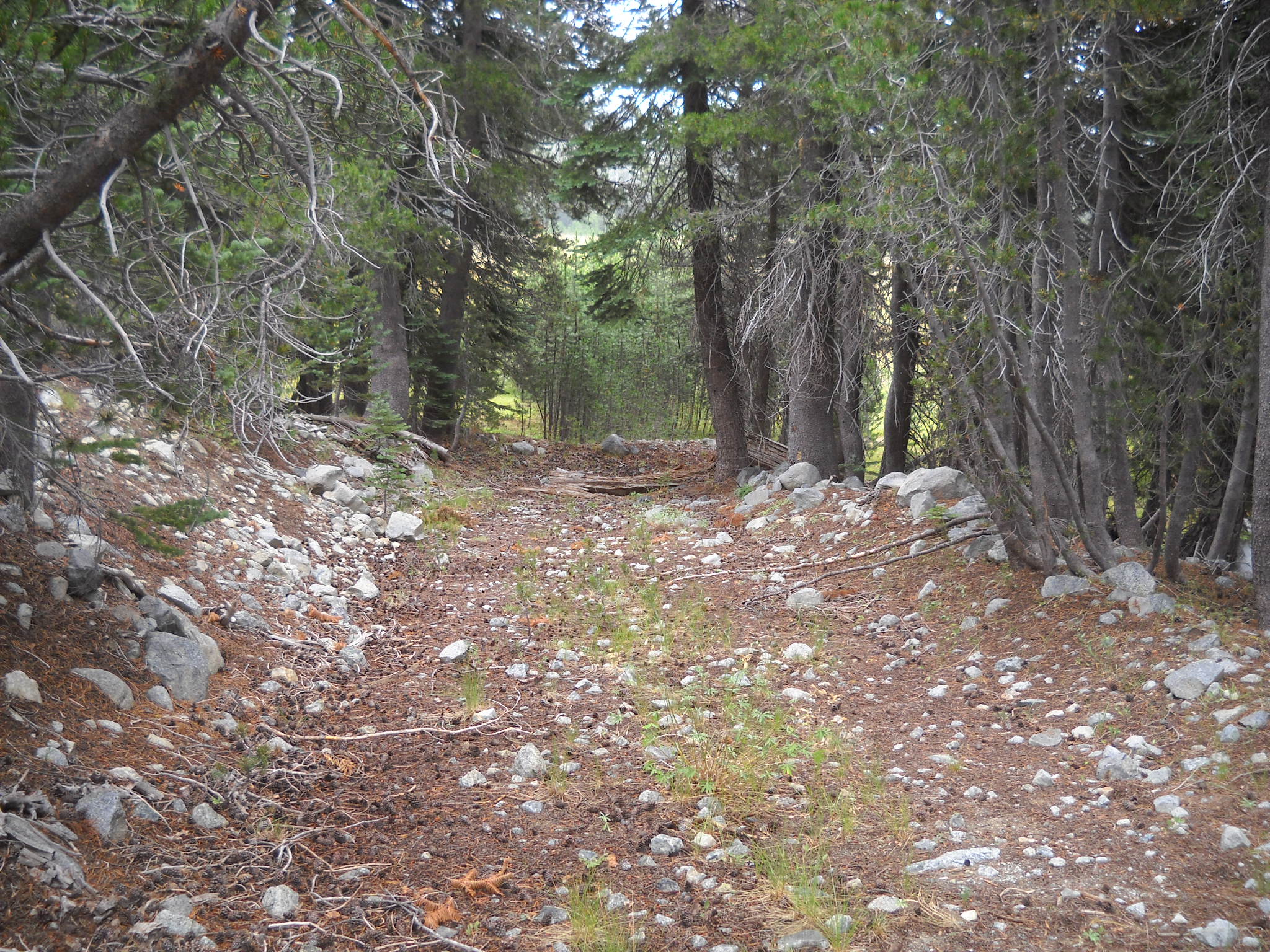
Here is a shot looking across the meadow and then south to Sourdough Hill:


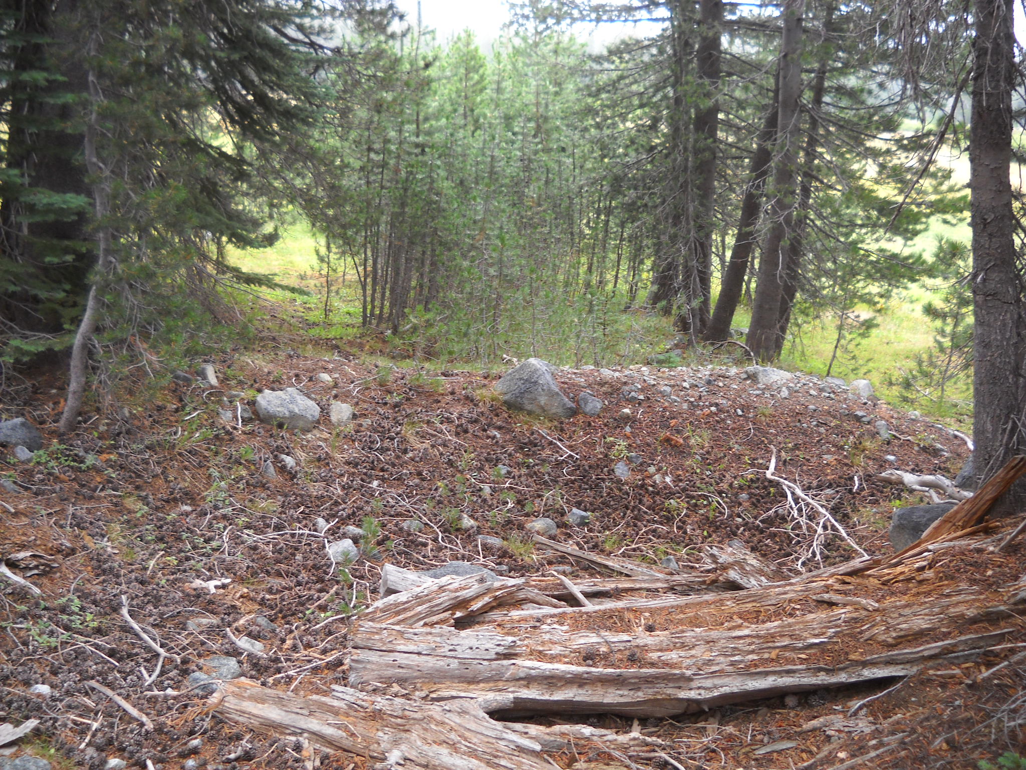
The second half of the meadow and evidence that I was on the trail, an old Jeep rim.


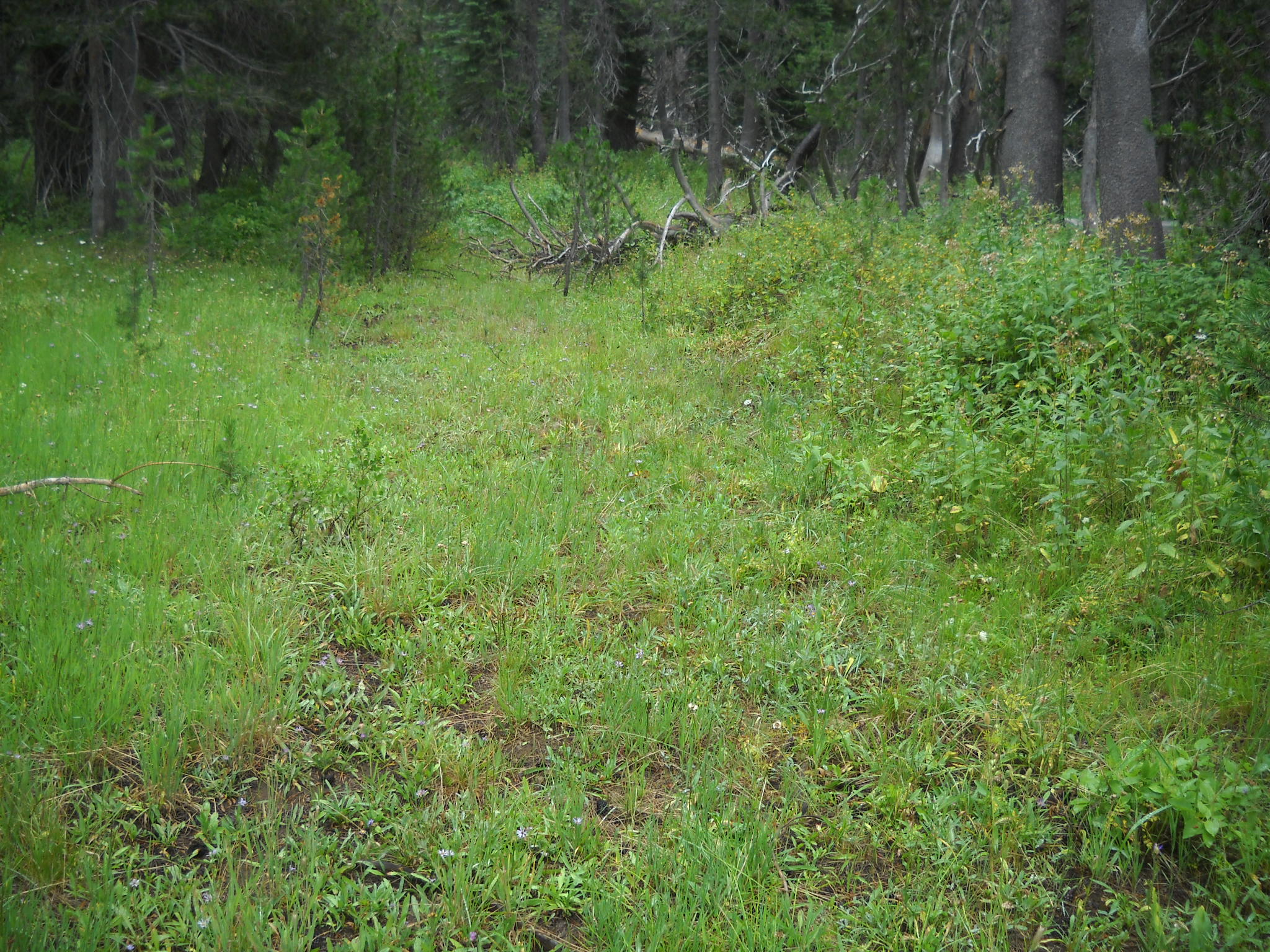
Trees growing ON the trail on the east end of the meadow and the trail disappearing in to the forest.

It was cool to get out and walk around and check things out. I found another old logging road that would be cool to reopen but don’t hold your breath.
Tahoe NF Motor Vehicle Use Map Released!
Posted: May 26, 2014 Filed under: Access, Travel | Tags: Rubicon, TNF Leave a commentThe Tahoe National Forest (TNF) finally released the latest Motor Vehicle Use Map (MVUM). The forest had been without one for years. It had released and then retracted one previously.
There are ten maps for the four different districts within the Tahoe National Forest. The Rubicon Trail is documented on the Truckee District -south map. Hard copies of these maps are available for free at any of the TNF offices.
The Rubicon is listed as 16N75. Although the Rubicon is listed on and has been given a Forest Service (FS) number, it is still a county right of way. The FS gave it a number as the trail needed to be listed to have the rest of the area trails make sense.
New in this version of the MVUM, Observation Point (16E78) is officially recognized by the FS as being a 163 foot long ‘trail’. Previously undocumented, the turn out has always been allowed by the FS.
Also new are four camp sites:
3013-026 is an elevated area from the Rubicon before the old water hole. The FS documented this ‘road’ as 64 feet long.
3013-24 is at the east end of Miller Lake just past the old water hole. The FS documented this ‘road’ as 29 feet long.
3013-22 is at the west end of Miller Lake and is truly lake front. The FS documented this ‘road’ as 62 feet. It’s more of a turn out.
16E77 is just east of Observation. It’s know as Bear Camp and in the early spring is under six inches of water. It’s 50 feet long or deep, depending on how the FS measured it. It is documented as a ‘trail’.
And for the first new OHV trail in a long time on the TNF, the Long Lake Trail, previously known as TKS-11, is now officially 16E12.
I want to thank the TNF for getting this out to the public. It took a lot of hard work to get this right. The last map was actually printed but because there were so many flaws the forest decided not to release it and to make the needed corrections. It’s worth the wait.
Now get out there and try a trail you’ve never been on before!
Extreme Fire Danger – what it means to the Rubicon and OHV
Posted: May 3, 2014 Filed under: Access | Tags: ENF, LTBMU, Rubicon, TNF Leave a commentThe winter of 2013/14 was a dud. The governor of California declared a drought for California in January. Mid-summer fire conditions existed in January and continue to get worse. The fire danger on the Rubicon and other trails this coming season will be extreme and fire restrictions will come very early. Unless we get a huge late snowfall, it could be a short wheeling season.
In 2007, the Tahoe National Forest (TNF) declared extreme fire danger and with a July 2nd forest order closed the entire forest to internal combustion engines. That closure included chainsaws, motorcycles and jeeps. This closure rekindled my interest in building an electric Jeep, but that’s a topic for another article.
Due to continued hot, dry, and windy weather, fire restrictions in the Tahoe National Forest (TNF) will be increased beginning Monday, July 2, 2007…the restrictions will affect several activities:
* Fireworks – Absolutely no fireworks are permitted in the National Forest.
* Campfires – Only permitted in those campgrounds that have water systems, metal campfire rings, fire engine accessibility and regular patrols by campground hosts. Visitors can contact any TNF office for a list of campgrounds where campfires are permitted.
* Portable Stoves and Lanterns – Permitted in all campgrounds and the backcountry with a valid campfire permit.
* Woodcutting – Check the woodcutting hotlines each day to determine if chainsaws are
* Off-Highway Vehicle Use – Only permitted on designated roads; the Prosser Pit area near Truckee; and the Sugar Pine OHV area north of Foresthill. (Not permitted on trails other than the areas mentioned.)
* Smoking – Limited to vehicles, buildings, and in a 3-foot cleared area.
* Contract/Permittee Operations – Any operation or permittee that uses internal combustion engines or fire, must have an approved fire plan.
Thankfully, in 2006, the Placer County Board of Supervisors voted to recognize the Rubicon Trail as a “public trail”. That vote transferred control of the Rubicon Trail from the forest service to Placer County. Both forests involved were okay with Placer County claiming the Rubicon Trail as a public trail and thus controlling management of the trail.
WHEREAS the “McKinney Rubicon Trail” is a world renowned off-highway vehicle trail
that is partially located on federal lands within Placer County; and
WHEREAS the Trail has been in public use for at least 150 years; and
WHEREAS the Trail provides valued recreational asset for the citizens of Placer
because of the technically advanced driving conditions that exist in the open space
environment for off-road vehicle enthusiasts; and
WHEREAS the County desires that the Trail continue to be available for public use into
the future;
BE IT HEREBY RESOLVED by the Board of Supervisors of the County of Placer, State
of California, that this Board recognizes the “McKinney Rubicon Trail” as a public trail;
AND HEREBY states its intent to use all reasonable measures available to it to ensure
continued public access.
If Placer County had not voted in favor of the “public trail”, the Rubicon would have been closed in 2007 to vehicular traffic, including both Jeepers Jamborees.
A similar order in 2014, by any one of the three forests along the Rubicon, could close some of the side trails off the Rubicon. So, if you have any intention of wheeling any of these routes, do it early. Fire restrictions are progressive, they start with banning camp fires, then move to ban any open flames (including cigarettes) and progress until they ban all internal combustion engines.
Components of Stages
There are two fire restriction stages: Stage I and Stage II. There is one closure stage: Stage III. To reduce confusion and standardize the restrictions, the following conditions, by stage, should be used in all restriction documents. Additional elements may be added as conditions dictate.
Stage I
The following acts are prohibited:
- Building, maintaining, attending, or using a fire or campfire except within a developed recreation site, or improved site. 36 CFR 261.52(a).
- Smoking, except within an enclosed vehicle or building, a developed recreation site or while stopped in an area at least three feet in diameter that is barren or cleared of all flammable materials. 36 CFR 261.52(d).
- Operating or using any internal or external combustion engine without a spark-arresting device properly installed, maintained, and in effective working order meeting either the USDA Forest Service Standard 5100-1a (as amended), or appropriate Society of Automotive Engineers (SAE) recommended practice J335(b) and J350(a) (36 CFR 261.52(j)).
Stage II
The following acts are prohibited, in addition to the prohibitions of Stage I:
- Building, maintaining, attending, or using a fire or campfire. 36 CFR 261.52(a)
- Smoking, except within an enclosed vehicle or building. 36 CFR 261.52(c)
- Possessing, discharging, or using any kind of firework or other pyrotechnic device.
36 CFR 261.52(f)
- Using an explosive. 36 CFR 261.52(b)
- Operating a chainsaw or other equipment powered by an internal combustion engine between 1:00 p.m. to 1:00 a.m. 36 CFR 261.52(h).
- Operating or using any internal or external combustion engine without a spark arresting device properly installed, maintained and in effective working order meeting
either:
- USDA Forest Service Standard 5100-1a (as amended); or
- Appropriate Society of Automotive Engineers (SAE) recommended practice
J335 (b) and J350 (a). 36 CFR § 261.52(j) and 43 CFR § 9212.1(h);
- Welding, or operating an acetylene or other torch with open flame. 36 CFR 261.52(i)
- Possess or use a motor vehicle off: Forest System Roads (36 CFR 261.56) Except when parking in an area devoid of vegetation within 10 feet of the roadway; and except for parking overnight in developed campgrounds and at trailheads.
Stage III
The area is closed to all entry (36 CFR 261.52(e)) other than as follows:
- Persons with a written fire entry and activity permit that specifically authorizes the otherwise prohibited act. This may include such persons as grazing-permit holders when entry is needed to gather, move, or otherwise manage their permitted livestock, special-use authorization holders when access is needed to maintain emergency or other communications operations, and others.
- Any federal, state, or local officer, or member of an organized rescue or firefighting force in the performance of an official duty.
- Resident owners and lessees of land within the closed area.
Dates for fire restrictions being put in place on the TNF over the last decade or so range from June 1st to August 18th and in in 2011 I don’t think they EVER had fire restrictions due to the huge and late winter. Dates for lifting the ban on camp fires range from September 1st to October 23rd.
So, get out early this season. Make sure you rig is good to go now so you can take advantage of the early opening dates of the trails in the Sierras. Don’t wait for the waters and air temperatures to warm up because by the time things warm up, they might be closed.
Bring extra layers to wear instead of starting a camp fire every night even if they are still allowed. Eat sandwiches instead of steaks and cereal instead of bacon and eggs. Or have a contest with your buddies to see who can build the better solar cooker for your next camp out.

