
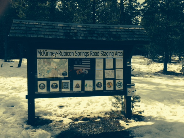
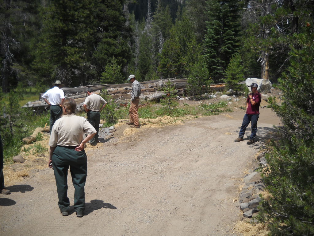
Sign updated at staging area
Posted: January 29, 2015 Filed under: Access, Maintenance, Travel | Tags: education, El Dorado County, FOTR, Placer, RTF, Rubicon Leave a commentAs was the subject of the last “Photo of the month”, the sign at the McKinney-Rubicon Springs Road has been in the need of attention for some time.
Recently, some new material was installed along with a new piece of backing plywood and a new plexi-glass cover. Additionally, the broken map box was replaced and stocked with both the RTF Rubicon Trail map and the new Rubicon Area OHV Trails map and flier. The map was covered in my last post.
Here is the new signage in all it’s glory:
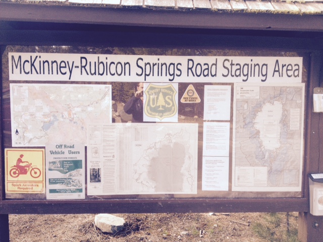
The RTF map is on the left.
The agencies involved with the trail are represented across the bottom: Placer County, El Dorado County, US Forest Service, CA State Parks OHV, Friends of the Rubicon, Rubicon Trail Foundation, CA Association of Four Wheel Drive Clubs, and the Blue Ribbon Coalition.
Towards the right is some educational information including ham radio frequencies, contact information for the agencies involved, how to volunteer, driving cautions and a copy of the new tri-MVUM map.
A close up of the new map box now housing the RTF Rubicon Trail map and the new tri-MVUM of Rubicon Area OHV trails:

This was a private effort. Hopefully, in the future, the agencies listed on the sign will get together with the users to decide what more signage and information is needed at the staging area and along the trail.
UPDATE 2-20-15:
The LTBMU visited the staging area and decided that the sign needed a few changes. Here is a photo of the current sign. I’m working on getting FOTR to join the party and hopefully, together, we can all get the information on the sign to reflect what the users need to travel safely and enjoy the area.
They added a full Motor Vehicle Use Map for North Tahoe and a snowmobile riding area map.
New Tri-MVUM map for Rubicon area
Posted: January 27, 2015 Filed under: Access, Travel | Tags: El Dorado County, Placer, Rubicon Leave a commentIt’s only a first draft but here is a new map of the Rubicon Trail area:

This map combines the three Motor Vehicle Use Maps (MVUM) from the Tahoe National Forest (TNF), the Eldorado National Forest (ENF) and the Lake Tahoe Basin Management Unit (LTBMU). This issue only comes up on the Placer side as the ENF MVUM map covers the entire Rubicon on the El Dorado side.
This map will provide the users with a guide to side trails in the area from Blackwood Canyon to Sourdough Hill. This map is provided for reference only. It is not intended to be used to navigate. Most of the trails listed on this map are seasonal use only, for wheeled motorized vehicles. It is the users responsibility to know when the trails are open for use.
The backside of this map has user information including trail names to go with the FS trail numbers, ham radio frequencies and contact information for Rubicon agencies:
As I said, first draft. This version started as a scan of the three MVUMs. Not a great quality to start with. As I’m new to Photoshop, the resolution was not set to the optimum setting. I’m already working on a new map, from the online FS maps, that should be of good enough quality to enlarge to a size suitable for the trailhead sign.
Although the forests involved would probably rather see ALL the data left on the maps, in future drafts I’m going to eliminate some of the clutter, including all the labeling of the really short trails. That would be all the 003-004-07 kind of numbers.
The LTBMU labels private property vs forest lands differently than the other two forest. Not noticeable in this version. The border between the forests gets a little lost but is the solid black line. No lines for the two counties. The two wildernesses are marked but only one is labeled. Again, first draft. The different forests use different styles to mark the OHV trails. I tried to get the LTBMU and the TNF the same but I’ll wait for the next draft to make the ENF trails look the same.
As crude as this first draft is, these fliers are currently available at the Tahoma Staging Area.
I wanted to get these out so I could get some feedback on the idea. Please let me know what you think these maps need to make them worth while.
Thanks!
LTBMU, ENF & TNF lift fire restrictions
Posted: October 4, 2014 Filed under: Access | Tags: ENF, fire, LTBMU, TNF Leave a comment
The last of the trio of Rubicon forests has lifted fire restrictions. The ENF lifted restrictions as of 10-8-14.
http://www.fs.usda.gov/detail/eldorado/news-events/?cid=STELPRD3819658
Starting 9-30-14, the Tahoe National Forest has lifted fire restrictions for the season.
http://www.fs.usda.gov/detail/tahoe/news-events/?cid=STELPRD3818599
Starting 10-3-14, the Lake Tahoe Basin Management Unit has lifted fire restrictions for the season.
http://www.fs.usda.gov/detail/ltbmu/news-events/?cid=STELPRD3818996
Although I feel this is too early, fires are now allowed with the proper fire permit. Please take the time to make sure the fire is completely out. This means OUT, not just no flames. The fire pit should be cold enough to run your hands through the coals. I usually pour two five gallon buckets of water on the coals and stir as I go.
Several unattended fires have been reported over the past summer along the Rubicon. Luckily, none of them turn in to major wild fires. The only major fire was arson. We did have a few lighting started fires. The one instance I heard of where a camp fire became a wild fire was in Desolation Wilderness, and you know that wasn’t the fault of a wheeler.
Please be safe and help protect our forests.
Awesome 14N39 news!
Posted: July 17, 2014 Filed under: Access, Maintenance Leave a commentOn July 16th, 12 people took part in a tour of 14N39-9. This is the last ‘meadow’ on the Richardson Lake Trail. This one is actually a meadow and the trail goes right through it. We were going to hear the FS ideas to get the trail to meet S&G100 and to offer our ideas. I must say the ENF has been open to input throughout this process.
Early opinions had this one pegged as a reroute as the trail did go through a meadow, actually the documents claim two meadows. This would require a NEPA, EIS, EA and of course CYA. Read as lots of money and many YEARS to finally get the route open to the top.
Well, the tour started with a briefing at the Rubicon staging area. I nearly fell over when the lead FS guy, Richard Thorburgh, said they were favoring a “fix in place” over a reroute. The day just kept getting better.
The trail does cross a meadow. But it does so at the shortest point and perpendicular to the meadow. The hydrologist said, ‘when you have to cross a meadow with a road, that’s how is should be done’.
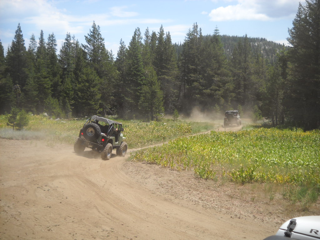
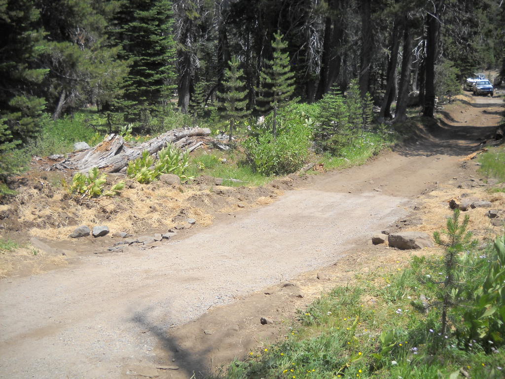
Here’s a shot of the tour returning down the mountain, driving through meadow 14N39-9, after having lunch at the summit:
The proposed solution is to rebuild the road in a manor that allows water to flow from the upper meadow to the lower meadow. The classic part of all this is that the lower meadow looked completely unaffected by the trail. It was pointed out by a few people but the FS wants to harden the trail before it gets reopened.
Karen S (I will not put her name on my website) was part of the tour and was still pushing for a reroute, to save the undamaged meadow. The FS explained what would be involved with a reroute, falling of trees (62 were dropped to reroute Barrett), cutting of a road with a bulldozer, the future possible problem of water on the new road, etc. She still wanted to walk around the back side of the hill to see for herself. Most went with her, I stayed at the rigs and had lunch.
The original survey stated that the last 500 feet went through a meadow. The FS took a second look at the trail earlier this year and concluded that the ‘meadow’ was really a cleared hillside and too steep to hold enough water, even seasonally, to be called a meadow. Thus it was not a meadow and did not have to meet S&G100. No fix needed, We moved on.
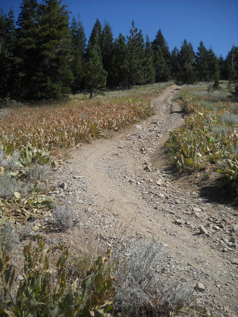
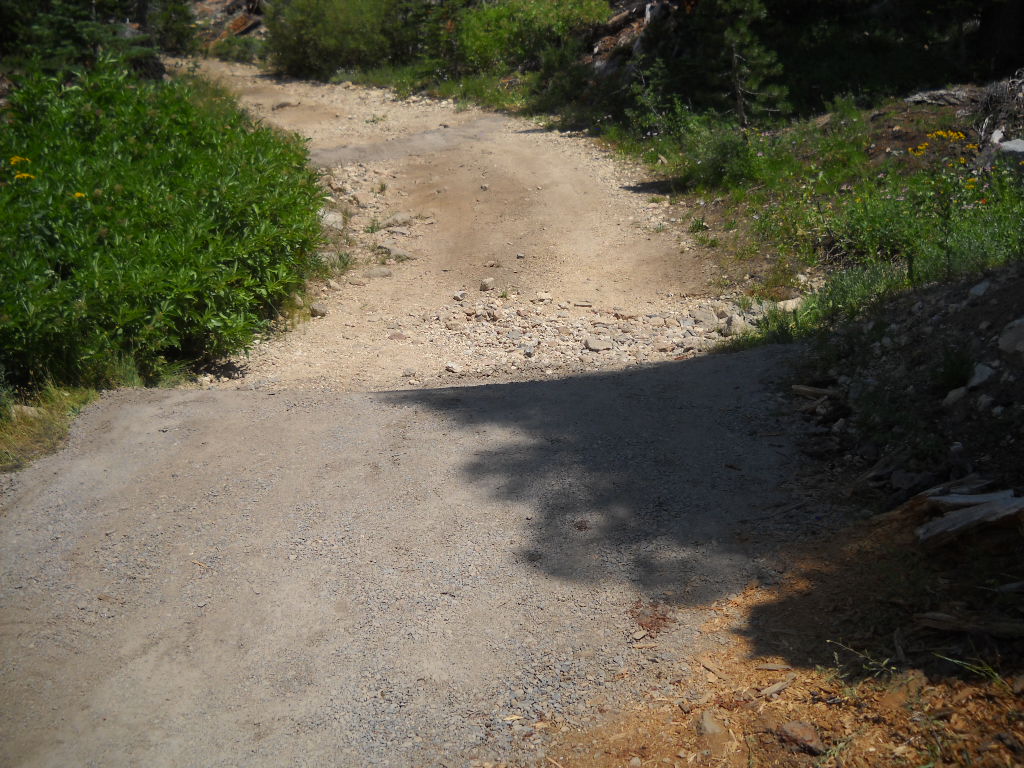
Although not a meadow, the trail does need some work. A few rolling dips would go a long way. The non-meadow:

Further along in the non-meadow, it’s steeper than it looks:
The best news, yes it gets better, is how soon this could open. The reroute would have taken all year to plan, fund and study. It would have been done in 2015 but a new road requires “winterizing” by waiting over one winter before it can be used. That would put the opening in 2016.
By fixing in place it could be open next spring. The FS is looking in to using a Placer County contractor who will be working the Rubicon in Sept to transport material this Sept! The FS would be there with heavy equipment to get the bulk of the work done. I don’t see it being finished this fall but I do see it opening next summer after it gets hardened the same way the first three meadows were done.
The basic plan is to rip up the current road to restore the ability of water to flow below the road surface (even thought it still flows under the currently compacted road), fill with large rip-rap crushed rock, use a geo-fabric to prevent the movement of dirt but allow water to drain and then cover it all with an appropriate surface rock.
At each end of the road through the meadow (see the two Jeeps in the above photo), there will be a large rolling dip. The upper and lower rolling dips will prevent water from running down the trail.
What an awesome day!
14N39 to re-open!!!
Posted: July 14, 2014 Filed under: Access, Maintenance | Tags: 14N39, ENF Leave a commentWe should still wait for the official word from the ENF but this past weekend, the FS and two dozen volunteers ‘fixed’ the S&G100 issues along 14N39. At least we fixed the first three issues. The trail should now be open to a point past 14N39-7 but before 14N39-9.

Thanks to everyone involved!
We had a good turnout. Five trailers and one full size pick-up moving gravel (gravel/dirt/binder mix – like road base) the first day and three trailers running the second day. I didn’t count but probably 20 people the first day and 7 or 8 the next day.
The group built to rolling dips with the ‘gravel’, we covered about seven features with gravel, about 150′ of trail. We hand moved rock so the FS could rock line the sediment trap at the first ‘meadow’. Bad photo, but the trap is to the left where everyone is looking.
Once the gravel was dumped (Thank you RTF for the trailers, we had two working both days) the volunteers spread it to the depth required by the FS. The FS then sprayed it with water to activate the binding agent and then ran a ‘vibra-plate’ compactor over every square foot of gravel to pack it down. They were there very late on Sunday finishing that off, we left.
This is meadow 14N39-5. Heavy equipment rebuilt the rolling dip, the volunteers hauled and placed the gravel and the FS compacted it down.
This is meadow 14N39-7 (actually a creek issue). We built two rolling dips and spread forest debris to slow water and promote growth.
Special thanks to Mike for feeding us BOTH days.
The FS did install a fence further up the trail, past the last ‘meadow’ we fixed but before the last ‘meadow’ issue. They were to drive to the last meadow, turn around, drive down and place the gate at the first wide spot (to allow people to turn around) that was not a arch site.

I was the last one through the gate on a tour of 14N39-9 on July 16th.
The last meadow needs a re-route. We will be on the trail Wed to find the new route. There will be NEPA and the rest of the studies that go with it. Best case is we find a route on Wed, study it and plan it over the winter, and build it in 2015. Because it is a brand new road cut in the forest, it will need to ‘winter’ once before it can be driven, so look for it to open in 2016.
I will be pushing HARD for a temporary fix of that meadow so we can access the summit while the re-route is being planned and built. Stay tuned.
Picture just added but I’ll leave this one. I did have some fun moving trailers around:
Sent out Monday the 14th:
Forest Road 14N39 re-opened today as far as the Pacific Crest Trail. Our hydrologist verified that the Forest is in compliance with S&G 100 at Meadows 14N39-1, -5 and -7 based on the maintenance repairs completed to date. A big thanks to all the volunteers who worked so hard over the weekend!
Richard Thornburgh
Pacific District Ranger
Eldorado National Forest7887 Highway 50
Pollock Pines, CA 95726
😉

