
Deer Valley Trail – good news!
Posted: August 31, 2016 Filed under: Access | Tags: access, ENF Leave a commentSo the Dept of Fish & Wildlife finally got back top the Eldorado National Forest regarding the re-opening of the Deer Valley Trail.
They agree with the ENF that the re-opening and future work “may affect, but is most likely not to adversely effect” the Lahontan Cutthroat and yellow legged frog.
Here’s the whole document:
We are not out of the woods yet.
- Rick Hobson, Amador District Ranger, will draft his “Final Decision”
- The decision will be posted/published publically
- There will be a 30 day “objection” period (not the same as comments)
- Crabtree will consider any “objection” and will draft his decision
- This decision may include things to address any “objection” such as requiring the approach/departure of the creek crossing to be completed before the trail opens. He could alter the dates of the seasonal closure.
This trail is scheduled to stay open until January 1st. That means two months from now we will be on the trail. Baring any last minute lawsuits that will eventually far short because this has already been to court.
Rubicon Ronin
Ellis Lake Trail
Posted: July 31, 2016 Filed under: Access, Travel | Tags: access, camping, TNF Leave a commentSo, it officially starts as the Ellis Peak Trail (03-04012-05), that’s the right turn past Miller Lake, the range fence and just after the “pond”. There is one dead-end trail that is not marked and not yet blocked, stay left. When you get to a four-way intersection, that should be better marked by Aug 5th, go straight (16E18) don’t turn right.
This route will take you to Ellis Lake.
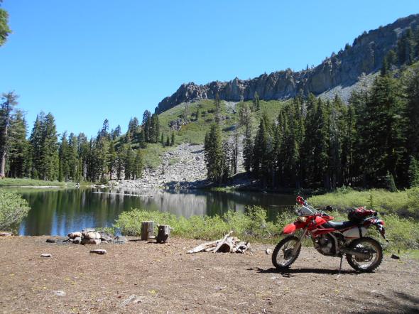
I was there mid-July and there was still a snow drift or two.

This is a perfect camp for someone who wants to sleep in. The towering ridge to the east, that includes Ellis Peak, shelters you from the morning sun.

I have no idea if there are fish but it would be a great float late in the afternoon. I’ve heard there might be a bug issue in the area too early in the season.

A very short walk provides a view of Blackwood Canyon.
West towards Barker Pass:

Further east towards the entrance of the canyon at the Kaspian Camp ground:

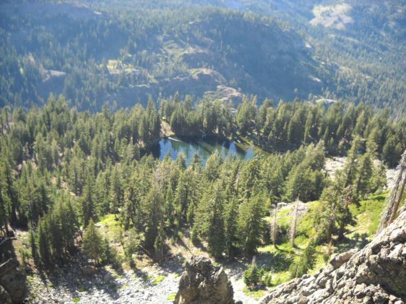
Here’s a view of Ellis Lake from Ellis Peak. Note the severe drop off on what would be the north west corner of the lake.
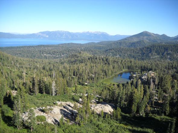
And a view of Buck Lake and the south end of Lake Tahoe from Ellis Peak.
If you or your club, group business or whatever would like to “Adopt” this trail and campsite, please let me know.
This is just one of many examples of what is out there in the Rubicon Trail area. Get out there and find enjoy it all.
“Turn Around, Don’t Go Around”
Forest Road 03-06-02
Posted: June 26, 2016 Filed under: Access, Travel | Tags: access, camping, TNF Leave a commentSo I bought a dual sport. A 2009 Kawasaki KLX250s. Well, this past Saturday I finally got some decent time on it. Earlier, I took the bike up the Rubicon but didn’t get too far. This time it was two and a half hours. I went out exploring the OHV trails around the Barker Pass area.
This writing is specifically about forest road 03-06-02. It is the trail that ventures the furthest west past Barker Pass. At one time, this trail looped around to the south and hooked up with forest road 03. Then came the Granite Chief Wilderness area.
But it almost makes it better for camping because nobody goes out there!
The drive/ride along forest road 03 to get to 03-06 and then 03-06-02 gives you some great views of the valley that runs from Rubicon Springs to the Hell Hole reservoir. That’s the valley of the Long Lake Trail, 16E12, another trail to check out.
There are a few trees down towards the end of the trail. This is only the first.

A short hike down the trail, past the first tree blocking the trail, which I am sure if far from the end of the trail, you get a glimpse of Hell Hole Reservoir through the trees.
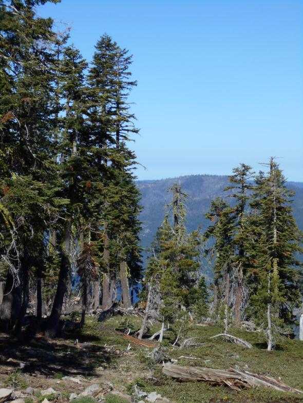
With a 50 yard hike from the trail you get some great views of Hell Hole. You might not be able to tell but you can see evidence of the King fire on the far bank of the lake.

Further down the trail there are more trees.

This is where I think the trail officially ends. It is not pictured well but there is an unnatural dirt berm attempting to block the trail.
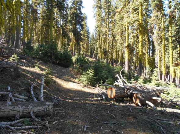
Past the official end of the trail there are still more trees blocking the trail.
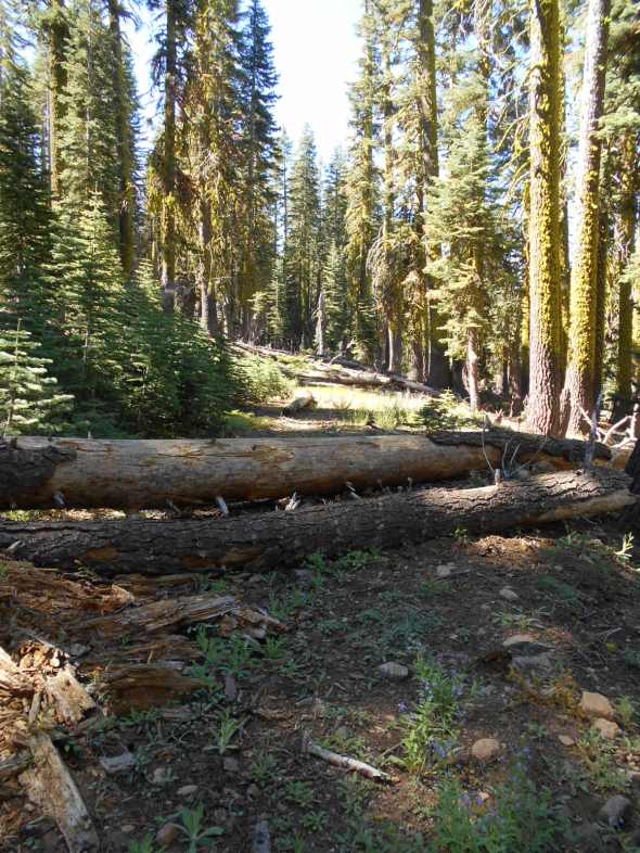
We’ll see if I can work with the Tahoe National Forest and get an accurate GPS of the end of the trail and then clear any trees blocking access to the true end of the trail.
I suggest that you get out and explore sections of our public lands you haven’t seen before. Here’s a hint, look for the trails that dead end far away from other trails.
15N38 (Middle Fork) gate still closed!!!!
Posted: June 13, 2016 Filed under: Access | Tags: 15N38, access, LTBMU, Middle Fork Trail Leave a commentThe plan was to meet the Tahoe Donner 4wdc at the Rubicon staging area, run up the Rubicon to Forest Road 03-04 and head over to Blackwood canyon and come out the Middle Fork Trail, 15N38.
I had this feeling I needed to check the gate at the bottom of Blackwood Canyon at both Forest Road 03 and the Middle Fork Trail. The 03 road isn’t scheduled to open until June 15th, and they never OPEN roads early. The gate for 03 and the Middle Fork Trail are supposed to open June 1st. Well the main road was open but the Middle Fork Trail is still closed.
At the staging area, we ran in to another group who were planning the same route, Rubicon to 03-04- and out 15N38. I passed along the bad news. They took their six Unimogs and headed up the Richardson Lake Trail and made the summit. Some snow but enough dirt to maintain traction.
The Motor Vehicle Use Map (MVUM) posted at the Rubicon staging area has June 1st as the opening date for 15N38. The MVUM on the Lake Tahoe Basin Management Unit’s (LTBMU) website has June 1st as the opening date as well. Yet the gate isn’t open. I don’t know if the gate is open at the top.
The LTBMU needs to get on top of this and fast. How many other groups are going to head north from the Rubicon expecting to get out Blackwood Canyon and find closed gates?
Maybe some new guy at the LTBMU thinks it should open with the gate on 03 just past the river on June 15th. I’ll be contacting the LTBMU in the morning about this issue. Please feel free to join me in letting them know how you feel about them not opening our OHV trail in a timely fashion.(530) 543-2600
was headed to run around the Rubicon area on the 11th and
The LTBMU fails to get any OHV funds
Posted: June 9, 2016 Filed under: Access, Maintenance, Travel | Tags: access, FOTR, grant, Hi-Lo's, LTBMU, maintenance, OHV grant, OHV State Parks, Placer, TNF Leave a commentThis OHV season, the CA State Parks OHV Division made available almost $11 million dollars for OHV issues, projects, maintenance, law enforcement, education, etc.
The Lake Tahoe Basin Management Unit (LTBMU) failed to obtain a single penny of it. In comparison, the Eldorado National Forest (ENF) received $438k and the Tahoe National Forest (TNF) received $650k.
There is a 30 day grace period for the agency requesting funds to ask that their grant be reviewed and rescored but don’t hold your breath. This is the second straight year the grant writers and administrators at the LTBMU have fallen short. I think it’s safe to say the LTBMU needs a new grant writing staff.
Here’s the problem, even though the LTBMU didn’t receive CA State Parks grant funding, they are still required to manage OHV on their forest. It’s just going to be that much more difficult without specific funding for OHV.
I’m using this lack of funding problem to push the LTBMU to reinstate the Adopt-A-Trail program they dumped two years ago.
If you or your club, group, business or organization would like to adopt an OHV trail within the LTBMU, email them, call them, hound them, do not take no for an answer, Right now I only know of the Twin peaks Trail in South Lake Tahoe, the Buck Lake Trail off the Rubicon and the Middle Fork Trail up Blackwood Canyon (just north of the Rubicon) that historically have been adopted.
That list doesn’t include the pre-Placer County Rubicon when the Lake Tahoe Hi-Lo’s had the entire east side of the trail adopted. For adopting a section of the Placer side of the Rubicon Trail, contact the Rubicon Trail Foundation.
Here is a list of OHV trails within the basin from the LTBMU website. Not all trails are listed. Check the Motor Vehicle Use Map (MVUM) for more trails.
Lake Tahoe – East Shore
- Genoa Peak Road 14N32
- Kingsbury Stinger 18E39.3
- Logan House 14N33
Lake Tahoe – North Shore
- Kings Beach 18E18
- Mt Watson 73E
Lake Tahoe – South Lake Tahoe
- Corral Trail 18E14
- Hellhouse Road 12N01D
- High Meadows Trail 18E33A
- Power Line Road 12N08
- Sand Pit 12N08
- Sawmill Pond 12N30
- Twin Peaks 12n30
Lake Tahoe – West Shore
- Buck Lake Road – 14N40
- McKinney / Rubicon Trailhead
- Noonchester 14N34A
Please step up, adopt a trail, push the LTBMU to work with the users!


