New Rubicon Area OHV Trails Map
Posted: March 18, 2015 Filed under: Access, Travel | Tags: access, education, ENF, LTBMU, rubicon trail, TNF Leave a commentSo, some time ago, I posted a new map of OHV trails in the area of the Tahoe side of the Rubicon Trail. Since then, I’ve learned a lot about using Photoshop. The old map was 72dpi, the new map was 300dpi. The old map was a cluttered mess. The new map is leaner and cleaner.
I’ve bounced different drafts off a lot of people including those within the Forest Service (FS). Some in the FS were not overwhelmingly in support. Some had concerns over the possible differences between my map and current MVUM provided by the FS.
I’ve gone further to distance this map from the official FS MVUM. The FS MVUM is a legal document used to notify the public as to what trails are open for public use. This new map is not intended for navigation nor is it to be used to determine what trails are currently open. This map displays ALL the OHV trails in the area but does not report which are open and which are closed. All but the Rubicon are seasonally closed. At least one is partially closed due to meadow issues.
It is the users responsibility to know where they are at all times and the status of the trail they are driving. Please visit the forest website and read all forest orders that may apply.
Hot off the presses:
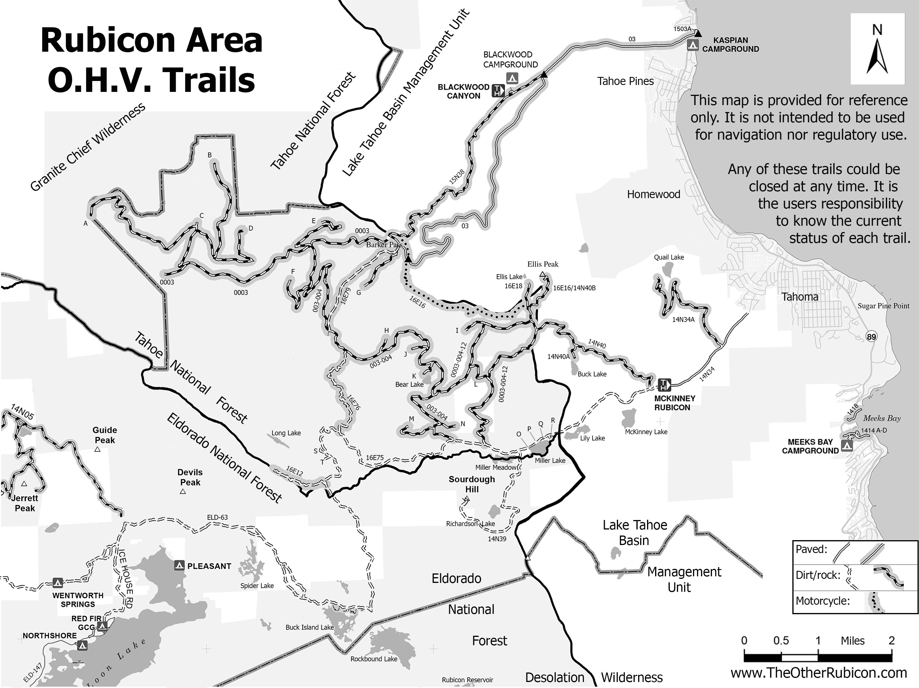
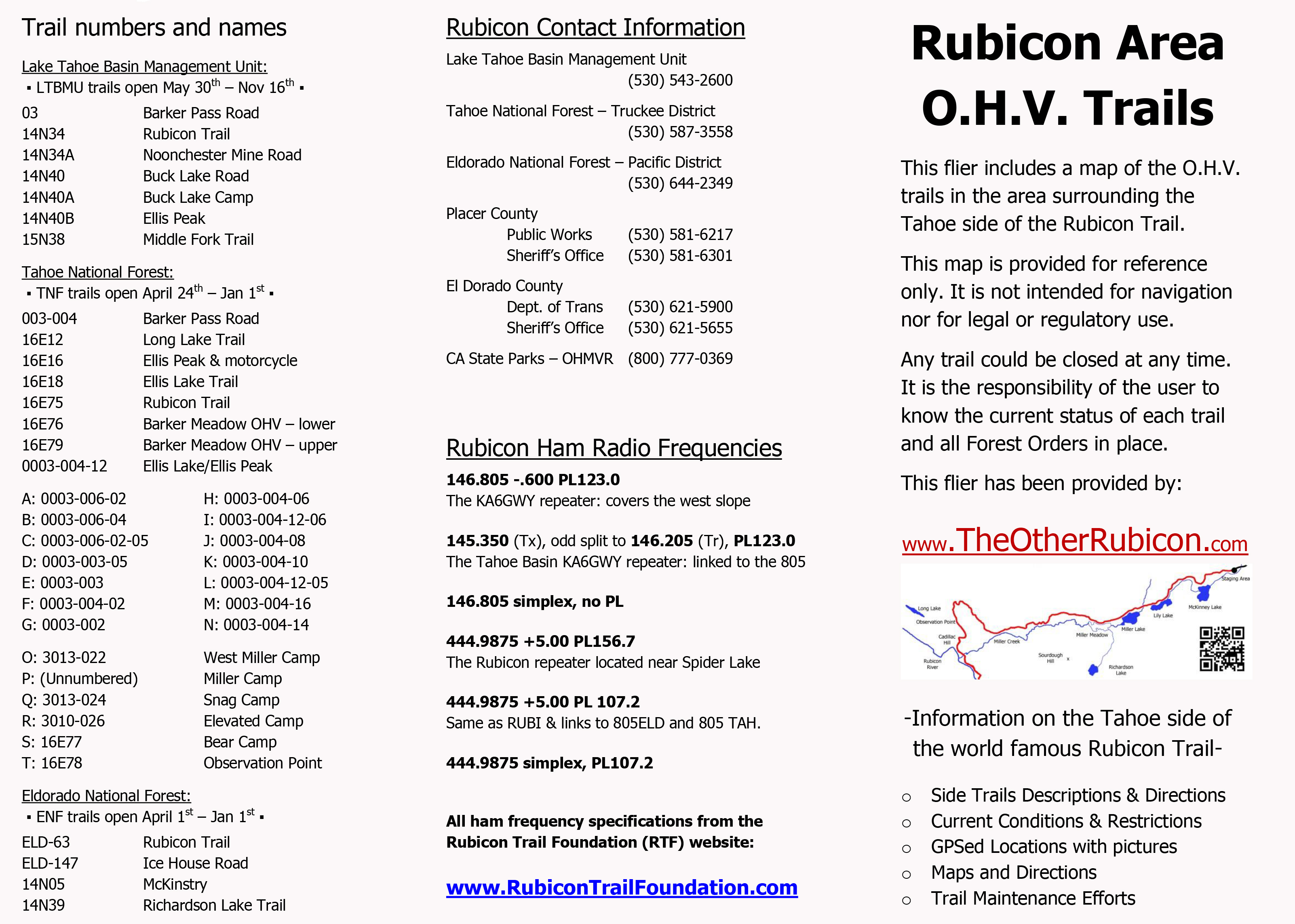
I’ve created a flier from this map to be handed out to users. Here is the front side of the flier with information on the names of trails, seasonal dates for the opening of those trails (which could be changed at any time), ham freqs, agency contact information, etc.
I’ll be handing this map out at the Reno Motorsports Show this Friday and Saturday. The maps will be there Sunday but I have to work. Stop by and pick up a few. I’m still open to comments about what could make this a better map for the users.
The 2015 Cone Zone
Posted: March 15, 2015 Filed under: Access, Travel | Tags: El Dorado County, Placer, Rubicon Leave a commentYes, the orange blooms are already happening.
Road construction has started in the Lake Tahoe Basin. This is important enough that I may start a direct link to updated information on current construction project that could affect driving to and/or from the world Famous Rubicon Trail.
The website of the week: http://www.tahoeroads.com/
This website has all kinds of information on road construction around Tahoe. The easiest page to understand has pictures. So, rather than me ramble on with too many words, here are two pictures pages that says it all. The link is for the web page of the two images below.
http://www.tahoeroads.com/docs/files/File/TahoeBasinMap2014%20with%20logo.pdf:
![]()
![]()
The Sierra Sun is also reporting:
- Paving treatment on Highway 267, airport to the summit, May-Oct, 20 minute delays
- Paving treatment on 28, between Tahoe City and 267. Aug-Oct, 10 minute delays
- Bridge replacement on the road to Alpine Meadows at 89, May-Oct
- Highway 80 at the Donner Lake Interchange, May-July
- Highway 80 Boca to Floriston, May-Oct, 20 minute delays
Please check conditions before you travel. Add time to your trip as needed. Watch out for the workers.
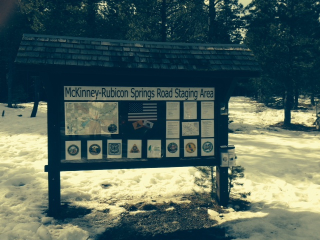
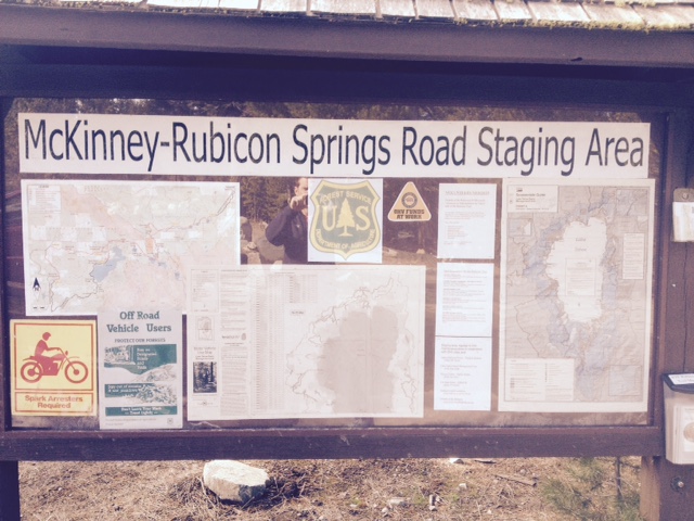
Sign updated at staging area
Posted: January 29, 2015 Filed under: Access, Maintenance, Travel | Tags: education, El Dorado County, FOTR, Placer, RTF, Rubicon Leave a commentAs was the subject of the last “Photo of the month”, the sign at the McKinney-Rubicon Springs Road has been in the need of attention for some time.
Recently, some new material was installed along with a new piece of backing plywood and a new plexi-glass cover. Additionally, the broken map box was replaced and stocked with both the RTF Rubicon Trail map and the new Rubicon Area OHV Trails map and flier. The map was covered in my last post.
Here is the new signage in all it’s glory:
The RTF map is on the left.
The agencies involved with the trail are represented across the bottom: Placer County, El Dorado County, US Forest Service, CA State Parks OHV, Friends of the Rubicon, Rubicon Trail Foundation, CA Association of Four Wheel Drive Clubs, and the Blue Ribbon Coalition.
Towards the right is some educational information including ham radio frequencies, contact information for the agencies involved, how to volunteer, driving cautions and a copy of the new tri-MVUM map.
A close up of the new map box now housing the RTF Rubicon Trail map and the new tri-MVUM of Rubicon Area OHV trails:

This was a private effort. Hopefully, in the future, the agencies listed on the sign will get together with the users to decide what more signage and information is needed at the staging area and along the trail.
UPDATE 2-20-15:
The LTBMU visited the staging area and decided that the sign needed a few changes. Here is a photo of the current sign. I’m working on getting FOTR to join the party and hopefully, together, we can all get the information on the sign to reflect what the users need to travel safely and enjoy the area.
They added a full Motor Vehicle Use Map for North Tahoe and a snowmobile riding area map.
New Tri-MVUM map for Rubicon area
Posted: January 27, 2015 Filed under: Access, Travel | Tags: El Dorado County, Placer, Rubicon Leave a commentIt’s only a first draft but here is a new map of the Rubicon Trail area:

This map combines the three Motor Vehicle Use Maps (MVUM) from the Tahoe National Forest (TNF), the Eldorado National Forest (ENF) and the Lake Tahoe Basin Management Unit (LTBMU). This issue only comes up on the Placer side as the ENF MVUM map covers the entire Rubicon on the El Dorado side.
This map will provide the users with a guide to side trails in the area from Blackwood Canyon to Sourdough Hill. This map is provided for reference only. It is not intended to be used to navigate. Most of the trails listed on this map are seasonal use only, for wheeled motorized vehicles. It is the users responsibility to know when the trails are open for use.
The backside of this map has user information including trail names to go with the FS trail numbers, ham radio frequencies and contact information for Rubicon agencies:
As I said, first draft. This version started as a scan of the three MVUMs. Not a great quality to start with. As I’m new to Photoshop, the resolution was not set to the optimum setting. I’m already working on a new map, from the online FS maps, that should be of good enough quality to enlarge to a size suitable for the trailhead sign.
Although the forests involved would probably rather see ALL the data left on the maps, in future drafts I’m going to eliminate some of the clutter, including all the labeling of the really short trails. That would be all the 003-004-07 kind of numbers.
The LTBMU labels private property vs forest lands differently than the other two forest. Not noticeable in this version. The border between the forests gets a little lost but is the solid black line. No lines for the two counties. The two wildernesses are marked but only one is labeled. Again, first draft. The different forests use different styles to mark the OHV trails. I tried to get the LTBMU and the TNF the same but I’ll wait for the next draft to make the ENF trails look the same.
As crude as this first draft is, these fliers are currently available at the Tahoma Staging Area.
I wanted to get these out so I could get some feedback on the idea. Please let me know what you think these maps need to make them worth while.
Thanks!
Beavers and we’re not talking Oregon State
Posted: September 6, 2014 Filed under: Travel Leave a commentOkay, so I’m sitting here waiting for the college football games to start…
But there is wildlife at Rubicon Springs and that includes beavers. Last year, I took part in trying to bring down a HUGE beaver dam on the south end of the private property. Here it is returned this year:
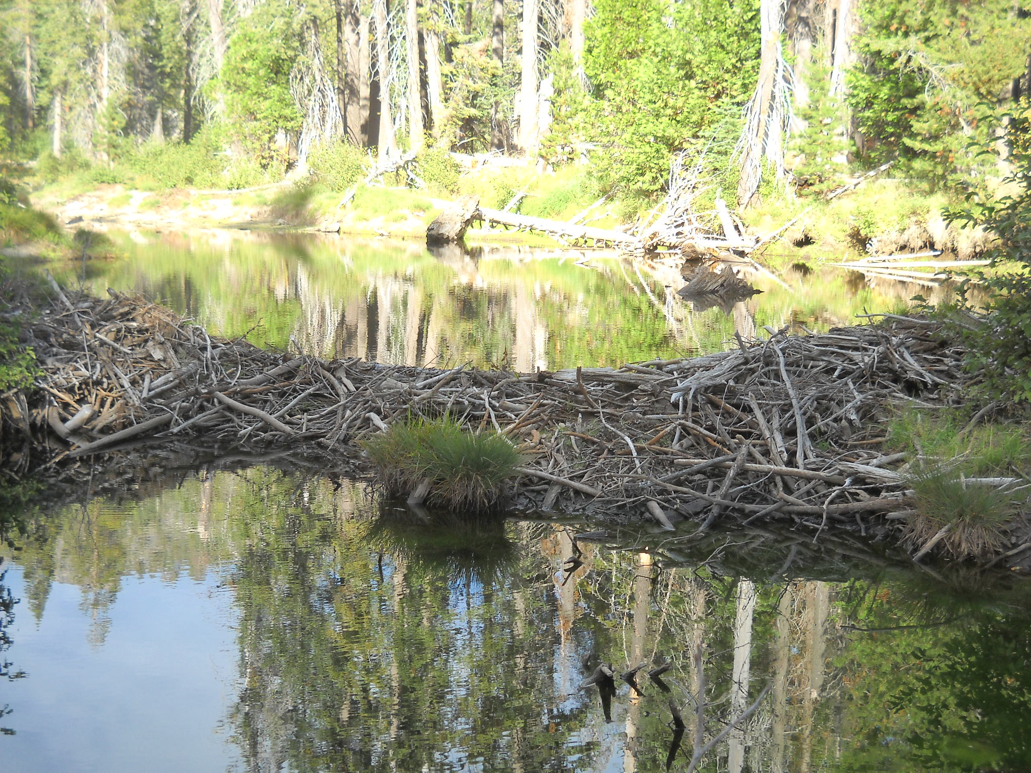

Jimmy Martin had welded up a large grappling hook that we placed on the end of a winch cable. There were two brave (and cold) soles who were placing the hook in the dam. The vehicle with the which was owned and run by a member of the Lake Tahoe Hi-Lo’s. We were successful that day but we knew the dam would be back.
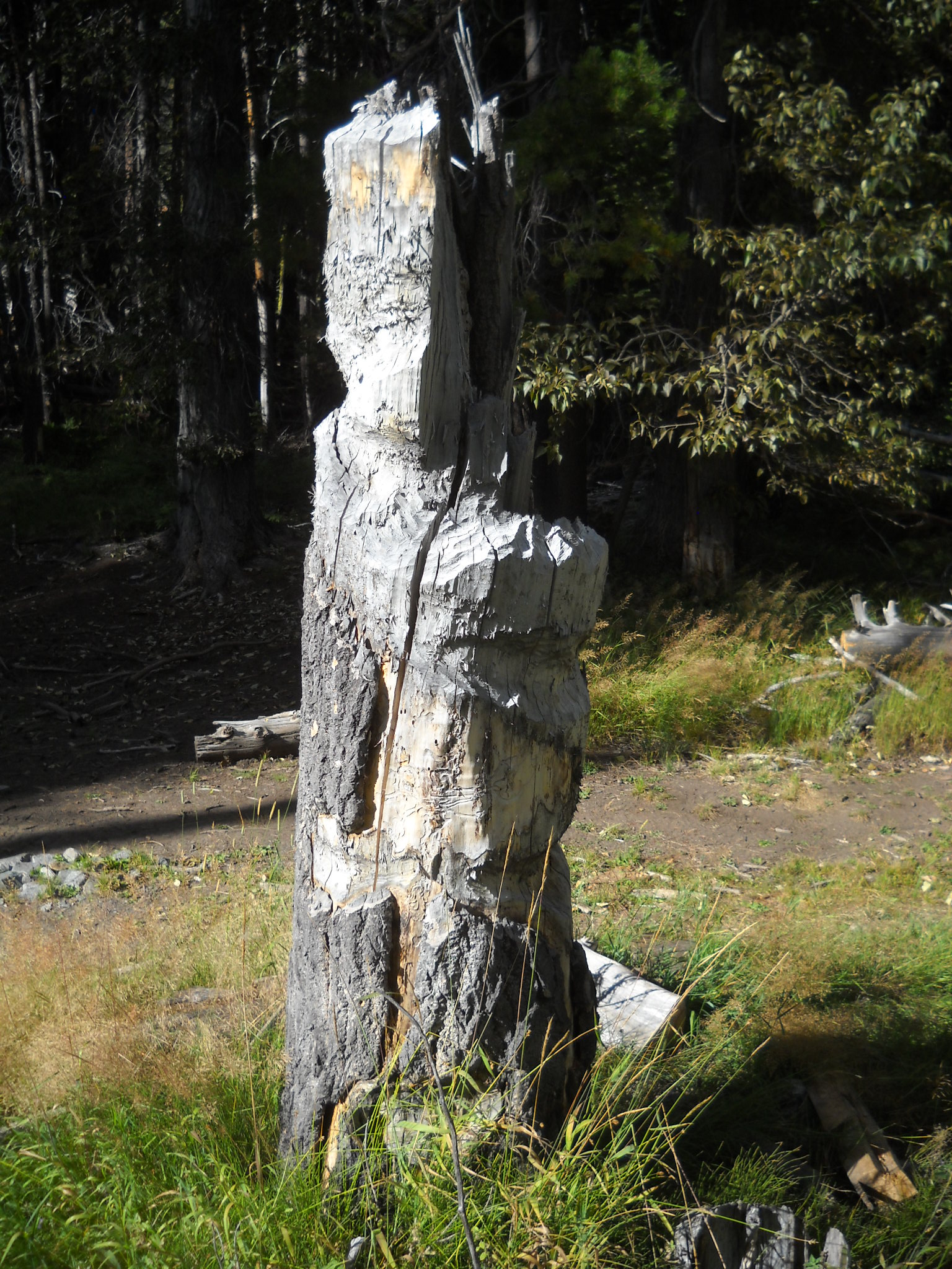
The beavers in the area have high hopes. Here are a few pictures of the trees the beavers have tried to bring down over the years. We’re not sure but we think they might start early enough in the year that they are still on snow pack when trying to bring these down.